Mouliets-et-Villemartin (Mouliets-et-Villemartin)

- commune in Gironde, France
- Country:

- Postal Code: 33350
- Coordinates: 44° 50' 31" N, 0° 1' 7" E


- GPS tracks (wikiloc): [Link]
- Area: 15.91 sq km
- Population: 1072
- Wikipedia en: wiki(en)
- Wikipedia: wiki(fr)
- Wikidata storage: Wikidata: Q656475
- Wikipedia Commons Category: [Link]
- Freebase ID: [/m/03nr_t4]
- GeoNames ID: Alt: [6432318]
- SIREN number: [213302961]
- BnF ID: [152563475]
- PACTOLS thesaurus ID: [pcrtqE7gJRfFHX]
- INSEE municipality code: 33296
Shares border with regions:


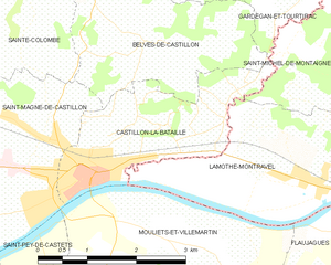
Lamothe-Montravel
- commune in Dordogne, France
- Country:
- Postal Code: 24230
- Coordinates: 44° 51' 5" N, 0° 1' 31" E
- GPS tracks (wikiloc): [Link]
- Area: 11.63 sq km
- Population: 1311
- Web site: [Link]

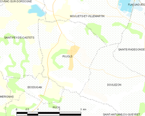
Pujols
- commune in Gironde, France
- Country:
- Postal Code: 33350
- Coordinates: 44° 48' 24" N, 0° 1' 52" E
- GPS tracks (wikiloc): [Link]
- Area: 7.4 sq km
- Population: 561
- Web site: [Link]


Saint-Pey-de-Castets
- commune in Gironde, France
- Country:
- Postal Code: 33350
- Coordinates: 44° 48' 39" N, 0° 4' 6" E
- GPS tracks (wikiloc): [Link]
- Area: 11.07 sq km
- Population: 627


Doulezon
- commune in Gironde, France
- Country:
- Postal Code: 33350
- Coordinates: 44° 47' 32" N, 0° 0' 20" E
- GPS tracks (wikiloc): [Link]
- AboveSeaLevel: 89 м m
- Area: 7.36 sq km
- Population: 257
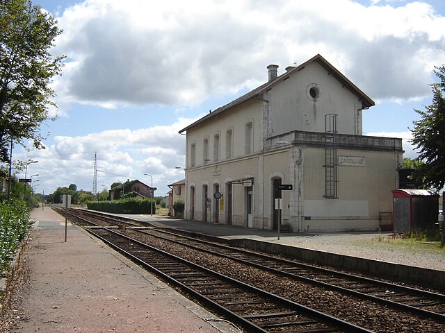
Castillon-la-Bataille
- commune in Gironde, France
- Country:
- Postal Code: 33350
- Coordinates: 44° 51' 12" N, 0° 2' 40" E
- GPS tracks (wikiloc): [Link]
- Area: 5.68 sq km
- Population: 3070


Flaujagues
- commune in Gironde, France
- Country:
- Postal Code: 33350
- Coordinates: 44° 49' 39" N, 0° 2' 11" E
- GPS tracks (wikiloc): [Link]
- Area: 7.8 sq km
- Population: 610

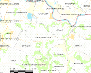
Sainte-Radegonde
- commune in Gironde, France
- Country:
- Postal Code: 33350
- Coordinates: 44° 48' 21" N, 0° 0' 56" E
- GPS tracks (wikiloc): [Link]
- Area: 12.48 sq km
- Population: 469


Saint-Magne-de-Castillon
- commune in Gironde, France
- Country:
- Postal Code: 33350
- Coordinates: 44° 51' 51" N, 0° 3' 54" E
- GPS tracks (wikiloc): [Link]
- Area: 13.87 sq km
- Population: 2003