Moutiers (Moutiers)

- commune in Meurthe-et-Moselle, France
- Country:

- Postal Code: 54660
- Coordinates: 49° 14' 3" N, 5° 57' 50" E


- GPS tracks (wikiloc): [Link]
- Area: 6.82 sq km
- Population: 1574
- Web site: http://www.ville-moutiers.fr
- Wikipedia en: wiki(en)
- Wikipedia: wiki(fr)
- Wikidata storage: Wikidata: Q208732
- Wikipedia Commons Category: [Link]
- Freebase ID: [/m/03qdlx8]
- Freebase ID: [/m/03qdlx8]
- Freebase ID: [/m/03qdlx8]
- GeoNames ID: Alt: [6436770]
- GeoNames ID: Alt: [6436770]
- GeoNames ID: Alt: [6436770]
- SIREN number: [215403916]
- SIREN number: [215403916]
- SIREN number: [215403916]
- BnF ID: [15264460c]
- BnF ID: [15264460c]
- BnF ID: [15264460c]
- INSEE municipality code: 54391
- INSEE municipality code: 54391
- INSEE municipality code: 54391
Shares border with regions:


Les Baroches
- commune in Meurthe-et-Moselle, France
- Country:
- Postal Code: 54150
- Coordinates: 49° 13' 48" N, 5° 53' 32" E
- GPS tracks (wikiloc): [Link]
- Area: 13.28 sq km
- Population: 362


Homécourt
- commune in Meurthe-et-Moselle, France
- Country:
- Postal Code: 54310
- Coordinates: 49° 13' 23" N, 5° 59' 34" E
- GPS tracks (wikiloc): [Link]
- Area: 4.44 sq km
- Population: 6157
- Web site: [Link]


Valleroy
- commune in Meurthe-et-Moselle, France
- Country:
- Postal Code: 54910
- Coordinates: 49° 12' 43" N, 5° 56' 8" E
- GPS tracks (wikiloc): [Link]
- Area: 12.26 sq km
- Population: 2359
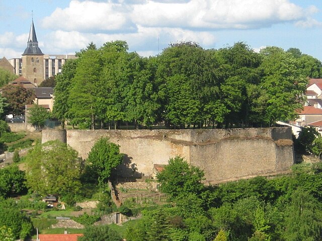
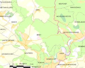
Briey
- former commune in Meurthe-et-Moselle, France
- Country:
- Postal Code: 54150
- Coordinates: 49° 14' 55" N, 5° 56' 22" E
- GPS tracks (wikiloc): [Link]
- AboveSeaLevel: 240 м m
- Area: 27.13 sq km
- Population: 5819
- Web site: [Link]


Auboué
- commune in Meurthe-et-Moselle, France
- Country:
- Postal Code: 54580
- Coordinates: 49° 12' 43" N, 5° 58' 37" E
- GPS tracks (wikiloc): [Link]
- Area: 4.54 sq km
- Population: 2509