%20Wikivoyage%20Banner.jpg)
Munster, Lower Saxony (Munster)

- municipality of Germany
 Hiking in Munster, Lower Saxony
Munster, Lower Saxony, is surrounded by beautiful landscapes that offer a variety of hiking opportunities for enthusiasts of all levels. The region features a mix of scenic countryside, forested areas, and picturesque villages, making it an ideal destination for hiking.
Popular Hiking Areas:
-
Teutoburg Forest:
- Located to the south of Munster, this forest is well-known for its rolling hills, ancient woodlands, and historical sites. There are multiple hiking trails, including the Hermannsweg, which is a long-distance trail that runs through this area.
-
Lüneburg Heath:
- To the northeast, the Lüneburg Heath National Park is famous for its heathland, unique flora, and picturesque landscapes. There are several marked trails here that allow you to experience the beauty of the heath, especially when the heather blooms in August.
-
Aller and Örtze River Valleys:
- These rivers offer beautiful scenic trails that wind through lush forests and alongside the rivers. You can enjoy peaceful walks and the chance to spot various wildlife endemic to the area.
-
Münsterland:
- To the northwest of Munster, the Münsterland region offers flat terrain and a network of well-maintained paths. It’s ideal for leisurely hikes and cycling, with charming towns and historical castles dotting the landscape.
Tips for Hiking in Munster:
-
Trail Markings: Ensure you follow the signposts and markings along the trails. Many paths in Lower Saxony are well-marked, but it's a good idea to have a map or a GPS device as a backup.
-
Weather Preparedness: The weather can change quickly, so check the forecast and dress in layers. Waterproof gear and sturdy hiking boots are recommended.
-
Leave No Trace: Familiarize yourself with the local guidelines for preserving nature. Make sure to take all trash with you and stay on marked trails.
-
Wildlife Awareness: Keep an eye out for local wildlife, but maintain a safe distance. If you're hiking in certain seasons, be cautious of ticks, especially in wooded areas.
-
Local Amenities: Many hiking routes are near small villages where you can find cafes or stores for refreshments, so plan your route accordingly.
Hiking Events:
Occasionally, Munster and its surrounding areas host hiking events and guided tours, providing opportunities to explore the local environment with knowledgeable guides.
With its diverse nature and well-preserved landscapes, hiking in Munster, Lower Saxony, offers both a relaxing escape and a chance to connect with nature. Whether you're an experienced hiker or just looking for a leisurely stroll, there's something for everyone in this charming German region.
- Country:

- Postal Code: 29633
- Local Dialing Code: 05192
- Licence Plate Code: HK
- Coordinates: 52° 59' 19" N, 10° 5' 28" E


- GPS tracks (wikiloc): [Link]
- AboveSeaLevel: 73 м m
- Area: 193.42 sq km
- Population: 14958
- Web site: http://www.munster.de
- Wikipedia en: wiki(en)
- Wikipedia: wiki(de)
- Wikidata storage: Wikidata: Q506599
- Wikipedia Commons Category: [Link]
- Wikipedia Commons Maps Category: [Link]
- Freebase ID: [/m/05cfvh]
- GeoNames ID: Alt: [6557447]
- VIAF ID: Alt: [4146152922605251500]
- OSM relation ID: [1809014]
- GND ID: Alt: [4040748-2]
- archINFORM location ID: [11994]
- MusicBrainz area ID: [236912a5-dcd5-437b-9360-81d0d11d0540]
- Facebook Places ID: [110614392297851]
- German municipality key: 03358016
Includes regions:
Trauen
- human settlement in Germany
Hiking in Trauen
Trauen is a small town in Lower Saxony, Germany, which is situated near scenic landscapes ideal for hiking enthusiasts. While it may not be as famous as some other hiking destinations, it offers a range of trails and outdoor experiences that cater to different skill levels....
- Country:
- Coordinates: 52° 56' 0" N, 10° 8' 13" E
- GPS tracks (wikiloc): [Link]
Breloh
- human settlement in Germany
Hiking in Breloh
It seems there might be a misunderstanding since there isn't a well-known hiking destination called "Breloh." However, if you're referring to a specific region or locale that may not be widely recognized or a typo for a more popular location, I'd be happy to help if you could provide more details or clarify the name....
- Country:
Oerrel
- human settlement in Germany
Hiking in Oerrel
Oerrel is a picturesque area that offers a variety of hiking opportunities, ideal for both beginners and experienced hikers. While specific information about Oerrel can vary, here are some general aspects of hiking in similar regions:...
- Country:
Shares border with regions:


Bispingen
- municipality of Germany
Hiking in Bispingen
Bispingen is a charming small town located in Lower Saxony, Germany, and is part of the German Lüneburg Heath region. This area is known for its beautiful landscapes, extensive hiking trails, and unique heathland scenery, making it a great destination for outdoor enthusiasts....
- Country:
- Postal Code: 29646
- Local Dialing Code: 05194
- Licence Plate Code: SFA
- Coordinates: 53° 4' 58" N, 9° 59' 54" E
- GPS tracks (wikiloc): [Link]
- AboveSeaLevel: 78 м m
- Area: 128.55 sq km
- Population: 6486
- Web site: [Link]


Soltau
- town in Heidekreis District, in Lower Saxony, Germany
Hiking in Soltau
Hiking in Soltau, a quaint town located in Lower Saxony, Germany, offers a blend of scenic landscapes, lush forests, and a range of trails suitable for all skill levels. The region is part of the Lüneburg Heath (Lüneburger Heide), known for its picturesque heathland, rolling hills, and charming villages....
- Country:
- Postal Code: 29614
- Local Dialing Code: 05191
- Licence Plate Code: HK
- Coordinates: 52° 59' 0" N, 9° 50' 0" E
- GPS tracks (wikiloc): [Link]
- AboveSeaLevel: 57 м m
- Area: 203.25 sq km
- Population: 21324
- Web site: [Link]

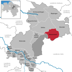
Wietzendorf
- municipality of Germany
Hiking in Wietzendorf
Wietzendorf, located in Lower Saxony, Germany, offers a variety of hiking trails that showcase the beautiful nature and landscapes of the region. Here are some highlights to consider when hiking in Wietzendorf:...
- Country:
- Postal Code: 29649
- Local Dialing Code: 05196
- Licence Plate Code: SFA
- Coordinates: 52° 55' 0" N, 9° 59' 0" E
- GPS tracks (wikiloc): [Link]
- AboveSeaLevel: 66 м m
- Area: 106.88 sq km
- Population: 4133
- Web site: [Link]
Rehlingen
- municipality of Germany
Hiking in Rehlingen
Rehlingen is a picturesque area located in Germany, particularly known for its beautiful landscapes and outdoor recreational opportunities, making it an inviting destination for hiking enthusiasts. Here are some highlights and tips for hiking in Rehlingen:...
- Country:
- Postal Code: 21385
- Local Dialing Code: 04132
- Licence Plate Code: LG
- Coordinates: 53° 6' 0" N, 10° 13' 0" E
- GPS tracks (wikiloc): [Link]
- AboveSeaLevel: 86 м m
- Area: 65.96 sq km
- Population: 767
- Web site: [Link]

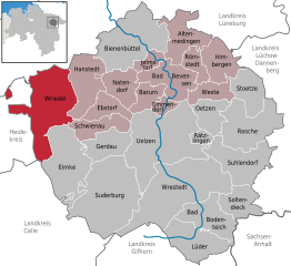
Wriedel
- Municipality in Germany
Hiking in Wriedel
Wriedel, a charming village located in the Lower Saxony region of Germany, is surrounded by beautiful natural landscapes that make it an appealing destination for hiking enthusiasts. While Wriedel itself may not be a well-known hiking hotspot, the surrounding areas offer various trails and opportunities to enjoy the great outdoors....
- Country:
- Postal Code: 29565
- Local Dialing Code: 05829
- Licence Plate Code: UE
- Coordinates: 53° 2' 0" N, 10° 19' 0" E
- GPS tracks (wikiloc): [Link]
- AboveSeaLevel: 64 м m
- Area: 104.15 sq km
- Population: 2398
- Web site: [Link]