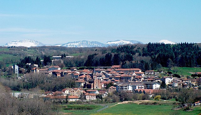
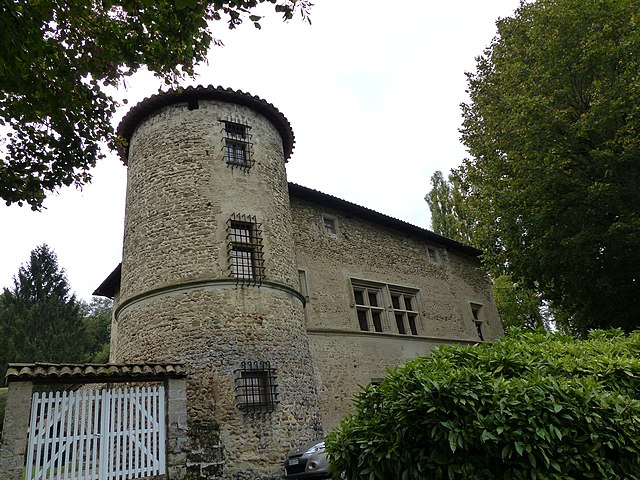
Murinais (Murinais)

- commune in Isère, France
 Hiking in Murinais
Murinais is a lesser-known destination for hiking enthusiasts, offering beautiful landscapes and a chance to experience nature away from the more crowded trails. While specific information about Murinais might be limited, here are some general tips and highlights you can consider for hiking in such regions:
-
Scenic Trails: Look for trails that offer a mix of terrains, including forests, hills, and rivers. Always check local resources for trail maps and difficulty levels.
-
Seasonal Considerations: Depending on the time of year you plan to hike, conditions can vary. Spring and early fall are usually ideal for hiking due to favorable weather.
-
Wildlife: Be aware of local wildlife. If Murinais is home to specific wildlife, it's good to research what animals you might encounter and how to behave safely around them.
-
Preparation: Always carry enough water, appropriate snacks, and a first-aid kit. Wear suitable hiking boots and dress in layers to adapt to changing weather.
-
Leave No Trace: Respect nature by following the Leave No Trace principles. Take your trash with you, stick to designated trails, and avoid disturbing local flora and fauna.
-
Maps and Guides: Utilize maps or hiking guides when exploring new trails. Local hiking clubs or tourism websites could provide valuable information on the best hiking routes and hidden gems.
-
Local Rules: Check for any regulations regarding hiking in the area, including camping, fires, and trail access.
Before heading out, make sure to verify the current conditions of the trails and any safety advisories. Enjoy your hiking adventures!
- Country:

- Postal Code: 38160
- Coordinates: 45° 12' 47" N, 5° 18' 54" E


- GPS tracks (wikiloc): [Link]
- Area: 8.22 sq km
- Population: 384
- Web site: http://www.murinais.fr
- Wikipedia en: wiki(en)
- Wikipedia: wiki(fr)
- Wikidata storage: Wikidata: Q1069043
- Wikipedia Commons Category: [Link]
- Freebase ID: [/m/03nvjr0]
- GeoNames ID: Alt: [6433262]
- SIREN number: [213802721]
- BnF ID: [152580841]
- INSEE municipality code: 38272
Shares border with regions:


Chevrières
- commune in Isère, France
Hiking in Chevrières
Chevrières is a small village in the Isère department of the Auvergne-Rhône-Alpes region in southeastern France. While it may not be as well-known as some larger hiking destinations, it is surrounded by beautiful landscapes and offers opportunities for outdoor activities, including hiking....
- Country:
- Postal Code: 38160
- Coordinates: 45° 11' 15" N, 5° 17' 25" E
- GPS tracks (wikiloc): [Link]
- Area: 16.62 sq km
- Population: 710
- Web site: [Link]


Varacieux
- commune in Isère, France
Hiking in Varacieux
Varacieux is a charming village located in the Auvergne-Rhône-Alpes region of France. While it's a small community, it is surrounded by natural beauty and offers a variety of hiking opportunities that cater to different skill levels....
- Country:
- Postal Code: 38470
- Coordinates: 45° 13' 55" N, 5° 20' 15" E
- GPS tracks (wikiloc): [Link]
- Area: 18.48 sq km
- Population: 879
- Web site: [Link]

Roybon
- commune in Isère, France
Hiking in Roybon
Roybon, located in the Auvergne-Rhône-Alpes region of France, offers several hiking opportunities for outdoor enthusiasts. The area is characterized by its beautiful landscapes, ranging from forests to rolling hills, making it ideal for both novice and experienced hikers....
- Country:
- Postal Code: 38940
- Coordinates: 45° 15' 31" N, 5° 14' 39" E
- GPS tracks (wikiloc): [Link]
- Area: 67.31 sq km
- Population: 1229
- Web site: [Link]

Saint-Vérand
- commune in Isère, France
Hiking in Saint-Vérand
Saint-Vérand is a charming village located in the Isère department of the Auvergne-Rhône-Alpes region in southeastern France. It is nestled in the foothills of the Alps and offers a variety of hiking opportunities that showcase the stunning natural landscapes of the area....
- Country:
- Postal Code: 38160
- Coordinates: 45° 10' 23" N, 5° 19' 54" E
- GPS tracks (wikiloc): [Link]
- AboveSeaLevel: 290 м m
- Area: 17.83 sq km
- Population: 1727
- Web site: [Link]