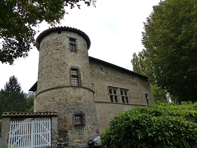
Chevrières (Chevrières)

- commune in Isère, France
 Hiking in Chevrières
Chevrières is a small village in the Isère department of the Auvergne-Rhône-Alpes region in southeastern France. While it may not be as well-known as some larger hiking destinations, it is surrounded by beautiful landscapes and offers opportunities for outdoor activities, including hiking.
Hiking Opportunities in Chevrières
-
Scenic Trails: The area around Chevrières offers various trails that provide stunning views of the Chartreuse and Vercors mountain ranges. You can expect to find a mix of shaded forest paths, open meadows, and panoramic viewpoints.
-
Nature Exploration: Hiking in this region allows you to encounter diverse flora and fauna typical of the Alpine environment. Keep an eye out for unique wildlife and plant species along your routes.
-
Local Culture: Hiking around Chevrières can also be an opportunity to explore the local culture and heritage. Look for signs of traditional Alpine architecture and perhaps even local farms or artisanal products along your hikes.
-
Accessibility: The village is relatively close to larger towns like Grenoble, which can serve as convenient starting points for more extensive hiking excursions, either in the nearby national parks or mountain ranges.
Tips for Hiking in Chevrières
- Check Weather Conditions: The weather can change quickly in the mountains, so be sure to check forecasts before setting out.
- Trail Maps: Utilize local maps or hiking apps to navigate the trails. Some trails may not be well-marked, so having a reliable map or GPS can be crucial.
- Gear Up Properly: Wear appropriate footwear and dress in layers, as mountain weather can change rapidly. It’s also a good idea to have a small backpack with water, snacks, and a first-aid kit.
- Travel Light: When hiking, carry only what you need to maintain comfort and mobility.
- Respect Nature: Stay on marked trails to minimize your impact on the environment and be considerate of wildlife.
Conclusion
Hiking in Chevrières can be a delightful experience for those seeking a more tranquil setting away from the bustling tourist hotspots. Prepare adequately and enjoy the beautiful and varied landscape the Isère region has to offer!
- Country:

- Postal Code: 38160
- Coordinates: 45° 11' 15" N, 5° 17' 25" E


- GPS tracks (wikiloc): [Link]
- Area: 16.62 sq km
- Population: 710
- Web site: http://www.chevrieres.fr
- Wikipedia en: wiki(en)
- Wikipedia: wiki(fr)
- Wikidata storage: Wikidata: Q1003000
- Wikipedia Commons Category: [Link]
- Freebase ID: [/m/03nvgtv]
- GeoNames ID: Alt: [6613751]
- SIREN number: [213800998]
- BnF ID: [15257925r]
- INSEE municipality code: 38099
Shares border with regions:

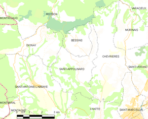
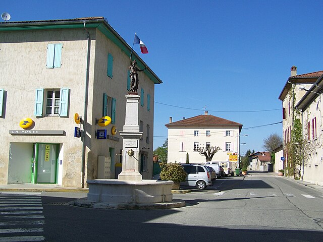
Saint-Appolinard
- commune in Isère, France
Hiking in Saint-Appolinard
Saint-Appolinard is a charming commune located in the Isère department in the Auvergne-Rhône-Alpes region of southeastern France. Known for its picturesque landscapes, it offers a variety of hiking opportunities suitable for different skill levels. Here are some highlights and tips for hiking in the area:...
- Country:
- Postal Code: 38160
- Coordinates: 45° 11' 20" N, 5° 15' 45" E
- GPS tracks (wikiloc): [Link]
- AboveSeaLevel: 380 м m
- Area: 10.76 sq km
- Population: 400
- Web site: [Link]
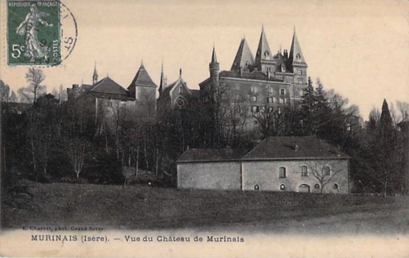

Murinais
- commune in Isère, France
Hiking in Murinais
Murinais is a lesser-known destination for hiking enthusiasts, offering beautiful landscapes and a chance to experience nature away from the more crowded trails. While specific information about Murinais might be limited, here are some general tips and highlights you can consider for hiking in such regions:...
- Country:
- Postal Code: 38160
- Coordinates: 45° 12' 47" N, 5° 18' 54" E
- GPS tracks (wikiloc): [Link]
- Area: 8.22 sq km
- Population: 384
- Web site: [Link]


Saint-Marcellin
- commune in Isère, France
Hiking in Saint-Marcellin
Saint-Marcellin, located in the Isère department of the Auvergne-Rhône-Alpes region in southeastern France, is surrounded by beautiful natural landscapes, making it an excellent destination for hiking enthusiasts. The area features a mix of rolling hills, lush forests, and stunning views of the Vercors and Chartreuse mountains....
- Country:
- Postal Code: 38160
- Coordinates: 45° 9' 6" N, 5° 19' 11" E
- GPS tracks (wikiloc): [Link]
- AboveSeaLevel: 300 м m
- Area: 7.81 sq km
- Population: 8133
- Web site: [Link]

Chatte
- commune in Isère, France
Hiking in Chatte
It seems like you might be referring to a location that could be spelled differently or may not be widely recognized as a hiking destination. If you meant "Chattahoochee" or other known areas, please clarify. However, if you are referring to a lesser-known area, here's a general guide on how to approach hiking in any location:...
- Country:
- Postal Code: 38160
- Coordinates: 45° 8' 37" N, 5° 16' 59" E
- GPS tracks (wikiloc): [Link]
- Area: 22.81 sq km
- Population: 2496
- Web site: [Link]

Roybon
- commune in Isère, France
Hiking in Roybon
Roybon, located in the Auvergne-Rhône-Alpes region of France, offers several hiking opportunities for outdoor enthusiasts. The area is characterized by its beautiful landscapes, ranging from forests to rolling hills, making it ideal for both novice and experienced hikers....
- Country:
- Postal Code: 38940
- Coordinates: 45° 15' 31" N, 5° 14' 39" E
- GPS tracks (wikiloc): [Link]
- Area: 67.31 sq km
- Population: 1229
- Web site: [Link]

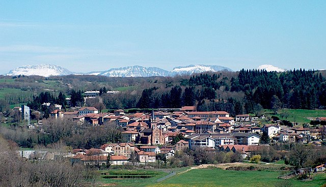
Saint-Vérand
- commune in Isère, France
Hiking in Saint-Vérand
Saint-Vérand is a charming village located in the Isère department of the Auvergne-Rhône-Alpes region in southeastern France. It is nestled in the foothills of the Alps and offers a variety of hiking opportunities that showcase the stunning natural landscapes of the area....
- Country:
- Postal Code: 38160
- Coordinates: 45° 10' 23" N, 5° 19' 54" E
- GPS tracks (wikiloc): [Link]
- AboveSeaLevel: 290 м m
- Area: 17.83 sq km
- Population: 1727
- Web site: [Link]