Neu-Ulm (Neu-Ulm)
- town in Bavaria, Germany
Neu-Ulm, located in Bavaria, Germany, sits along the banks of the Danube River and offers a variety of hiking opportunities in the surrounding areas. While the city itself is more urban, the nearby countryside and natural landscapes provide excellent options for outdoor exploration. Here are a few highlights related to hiking in and around Neu-Ulm:
-
Danube Bike Path (Donauradweg): Although primarily a cycling route, the Danube Bike Path is also popular for hiking. You can enjoy scenic views of the river, nearby towns, and lush greenery along the path.
-
Wiblingen Monastery Trail: A short distance from Neu-Ulm, hiking trails lead to Wiblingen Abbey, famous for its stunning Baroque architecture and beautiful gardens. The surrounding forests are great for walks and exploring local flora.
-
Nature Parks: The areas south of Neu-Ulm, such as the Swabian Jura (Schwäbische Alb), offer numerous trails with varying difficulty levels. Hiking in this region allows you to experience spectacular rock formations, caves, and diverse wildlife.
-
Ulm and Neu-Ulm Trails: Exploring both cities offers not just urban hikes but links to several trails that connect parks and green spaces between the two locations.
-
Local Parks: Within Neu-Ulm, there are parks like the Edwin-Scharff-Haus Park and the Danube park where you can enjoy leisurely strolls.
-
Historical Trails: Some hikes in the area may offer a chance to explore historical sites, like old fortifications, remnants of the city’s past, and other cultural landmarks.
-
Seasonal Hikes: Each season offers a different experience. Spring and summer are great for enjoying blooming landscapes, while autumn provides beautiful fall foliage.
Make sure to dress appropriately for the weather, bring plenty of water, and check trail conditions before heading out. Whether you’re looking for a leisurely stroll or a more challenging hike, the areas around Neu-Ulm have something to offer for every level of hiker.
- Country:

- Postal Code: 89231
- Local Dialing Code: 0731; 07308; 07307
- Licence Plate Code: NU
- Coordinates: 48° 23' 0" N, 10° 0' 0" E


- GPS tracks (wikiloc): [Link]
- AboveSeaLevel: 474 м m
- Area: 80.50 sq km
- Population: 57727
- Web site: https://nu.neu-ulm.de/
- Wikipedia en: wiki(en)
- Wikipedia: wiki(de)
- Wikidata storage: Wikidata: Q4120
- Wikipedia Commons Gallery: [Link]
- Wikipedia Commons Category: [Link]
- Freebase ID: [/m/050nkv]
- GeoNames ID: Alt: [2863941]
- VIAF ID: Alt: [153648940]
- OSM relation ID: [941087]
- GND ID: Alt: [4041987-3]
- archINFORM location ID: [262]
- Library of Congress authority ID: Alt: [n83227690]
- MusicBrainz area ID: [ec6b6d65-bce9-4dce-89d2-f52db4210458]
- WOEID: [23700836]
- Historical Gazetteer (GOV) ID: [NEUULMJN58AJ]
- Facebook Places ID: [112074392151721]
- Bavarikon ID: [ODB_A00000693]
- National Library of Israel ID: [001002109]
- German municipality key: 09775135
Shares border with regions:
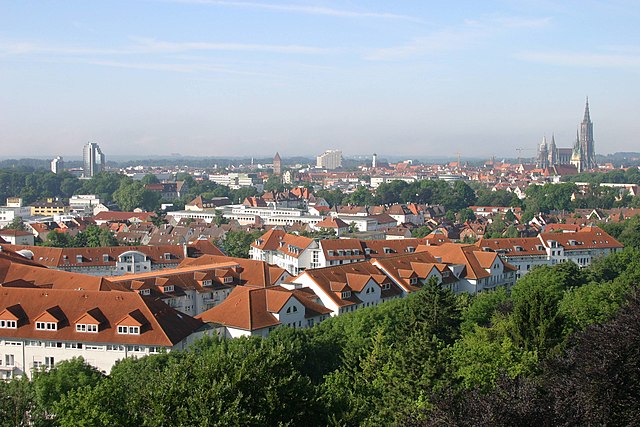

Ulm
- city in Baden-Württemberg
Ulm, located in the state of Baden-Württemberg in Germany, is not only rich in history and culture but also offers beautiful natural landscapes that are perfect for hiking enthusiasts. Here are some key points to consider when hiking in and around Ulm:...
- Country:

- Postal Code: 89079; 89077; 89075; 89073; 89081
- Local Dialing Code: 07305; 07346; 0731
- Licence Plate Code: UL
- Coordinates: 48° 23' 54" N, 9° 59' 30" E


- GPS tracks (wikiloc): [Link]
- AboveSeaLevel: 478 м m
- Area: 118.68 sq km
- Population: 123953
- Web site: [Link]


Senden
- town in Bavaria, Germany
Senden, located in North Rhine-Westphalia, Germany, may not be widely recognized as a major hiking destination, but it offers several opportunities for outdoor enthusiasts to explore nature. Here are some aspects to consider when hiking in and around Senden:...
- Country:

- Postal Code: 89250
- Local Dialing Code: 07309; 07307
- Licence Plate Code: NU
- Coordinates: 48° 19' 0" N, 10° 4' 0" E


- GPS tracks (wikiloc): [Link]
- AboveSeaLevel: 486 м m
- Area: 25.17 sq km
- Population: 19010
- Web site: [Link]
Elchingen
- municipality of Germany
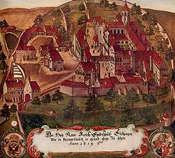
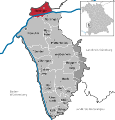
Elchingen, located in Bavaria, Germany, is a charming area known for its picturesque landscapes and outdoor activities, including hiking. The region is characterized by its rolling hills, lush forests, and scenic rivers, making it an attractive destination for nature enthusiasts....
- Country:

- Postal Code: 89081; 89275
- Local Dialing Code: 0731; 07308
- Licence Plate Code: ILL; NU
- Coordinates: 48° 27' 6" N, 10° 5' 52" E


- GPS tracks (wikiloc): [Link]
- AboveSeaLevel: 465 м m
- Area: 24.87 sq km
- Population: 9341
- Web site: [Link]

Nersingen
- municipality of Germany
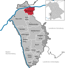
Nersingen is located in Bavaria, Germany, and is known for its beautiful landscapes and picturesque nature, making it a lovely spot for hiking enthusiasts. While there aren't extensive hiking trails specifically designated in Nersingen, you can find routes that connect to the surrounding areas, which offer a variety of hiking options....
- Country:

- Postal Code: 89278
- Local Dialing Code: 07308
- Licence Plate Code: ILL; NU
- Coordinates: 48° 25' 44" N, 10° 7' 19" E


- GPS tracks (wikiloc): [Link]
- AboveSeaLevel: 465 м m
- Area: 24.28 sq km
- Population: 9437
- Web site: [Link]


Holzheim
- town in Neu-Ulm District, Bavaria, Germany
Holzheim, located in the Neu-Ulm district of Germany, offers beautiful landscapes and opportunities for outdoor activities, including hiking. While it may not be widely known as a hiking destination, the region is characterized by scenic trails that can be enjoyed by both beginners and experienced hikers....
- Country:

- Postal Code: 89291
- Local Dialing Code: 07302
- Licence Plate Code: ILL; NU
- Coordinates: 48° 23' 0" N, 10° 6' 0" E


- GPS tracks (wikiloc): [Link]
- AboveSeaLevel: 475 м m
- Area: 7.60 sq km
- Population: 1455
- Web site: [Link]


Illerkirchberg
- municipality in Baden-Württemberg, Germany
Illerkirchberg is a picturesque village located in the state of Baden-Württemberg, Germany, near the city of Ulm. The area is characterized by scenic landscapes, rolling hills, and the nearby Iller River, making it a great destination for hiking enthusiasts....
- Country:

- Postal Code: 89171
- Local Dialing Code: 07346
- Licence Plate Code: UL
- Coordinates: 48° 19' 16" N, 10° 1' 12" E


- GPS tracks (wikiloc): [Link]
- AboveSeaLevel: 513 м m
- Area: 11.45 sq km
- Population: 4716
- Web site: [Link]
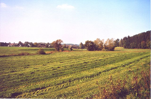

Pfaffenhofen an der Roth
- municipality of Germany
 Hiking in Pfaffenhofen an der Roth
Pfaffenhofen an der Roth, located in Bavaria, Germany, is surrounded by beautiful landscapes that make it an excellent spot for hiking enthusiasts. The region features a mix of forested pathways, rolling hills, and picturesque rural settings, ideal for hikers of all levels....
- Country:

- Postal Code: 89284
- Local Dialing Code: 07302
- Licence Plate Code: ILL; NU
- Coordinates: 48° 21' 16" N, 10° 9' 43" E


- GPS tracks (wikiloc): [Link]
- AboveSeaLevel: 489 м m
- Area: 42.66 sq km
- Population: 5897
- Web site: [Link]
