Neuenrade (Neuenrade)
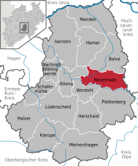
- town in North Rhine-Westphalia, Germany
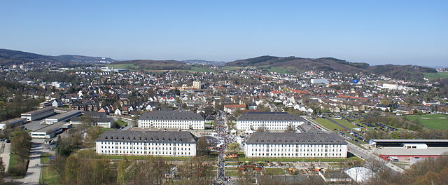
Neuenrade, located in North Rhine-Westphalia, Germany, offers some charming hiking opportunities amidst beautiful natural landscapes. The region is characterized by its rolling hills, woodlands, and picturesque valleys, making it an attractive destination for nature lovers and hikers. Here are some highlights of hiking in the Neuenrade area:
Hiking Trails
-
Naturpark Sauerland-Rothaargebirge: Neuenrade is located near the Sauerland region, which features various marked hiking trails that cater to different skill levels. The trails often pass through dense forests, meadows, and along streams.
-
Themed Trails: Some trails may be themed, focusing on local wildlife, historical landmarks, or natural features. Exploring these can provide both a physical challenge and an educational experience.
-
Wanderwege (Hiking Paths): There are numerous marked paths (known as Wanderwege) around Neuenrade, providing access to scenic viewpoints, charming villages, and the tranquility of nature.
Difficulty Levels
- Easy Routes: Many trails are suitable for families or those looking for a leisurely stroll. These routes typically feature gentle elevations and are well-marked.
- Moderate to Challenging Trails: For more experienced hikers, there are trails that include steeper sections and more challenging terrain, rewarding hikers with stunning views and a sense of adventure.
Scenic Highlights
- Panoramic Views: Many of the trails around Neuenrade offer breathtaking views over the surrounding countryside, particularly from higher elevations.
- Wildlife Observation: Hikers may encounter a variety of local wildlife, including birds, deer, and diverse plant species.
Practical Tips
- Weather Considerations: Check the weather forecast before your hike, as conditions can change rapidly in the region.
- Footwear: Wear appropriate hiking boots to ensure comfort and safety, especially on uneven terrain.
- Hydration and Snacks: Carry enough water and snacks to keep your energy levels up during the trek.
- Maps and Navigation: While many trails are well-marked, bringing a map or using a hiking app can help with navigation.
Local Amenities
After a hike, you might want to explore the local culture, perhaps enjoying a meal at a traditional German restaurant or visiting local shops in Neuenrade.
If you're looking for a combination of outdoor activity and tranquility, hiking in Neuenrade will offer you both in abundance!
- Country:

- Postal Code: 58809
- Local Dialing Code: 02394; 02392
- Licence Plate Code: MK
- Coordinates: 51° 17' 2" N, 7° 46' 48" E


- GPS tracks (wikiloc): [Link]
- AboveSeaLevel: 320 м m
- Area: 54.1 sq km
- Population: 11963
- Web site: https://www.neuenrade.de/
- Wikipedia en: wiki(en)
- Wikipedia: wiki(de)
- Wikidata storage: Wikidata: Q5535
- Wikipedia Commons Gallery: [Link]
- Wikipedia Commons Category: [Link]
- Wikipedia Commons Maps Category: [Link]
- Freebase ID: [/m/03l7dt]
- GeoNames ID: Alt: [2865592]
- VIAF ID: Alt: [242981132]
- OSM relation ID: [168536]
- GND ID: Alt: [4041757-8]
- archINFORM location ID: [14488]
- WOEID: [678275]
- TGN ID: [1040445]
- German municipality key: 05962048
Shares border with regions:


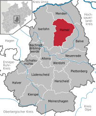
Hemer
- German town in the Märkischer Kreis district of North Rhine-Westphalia
Hemer, located in the North Rhine-Westphalia region of Germany, offers several beautiful hiking opportunities that showcase its natural landscapes and scenic views. Here are some highlights and tips for hiking in this area:...
- Country:

- Postal Code: 58675; 5870
- Local Dialing Code: 02372
- Licence Plate Code: MK
- Coordinates: 51° 23' 0" N, 7° 46' 0" E


- GPS tracks (wikiloc): [Link]
- AboveSeaLevel: 546 м m
- Area: 67.66 sq km
- Population: 33535
- Web site: [Link]


Plettenberg
- town in the Märkischer Kreis, in North Rhine-Westphalia, Germany
Plettenberg Bay, located along South Africa's stunning Garden Route, offers a fantastic variety of hiking opportunities in a beautiful natural setting. Here are some highlights and options for hiking in and around Plettenberg Bay:...
- Country:

- Postal Code: 58840
- Local Dialing Code: 02391
- Licence Plate Code: MK
- Coordinates: 51° 13' 0" N, 7° 53' 0" E


- GPS tracks (wikiloc): [Link]
- AboveSeaLevel: 240 м m
- Area: 96.75 sq km
- Population: 25414
- Web site: [Link]

