Hemer (Hemer)
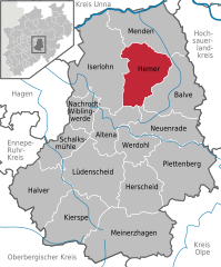
- German town in the Märkischer Kreis district of North Rhine-Westphalia
Hemer, located in the North Rhine-Westphalia region of Germany, offers several beautiful hiking opportunities that showcase its natural landscapes and scenic views. Here are some highlights and tips for hiking in this area:
1.
- Hemer is situated near the Sauerland, a popular hiking destination known for its rolling hills, forests, and picturesque valleys. Many trails in this area cater to various skill levels, from easy walks to more challenging hikes.
2.
- Naherholungsgebiet Hemer: This local recreation area offers several marked trails suitable for families and casual hikers. You can enjoy the beautiful woods and possibly spot some local wildlife.
- The Hemer Kletterpark: While primarily an adventure park, the surrounding area includes hiking paths that provide a unique perspective on the landscape.
- Ruine Hohensyburg: Not far from Hemer, this historic site has trails leading to stunning lookout points over the Ruhr Valley and the surrounding areas, perfect for those looking to combine history with their hike.
3.
- The Hemer region features diverse landscapes, including forests, hills, and river valleys. Many trails offer panoramic views, especially from higher elevations, making for great photo opportunities.
4.
- As you hike through Hemer, you may encounter a variety of wildlife, including deer, birds, and other animals native to the region. The diverse flora adds to the beauty, with different plant species along the trails.
5.
- Best Time to Hike: Spring and autumn are particularly nice for hiking when the weather is mild and the scenery is vibrant with colors.
- Equipment: Wear sturdy hiking shoes and appropriate clothing for the weather. A hiking pole can also be handy for uneven terrain.
- Stay Hydrated: Carry enough water and snacks, especially on longer hikes, to keep your energy up.
- Trail Maps: Make sure to have a trail map or a GPS device, as trails can sometimes be less clearly marked.
6.
- Many trails around Hemer are accessible for various fitness levels. Be sure to check the trail descriptions and difficulty levels to choose one that suits your group's experience.
Hiking in and around Hemer offers a wonderful way to explore the natural beauty of this region while enjoying the tranquility of the outdoors. Whether you are a seasoned hiker or a beginner, there are plenty of options to enjoy!
- Country:

- Postal Code: 58675; 5870
- Local Dialing Code: 02372
- Licence Plate Code: MK
- Coordinates: 51° 23' 0" N, 7° 46' 0" E


- GPS tracks (wikiloc): [Link]
- AboveSeaLevel: 546 м m
- Area: 67.66 sq km
- Population: 33535
- Web site: https://www.hemer.de/
- Wikipedia en: wiki(en)
- Wikipedia: wiki(de)
- Wikidata storage: Wikidata: Q1104
- Wikipedia Commons Gallery: [Link]
- Wikipedia Commons Category: [Link]
- Wikipedia Commons Maps Category: [Link]
- Freebase ID: [/m/018w3h]
- GeoNames ID: Alt: [2906595]
- VIAF ID: Alt: [162897788]
- OSM relation ID: [2063637]
- GND ID: Alt: [4024358-8]
- archINFORM location ID: [10899]
- Library of Congress authority ID: Alt: [n81072005]
- MusicBrainz area ID: [132e3f91-b5c6-4e7c-b56c-2dab0f16b727]
- WOEID: [12624259]
- TGN ID: [7012500]
- Facebook Places ID: [106091896098254]
- NKCR AUT ID: [ge1000430]
- National Library of Israel ID: [000985865]
- German municipality key: 05962016
- GNS Unique Feature ID: -1790146
Shares border with regions:


Iserlohn
- German city in the Märkischer Kreis district of North Rhine-Westphalia
Iserlohn is a picturesque town located in North Rhine-Westphalia, Germany, and offers a variety of excellent hiking opportunities for outdoor enthusiasts. The surrounding landscape is characterized by beautiful forests, hills, and the scenic Lenne River, making it an inviting destination for hiking....
- Country:

- Postal Code: 58636–58644
- Local Dialing Code: 02371
- Licence Plate Code: MK
- Coordinates: 51° 23' 0" N, 7° 40' 0" E


- GPS tracks (wikiloc): [Link]
- AboveSeaLevel: 253 м m
- Area: 125.49 sq km
- Population: 92928
- Web site: [Link]


Menden (Sauerland)
- town in the district Märkischer Kreis, in North Rhine-Westphalia, Germany
Menden, located in North Rhine-Westphalia, Germany, offers several hiking opportunities that take advantage of the area's natural beauty and rich landscapes. The region features a mix of forested areas, hills, and rivers, making it suitable for hikers of various skill levels....
- Country:

- Postal Code: 58706–58710
- Local Dialing Code: 02373
- Licence Plate Code: MK
- Coordinates: 51° 26' 0" N, 7° 48' 0" E


- GPS tracks (wikiloc): [Link]
- AboveSeaLevel: 150 м m
- Area: 86.08 sq km
- Population: 53046
- Web site: [Link]


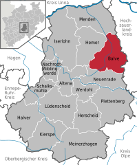
Balve
- town in the Märkischer Kreis district, North Rhine-Westphalia, Germany
Balve is a charming town located in the Sauerland region of Germany, surrounded by picturesque landscapes and a variety of hiking opportunities. The area is known for its natural beauty, including forests, hills, and valleys, making it an excellent destination for outdoor enthusiasts....
- Country:

- Postal Code: 58802
- Local Dialing Code: 02375
- Licence Plate Code: MK
- Coordinates: 51° 20' 0" N, 7° 52' 0" E


- GPS tracks (wikiloc): [Link]
- AboveSeaLevel: 250 м m
- Area: 74.76 sq km
- Population: 11449
- Web site: [Link]


Altena
- town in the district of Märkischer Kreis, North Rhine-Westphalia, Germany
Hiking in Altena, a picturesque town in North Rhine-Westphalia, Germany, offers a delightful experience for outdoor enthusiasts. Surrounded by lush forests, beautiful valleys, and scenic landscapes, the area is ideal for both novice and experienced hikers. Here are some highlights and tips for hiking in Altena:...
- Country:

- Postal Code: 58741–58762
- Local Dialing Code: 02352
- Coordinates: 51° 18' 0" N, 7° 40' 0" E


- GPS tracks (wikiloc): [Link]
- AboveSeaLevel: 190 м m
- Area: 44.29 sq km
- Population: 17081
- Web site: [Link]


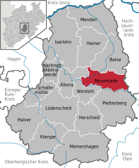
Neuenrade
- town in North Rhine-Westphalia, Germany
Neuenrade, located in North Rhine-Westphalia, Germany, offers some charming hiking opportunities amidst beautiful natural landscapes. The region is characterized by its rolling hills, woodlands, and picturesque valleys, making it an attractive destination for nature lovers and hikers. Here are some highlights of hiking in the Neuenrade area:...
- Country:

- Postal Code: 58809
- Local Dialing Code: 02394; 02392
- Licence Plate Code: MK
- Coordinates: 51° 17' 2" N, 7° 46' 48" E


- GPS tracks (wikiloc): [Link]
- AboveSeaLevel: 320 м m
- Area: 54.1 sq km
- Population: 11963
- Web site: [Link]

