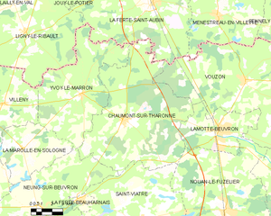
Neung-sur-Beuvron (Neung-sur-Beuvron)

- commune in Loir-et-Cher, France
- Country:

- Postal Code: 41210
- Coordinates: 47° 32' 7" N, 1° 48' 17" E


- GPS tracks (wikiloc): [Link]
- Area: 63 sq km
- Population: 1220
- Web site: http://www.neung-sur-beuvron.fr
- Wikipedia en: wiki(en)
- Wikipedia: wiki(fr)
- Wikidata storage: Wikidata: Q1169924
- Wikipedia Commons Category: [Link]
- Freebase ID: [/m/03nw1pp]
- GeoNames ID: Alt: [2990603]
- SIREN number: [214101594]
- BnF ID: [15259433g]
- VIAF ID: Alt: [244283403]
- PACTOLS thesaurus ID: [pcrtEWSGDxaSWv]
- SUDOC authorities ID: [18145954X]
- INSEE municipality code: 41159
Shares border with regions:

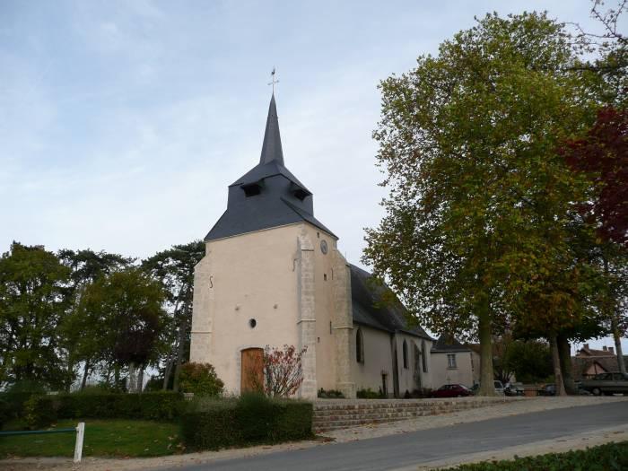
Chaumont-sur-Tharonne
- commune in Loir-et-Cher, France
- Country:
- Postal Code: 41600
- Coordinates: 47° 36' 40" N, 1° 54' 21" E
- GPS tracks (wikiloc): [Link]
- Area: 78.33 sq km
- Population: 1090
- Web site: [Link]


La Ferté-Beauharnais
- commune in Loir-et-Cher, France
- Country:
- Postal Code: 41210
- Coordinates: 47° 32' 30" N, 1° 51' 0" E
- GPS tracks (wikiloc): [Link]
- Area: 2.42 sq km
- Population: 512


La Marolle-en-Sologne
- commune in Loir-et-Cher, France
- Country:
- Postal Code: 41210
- Coordinates: 47° 35' 3" N, 1° 46' 45" E
- GPS tracks (wikiloc): [Link]
- Area: 25.24 sq km
- Population: 388
Yvoy-le-Marron
- commune in Loir-et-Cher, France
- Country:
- Postal Code: 41600
- Coordinates: 47° 37' 57" N, 1° 51' 11" E
- GPS tracks (wikiloc): [Link]
- Area: 48.92 sq km
- Population: 658


Saint-Viâtre
- commune in Loir-et-Cher, France
- Country:
- Postal Code: 41210
- Coordinates: 47° 31' 24" N, 1° 56' 0" E
- GPS tracks (wikiloc): [Link]
- Area: 89.79 sq km
- Population: 1236
- Web site: [Link]


Marcilly-en-Gault
- commune in Loir-et-Cher, France
- Country:
- Postal Code: 41210
- Coordinates: 47° 27' 55" N, 1° 52' 25" E
- GPS tracks (wikiloc): [Link]
- Area: 50.31 sq km
- Population: 751

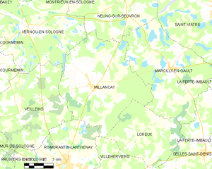
Millançay
- commune in Loir-et-Cher, France
- Country:
- Postal Code: 41200
- Coordinates: 47° 26' 49" N, 1° 46' 22" E
- GPS tracks (wikiloc): [Link]
- Area: 57.94 sq km
- Population: 771

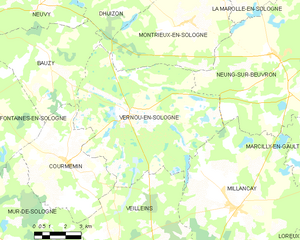
Vernou-en-Sologne
- commune in Loir-et-Cher, France
- Country:
- Postal Code: 41230
- Coordinates: 47° 30' 5" N, 1° 40' 48" E
- GPS tracks (wikiloc): [Link]
- Area: 51.31 sq km
- Population: 618
- Web site: [Link]
Montrieux-en-Sologne
- commune in Loir-et-Cher, France
- Country:
- Postal Code: 41210
- Coordinates: 47° 33' 12" N, 1° 43' 25" E
- GPS tracks (wikiloc): [Link]
- Area: 34.11 sq km
- Population: 674