Chaumont-sur-Tharonne (Chaumont-sur-Tharonne)

- commune in Loir-et-Cher, France
- Country:

- Postal Code: 41600
- Coordinates: 47° 36' 40" N, 1° 54' 21" E


- GPS tracks (wikiloc): [Link]
- Area: 78.33 sq km
- Population: 1090
- Web site: http://www.chaumont-sur-tharonne.fr
- Wikipedia en: wiki(en)
- Wikipedia: wiki(fr)
- Wikidata storage: Wikidata: Q1135489
- Wikipedia Commons Category: [Link]
- Freebase ID: [/m/03nv_fd]
- GeoNames ID: Alt: [6448917]
- SIREN number: [214100463]
- BnF ID: [15259322j]
- VIAF ID: Alt: [112144648617200962913]
- Library of Congress authority ID: Alt: [n83050337]
- SUDOC authorities ID: [175209510]
- INSEE municipality code: 41046
Shares border with regions:


Vouzon
- commune in Loir-et-Cher, France
- Country:
- Postal Code: 41600
- Coordinates: 47° 38' 45" N, 2° 3' 31" E
- GPS tracks (wikiloc): [Link]
- Area: 78.25 sq km
- Population: 1503
- Web site: [Link]
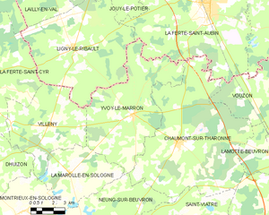
Yvoy-le-Marron
- commune in Loir-et-Cher, France
- Country:
- Postal Code: 41600
- Coordinates: 47° 37' 57" N, 1° 51' 11" E
- GPS tracks (wikiloc): [Link]
- Area: 48.92 sq km
- Population: 658


Neung-sur-Beuvron
- commune in Loir-et-Cher, France
- Country:
- Postal Code: 41210
- Coordinates: 47° 32' 7" N, 1° 48' 17" E
- GPS tracks (wikiloc): [Link]
- Area: 63 sq km
- Population: 1220
- Web site: [Link]


Saint-Viâtre
- commune in Loir-et-Cher, France
- Country:
- Postal Code: 41210
- Coordinates: 47° 31' 24" N, 1° 56' 0" E
- GPS tracks (wikiloc): [Link]
- Area: 89.79 sq km
- Population: 1236
- Web site: [Link]


Nouan-le-Fuzelier
- commune in Loir-et-Cher, France
- Country:
- Postal Code: 41600
- Coordinates: 47° 32' 13" N, 2° 2' 17" E
- GPS tracks (wikiloc): [Link]
- Area: 85.49 sq km
- Population: 2330

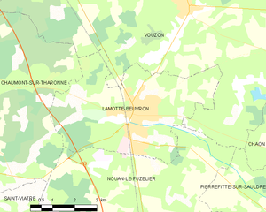
Lamotte-Beuvron
- commune in Loir-et-Cher, France
- Country:
- Postal Code: 41600
- Coordinates: 47° 36' 8" N, 2° 1' 29" E
- GPS tracks (wikiloc): [Link]
- Area: 23.34 sq km
- Population: 4750
- Web site: [Link]


La Ferté-Saint-Aubin
- commune in Loiret, France
- Country:
- Postal Code: 45240
- Coordinates: 47° 43' 2" N, 1° 56' 29" E
- GPS tracks (wikiloc): [Link]
- Area: 86.12 sq km
- Population: 7367
- Web site: [Link]