
Nevers (Nevers)

- commune in Nièvre, France
- Country:

- Postal Code: 58000
- Coordinates: 46° 59' 33" N, 3° 9' 24" E


- GPS tracks (wikiloc): [Link]
- AboveSeaLevel: 180 м m
- Area: 17.33 sq km
- Population: 34228
- Web site: http://www.nevers.fr
- Wikipedia en: wiki(en)
- Wikipedia: wiki(fr)
- Wikidata storage: Wikidata: Q166997
- Wikipedia Commons Gallery: [Link]
- Wikipedia Commons Category: [Link]
- Freebase ID: [/m/01ngfx]
- Freebase ID: [/m/01ngfx]
- Freebase ID: [/m/01ngfx]
- Freebase ID: [/m/01ngfx]
- Freebase ID: [/m/01ngfx]
- GeoNames ID: Alt: [2990474]
- GeoNames ID: Alt: [2990474]
- GeoNames ID: Alt: [2990474]
- GeoNames ID: Alt: [2990474]
- GeoNames ID: Alt: [2990474]
- SIREN number: [215801945]
- SIREN number: [215801945]
- SIREN number: [215801945]
- SIREN number: [215801945]
- SIREN number: [215801945]
- BnF ID: [15266459n]
- BnF ID: [15266459n]
- BnF ID: [15266459n]
- BnF ID: [15266459n]
- BnF ID: [15266459n]
- VIAF ID: Alt: [148929692]
- VIAF ID: Alt: [148929692]
- VIAF ID: Alt: [148929692]
- VIAF ID: Alt: [148929692]
- VIAF ID: Alt: [148929692]
- GND ID: Alt: [4041998-8]
- GND ID: Alt: [4041998-8]
- GND ID: Alt: [4041998-8]
- GND ID: Alt: [4041998-8]
- GND ID: Alt: [4041998-8]
- archINFORM location ID: [5952]
- archINFORM location ID: [5952]
- archINFORM location ID: [5952]
- archINFORM location ID: [5952]
- archINFORM location ID: [5952]
- Library of Congress authority ID: Alt: [n81020984]
- Library of Congress authority ID: Alt: [n81020984]
- Library of Congress authority ID: Alt: [n81020984]
- Library of Congress authority ID: Alt: [n81020984]
- Library of Congress authority ID: Alt: [n81020984]
- MusicBrainz area ID: [15f5925a-5f35-49e6-a2b6-730f0f1b8d15]
- MusicBrainz area ID: [15f5925a-5f35-49e6-a2b6-730f0f1b8d15]
- MusicBrainz area ID: [15f5925a-5f35-49e6-a2b6-730f0f1b8d15]
- MusicBrainz area ID: [15f5925a-5f35-49e6-a2b6-730f0f1b8d15]
- MusicBrainz area ID: [15f5925a-5f35-49e6-a2b6-730f0f1b8d15]
- Quora topic ID: [Nevers]
- Quora topic ID: [Nevers]
- Quora topic ID: [Nevers]
- Quora topic ID: [Nevers]
- Quora topic ID: [Nevers]
- SUDOC authorities ID: [078830052]
- SUDOC authorities ID: [078830052]
- SUDOC authorities ID: [078830052]
- SUDOC authorities ID: [078830052]
- SUDOC authorities ID: [078830052]
- Encyclopædia Britannica Online ID: [place/Nevers]
- Encyclopædia Britannica Online ID: [place/Nevers]
- Encyclopædia Britannica Online ID: [place/Nevers]
- Encyclopædia Britannica Online ID: [place/Nevers]
- Encyclopædia Britannica Online ID: [place/Nevers]
- Gran Enciclopèdia Catalana ID: [0045885]
- Gran Enciclopèdia Catalana ID: [0045885]
- Gran Enciclopèdia Catalana ID: [0045885]
- Gran Enciclopèdia Catalana ID: [0045885]
- Gran Enciclopèdia Catalana ID: [0045885]
- Encyclopædia Universalis ID: [nevers]
- Encyclopædia Universalis ID: [nevers]
- Encyclopædia Universalis ID: [nevers]
- Encyclopædia Universalis ID: [nevers]
- Encyclopædia Universalis ID: [nevers]
- EMLO location ID: [00199ef9-56bc-4953-b3f0-4024689e8665]
- EMLO location ID: [00199ef9-56bc-4953-b3f0-4024689e8665]
- EMLO location ID: [00199ef9-56bc-4953-b3f0-4024689e8665]
- EMLO location ID: [00199ef9-56bc-4953-b3f0-4024689e8665]
- EMLO location ID: [00199ef9-56bc-4953-b3f0-4024689e8665]
- Digital Atlas of the Roman Empire ID: [118]
- Digital Atlas of the Roman Empire ID: [118]
- Digital Atlas of the Roman Empire ID: [118]
- Digital Atlas of the Roman Empire ID: [118]
- Digital Atlas of the Roman Empire ID: [118]
- data.gouv.fr org ID: [ville-de-nevers]
- data.gouv.fr org ID: [ville-de-nevers]
- data.gouv.fr org ID: [ville-de-nevers]
- data.gouv.fr org ID: [ville-de-nevers]
- data.gouv.fr org ID: [ville-de-nevers]
- Facebook ID: Alt: [103127899727512]
- Facebook ID: Alt: [103127899727512]
- Facebook ID: Alt: [103127899727512]
- Facebook ID: Alt: [103127899727512]
- Facebook ID: Alt: [103127899727512]
- INSEE municipality code: 58194
- INSEE municipality code: 58194
- INSEE municipality code: 58194
- INSEE municipality code: 58194
- INSEE municipality code: 58194
- US National Archives Identifier: 10045036
- US National Archives Identifier: 10045036
- US National Archives Identifier: 10045036
- US National Archives Identifier: 10045036
- US National Archives Identifier: 10045036
Shares border with regions:

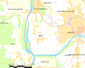
Marzy
- commune in Nièvre, France
- Country:
- Postal Code: 58180
- Coordinates: 46° 58' 51" N, 3° 5' 36" E
- GPS tracks (wikiloc): [Link]
- Area: 24.41 sq km
- Population: 3661
- Web site: [Link]

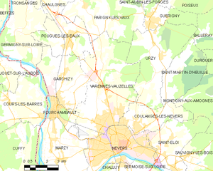
Varennes-Vauzelles
- commune in Nièvre, France
- Country:
- Postal Code: 58640
- Coordinates: 47° 0' 44" N, 3° 8' 47" E
- GPS tracks (wikiloc): [Link]
- AboveSeaLevel: 195 м m
- Area: 33.99 sq km
- Population: 9449
- Web site: [Link]


Sermoise-sur-Loire
- commune in Nièvre, France
- Country:
- Postal Code: 58000
- Coordinates: 46° 57' 6" N, 3° 11' 6" E
- GPS tracks (wikiloc): [Link]
- AboveSeaLevel: 215 м m
- Area: 24.88 sq km
- Population: 1566
- Web site: [Link]


Saint-Éloi
- commune in Nièvre, France
- Country:
- Postal Code: 58000
- Coordinates: 46° 58' 51" N, 3° 13' 12" E
- GPS tracks (wikiloc): [Link]
- Area: 16.45 sq km
- Population: 2139

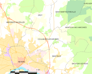
Coulanges-lès-Nevers
- commune in Nièvre, France
- Country:
- Postal Code: 58660
- Coordinates: 47° 0' 19" N, 3° 11' 12" E
- GPS tracks (wikiloc): [Link]
- Area: 10.8 sq km
- Population: 3601
- Web site: [Link]

Challuy
- commune in Nièvre, France
- Country:
- Postal Code: 58000
- Coordinates: 46° 57' 1" N, 3° 8' 54" E
- GPS tracks (wikiloc): [Link]
- Area: 18.89 sq km
- Population: 1540
- Web site: [Link]