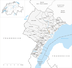
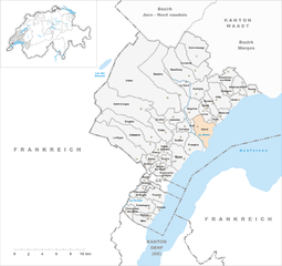
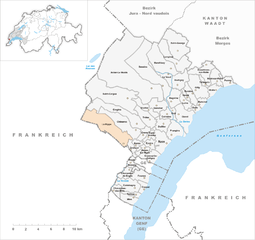
Nyon District (Bezirk Nyon)

- district of the canton of Vaud, Switzerland
 Hiking in Nyon District
Hiking in the Nyon District, located in the Vaud canton of Switzerland, offers a stunning blend of natural beauty, cultural sites, and diverse landscapes. Here are some key highlights to consider when hiking in this area:
Scenic Views
The Nyon District is situated along the north shore of Lake Geneva, surrounded by the majestic Jura Mountains and, to the south, the Alps. Hikers can enjoy breathtaking views of the lake and the mountains, making it a picturesque destination for both casual and experienced hikers.
Trails and Routes
-
Le Mont Notre-Dame: This hike offers a moderate trail that leads to beautiful vistas of the surrounding areas and the lake. It's a favorite among locals for its accessibility and scenic views.
-
La Côte Region: The vineyards between Nyon and Geneva are interspersed with marked hiking trails. You can walk through picturesque villages like Mont-sur-Rolle and enjoy wine-tasting opportunities along the way.
-
Jura Crest Trail: This longer trek runs along the ridge of the Jura Mountains offering panoramic views of the landscape. Portions of this trail pass through the Nyon District, allowing hikers to experience the rugged terrain and scenic beauty.
-
Lac de Divonne: Just across the border in France, this area provides lovely lakeside walks and trails that are suitable for families or those looking for a leisurely hike.
Flora and Fauna
The diverse ecosystems in the Nyon District are home to various plant and animal species. Hikers may encounter wildflowers, beech and conifer forests, and possibly wildlife such as deer and various bird species.
Accessibility and Facilities
Nyon is well-connected by public transportation, making it an easy point of access for hikers. There are various amenities in the town, including cafes and restaurants for post-hike refreshments. Many trails are well-marked, ensuring that hikers can find their way even if they are unfamiliar with the area.
Tips for Hiking
- Check Weather Conditions: The weather can change rapidly in mountain areas, so it's crucial to check forecasts.
- Stay Hydrated and Pack Essentials: Always bring enough water, snacks, and a first-aid kit, especially for longer hikes.
- Footwear: Wear sturdy hiking boots that provide good traction to navigate the trails comfortably.
- Respect Nature: Stick to marked paths, follow local guidelines, and practice Leave No Trace principles.
Overall, the Nyon District is a fantastic destination for hiking, offering a mix of challenging and easy trails with stunning scenery and a chance to experience local culture and cuisine.
- Country:

- Capital: Nyon
- Licence Plate Code: VD
- Coordinates: 46° 25' 12" N, 6° 13' 18" E


- GPS tracks (wikiloc): [Link]
- AboveSeaLevel: 469 м m
- Area: 307.34 sq km
- Wikipedia en: wiki(en)
- Wikipedia: wiki(de)
- Wikidata storage: Wikidata: Q675501
- Wikipedia Commons Category: [Link]
- Freebase ID: [/m/094wzs]
- GeoNames ID: Alt: [7285006]
- archINFORM location ID: [42799]
- HDS ID: [7579]
Includes regions:
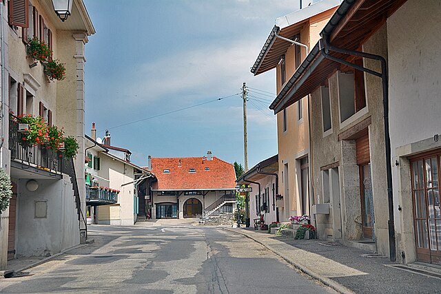
Arnex-sur-Nyon
- municipality in Switzerland
Hiking in Arnex-sur-Nyon
Arnex-sur-Nyon is a charming village located in the Vaud region of Switzerland, near Lake Geneva. The area is known for its picturesque landscapes, rolling hills, and stunning views of the Alps, making it a great destination for hiking enthusiasts....
- Country:
- Local Dialing Code: 022
- Licence Plate Code: VD
- Coordinates: 46° 22' 0" N, 6° 11' 0" E
- GPS tracks (wikiloc): [Link]
- AboveSeaLevel: 454 м m
- Area: 2.04 sq km
- Population: 224
- Web site: [Link]


Arzier
- municipality in Switzerland
Hiking in Arzier
Arzier-Le Muids, located in the Vaud canton of Switzerland, is a beautiful destination for hiking enthusiasts. Nestled in the Jura Mountains, it offers breathtaking views of Lake Geneva and the surrounding landscapes. Here’s what you can expect when hiking in this area:...
- Country:
- Postal Code: 1273
- Local Dialing Code: 022
- Licence Plate Code: VD
- Coordinates: 46° 29' 13" N, 6° 9' 29" E
- GPS tracks (wikiloc): [Link]
- AboveSeaLevel: 1299 м m
- Area: 51.89 sq km
- Population: 2656
- Web site: [Link]


Bassins
- municipality in Switzerland
Hiking in Bassins
Hiking in the Bassins region, which often refers to areas featuring natural basins or depressions, can offer a unique experience depending on the specific location you're interested in. Here are some general insights about hiking in regions characterized by basins:...
- Country:
- Local Dialing Code: 022
- Licence Plate Code: VD
- Coordinates: 46° 28' 0" N, 6° 14' 0" E
- GPS tracks (wikiloc): [Link]
- AboveSeaLevel: 753 м m
- Area: 20.80 sq km
- Population: 1351
- Web site: [Link]

Begnins
- municipality in Switzerland
Hiking in Begnins
Begnins is a charming village located in the Vaud region of Switzerland, near the shores of Lake Geneva. It offers several excellent hiking opportunities, characterized by picturesque landscapes, vineyards, and panoramic views of the surrounding area, including the Alps and the lake....
- Country:
- Postal Code: 1268
- Local Dialing Code: 022
- Licence Plate Code: VD
- Coordinates: 46° 26' 48" N, 6° 15' 12" E
- GPS tracks (wikiloc): [Link]
- AboveSeaLevel: 624 м m
- Area: 4.76 sq km
- Population: 1910
- Web site: [Link]
Bogis-Bossey
- municipality in Switzerland
Hiking in Bogis-Bossey
Bogis-Bossey is a picturesque village located in the Vaud region of Switzerland, near Lake Geneva and nestled in the beautiful foothills of the Jura Mountains. It offers a range of hiking opportunities that cater to all experience levels. Here are some highlights and tips for hiking in Bogis-Bossey:...
- Country:
- Local Dialing Code: 022
- Licence Plate Code: VD
- Coordinates: 46° 21' 14" N, 6° 10' 18" E
- GPS tracks (wikiloc): [Link]
- AboveSeaLevel: 465 м m
- Area: 2.44 sq km
- Population: 910
- Web site: [Link]
Borex
- municipality in Switzerland
Hiking in Borex
Borex is a picturesque commune located in Switzerland, near Lake Geneva, which offers a variety of hiking opportunities with stunning views of the surrounding landscapes, including the Alps and the lake itself. The region is characterized by its rolling hills, vineyards, and forests, making it a great destination for both novice and experienced hikers....
- Country:
- Local Dialing Code: 022
- Licence Plate Code: VD
- Coordinates: 46° 22' 51" N, 6° 10' 45" E
- GPS tracks (wikiloc): [Link]
- AboveSeaLevel: 469 м m
- Area: 2.01 sq km
- Population: 1129
- Web site: [Link]
Bursinel
- municipality in Switzerland
Hiking in Bursinel
Bursinel is a small village located in the Vaud canton in Switzerland, situated near the shores of Lake Geneva. While it may not be a major hiking destination, its beautiful surroundings and proximity to regional trails make it an appealing location for hikers....
- Country:
- Local Dialing Code: 021
- Licence Plate Code: VD
- Coordinates: 46° 26' 27" N, 6° 18' 32" E
- GPS tracks (wikiloc): [Link]
- AboveSeaLevel: 418 м m
- Area: 1.76 sq km
- Population: 487
- Web site: [Link]
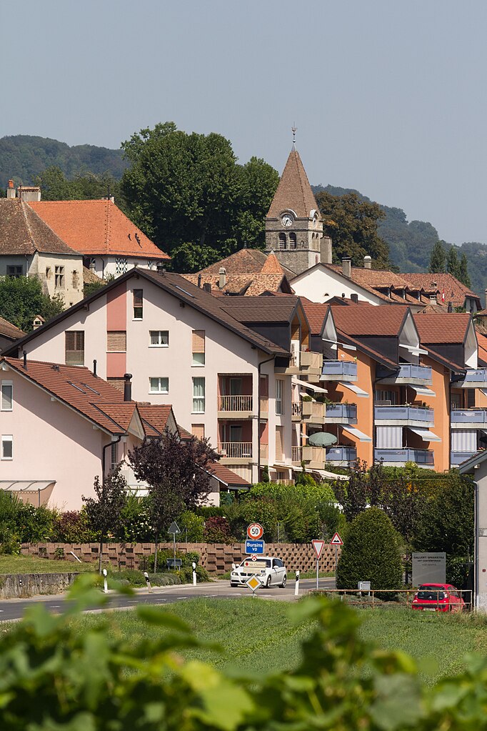

Bursins
- municipality in Switzerland
Hiking in Bursins
Bursins is a charming village located in the Vaud region of Switzerland, known for its beautiful landscapes and proximity to vineyards and Lake Geneva. Hiking in and around Bursins offers several trails that cater to different skill levels and provide picturesque views of the surrounding countryside and the lake....
- Country:
- Local Dialing Code: 021
- Licence Plate Code: VD
- Coordinates: 46° 27' 7" N, 6° 17' 11" E
- GPS tracks (wikiloc): [Link]
- AboveSeaLevel: 461 м m
- Area: 3.36 sq km
- Population: 738
- Web site: [Link]


Burtigny
- municipality in Switzerland
Hiking in Burtigny
Burtigny, located in the Swiss canton of Vaud, is a picturesque village that offers a charming experience for hikers. Nestled in the Jura mountains, it boasts a mix of lush forests, open meadows, and stunning views of the surrounding countryside and nearby mountains....
- Country:
- Local Dialing Code: 022
- Licence Plate Code: VD
- Coordinates: 46° 28' 0" N, 6° 15' 0" E
- GPS tracks (wikiloc): [Link]
- AboveSeaLevel: 750 м m
- Area: 5.69 sq km
- Population: 359
- Web site: [Link]
Chavannes-de-Bogis
- municipality in Switzerland
Hiking in Chavannes-de-Bogis
Chavannes-de-Bogis is a picturesque village located in the Vaud region of Switzerland, near Lake Geneva. It's an excellent spot for hiking enthusiasts, offering beautiful natural landscapes, panoramic views, and a variety of trails suitable for different skill levels. Here are some highlights and tips for hiking in this area:...
- Country:
- Local Dialing Code: 022
- Licence Plate Code: VD
- Coordinates: 46° 21' 0" N, 6° 10' 0" E
- GPS tracks (wikiloc): [Link]
- AboveSeaLevel: 479 м m
- Area: 2.85 sq km
- Population: 1306
- Web site: [Link]
Chavannes-des-Bois
- municipality in Switzerland
Hiking in Chavannes-des-Bois
Chavannes-des-Bois, located in the canton of Vaud in Switzerland, is a beautiful destination for hiking enthusiasts. It offers a mix of stunning landscapes, including lush forests, rolling hills, and breathtaking views of the surrounding Alps....
- Country:
- Local Dialing Code: 022
- Licence Plate Code: VD
- Coordinates: 46° 19' 0" N, 6° 8' 0" E
- GPS tracks (wikiloc): [Link]
- AboveSeaLevel: 469 м m
- Area: 2.13 sq km
- Population: 962
- Web site: [Link]


Chéserex
- municipality in Switzerland
Hiking in Chéserex
Chéserex, a charming village located in the Vaud region of Switzerland, offers a beautiful setting for hiking enthusiasts. Nestled near the shores of Lake Geneva and surrounded by rolling hills and vineyards, the area features a variety of trails suitable for hikers of all levels....
- Country:
- Postal Code: 1275
- Local Dialing Code: 022
- Licence Plate Code: VD
- Coordinates: 46° 25' 0" N, 6° 10' 0" E
- GPS tracks (wikiloc): [Link]
- AboveSeaLevel: 530 м m
- Area: 10.60 sq km
- Population: 1220
- Web site: [Link]


Coinsins
- municipality in Switzerland
Hiking in Coinsins
Coinsins is a charming village located in the Vaud region of Switzerland, near Lake Geneva. It offers opportunities for outdoor enthusiasts and hikers to explore the beautiful landscapes and scenic views of the surrounding areas....
- Country:
- Local Dialing Code: 022
- Licence Plate Code: VD
- Coordinates: 46° 25' 0" N, 6° 14' 0" E
- GPS tracks (wikiloc): [Link]
- AboveSeaLevel: 472 м m
- Area: 2.90 sq km
- Population: 483
- Web site: [Link]


Commugny
- municipality in Switzerland
Hiking in Commugny
Commugny is a charming village located in the canton of Vaud, Switzerland, near Lake Geneva. While it may not be as widely known as some larger hiking destinations, it offers beautiful landscapes and access to more extensive hiking trails in the surrounding areas, making it a lovely spot for outdoor enthusiasts....
- Country:
- Postal Code: 1291
- Local Dialing Code: 022
- Licence Plate Code: VD
- Coordinates: 46° 19' 0" N, 6° 11' 0" E
- GPS tracks (wikiloc): [Link]
- AboveSeaLevel: 419 м m
- Area: 6.52 sq km
- Population: 2848
- Web site: [Link]


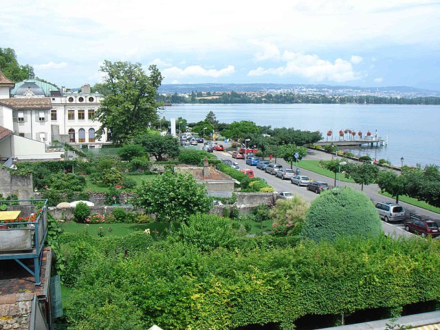
Coppet
- municipality in Switzerland
Hiking in Coppet
Coppet, located near Lake Geneva in Switzerland, offers beautiful hiking opportunities with picturesque landscapes and historical charm. The area is characterized by its stunning views of the lake, vineyards, and the Alps in the distance. Here are some highlights and tips for hiking in and around Coppet:...
- Country:
- Postal Code: 1296
- Local Dialing Code: 022
- Licence Plate Code: VD
- Coordinates: 46° 19' 17" N, 6° 11' 21" E
- GPS tracks (wikiloc): [Link]
- AboveSeaLevel: 397 м m
- Area: 1.93 sq km
- Population: 3152
- Web site: [Link]


Crans-près-Céligny
- municipality in Switzerland
Hiking in Crans-près-Céligny
Crans-près-Céligny, located in the Vaud canton of Switzerland near Lake Geneva, offers beautiful hiking opportunities with stunning views of the surrounding landscapes and the Alps. Here are some highlights about hiking in the area:...
- Country:
- Postal Code: 1299
- Local Dialing Code: 022
- Licence Plate Code: VD
- Coordinates: 46° 21' 0" N, 6° 12' 0" E
- GPS tracks (wikiloc): [Link]
- AboveSeaLevel: 423 м m
- Area: 4.29 sq km
- Population: 2182
- Web site: [Link]


Crassier
- municipality in Switzerland
Hiking in Crassier
Crassier is a small village located in the Vaud canton of Switzerland, near the French border and not far from Lake Geneva. While Crassier itself may not be a prominent hiking destination, it is situated in a beautiful region that offers several hiking opportunities....
- Country:
- Postal Code: 1263
- Local Dialing Code: 022
- Licence Plate Code: VD
- Coordinates: 46° 22' 0" N, 6° 10' 0" E
- GPS tracks (wikiloc): [Link]
- AboveSeaLevel: 475 м m
- Area: 2.03 sq km
- Population: 1153
- Web site: [Link]
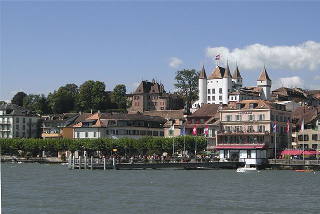

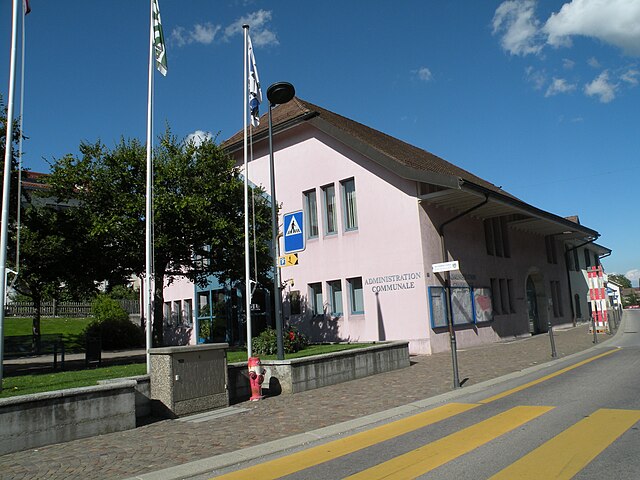
Nyon
- municipality in Switzerland
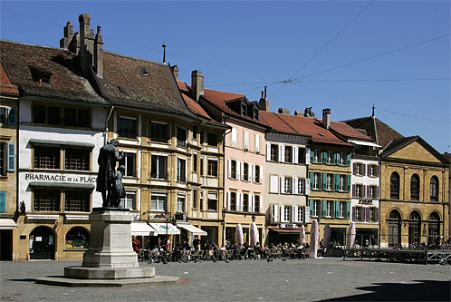
Hiking in Nyon
Nyon, located on the shores of Lake Geneva in Switzerland, offers a variety of hiking opportunities that showcase stunning landscapes, historical sites, and natural beauty. Here are several aspects to consider when hiking in and around Nyon:...
- Country:
- Postal Code: 1260
- Local Dialing Code: 022
- Licence Plate Code: VD
- Coordinates: 46° 19' 44" N, 6° 14' 25" E
- GPS tracks (wikiloc): [Link]
- AboveSeaLevel: 403 м m
- Area: 6.79 sq km
- Population: 20272
- Web site: [Link]
Perroy
- municipality in Switzerland
Hiking in Perroy
Perroy is a charming village located on the shores of Lake Geneva in Switzerland, known for its picturesque landscapes and serene atmosphere. Hiking in and around Perroy offers a wonderful opportunity to explore the stunning natural beauty of the region while enjoying views of the lake and the surrounding vineyards....
- Country:
- Postal Code: 1166
- Local Dialing Code: 021
- Licence Plate Code: VD
- Coordinates: 46° 28' 0" N, 6° 22' 0" E
- GPS tracks (wikiloc): [Link]
- AboveSeaLevel: 418 м m
- Area: 2.89 sq km
- Population: 1508
- Web site: [Link]

Dully
- municipality in Switzerland
Hiking in Dully
Dully, located on the shores of Lake Geneva in Switzerland, offers beautiful landscapes and a tranquil atmosphere for hiking enthusiasts. While it may not be as well-known as some of Switzerland's larger hiking destinations, it provides a unique charm and access to scenic trails....
- Country:
- Postal Code: 1195
- Local Dialing Code: 021
- Licence Plate Code: VD
- Coordinates: 46° 26' 0" N, 6° 18' 0" E
- GPS tracks (wikiloc): [Link]
- AboveSeaLevel: 420 м m
- Area: 1.66 sq km
- Population: 639
- Web site: [Link]


Saint-George
- municipality in Switzerland
Hiking in Saint-George
Saint-George, located near the city of St. George, Utah, offers a variety of hiking opportunities suited for all skill levels and preferences. The area is known for its stunning desert landscapes, red rock formations, and diverse ecosystems. Here are some highlights and popular hiking spots in and around Saint-George:...
- Country:
- Postal Code: 1188
- Local Dialing Code: 022
- Licence Plate Code: VD
- Coordinates: 46° 30' 51" N, 6° 15' 33" E
- GPS tracks (wikiloc): [Link]
- AboveSeaLevel: 949 м m
- Area: 12.30 sq km
- Population: 1028
- Web site: [Link]


Marchissy
- municipality in Switzerland
Hiking in Marchissy
Marchissy is a picturesque village located in the Vaud region of Switzerland, nestled near Lake Geneva and the Jura mountains. It's a great spot for hiking enthusiasts, offering a variety of trails that cater to different skill levels and preferences. Here’s what you can expect when hiking in and around Marchissy:...
- Country:
- Postal Code: 1261
- Local Dialing Code: 022
- Licence Plate Code: VD
- Coordinates: 46° 29' 0" N, 6° 15' 0" E
- GPS tracks (wikiloc): [Link]
- AboveSeaLevel: 825 м m
- Area: 11.98 sq km
- Population: 454
- Web site: [Link]


Vinzel
- municipality in Switzerland
Hiking in Vinzel
Vinzel is a charming village located in the Vaud region of Switzerland, known for its beautiful landscapes and proximity to the scenic vineyards of the Lavaux region. Hiking in and around Vinzel offers a delightful mix of nature, culture, and stunning views....
- Country:
- Postal Code: 1184
- Local Dialing Code: 021
- Licence Plate Code: VD
- Coordinates: 46° 27' 2" N, 6° 16' 37" E
- GPS tracks (wikiloc): [Link]
- AboveSeaLevel: 551 м m
- Area: 1.11 sq km
- Population: 370
- Web site: [Link]


Essertines-sur-Rolle
- municipality in Switzerland
Hiking in Essertines-sur-Rolle
Essertines-sur-Rolle is a charming village located in the Vaud canton of Switzerland, nestled between the Jura Mountains and Lake Geneva. The surrounding region offers a variety of hiking opportunities that cater to different skill levels, from leisurely strolls to more challenging treks....
- Country:
- Postal Code: 1186
- Local Dialing Code: 021
- Licence Plate Code: VD
- Coordinates: 46° 29' 1" N, 6° 18' 45" E
- GPS tracks (wikiloc): [Link]
- AboveSeaLevel: 792 м m
- Area: 6.92 sq km
- Population: 691
- Web site: [Link]


Luins
- municipality in Switzerland
Hiking in Luins
Luins is a picturesque village located in the Vaud region of Switzerland, nested in the Jura mountains and overlooking the beautiful Lake Geneva. Hiking in this area offers stunning landscapes, lush forests, and a rich variety of flora and fauna. Here are some key points to consider for hiking in and around Luins:...
- Country:
- Postal Code: 1184
- Local Dialing Code: 021
- Licence Plate Code: VD
- Coordinates: 46° 27' 0" N, 6° 16' 0" E
- GPS tracks (wikiloc): [Link]
- AboveSeaLevel: 460 м m
- Area: 2.69 sq km
- Population: 605
- Web site: [Link]


Mont-sur-Rolle
- municipality in Switzerland
Hiking in Mont-sur-Rolle
Mont-sur-Rolle is a charming village located in the Swiss canton of Vaud, near Lake Geneva. It offers several fantastic hiking opportunities that cater to a variety of skill levels, with picturesque views of the surrounding landscape, vineyards, and the Jura mountains....
- Country:
- Postal Code: 1185
- Local Dialing Code: 021
- Licence Plate Code: VD
- Coordinates: 46° 28' 0" N, 6° 20' 0" E
- GPS tracks (wikiloc): [Link]
- AboveSeaLevel: 473 м m
- Area: 3.89 sq km
- Population: 2708
- Web site: [Link]

Vich
- municipality in Switzerland
Hiking in Vich
Vich, a picturesque village located in the Canton of Vaud, Switzerland, is an excellent spot for hiking enthusiasts. Nestled near the shores of Lake Geneva and surrounded by the stunning Swiss countryside, Vich offers a variety of hiking trails that cater to different skill levels....
- Country:
- Postal Code: 1267
- Local Dialing Code: 022
- Licence Plate Code: VD
- Coordinates: 46° 25' 41" N, 6° 14' 58" E
- GPS tracks (wikiloc): [Link]
- AboveSeaLevel: 457 м m
- Area: 1.56 sq km
- Population: 1022
- Web site: [Link]
Grens
- municipality in Switzerland
Hiking in Grens
Grens is a lesser-known hiking area that offers a unique experience for outdoor enthusiasts. While it may not be as popular as some larger national parks, it boasts stunning landscapes, diverse ecosystems, and trails that cater to various skill levels....
- Country:
- Postal Code: 1274
- Local Dialing Code: 022
- Licence Plate Code: VD
- Coordinates: 46° 23' 38" N, 6° 11' 29" E
- GPS tracks (wikiloc): [Link]
- AboveSeaLevel: 496 м m
- Area: 2.54 sq km
- Population: 381
- Web site: [Link]


Eysins
- municipality in Switzerland
Hiking in Eysins
Eysins is a small municipality in Switzerland, nestled in the beautiful Vaud region near Lake Geneva. While it may not be as widely known as some larger hiking destinations, it offers a picturesque setting for walkers and hikers looking to explore the scenic countryside....
- Country:
- Postal Code: 1262
- Local Dialing Code: 022
- Licence Plate Code: VD
- Coordinates: 46° 22' 54" N, 6° 12' 24" E
- GPS tracks (wikiloc): [Link]
- AboveSeaLevel: 438 м m
- Area: 2.38 sq km
- Population: 1601
- Web site: [Link]
Genolier
- municipality in Switzerland
Hiking in Genolier
Genolier is a picturesque village located in the Vaud region of Switzerland, nestled between rolling hills and offering stunning views of Lake Geneva and the surrounding Alps. Hiking in Genolier offers a variety of trails suitable for different skill levels and preferences....
- Country:
- Postal Code: 1272
- Local Dialing Code: 022
- Licence Plate Code: VD
- Coordinates: 46° 26' 0" N, 6° 13' 0" E
- GPS tracks (wikiloc): [Link]
- AboveSeaLevel: 547 м m
- Area: 4.83 sq km
- Population: 1937
- Web site: [Link]


Prangins
- municipality in Switzerland
Hiking in Prangins
Prangins, a charming town located in the Vaud region of Switzerland, offers some beautiful hiking opportunities, especially with its stunning backdrop of the Lake Geneva shoreline and the Jura Mountains....
- Country:
- Postal Code: 1197
- Local Dialing Code: 022
- Licence Plate Code: VD
- Coordinates: 46° 24' 2" N, 6° 15' 19" E
- GPS tracks (wikiloc): [Link]
- AboveSeaLevel: 409 м m
- Area: 6.06 sq km
- Population: 4072
- Web site: [Link]

Gland
- municipality in Switzerland
Hiking in Gland
Gland, Switzerland, located on the shores of Lake Geneva and surrounded by the stunning landscapes of the Vaud region, offers several excellent hiking opportunities. Here are some highlights and recommendations for hiking in and around Gland:...
- Country:
- Postal Code: 1196
- Local Dialing Code: 022
- Licence Plate Code: VD
- Coordinates: 46° 25' 0" N, 6° 16' 0" E
- GPS tracks (wikiloc): [Link]
- AboveSeaLevel: 416 м m
- Area: 8.30 sq km
- Population: 13078
- Web site: [Link]

La Rippe
- municipality in Switzerland
Hiking in La Rippe
La Rippe is a beautiful hiking destination located in Switzerland, near the border with France. It offers a variety of trails that cater to different skill levels and preferences, making it an excellent spot for hikers of all kinds. The region is characterized by its picturesque landscapes, lush forests, and sweeping views of the surrounding mountains and valleys....
- Country:
- Postal Code: 1278
- Local Dialing Code: 022
- Licence Plate Code: VD
- Coordinates: 46° 23' 0" N, 6° 9' 0" E
- GPS tracks (wikiloc): [Link]
- AboveSeaLevel: 528 м m
- Area: 16.61 sq km
- Population: 1167
- Web site: [Link]
Tannay
- municipality in Switzerland
Hiking in Tannay
Tannay, a charming village located near Lake Geneva in Switzerland, offers a variety of hiking opportunities that showcase the stunning natural beauty of the region. Here are some highlights to consider when hiking in and around Tannay:...
- Country:
- Postal Code: 1295
- Local Dialing Code: 022
- Licence Plate Code: VD
- Coordinates: 46° 18' 0" N, 6° 11' 0" E
- GPS tracks (wikiloc): [Link]
- AboveSeaLevel: 420 м m
- Area: 1.80 sq km
- Population: 1595
- Web site: [Link]


Givrins
- municipality in Switzerland
Hiking in Givrins
Givrins is a picturesque village located in the Vaud region of Switzerland, nestled near the shores of Lake Geneva. It offers beautiful landscapes, making it an appealing destination for hiking enthusiasts. Here are some insights into hiking in and around Givrins:...
- Country:
- Postal Code: 1271
- Local Dialing Code: 022
- Licence Plate Code: VD
- Coordinates: 46° 26' 0" N, 6° 12' 0" E
- GPS tracks (wikiloc): [Link]
- AboveSeaLevel: 546 м m
- Area: 3.97 sq km
- Population: 989
- Web site: [Link]


Trélex
- municipality in Switzerland
Hiking in Trélex
Trélex is a charming town located in the Vaud region of Switzerland, nestled between Lake Geneva and the Jura Mountains. It offers a fantastic setting for hiking enthusiasts, with beautiful landscapes, picturesque views, and a network of trails suitable for various skill levels....
- Country:
- Postal Code: 1270
- Local Dialing Code: 022
- Licence Plate Code: VD
- Coordinates: 46° 25' 8" N, 6° 11' 48" E
- GPS tracks (wikiloc): [Link]
- AboveSeaLevel: 550 м m
- Area: 5.69 sq km
- Population: 1402
- Web site: [Link]
Signy-Avenex
- municipality in Switzerland
Hiking in Signy-Avenex
Signy-Avenex is situated in the Vaud region of Switzerland, offering beautiful landscapes and a variety of hiking opportunities. The area covers both natural scenery and charming village life, making it a delightful destination for hikers. Here are some key aspects to consider when hiking in Signy-Avenex:...
- Country:
- Postal Code: 1274
- Local Dialing Code: 022
- Licence Plate Code: VD
- Coordinates: 46° 23' 0" N, 6° 12' 0" E
- GPS tracks (wikiloc): [Link]
- AboveSeaLevel: 470 м m
- Area: 1.93 sq km
- Population: 566
- Web site: [Link]


Mies
- municipality in Switzerland
Hiking in Mies
Mies, located in the Canton of Vaud in Switzerland, offers beautiful landscapes and a pleasant hiking environment, although it may not be as widely known for hiking as some other Swiss regions. Here are some key points about hiking in and around Mies:...
- Country:
- Postal Code: 1295
- Local Dialing Code: 022
- Licence Plate Code: VD
- Coordinates: 46° 18' 14" N, 6° 9' 39" E
- GPS tracks (wikiloc): [Link]
- AboveSeaLevel: 436 м m
- Area: 3.47 sq km
- Population: 2050
- Web site: [Link]


Founex
- municipality in Switzerland
Hiking in Founex
Founex is a charming village located near Lake Geneva in the canton of Vaud, Switzerland. While it may not be the most famous hiking destination in the region, it offers access to beautiful trails and scenic views of the lake and surrounding areas....
- Country:
- Postal Code: 1297
- Local Dialing Code: 022
- Licence Plate Code: VD
- Coordinates: 46° 20' 11" N, 6° 11' 6" E
- GPS tracks (wikiloc): [Link]
- AboveSeaLevel: 420 м m
- Area: 4.79 sq km
- Population: 3796
- Web site: [Link]

Le Vaud
- municipality in Switzerland
Hiking in Le Vaud
Le Vaud is a charming village located in the Vaud region of Switzerland, surrounded by picturesque landscapes and offering a variety of outdoor activities, including hiking. The area is characterized by its rolling hills, lush forests, and stunning views of the nearby mountains and Lake Geneva. Here are a few key points to consider when hiking in and around Le Vaud:...
- Country:
- Postal Code: 1261
- Local Dialing Code: 022
- Licence Plate Code: VD
- Coordinates: 46° 28' 39" N, 6° 14' 1" E
- GPS tracks (wikiloc): [Link]
- AboveSeaLevel: 825 м m
- Area: 3.11 sq km
- Population: 1274
- Web site: [Link]


Saint-Cergue
- municipality in Switzerland
Hiking in Saint-Cergue
Saint-Cergue is a charming village located in the Jura Mountains of Switzerland, offering a fantastic destination for hiking enthusiasts. Its picturesque landscapes, diverse trails, and stunning views of the surrounding mountains and Lake Geneva make it an appealing spot for both casual hikers and more experienced adventurers....
- Country:
- Postal Code: 1264
- Local Dialing Code: 022
- Licence Plate Code: VD
- Coordinates: 46° 27' 5" N, 6° 7' 38" E
- GPS tracks (wikiloc): [Link]
- AboveSeaLevel: 1217 м m
- Area: 24.26 sq km
- Population: 2547
- Web site: [Link]


Gingins
- municipality in Switzerland
Hiking in Gingins
Gingins, located in the Vaud region of Switzerland, is a picturesque area offering beautiful landscapes and a variety of hiking opportunities. The region is characterized by rolling hills, vineyards, and stunning views of the Jura Mountains and Lake Geneva. Here are some key points to consider when planning a hiking trip in Gingins:...
- Country:
- Postal Code: 1276
- Local Dialing Code: 022
- Licence Plate Code: VD
- Coordinates: 46° 25' 34" N, 6° 8' 17" E
- GPS tracks (wikiloc): [Link]
- AboveSeaLevel: 1212 м m
- Area: 12.58 sq km
- Population: 1210
- Web site: [Link]


Rolle
- municipality in Switzerland
Hiking in Rolle
Rolle, located in the Canton of Vaud in Switzerland, offers beautiful hiking opportunities that take advantage of the stunning landscapes surrounding Lake Geneva and the nearby Jura Mountains. Here are some key points about hiking in this area:...
- Country:
- Postal Code: 1180
- Local Dialing Code: 021
- Licence Plate Code: VD
- Coordinates: 46° 27' 27" N, 6° 19' 54" E
- GPS tracks (wikiloc): [Link]
- AboveSeaLevel: 397 м m
- Area: 2.72 sq km
- Population: 6218
- Web site: [Link]
Tartegnin
- municipality in Switzerland
Hiking in Tartegnin
Tartegnin is a charming commune in Switzerland, situated in the district of Monthey in the Canton of Valais. It offers a variety of hiking opportunities for outdoor enthusiasts, thanks to its picturesque landscapes and diverse terrain....
- Country:
- Postal Code: 1180
- Local Dialing Code: 021
- Licence Plate Code: VD
- Coordinates: 46° 28' 0" N, 6° 18' 57" E
- GPS tracks (wikiloc): [Link]
- AboveSeaLevel: 492 м m
- Area: 1.09 sq km
- Population: 235
- Web site: [Link]


Longirod
- municipality in Switzerland
Hiking in Longirod
Longirod is a picturesque village located in the Vaud region of Switzerland, nestled in the Jura Mountains. It's an excellent location for hiking enthusiasts, offering beautiful landscapes, lush forests, and stunning views of the surrounding mountains and valleys....
- Country:
- Postal Code: 1261
- Local Dialing Code: 022
- Licence Plate Code: VD
- Coordinates: 46° 30' 15" N, 6° 15' 8" E
- GPS tracks (wikiloc): [Link]
- AboveSeaLevel: 956 м m
- Area: 9.48 sq km
- Population: 469
- Web site: [Link]


Gilly
- municipality in Switzerland
Hiking in Gilly
Hiking in Gilly, a village located in the picturesque region of Switzerland, offers a variety of trails that cater to different experience levels and preferences. Situated near the shores of Lake Geneva and surrounded by stunning alpine scenery, Gilly is an excellent destination for both casual walkers and serious hikers....
- Country:
- Postal Code: 1182
- Local Dialing Code: 021
- Licence Plate Code: VD
- Coordinates: 46° 27' 0" N, 6° 18' 0" E
- GPS tracks (wikiloc): [Link]
- AboveSeaLevel: 484 м m
- Area: 7.78 sq km
- Population: 1309
- Web site: [Link]
Duillier
- municipality in Switzerland
Hiking in Duillier
Duillier is a charming village located in the Canton of Vaud, Switzerland, near Lake Geneva and the picturesque town of Nyon. The area is known for its scenic landscapes, vineyards, and the proximity to larger hiking trails in the region....
- Country:
- Postal Code: 1266
- Local Dialing Code: 022
- Licence Plate Code: VD
- Coordinates: 46° 25' 0" N, 6° 14' 0" E
- GPS tracks (wikiloc): [Link]
- AboveSeaLevel: 466 м m
- Area: 4.19 sq km
- Population: 1080
- Web site: [Link]
Shares border with regions:

Morges District
- district of the canton of Vaud, Switzerland
Hiking in Morges District
Morges District, located on the shores of Lake Geneva in Switzerland, offers a variety of scenic hiking opportunities that cater to different skill levels. The region boasts beautiful landscapes, vineyards, and charming villages, making it an excellent destination for hikers....
- Country:
- Capital: Morges
- Licence Plate Code: VD
- Coordinates: 46° 30' 0" N, 6° 30' 0" E
- GPS tracks (wikiloc): [Link]
- AboveSeaLevel: 492 м m
- Area: 372.99 sq km

Jura-Nord vaudois District
- district of the canton of Vaud, Switzerland
Hiking in Jura-Nord vaudois District
Hiking in the Jura-Nord Vaudois District, located in the Jura Mountains of Switzerland, offers stunning landscapes, diverse flora and fauna, and a range of trails that cater to all skill levels. Here are some highlights:...
- Country:
- Capital: Yverdon-les-Bains
- Licence Plate Code: VD
- Coordinates: 46° 46' 0" N, 6° 38' 0" E
- GPS tracks (wikiloc): [Link]
- AboveSeaLevel: 654 м m
- Area: 702.61 sq km