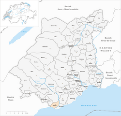
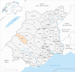
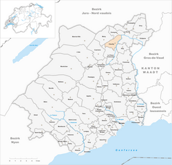
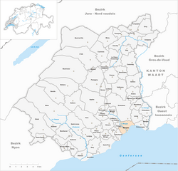
Morges District (Bezirk Morges)

- district of the canton of Vaud, Switzerland
 Hiking in Morges District
Morges District, located on the shores of Lake Geneva in Switzerland, offers a variety of scenic hiking opportunities that cater to different skill levels. The region boasts beautiful landscapes, vineyards, and charming villages, making it an excellent destination for hikers.
Popular Hiking Routes:
-
Sentier des Toblerones:
- This trail, named after the Toblerone chocolate shape in the landscape, follows the ridge along Lake Geneva, offering stunning panoramic views. It's a relatively easy hike that connects the towns of Montreux and Vevey, passing through vineyards and offering plenty of spots for picnicking.
-
Hike to the Lavaux Vineyards:
- The Lavaux region, a UNESCO World Heritage site, is famous for its terraced vineyards along the lakeside. You can hike through the vineyards, enjoy wine tastings at local wineries, and soak in the breathtaking views of Lake Geneva and the Alps.
-
Mont d'Or:
- For those seeking a bit more challenge, the hike up Mont d'Or offers a moderate ascent with rewarding views from the summit. The trail is well-marked, and you’ll be surrounded by a mix of forests and open hillsides.
-
Around Morges Town:
- Morges itself has several lovely paths along the lakeside promenade, perfect for leisurely walks. The Parc de l'Indépendance offers walking paths with beautiful gardens, and you can find trails that lead into the nearby forests and hills.
Hiking Tips:
- Check the Weather: The weather can change quickly in the Alps, so make sure to check the forecast before heading out.
- Wear Proper Gear: Good hiking shoes are essential, especially in more rugged areas. Dress in layers to adjust to changing temperatures.
- Stay Hydrated: Carry enough water, particularly if hiking on warmer days.
- Respect Nature: Stick to marked trails and leave no trace to help preserve the natural beauty of the area.
Best Time to Hike:
- Spring and Autumn: These seasons are ideal for hiking in Morges District, as the temperatures are moderate, and the scenery is particularly beautiful with blooming flowers or autumn foliage.
- Summer: While excellent for hiking, summer can be warm, so plan your hikes for the cooler parts of the day.
Overall, Morges District provides a wonderful blend of nature, culture, and culinary delight through its hiking trails. Whether you're an experienced hiker or just looking for a short stroll, there's something for everyone to enjoy!
- Country:

- Capital: Morges
- Licence Plate Code: VD
- Coordinates: 46° 30' 0" N, 6° 30' 0" E


- GPS tracks (wikiloc): [Link]
- AboveSeaLevel: 492 м m
- Area: 372.99 sq km
- Wikipedia en: wiki(en)
- Wikipedia: wiki(de)
- Wikidata storage: Wikidata: Q660462
- Wikipedia Commons Category: [Link]
- Freebase ID: [/m/074jdy]
- GeoNames ID: Alt: [6458855]
- BnF ID: [124124316]
- archINFORM location ID: [42797]
- HDS ID: [7577]
Includes regions:


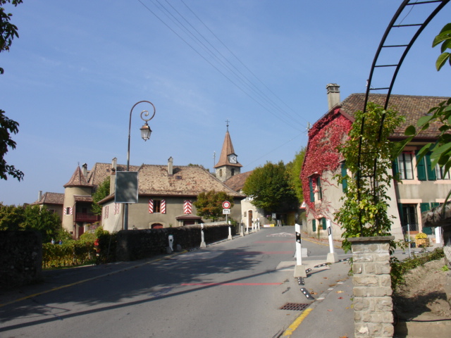
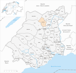
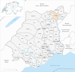
Aclens
- municipality in Switzerland
Hiking in Aclens
Aclens, located in Switzerland, is a charming village in the Canton of Vaud, surrounded by beautiful landscapes, which makes it a great spot for hiking enthusiasts. While Aclens itself might not have extensive hiking trails, it is conveniently situated near larger areas with plenty of hiking opportunities in the nearby regions....
- Country:
- Local Dialing Code: 021
- Licence Plate Code: VD
- Coordinates: 46° 34' 0" N, 6° 31' 0" E
- GPS tracks (wikiloc): [Link]
- AboveSeaLevel: 461 м m
- Area: 3.92 sq km
- Population: 544
- Web site: [Link]
Allaman
- municipality in Switzerland
Hiking in Allaman
Allaman, a charming village located along the shores of Lake Geneva in Switzerland, offers a variety of beautiful hiking opportunities that cater to different skill levels and preferences. Here are some highlights to consider when hiking in and around Allaman:...
- Country:
- Local Dialing Code: 021
- Licence Plate Code: VD
- Coordinates: 46° 28' 12" N, 6° 23' 38" E
- GPS tracks (wikiloc): [Link]
- AboveSeaLevel: 400 м m
- Area: 2.60 sq km
- Population: 438
- Web site: [Link]


Apples
- municipality in Switzerland
Hiking in Apples
Apples, located in the Vaud region of Switzerland, is surrounded by stunning natural beauty and offers various opportunities for hiking. The area is characterized by picturesque landscapes that include rolling hills, vineyards, and views of the nearby Lake Geneva....
- Country:
- Local Dialing Code: 021
- Licence Plate Code: VD
- Coordinates: 46° 33' 0" N, 6° 26' 0" E
- GPS tracks (wikiloc): [Link]
- AboveSeaLevel: 630 м m
- Area: 12.89 sq km
- Population: 1440
- Web site: [Link]


Aubonne
- municipality in the canton of Vaud, Switzerland
Hiking in Aubonne
Aubonne, located in the Vaud canton of Switzerland, is a great destination for hiking enthusiasts. It sits at the foot of the Jura Mountains and is surrounded by beautiful landscapes that include forests, vineyards, and picturesque views of Lake Geneva....
- Country:
- Postal Code: 1170, 1174
- Local Dialing Code: 021
- Licence Plate Code: VD
- Coordinates: 46° 30' 0" N, 6° 23' 0" E
- GPS tracks (wikiloc): [Link]
- AboveSeaLevel: 512 м m
- Area: 9.39 sq km
- Population: 3263
- Web site: [Link]


Ballens
- municipality in Switzerland
Hiking in Ballens
It seems there might be a misunderstanding, as "Ballens" doesn't appear to refer to a widely recognized hiking location or destination in known hiking databases or resources. It's possible that it could be a local area, a less-known trail, or maybe a misspelling of another hiking destination....
- Country:
- Local Dialing Code: 021
- Licence Plate Code: VD
- Coordinates: 46° 33' 0" N, 6° 22' 0" E
- GPS tracks (wikiloc): [Link]
- AboveSeaLevel: 704 м m
- Area: 8.47 sq km
- Population: 524
- Web site: [Link]
Berolle
- municipality in Switzerland
Hiking in Berolle
Berolle, located in the Vaud region of Switzerland, offers beautiful hiking opportunities amid stunning natural scenery. The area is characterized by rolling hills, panoramic views, lush forests, and scenic landscapes, making it a favorite destination for outdoor enthusiasts....
- Country:
- Local Dialing Code: 021
- Licence Plate Code: VD
- Coordinates: 46° 33' 0" N, 6° 20' 0" E
- GPS tracks (wikiloc): [Link]
- AboveSeaLevel: 760 м m
- Area: 9.59 sq km
- Population: 301
- Web site: [Link]

Bière
- municipality in Switzerland
Hiking in Bière
Bière, a charming village in the Vaud region of Switzerland, offers a variety of hiking opportunities that cater to different skill levels and preferences. Nestled at the edge of the Jura Mountains and close to the Lake Geneva area, it provides beautiful landscapes, from rolling hills to forested trails and scenic views over the surrounding countryside....
- Country:
- Local Dialing Code: 021
- Licence Plate Code: VD
- Coordinates: 46° 32' 0" N, 6° 20' 0" E
- GPS tracks (wikiloc): [Link]
- AboveSeaLevel: 698 м m
- Area: 25.0 sq km
- Population: 1572
- Web site: [Link]


Bougy-Villars
- municipality in Switzerland
Hiking in Bougy-Villars
Bougy-Villars is a charming destination located in the Vaud region of Switzerland, offering a variety of hiking opportunities for all levels of outdoor enthusiasts. Nestled in the beautiful Swiss countryside, it provides stunning views of the surrounding landscapes, including the nearby Lake Geneva and the majestic Alps....
- Country:
- Local Dialing Code: 021
- Licence Plate Code: VD
- Coordinates: 46° 29' 0" N, 6° 21' 0" E
- GPS tracks (wikiloc): [Link]
- AboveSeaLevel: 548 м m
- Area: 1.78 sq km
- Population: 481
- Web site: [Link]
Bremblens
- municipality in Switzerland
Hiking in Bremblens
Bremblens, a charming locality located in the canton of Vaud, Switzerland, offers a picturesque backdrop for hiking enthusiasts. While it may not be as well-known as some of the larger hiking destinations in Switzerland, it provides access to beautiful landscapes, rolling hills, and scenic views of the surrounding area, including Lake Geneva and the Alps....
- Country:
- Local Dialing Code: 021
- Licence Plate Code: VD
- Coordinates: 46° 33' 0" N, 6° 31' 0" E
- GPS tracks (wikiloc): [Link]
- AboveSeaLevel: 464 м m
- Area: 2.92 sq km
- Population: 547
- Web site: [Link]
Buchillon
- municipality in Switzerland
Hiking in Buchillon
Buchillon is a picturesque village located on the shores of Lake Geneva in Switzerland, making it an attractive destination for hiking enthusiasts. The area around Buchillon offers a mix of scenic views, charming vineyards, and access to various trails that cater to different skill levels....
- Country:
- Local Dialing Code: 021
- Licence Plate Code: VD
- Coordinates: 46° 28' 0" N, 6° 25' 0" E
- GPS tracks (wikiloc): [Link]
- AboveSeaLevel: 398 м m
- Area: 2.11 sq km
- Population: 641
- Web site: [Link]
Bussy-Chardonney
- municipality in Switzerland
Hiking in Bussy-Chardonney
Bussy-Chardonney is a beautiful commune located in the canton of Vaud, Switzerland. While it may not be as widely known as some other hiking destinations in the region, it offers serene trails and picturesque landscapes that can appeal to hiking enthusiasts of all levels....
- Country:
- Local Dialing Code: 021
- Licence Plate Code: VD
- Coordinates: 46° 32' 0" N, 6° 27' 0" E
- GPS tracks (wikiloc): [Link]
- AboveSeaLevel: 520 м m
- Area: 3.10 sq km
- Population: 374
- Web site: [Link]


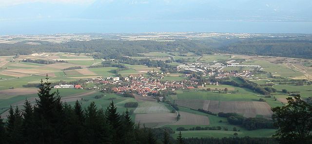
La Chaux
- municipality in Switzerland
Hiking in La Chaux
La Chaux, located near Cossonay in the Canton of Vaud, Switzerland, offers beautiful hiking opportunities with stunning views of the surrounding landscape. The region is characterized by its picturesque countryside, rolling hills, and lush forests....
- Country:
- Postal Code: 1308
- Local Dialing Code: 021
- Licence Plate Code: VD
- Coordinates: 46° 36' 58" N, 6° 28' 22" E
- GPS tracks (wikiloc): [Link]
- AboveSeaLevel: 559 м m
- Area: 6.74 sq km
- Population: 421
- Web site: [Link]


Chavannes-le-Veyron
- municipality in Switzerland
Hiking in Chavannes-le-Veyron
Chavannes-le-Veyron, located in the stunning region of Vaud in Switzerland, offers an excellent setting for hiking enthusiasts. Surrounded by picturesque landscapes, breathtaking vistas of the Alps, and lush greenery, this area has various trails that cater to different skill levels, from easy walks to more challenging hikes....
- Country:
- Local Dialing Code: 021
- Licence Plate Code: VD
- Coordinates: 46° 36' 0" N, 6° 27' 0" E
- GPS tracks (wikiloc): [Link]
- AboveSeaLevel: 610 м m
- Area: 2.58 sq km
- Population: 141
- Web site: [Link]
Chevilly
- municipality in Switzerland
Hiking in Chevilly
Chevilly, located in the Vaud region of Switzerland, offers a variety of hiking opportunities that showcase the stunning landscapes of the area. While Chevilly itself is a small village, its proximity to the nearby Alps and the picturesque countryside makes it an excellent starting point for hikes....
- Country:
- Local Dialing Code: 021
- Licence Plate Code: VD
- Coordinates: 46° 39' 0" N, 6° 29' 0" E
- GPS tracks (wikiloc): [Link]
- AboveSeaLevel: 575 м m
- Area: 3.89 sq km
- Population: 298
- Web site: [Link]

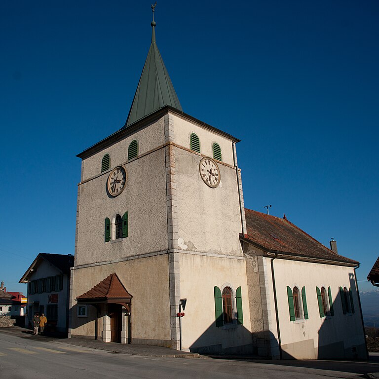
Chigny
- municipality in Switzerland
Hiking in Chigny
Chigny, located in the Canton of Vaud in Switzerland, is a lesser-known gem for hiking enthusiasts. This picturesque village offers access to beautiful trails that provide stunning views of the surrounding countryside, vineyards, and the nearby Jura mountains....
- Country:
- Local Dialing Code: 021
- Licence Plate Code: VD
- Coordinates: 46° 30' 58" N, 6° 28' 36" E
- GPS tracks (wikiloc): [Link]
- AboveSeaLevel: 428 м m
- Area: 0.89 sq km
- Population: 338
- Web site: [Link]
Clarmont
- municipality in Switzerland
Hiking in Clarmont
Claremont, located in the San Gabriel Valley of California, offers a range of hiking opportunities, particularly due to its proximity to the San Gabriel Mountains. Here are some key highlights and trails you might want to explore:...
- Country:
- Local Dialing Code: 021
- Licence Plate Code: VD
- Coordinates: 46° 33' 0" N, 6° 27' 0" E
- GPS tracks (wikiloc): [Link]
- AboveSeaLevel: 525 м m
- Area: 1.02 sq km
- Population: 189
- Web site: [Link]


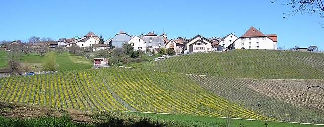
Cossonay
- municipality in Switzerland
Hiking in Cossonay
Cossonay is a charming town located in the canton of Vaud, Switzerland, known for its scenic landscapes and rich history. Hiking in the area offers a variety of trails that cater to different skill levels, showcasing the beautiful Swiss countryside, rolling hills, vineyards, and a picturesque view of the Jura mountains....
- Country:
- Postal Code: 1304
- Local Dialing Code: 021
- Licence Plate Code: VD
- Coordinates: 46° 37' 0" N, 6° 31' 0" E
- GPS tracks (wikiloc): [Link]
- AboveSeaLevel: 562 м m
- Area: 8.29 sq km
- Population: 3813
- Web site: [Link]
Cottens
- municipality in Switzerland
Hiking in Cottens
Cottens is a small village located in the Vaud region of Switzerland, surrounded by stunning natural landscapes that make it an appealing destination for hiking enthusiasts. Here are some highlights and tips for hiking in and around Cottens:...
- Country:
- Postal Code: 1116
- Local Dialing Code: 021
- Licence Plate Code: VD
- Coordinates: 46° 34' 27" N, 6° 27' 12" E
- GPS tracks (wikiloc): [Link]
- AboveSeaLevel: 585 м m
- Area: 2.36 sq km
- Population: 478
- Web site: [Link]


Saint-Prex
- municipality in Switzerland
Hiking in Saint-Prex
Saint-Prex is a charming municipality located on the shores of Lake Geneva in Switzerland, known for its picturesque landscapes and rich history. While it may not be as famous for hiking as some of the higher mountainous regions in Switzerland, there are still several options for outdoor enthusiasts looking to explore the area....
- Country:
- Postal Code: 1162
- Local Dialing Code: 021
- Licence Plate Code: VD
- Coordinates: 46° 29' 1" N, 6° 27' 27" E
- GPS tracks (wikiloc): [Link]
- AboveSeaLevel: 402 м m
- Area: 5.49 sq km
- Population: 5682
- Web site: [Link]


Lonay
- municipality in Switzerland
Hiking in Lonay
Lonay is a charming municipality located on the shores of Lake Geneva in Switzerland. While it might not be as widely recognized as some of the larger hiking destinations in the region, it offers a variety of beautiful trails that cater to different skill levels. Here’s what you need to know about hiking in and around Lonay:...
- Country:
- Postal Code: 1127
- Local Dialing Code: 021
- Licence Plate Code: VD
- Coordinates: 46° 32' 0" N, 6° 31' 0" E
- GPS tracks (wikiloc): [Link]
- AboveSeaLevel: 416 м m
- Area: 3.71 sq km
- Population: 2491
- Web site: [Link]


L'Isle
- municipality in Switzerland
Hiking in L'Isle
L'Isle is a charming area, often referred to as L'Isle-sur-la-Sorgue, located in the Provence region of France. Known for its picturesque canals, beautiful landscapes, and vibrant markets, L'Isle also offers several hiking opportunities nearby....
- Country:
- Postal Code: 1148
- Local Dialing Code: 021
- Licence Plate Code: VD
- Coordinates: 46° 37' 0" N, 6° 25' 0" E
- GPS tracks (wikiloc): [Link]
- AboveSeaLevel: 660 м m
- Area: 16.25 sq km
- Population: 1000
- Web site: [Link]
Denens
- municipality in Switzerland
Hiking in Denens
Denens is a quaint village located in the Vaud region of Switzerland, near Lake Geneva. While it may not be as famous as some other hiking destinations in the country, it offers beautiful landscapes and access to a range of hiking trails that showcase the stunning Swiss scenery, including views of the Alps and Lake Geneva....
- Country:
- Postal Code: 1135
- Local Dialing Code: 021
- Licence Plate Code: VD
- Coordinates: 46° 31' 0" N, 6° 27' 0" E
- GPS tracks (wikiloc): [Link]
- AboveSeaLevel: 504 м m
- Area: 3.27 sq km
- Population: 774
- Web site: [Link]
Ferreyres
- municipality in Switzerland
Hiking in Ferreyres
Ferreyres is a lesser-known hiking destination that offers a serene and beautiful landscape for nature lovers. While specific trails and details may vary, here are some general aspects to consider when hiking in areas like Ferreyres:...
- Country:
- Postal Code: 1313
- Local Dialing Code: 021
- Licence Plate Code: VD
- Coordinates: 46° 40' 0" N, 6° 29' 0" E
- GPS tracks (wikiloc): [Link]
- AboveSeaLevel: 560 м m
- Area: 3.16 sq km
- Population: 321
- Web site: [Link]

Cuarnens
- municipality in Switzerland
Hiking in Cuarnens
Cuarnens, a charming village located in the Vaud region of Switzerland, offers beautiful landscapes and a range of hiking opportunities suitable for various skill levels. The area features rolling hills, lush forests, and scenic views of the surrounding countryside, making it an excellent spot for both leisurely walks and more challenging hikes....
- Country:
- Postal Code: 1309
- Local Dialing Code: 021
- Licence Plate Code: VD
- Coordinates: 46° 38' 0" N, 6° 26' 0" E
- GPS tracks (wikiloc): [Link]
- AboveSeaLevel: 620 м m
- Area: 7.13 sq km
- Population: 479
- Web site: [Link]


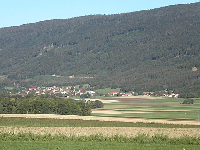
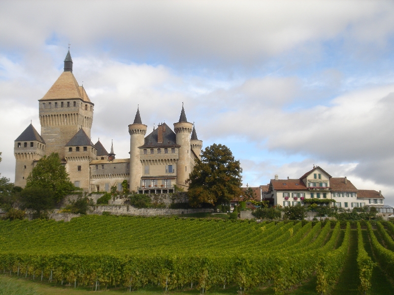
Montricher
- municipality in Switzerland
Hiking in Montricher
Montricher is a picturesque village located in the Vaud region of Switzerland, not far from Lake Geneva and the Jura mountain range. The area is known for its stunning landscapes, making it a great destination for hiking enthusiasts. Here are some points to consider if you're planning a hiking trip in Montricher:...
- Country:
- Postal Code: 1147
- Local Dialing Code: 021
- Licence Plate Code: VD
- Coordinates: 46° 36' 12" N, 6° 21' 32" E
- GPS tracks (wikiloc): [Link]
- AboveSeaLevel: 880 м m
- Area: 25.94 sq km
- Population: 986
- Web site: [Link]

Echandens
- municipality in Switzerland
Hiking in Echandens
Échandens is a charming municipality located in the canton of Vaud in Switzerland, not far from Lausanne. While it may not be as famous as some other hiking destinations, it offers various beautiful landscapes and trails that cater to different skill levels. Here are some tips and insights for hiking in the Échandens area:...
- Country:
- Postal Code: 1026
- Local Dialing Code: 021
- Licence Plate Code: VD
- Coordinates: 46° 32' 0" N, 6° 33' 0" E
- GPS tracks (wikiloc): [Link]
- AboveSeaLevel: 432 м m
- Area: 3.87 sq km
- Population: 2762
- Web site: [Link]

Vullierens
- municipality in Switzerland
Hiking in Vullierens
Vullierens is a picturesque village located in the Canton of Vaud, Switzerland. While it may not be as widely known as some larger hiking areas, it offers a peaceful and scenic environment for outdoor enthusiasts. Here are some highlights regarding hiking in and around Vullierens:...
- Country:
- Postal Code: 1115
- Local Dialing Code: 021
- Licence Plate Code: VD
- Coordinates: 46° 34' 24" N, 6° 28' 51" E
- GPS tracks (wikiloc): [Link]
- AboveSeaLevel: 533 м m
- Area: 6.84 sq km
- Population: 499
- Web site: [Link]

Grancy
- municipality in Switzerland
Hiking in Grancy
Grancy, located in the canton of Vaud in Switzerland, is a charming village that offers beautiful hiking opportunities amidst picturesque landscapes. The region is characterized by its rolling hills, lush forests, and stunning views of the surrounding Alps and Lake Geneva....
- Country:
- Postal Code: 1117
- Local Dialing Code: 021
- Licence Plate Code: VD
- Coordinates: 46° 35' 0" N, 6° 28' 0" E
- GPS tracks (wikiloc): [Link]
- AboveSeaLevel: 581 м m
- Area: 5.65 sq km
- Population: 403
- Web site: [Link]
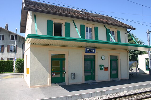

Yens
- municipality in Switzerland
Hiking in Yens
It seems there might be a mix-up with the term "Yens." If you're referring to a specific hiking destination or region, could you please clarify or provide more details?...
- Country:
- Postal Code: 1169
- Local Dialing Code: 021
- Licence Plate Code: VD
- Coordinates: 46° 31' 37" N, 6° 24' 24" E
- GPS tracks (wikiloc): [Link]
- AboveSeaLevel: 637 м m
- Area: 9.52 sq km
- Population: 1386
- Web site: [Link]
Denges
- municipality in Switzerland
Hiking in Denges
Denges, located near Lausanne in Switzerland, is a lesser-known area that offers beautiful landscapes and hiking opportunities, especially for those looking to explore the region without venturing into more crowded paths....
- Country:
- Postal Code: 1026
- Local Dialing Code: 021
- Licence Plate Code: VD
- Coordinates: 46° 31' 24" N, 6° 32' 21" E
- GPS tracks (wikiloc): [Link]
- AboveSeaLevel: 406 м m
- Area: 1.67 sq km
- Population: 1617
- Web site: [Link]
Montherod
- municipality in Switzerland
Hiking in Montherod
Montherod is a charming village located in the Vaud region of Switzerland, near the picturesque Lake Geneva. It's a great destination for outdoor enthusiasts and hikers due to its stunning landscapes, diverse trails, and proximity to the Jura Mountains and the Swiss Alps....
- Country:
- Postal Code: 1174
- Local Dialing Code: 021
- Licence Plate Code: VD
- Coordinates: 46° 30' 0" N, 6° 22' 0" E
- GPS tracks (wikiloc): [Link]
- AboveSeaLevel: 593 м m
- Area: 4.97 sq km
- Population: 532
- Web site: [Link]


Préverenges
- municipality in Switzerland
Hiking in Préverenges
Préverenges is a small municipality located on the shores of Lake Geneva in Switzerland. While it may not be a prominent hiking destination in comparison to the surrounding mountainous regions, there are still plenty of scenic opportunities for hiking and enjoying nature in and around Préverenges....
- Country:
- Postal Code: 1028
- Local Dialing Code: 021
- Licence Plate Code: VD
- Coordinates: 46° 30' 58" N, 6° 31' 45" E
- GPS tracks (wikiloc): [Link]
- AboveSeaLevel: 394 м m
- Area: 1.84 sq km
- Population: 5286
- Web site: [Link]
Villars-sous-Yens
- municipality in Switzerland
Hiking in Villars-sous-Yens
Villars-sous-Yens is a charming village located in the Vaud region of Switzerland, offering beautiful landscapes and an array of hiking opportunities. Nestled in the rolling hills near Lake Geneva, it provides a stunning backdrop for outdoor activities, particularly hiking....
- Country:
- Postal Code: 1168
- Local Dialing Code: 021
- Licence Plate Code: VD
- Coordinates: 46° 31' 0" N, 6° 26' 0" E
- GPS tracks (wikiloc): [Link]
- AboveSeaLevel: 481 м m
- Area: 3.06 sq km
- Population: 614
- Web site: [Link]
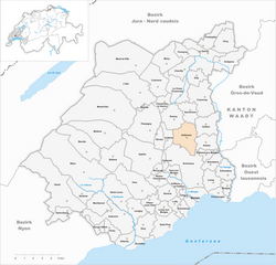
Lussy-sur-Morges
- municipality in Switzerland
Hiking in Lussy-sur-Morges
Lussy-sur-Morges is a charming village located in the Vaud district of Switzerland, known for its picturesque landscapes and proximity to the stunning natural scenery of the region. If you're planning to hike in and around Lussy-sur-Morges, here are some key points to consider:...
- Country:
- Postal Code: 1167
- Local Dialing Code: 021
- Licence Plate Code: VD
- Coordinates: 46° 30' 0" N, 6° 27' 0" E
- GPS tracks (wikiloc): [Link]
- AboveSeaLevel: 458 м m
- Area: 2.33 sq km
- Population: 668
- Web site: [Link]

Echichens
- municipality in Switzerland
Hiking in Echichens
Échichens is a charming village in the Canton of Vaud in Switzerland, nestled amidst beautiful landscapes that are perfect for hiking enthusiasts. The region offers a mix of gentle hills and more challenging terrains, with trails that cater to various skill levels....
- Country:
- Postal Code: 1112, 1113, 1114, 1125
- Local Dialing Code: 021
- Licence Plate Code: VD
- Coordinates: 46° 32' 0" N, 6° 30' 0" E
- GPS tracks (wikiloc): [Link]
- AboveSeaLevel: 466 м m
- Area: 13.3 sq km
- Population: 2706
- Web site: [Link]

Saint-Livres
- municipality in Switzerland
Hiking in Saint-Livres
Saint-Livres is a picturesque village located in the Canton of Vaud in Switzerland, renowned for its stunning landscapes and outdoor activities. Hiking in this area offers a unique blend of natural beauty and cultural experience. Here’s what you need to know:...
- Country:
- Postal Code: 1176
- Local Dialing Code: 021
- Licence Plate Code: VD
- Coordinates: 46° 30' 0" N, 6° 23' 0" E
- GPS tracks (wikiloc): [Link]
- AboveSeaLevel: 603 м m
- Area: 8.10 sq km
- Population: 682
- Web site: [Link]


Lavigny
- municipality in Switzerland
Hiking in Lavigny
Lavigny, a charming village located in the Vaud region of Switzerland, offers an array of picturesque hiking opportunities. Nestled near Lake Geneva, it serves as a splendid starting point for various hiking trails that cater to different skill levels. Here’s an overview of what you can expect when hiking in and around Lavigny:...
- Country:
- Postal Code: 1175
- Local Dialing Code: 021
- Licence Plate Code: VD
- Coordinates: 46° 30' 2" N, 6° 24' 29" E
- GPS tracks (wikiloc): [Link]
- AboveSeaLevel: 517 м m
- Area: 4.01 sq km
- Population: 1012
- Web site: [Link]


Moiry
- municipality in Switzerland
Hiking in Moiry
Hiking in the Moiry region of Switzerland offers spectacular views, stunning landscapes, and a chance to experience the natural beauty of the Swiss Alps. The Moiry Glacier, located in the Pennine Alps near the town of Grimentz, is one of the highlights of this area. Here are some aspects to consider when hiking in Moiry:...
- Country:
- Postal Code: 1148
- Local Dialing Code: 021
- Licence Plate Code: VD
- Coordinates: 46° 39' 1" N, 6° 27' 13" E
- GPS tracks (wikiloc): [Link]
- AboveSeaLevel: 629 м m
- Area: 6.66 sq km
- Population: 313
- Web site: [Link]


Saubraz
- municipality in Switzerland
Hiking in Saubraz
Saubraz is a charming location in Switzerland, nestled in the Vaud region, known for its beautiful countryside and scenic views. Hiking in Saubraz offers a variety of trails suitable for different skill levels, making it an excellent destination for both beginners and experienced hikers....
- Country:
- Postal Code: 1189
- Local Dialing Code: 021
- Licence Plate Code: VD
- Coordinates: 46° 31' 0" N, 6° 20' 0" E
- GPS tracks (wikiloc): [Link]
- AboveSeaLevel: 687 м m
- Area: 3.69 sq km
- Population: 423
- Web site: [Link]
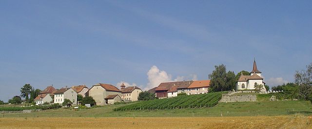
Vaux-sur-Morges
- municipality in Switzerland
Hiking in Vaux-sur-Morges
Vaux-sur-Morges is a charming village located in the Canton of Vaud in Switzerland, situated along the banks of the Morges River. The region offers several hiking opportunities, primarily characterized by picturesque landscapes, charming vineyards, and views of the surrounding hills and the Jura Mountains. Here are some key points about hiking in Vaux-sur-Morges:...
- Country:
- Postal Code: 1126
- Local Dialing Code: 021
- Licence Plate Code: VD
- Coordinates: 46° 32' 0" N, 6° 28' 0" E
- GPS tracks (wikiloc): [Link]
- AboveSeaLevel: 504 м m
- Area: 2.10 sq km
- Population: 199
- Web site: [Link]
Reverolle
- municipality in Switzerland
Hiking in Reverolle
Reverolle is a beautiful area in Switzerland, located in the Vaud region, known for its picturesque landscapes and outdoor recreational opportunities. Hiking in and around Reverolle offers a mix of scenic views, lush nature, and well-marked trails suitable for various skill levels....
- Country:
- Postal Code: 1128
- Local Dialing Code: 021
- Licence Plate Code: VD
- Coordinates: 46° 32' 0" N, 6° 26' 0" E
- GPS tracks (wikiloc): [Link]
- AboveSeaLevel: 585 м m
- Area: 1.17 sq km
- Population: 382
- Web site: [Link]

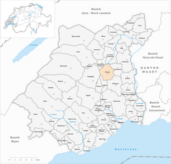
Pampigny
- municipality in Switzerland
Hiking in Pampigny
Pampigny is a charming commune located in the Vaud region of Switzerland, surrounded by beautiful landscapes that are ideal for hiking enthusiasts. While it may not be as well-known as some of the larger Swiss hiking destinations, it offers a variety of trails suitable for different skill levels, showcasing the picturesque Swiss countryside, rolling hills, and stunning views of the surrounding area....
- Country:
- Postal Code: 1142
- Local Dialing Code: 021
- Licence Plate Code: VD
- Coordinates: 46° 35' 0" N, 6° 26' 0" E
- GPS tracks (wikiloc): [Link]
- AboveSeaLevel: 650 м m
- Area: 11.08 sq km
- Population: 1126
- Web site: [Link]


Dizy
- municipality in Switzerland
Hiking in Dizy
Dizy, a picturesque village located in the Vaud region of Switzerland, offers a charming setting for hiking enthusiasts. Nestled on the northern shores of Lake Geneva and surrounded by the stunning landscapes of vineyards, rolling hills, and the Alps in the distance, Dizy provides a unique blend of natural beauty and outdoor activities. Here are some highlights to consider when hiking in and around Dizy:...
- Country:
- Postal Code: 1304
- Local Dialing Code: 021
- Licence Plate Code: VD
- Coordinates: 46° 38' 0" N, 6° 30' 0" E
- GPS tracks (wikiloc): [Link]
- AboveSeaLevel: 583 м m
- Area: 3.04 sq km
- Population: 229
- Web site: [Link]


Orny
- municipality in Switzerland
Hiking in Orny
Orny, located in the scenic region of Switzerland, is a fantastic destination for hiking enthusiasts. Nestled in the heart of the Alps, it boasts breathtaking landscapes, including dramatic mountain peaks, lush valleys, and glacial lakes. Here are some highlights and tips for hiking in Orny:...
- Country:
- Postal Code: 1317
- Local Dialing Code: 021
- Licence Plate Code: VD
- Coordinates: 46° 40' 6" N, 6° 31' 37" E
- GPS tracks (wikiloc): [Link]
- AboveSeaLevel: 466 м m
- Area: 5.55 sq km
- Population: 357
- Web site: [Link]


Lully
- municipality in Switzerland
Hiking in Lully
Lully, located in the Vaud region of Switzerland, is a picturesque area that offers some lovely hiking opportunities amidst beautiful landscapes. The region is characterized by rolling hills, fields, and views of the nearby Lake Geneva and the Alps....
- Country:
- Postal Code: 1132
- Local Dialing Code: 021
- Licence Plate Code: VD
- Coordinates: 46° 30' 0" N, 6° 28' 0" E
- GPS tracks (wikiloc): [Link]
- AboveSeaLevel: 425 м m
- Area: 2.06 sq km
- Population: 794
- Web site: [Link]


Saint-Oyens
- municipality in Switzerland
Hiking in Saint-Oyens
Saint-Oyens, a charming commune located in the Haute-Savoie region of France, offers stunning landscapes and a variety of hiking opportunities for nature enthusiasts. Here are some details about hiking in and around Saint-Oyens:...
- Country:
- Postal Code: 1187
- Local Dialing Code: 021
- Licence Plate Code: VD
- Coordinates: 46° 30' 0" N, 6° 19' 0" E
- GPS tracks (wikiloc): [Link]
- AboveSeaLevel: 731 м m
- Area: 3.04 sq km
- Population: 365
- Web site: [Link]
Tolochenaz
- municipality in Switzerland
Hiking in Tolochenaz
Tolochenaz is a picturesque village located in the Vaud region of Switzerland, near Lake Geneva. While it may not be as widely known as some other hiking hotspots in Switzerland, it offers a charming experience for hikers who want to explore the beauty of the Swiss countryside. Here are a few highlights you might consider when hiking in Tolochenaz:...
- Country:
- Postal Code: 1131
- Local Dialing Code: 021
- Licence Plate Code: VD
- Coordinates: 46° 30' 0" N, 6° 28' 0" E
- GPS tracks (wikiloc): [Link]
- AboveSeaLevel: 423 м m
- Area: 1.58 sq km
- Population: 1879
- Web site: [Link]
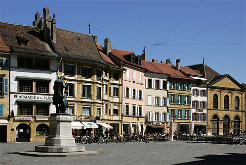
Morges
- city and municipality in Vaud, Switzerland
Hiking in Morges
Morges, located on the shores of Lake Geneva in Switzerland, is an excellent base for hiking enthusiasts. The region is known for its picturesque landscapes, beautiful vineyards, and stunning views of the lake and the surrounding Alps....
- Country:
- Postal Code: 1110
- Local Dialing Code: 021
- Licence Plate Code: VD
- Coordinates: 46° 30' 34" N, 6° 29' 55" E
- GPS tracks (wikiloc): [Link]
- AboveSeaLevel: 374 м m
- Area: 3.86 sq km
- Population: 15838
- Web site: [Link]

Vufflens-le-Château
- municipality in Switzerland
Hiking in Vufflens-le-Château
Vufflens-le-Château is a picturesque village in the canton of Vaud, Switzerland, located near Lake Geneva. While the village itself may not have extensive hiking trails, its proximity to the surrounding areas offers numerous hiking opportunities with stunning views of the lake and the Alps....
- Country:
- Postal Code: 1134
- Local Dialing Code: 021
- Licence Plate Code: VD
- Coordinates: 46° 32' 0" N, 6° 28' 0" E
- GPS tracks (wikiloc): [Link]
- AboveSeaLevel: 470 м m
- Area: 2.14 sq km
- Population: 884
- Web site: [Link]

La Sarraz
- municipality in Switzerland
Hiking in La Sarraz
La Sarraz, located in the Vaud region of Switzerland, offers beautiful landscapes for hiking enthusiasts. The area is known for its rolling hills, charming villages, and scenic views of the surrounding Jura Mountains and Lake Geneva. Here are some highlights and tips for hiking in La Sarraz:...
- Country:
- Postal Code: 1315
- Local Dialing Code: 021
- Licence Plate Code: VD
- Coordinates: 46° 39' 29" N, 6° 30' 30" E
- GPS tracks (wikiloc): [Link]
- AboveSeaLevel: 496 м m
- Area: 7.71 sq km
- Population: 2596
- Web site: [Link]


Etoy
- municipality in Switzerland
Hiking in Etoy
Étoy is a charming village situated in the Vaud region of Switzerland, near Lake Geneva. While it's a smaller location than some of the more famous hiking destinations in the Swiss Alps, it offers some lovely opportunities for walking and hiking in a picturesque setting....
- Country:
- Postal Code: 1163
- Local Dialing Code: 021
- Licence Plate Code: VD
- Coordinates: 46° 29' 0" N, 6° 25' 0" E
- GPS tracks (wikiloc): [Link]
- AboveSeaLevel: 454 м m
- Area: 4.93 sq km
- Population: 2919
- Web site: [Link]


Gimel
- municipality in Switzerland
Hiking in Gimel
Gimel, a picturesque village located in the Vaud region of Switzerland, is a wonderful destination for hiking enthusiasts. Nestled in the scenic landscape of the Jura Mountains, it offers a variety of trails suitable for different skill levels. Here are some highlights and tips for hiking in the area:...
- Country:
- Postal Code: 1188
- Local Dialing Code: 021
- Licence Plate Code: VD
- Coordinates: 46° 31' 0" N, 6° 18' 0" E
- GPS tracks (wikiloc): [Link]
- AboveSeaLevel: 730 м m
- Area: 18.86 sq km
- Population: 2016
- Web site: [Link]


Féchy
- municipality in Switzerland
Hiking in Féchy
Féchy is a charming village located in the Vaud region of Switzerland, known for its picturesque vineyards and stunning views of Lake Geneva and the Alps. Hiking in and around Féchy offers a blend of natural beauty, cultural experiences, and well-marked trails that accommodate various skill levels....
- Country:
- Postal Code: 1173
- Local Dialing Code: 021
- Licence Plate Code: VD
- Coordinates: 46° 29' 0" N, 6° 22' 0" E
- GPS tracks (wikiloc): [Link]
- AboveSeaLevel: 495 м m
- Area: 2.71 sq km
- Population: 896
- Web site: [Link]


Romanel-sur-Morges
- municipality in Switzerland
Hiking in Romanel-sur-Morges
Romanel-sur-Morges is a charming village located in the Vaud region of Switzerland, near Lake Geneva. It's positioned just outside of the bustling city of Lausanne, making it a peaceful spot for hiking enthusiasts looking to explore the beautiful Swiss countryside....
- Country:
- Postal Code: 1122
- Local Dialing Code: 021
- Licence Plate Code: VD
- Coordinates: 46° 33' 0" N, 6° 31' 0" E
- GPS tracks (wikiloc): [Link]
- AboveSeaLevel: 452 м m
- Area: 1.75 sq km
- Population: 469
- Web site: [Link]


Eclépens
- municipality in Switzerland
Hiking in Eclépens
Éclépens is a small municipality located in the Vaud region of Switzerland, often characterized by its picturesque landscapes and natural beauty, making it an appealing spot for hiking enthusiasts. The area around Éclépens offers a range of trails suitable for hikers of various skill levels....
- Country:
- Postal Code: 1312
- Local Dialing Code: 021
- Licence Plate Code: VD
- Coordinates: 46° 39' 0" N, 6° 32' 0" E
- GPS tracks (wikiloc): [Link]
- AboveSeaLevel: 461 м m
- Area: 5.81 sq km
- Population: 1093
- Web site: [Link]


Senarclens
- municipality in Switzerland
Hiking in Senarclens
Senarclens is a charming village in Switzerland's Vaud region, known for its beautiful natural landscapes and proximity to the Jura Mountains. Although it may not be as well-known as other hiking destinations in Switzerland, it offers some wonderful hiking opportunities....
- Country:
- Postal Code: 1304
- Local Dialing Code: 021
- Licence Plate Code: VD
- Coordinates: 46° 36' 0" N, 6° 29' 0" E
- GPS tracks (wikiloc): [Link]
- AboveSeaLevel: 582 м m
- Area: 3.98 sq km
- Population: 505
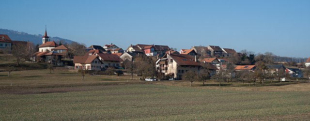
Sévery
- municipality in Switzerland
Hiking in Sévery
Sévery is a picturesque village located in the canton of Vaud, Switzerland, nestled within the stunning landscapes of the Swiss Alps. Hiking in this region offers spectacular views, diverse trails, and an opportunity to experience the natural beauty of Switzerland....
- Country:
- Postal Code: 1141
- Local Dialing Code: 021
- Licence Plate Code: VD
- Coordinates: 46° 35' 0" N, 6° 26' 0" E
- GPS tracks (wikiloc): [Link]
- AboveSeaLevel: 610 м m
- Area: 2.37 sq km
- Population: 233
- Web site: [Link]

Mont-la-Ville
- municipality in Switzerland
Hiking in Mont-la-Ville
Mont-la-Ville, located in Switzerland, is an excellent destination for hiking enthusiasts. The region is characterized by its stunning landscapes, rolling hills, and beautiful vistas. Here are some key points about hiking in Mont-la-Ville:...
- Country:
- Postal Code: 1328
- Local Dialing Code: 021
- Licence Plate Code: VD
- Coordinates: 46° 39' 13" N, 6° 23' 12" E
- GPS tracks (wikiloc): [Link]
- AboveSeaLevel: 1157 м m
- Area: 19.79 sq km
- Population: 418
- Web site: [Link]
Mollens
- municipality in Switzerland
Hiking in Mollens
Mollens is a picturesque village located in the Vaud region of Switzerland, nestled in the scenic landscape of the Swiss Alps. It's an excellent base for hiking enthusiasts due to its stunning surroundings, diverse trails, and breathtaking views....
- Country:
- Postal Code: 1146
- Local Dialing Code: 021
- Licence Plate Code: VD
- Coordinates: 46° 35' 0" N, 6° 22' 0" E
- GPS tracks (wikiloc): [Link]
- AboveSeaLevel: 742 м m
- Area: 11.0 sq km
- Population: 300
- Web site: [Link]
Mauraz
- municipality in Switzerland
Hiking in Mauraz
Mauraz is a charming village located in the Valais region of Switzerland, surrounded by stunning alpine scenery. Hiking in and around Mauraz offers a fantastic way to explore the natural beauty of the Swiss Alps, with varying levels of difficulty suitable for all hikers....
- Country:
- Postal Code: 1148
- Local Dialing Code: 021
- Licence Plate Code: VD
- Coordinates: 46° 36' 0" N, 6° 25' 0" E
- GPS tracks (wikiloc): [Link]
- AboveSeaLevel: 625 м m
- Area: 0.50 sq km
- Population: 60
- Web site: [Link]


Gollion
- municipality in Switzerland
Hiking in Gollion
Gollion is a picturesque village located in the Vaud region of Switzerland, nestled in the hills overlooking Lake Geneva. The area is known for its stunning natural beauty, offering a variety of hiking trails that cater to different skill levels....
- Country:
- Postal Code: 1124
- Local Dialing Code: 021
- Licence Plate Code: VD
- Coordinates: 46° 35' 10" N, 6° 30' 43" E
- GPS tracks (wikiloc): [Link]
- AboveSeaLevel: 504 м m
- Area: 5.44 sq km
- Population: 917
- Web site: [Link]


Pompaples
- municipality in Switzerland
Hiking in Pompaples
Pompaples is a small municipality located in the Canton of Vaud, Switzerland, known for its beautiful landscapes and proximity to nature. Hiking in and around Pompaples offers a variety of trails that cater to different skill levels, from leisurely walks to more challenging hikes....
- Country:
- Postal Code: 1318
- Local Dialing Code: 021
- Licence Plate Code: VD
- Coordinates: 46° 40' 0" N, 6° 31' 0" E
- GPS tracks (wikiloc): [Link]
- AboveSeaLevel: 490 м m
- Area: 4.44 sq km
- Population: 853
- Web site: [Link]
Shares border with regions:

Jura-Nord vaudois District
- district of the canton of Vaud, Switzerland
Hiking in Jura-Nord vaudois District
Hiking in the Jura-Nord Vaudois District, located in the Jura Mountains of Switzerland, offers stunning landscapes, diverse flora and fauna, and a range of trails that cater to all skill levels. Here are some highlights:...
- Country:
- Capital: Yverdon-les-Bains
- Licence Plate Code: VD
- Coordinates: 46° 46' 0" N, 6° 38' 0" E
- GPS tracks (wikiloc): [Link]
- AboveSeaLevel: 654 м m
- Area: 702.61 sq km


Ouest Lausannois District
- district of the canton of Vaud, Switzerland
Hiking in Ouest Lausannois District
The Ouest Lausannois District, located in the canton of Vaud in Switzerland, is a scenic area that offers various hiking opportunities amidst beautiful landscapes, featuring vineyards, rolling hills, and views of Lake Geneva. Here are some highlights and tips for hiking in this region:...
- Country:
- Licence Plate Code: VD
- Coordinates: 46° 32' 19" N, 6° 35' 3" E
- GPS tracks (wikiloc): [Link]
- AboveSeaLevel: 413 м m
- Area: 26.32 sq km

Nyon District
- district of the canton of Vaud, Switzerland
Hiking in Nyon District
Hiking in the Nyon District, located in the Vaud canton of Switzerland, offers a stunning blend of natural beauty, cultural sites, and diverse landscapes. Here are some key highlights to consider when hiking in this area:...
- Country:
- Capital: Nyon
- Licence Plate Code: VD
- Coordinates: 46° 25' 12" N, 6° 13' 18" E
- GPS tracks (wikiloc): [Link]
- AboveSeaLevel: 469 м m
- Area: 307.34 sq km


Gros-de-Vaud District
- district of the canton of Vaud, Switzerland
Hiking in Gros-de-Vaud District
Gros-de-Vaud District, located in the canton of Vaud in Switzerland, offers a wonderful hiking experience with its picturesque landscapes, charming villages, and diverse terrain. Here are some highlights of hiking in this beautiful region:...
- Country:
- Capital: Echallens
- Licence Plate Code: VD
- Coordinates: 46° 37' 59" N, 6° 37' 59" E
- GPS tracks (wikiloc): [Link]
- AboveSeaLevel: 636 м m
- Area: 232.22 sq km