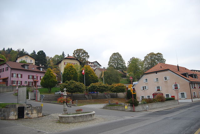
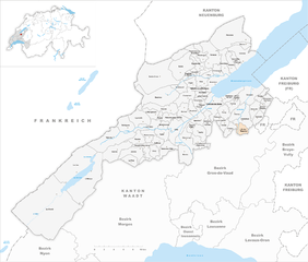
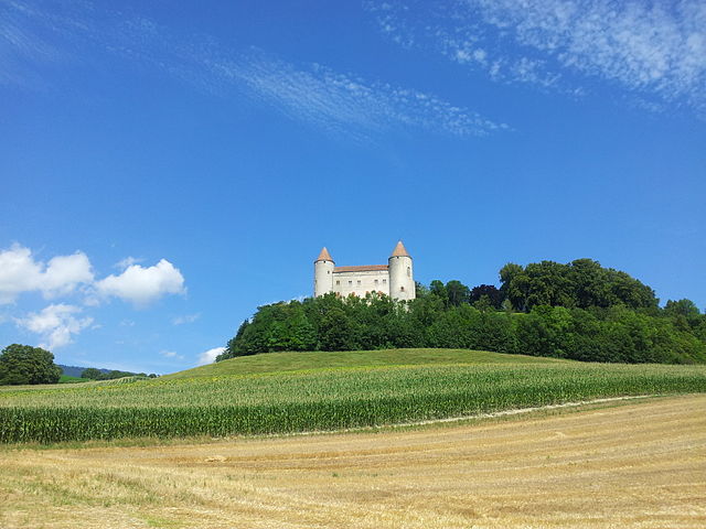
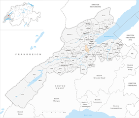
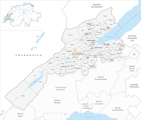
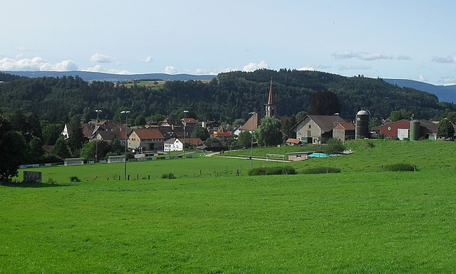
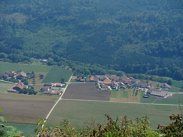
Jura-Nord vaudois District (Bezirk Jura-Nord vaudois)

- district of the canton of Vaud, Switzerland
 Hiking in Jura-Nord vaudois District
Hiking in the Jura-Nord Vaudois District, located in the Jura Mountains of Switzerland, offers stunning landscapes, diverse flora and fauna, and a range of trails that cater to all skill levels. Here are some highlights:
Scenic Trails
- Sentiers des crêtes: This ridge trail provides breathtaking panoramic views of the Alps and Lake Geneva. It's a great spot for experienced hikers looking for a challenging experience.
- Regional Nature Park of Haut-Jura: Part of this area falls within the park's limits, featuring various trails that wind through lush forests, pastological landscapes, and alpine meadows.
Key Locations
- Les Pléiades: This mountain offers several hiking routes with varying difficulty. The views from the summit are spectacular, especially at sunrise or sunset.
- Rochers de Naye: Known for its accessibility via a cogwheel train, hiking to and from this peak provides connectivity to other trails, allowing for route variations.
Flora and Fauna
The Jura region is rich in biodiversity. Hikers can expect to see a variety of plant species, including wildflowers in the spring and rich foliage during the summer months. Wildlife such as chamois and deer can also be spotted, especially in more remote areas.
Practical Considerations
- Season: The best time to hike is during late spring to early autumn (May to September), as trails are well-maintained and weather conditions are generally favorable.
- Gear: Good hiking boots, weather-appropriate clothing, and enough food and water are essential. A map or a GPS device is advisable for navigation.
- Local Tips: Many trails can be accessed from local train stations, making it convenient to explore different areas without the need for a car.
Safety
Always check the weather forecast beforehand and inform someone about your hiking plans. Depending on the trail's difficulty, consider the estimated time and be aware of your limits.
Overall, hiking in the Jura-Nord Vaudois District provides a unique opportunity to explore the natural beauty of Switzerland, offering a mix of challenging routes and accessible paths for enthusiasts of all ages. Enjoy your hike!
- Country:

- Capital: Yverdon-les-Bains
- Licence Plate Code: VD
- Coordinates: 46° 46' 0" N, 6° 38' 0" E


- GPS tracks (wikiloc): [Link]
- AboveSeaLevel: 654 м m
- Area: 702.61 sq km
- Wikipedia en: wiki(en)
- Wikipedia: wiki(de)
- Wikidata storage: Wikidata: Q660762
- Wikipedia Commons Category: [Link]
- Freebase ID: [/m/047mjk8]
- GeoNames ID: Alt: [7285004]
- archINFORM location ID: [42798]
- HDS ID: [49068]
Includes regions:
Agiez
- municipality in Switzerland
Hiking in Agiez
It seems like there may be a typo in "Agiez." If you meant a specific hiking location or region, please clarify. If you're referring to a place like "Aigües," which is a mountainous area in Spain, or "Aiguille," which is often associated with the Mont Blanc area in the French Alps, I can provide information on those....
- Country:
- Local Dialing Code: 024
- Licence Plate Code: VD
- Coordinates: 46° 43' 0" N, 6° 30' 0" E
- GPS tracks (wikiloc): [Link]
- AboveSeaLevel: 526 м m
- Area: 5.47 sq km
- Population: 314
- Web site: [Link]

Arnex-sur-Orbe
- municipality in Switzerland
Hiking in Arnex-sur-Orbe
Arnex-sur-Orbe is a charming village located in the Swiss canton of Vaud, nestled in the beautiful Jura Mountains. The area offers a variety of hiking opportunities that cater to different skill levels, from easy walks to more challenging routes. Here are some key points about hiking in and around Arnex-sur-Orbe:...
- Country:
- Local Dialing Code: 024
- Licence Plate Code: VD
- Coordinates: 46° 42' 0" N, 6° 31' 0" E
- GPS tracks (wikiloc): [Link]
- AboveSeaLevel: 543 м m
- Area: 7.62 sq km
- Population: 641
- Web site: [Link]

Ballaigues
- municipality in Switzerland
Hiking in Ballaigues
Ballaigues is a charming village located in the Vaud region of Switzerland, nestled amidst stunning landscapes that offer excellent hiking opportunities. Here are some key points to consider when hiking in and around Ballaigues:...
- Country:
- Local Dialing Code: 021
- Licence Plate Code: VD
- Coordinates: 46° 44' 6" N, 6° 24' 37" E
- GPS tracks (wikiloc): [Link]
- AboveSeaLevel: 995 м m
- Area: 9.06 sq km
- Population: 1092
- Web site: [Link]


Baulmes
- municipality in Switzerland
Hiking in Baulmes
Baulmes is a charming village located in the Jura mountains region of Switzerland, known for its picturesque landscapes and outdoor activities, including hiking. The area offers a range of trails that cater to different levels of experience, making it a great destination for both novice and experienced hikers....
- Country:
- Local Dialing Code: 024
- Licence Plate Code: VD
- Coordinates: 46° 47' 16" N, 6° 29' 58" E
- GPS tracks (wikiloc): [Link]
- AboveSeaLevel: 1030 м m
- Area: 22.53 sq km
- Population: 1056
- Web site: [Link]


Bavois
- municipality in Switzerland
Hiking in Bavois
Bavois is a charming village located in Switzerland, known for its beautiful countryside and surrounding nature. The area offers a range of hiking opportunities suitable for various skill levels, making it an excellent destination for both casual walkers and more experienced hikers....
- Country:
- Local Dialing Code: 024
- Licence Plate Code: VD
- Coordinates: 46° 41' 0" N, 6° 34' 0" E
- GPS tracks (wikiloc): [Link]
- AboveSeaLevel: 447 м m
- Area: 9.20 sq km
- Population: 926
- Web site: [Link]
Belmont-sur-Yverdon
- municipality in Switzerland
Hiking in Belmont-sur-Yverdon
Belmont-sur-Yverdon is a picturesque village located in the Canton of Vaud, Switzerland, and is an excellent base for hiking enthusiasts. The region offers a combination of stunning landscapes, including rolling hills, forests, and views of Lake Neuchâtel and the surrounding mountains....
- Country:
- Local Dialing Code: 024
- Licence Plate Code: VD
- Coordinates: 46° 45' 0" N, 6° 37' 0" E
- GPS tracks (wikiloc): [Link]
- AboveSeaLevel: 535 м m
- Area: 6.47 sq km
- Population: 378
- Web site: [Link]

Bioley-Magnoux
- municipality in Switzerland
Hiking in Bioley-Magnoux
Bioley-Magnoux, located in the Vaud region of Switzerland, is a picturesque destination for hiking enthusiasts. Nestled in the Swiss Pre-Alps, this area offers stunning landscapes, lush forests, and panoramic views of the surrounding mountains....
- Country:
- Local Dialing Code: 024
- Licence Plate Code: VD
- Coordinates: 46° 44' 0" N, 6° 43' 0" E
- GPS tracks (wikiloc): [Link]
- AboveSeaLevel: 573 м m
- Area: 4.29 sq km
- Population: 225
- Web site: [Link]
Bofflens
- municipality in Switzerland
Hiking in Bofflens
Bofflens, located in the picturesque region of the Swiss Jura Mountains, is an ideal destination for hiking enthusiasts. The area is characterized by lush greenery, rolling hills, and stunning views of the surrounding landscape. Here are some key points about hiking in Bofflens:...
- Country:
- Local Dialing Code: 024
- Licence Plate Code: VD
- Coordinates: 46° 42' 0" N, 6° 30' 0" E
- GPS tracks (wikiloc): [Link]
- AboveSeaLevel: 572 м m
- Area: 4.21 sq km
- Population: 192
- Web site: [Link]


Bonvillars
- municipality in Switzerland
Hiking in Bonvillars
Bonvillars is a charming village located in the Jura region of Switzerland, offering a variety of hiking opportunities surrounded by beautiful natural landscapes. Here's an overview of what you can expect when hiking in Bonvillars:...
- Country:
- Local Dialing Code: 024
- Licence Plate Code: VD
- Coordinates: 46° 50' 16" N, 6° 40' 17" E
- GPS tracks (wikiloc): [Link]
- AboveSeaLevel: 714 м m
- Area: 7.54 sq km
- Population: 497
- Web site: [Link]


Bretonnières
- municipality in Switzerland
Hiking in Bretonnières
Bretonnières, located in the heart of France, offers a wonderful experience for hikers looking to explore the scenic beauty and cultural heritage of the region. While specific trails and conditions can vary, here are some highlights about hiking in this area:...
- Country:
- Local Dialing Code: 024
- Licence Plate Code: VD
- Coordinates: 46° 43' 0" N, 6° 28' 0" E
- GPS tracks (wikiloc): [Link]
- AboveSeaLevel: 681 м m
- Area: 5.46 sq km
- Population: 262
- Web site: [Link]


Bullet
- municipality in Switzerland
Hiking in Bullet
Hiking in Bullet, Switzerland, offers a unique and beautiful experience, set against the backdrop of the stunning Swiss landscape. Bullet is located in the Canton of Vaud, near the shores of Lake Neuchâtel and is known for its picturesque scenery, rolling hills, and lush forests....
- Country:
- Postal Code: 1453
- Local Dialing Code: 024
- Licence Plate Code: VD
- Coordinates: 46° 50' 33" N, 6° 33' 25" E
- GPS tracks (wikiloc): [Link]
- AboveSeaLevel: 1252 м m
- Area: 16.85 sq km
- Population: 644
- Web site: [Link]


Chamblon
- municipality in Switzerland
Hiking in Chamblon
Chamblon is a charming village located in the Vaud region of Switzerland, surrounded by picturesque landscapes and a variety of hiking options. Here are some details about hiking in and around Chamblon:...
- Country:
- Postal Code: 1436
- Local Dialing Code: 024
- Licence Plate Code: VD
- Coordinates: 46° 47' 0" N, 6° 36' 0" E
- GPS tracks (wikiloc): [Link]
- AboveSeaLevel: 519 м m
- Area: 2.85 sq km
- Population: 533
- Web site: [Link]


Champagne
- municipality in the canton of Vaud, Switzerland
Hiking in Champagne
Hiking in the Champagne region of Switzerland offers a unique blend of scenic vistas, vineyard landscapes, and opportunities to explore charming villages. Although "Champagne" is often associated with the renowned sparkling wine from France, Switzerland does have regions that produce high-quality wines, including the Vaud and Valais regions, which are known for their beautiful orchards and vineyards....
- Country:
- Postal Code: 1424
- Local Dialing Code: 024
- Licence Plate Code: VD
- Coordinates: 46° 49' 0" N, 6° 39' 0" E
- GPS tracks (wikiloc): [Link]
- AboveSeaLevel: 457 м m
- Area: 3.93 sq km
- Population: 1027
- Web site: [Link]

Champvent
- municipality in Switzerland
Hiking in Champvent
Champvent, located in the district of Yverdon-les-Bains in Switzerland, is a charming area with various hiking opportunities that showcase the natural beauty of the region....
- Country:
- Local Dialing Code: 024
- Licence Plate Code: VD
- Coordinates: 46° 46' 59" N, 6° 34' 19" E
- GPS tracks (wikiloc): [Link]
- AboveSeaLevel: 531 м m
- Area: 6.88 sq km
- Population: 674
- Web site: [Link]


Chavannes-le-Chêne
- municipality in Switzerland
Hiking in Chavannes-le-Chêne
Chavannes-le-Chêne is a charming village located in the Vaud region of Switzerland, nestled amidst picturesque landscapes. Hiking in this area offers a wonderful opportunity to explore the natural beauty of the Swiss terrain, including rolling hills, forests, and panoramic views of the surrounding countryside....
- Country:
- Postal Code: 1464
- Local Dialing Code: 024
- Licence Plate Code: VD
- Coordinates: 46° 46' 48" N, 6° 46' 51" E
- GPS tracks (wikiloc): [Link]
- AboveSeaLevel: 668 м m
- Area: 4 sq km
- Population: 298
- Web site: [Link]


Chavornay
- municipality in Switzerland
Hiking in Chavornay
Chavornay, located in the Vaud region of Switzerland, is known for its picturesque countryside and serene landscapes, making it a pleasant spot for hiking enthusiasts. Although it's a smaller town, there are a few hiking trails in and around the area that offer beautiful views of the surrounding hills, vineyards, and forests....
- Country:
- Postal Code: 1373
- Local Dialing Code: 024
- Licence Plate Code: VD
- Coordinates: 46° 42' 0" N, 6° 34' 0" E
- GPS tracks (wikiloc): [Link]
- AboveSeaLevel: 452 м m
- Area: 11.07 sq km
- Population: 4903
- Web site: [Link]


Chêne-Pâquier
- municipality in Switzerland
Hiking in Chêne-Pâquier
Chêne-Pâquier, a charming village located in the Fribourg region of Switzerland, offers some wonderful hiking opportunities suitable for various skill levels. The picturesque landscape features lush forests, rolling hills, and stunning views of the Swiss Alps, making it a great destination for nature lovers and outdoor enthusiasts....
- Country:
- Postal Code: 1464
- Local Dialing Code: 024
- Licence Plate Code: VD
- Coordinates: 46° 45' 57" N, 6° 46' 14" E
- GPS tracks (wikiloc): [Link]
- AboveSeaLevel: 684 м m
- Area: 2.11 sq km
- Population: 138
- Web site: [Link]


Le Chenit
- municipality in Switzerland
Hiking in Le Chenit
Le Chenit, located in the Vallée de Joux in Switzerland, is a beautiful destination for hiking enthusiasts. This picturesque region is known for its stunning landscapes, featuring lush forests, tranquil lakes, and rolling hills, all set against the backdrop of the Vaud Alps....
- Country:
- Postal Code: 1341, 1347, 1348
- Local Dialing Code: 021
- Licence Plate Code: VD
- Coordinates: 46° 36' 0" N, 6° 14' 0" E
- GPS tracks (wikiloc): [Link]
- AboveSeaLevel: 1015 м m
- Area: 99.22 sq km
- Population: 4597
- Web site: [Link]


Cheseaux-Noréaz
- municipality in Switzerland
Hiking in Cheseaux-Noréaz
Cheseaux-Noréaz, located in the Vaud region of Switzerland, offers a range of hiking opportunities that showcase the area's beautiful landscapes, rolling hills, and scenic views of the surrounding countryside. Here are some highlights for hiking in and around Cheseaux-Noréaz:...
- Country:
- Local Dialing Code: 024
- Licence Plate Code: VD
- Coordinates: 46° 47' 0" N, 6° 41' 0" E
- GPS tracks (wikiloc): [Link]
- AboveSeaLevel: 500 м m
- Area: 6.12 sq km
- Population: 703
- Web site: [Link]

Les Clées
- municipality in Switzerland
Hiking in Les Clées
Les Clées is a small village located in the Vaud region of Switzerland, known for its picturesque landscapes and opportunities for hiking. The area is characterized by stunning views of the surrounding mountains, lush forests, and pleasant walking trails that cater to hikers of all skill levels....
- Country:
- Postal Code: 1356
- Local Dialing Code: 024
- Licence Plate Code: VD
- Coordinates: 46° 44' 0" N, 6° 28' 0" E
- GPS tracks (wikiloc): [Link]
- AboveSeaLevel: 610 м m
- Area: 7.04 sq km
- Population: 181
- Web site: [Link]


Concise
- municipality in Switzerland
Hiking in Concise
Hiking in Concise, a picturesque area in Switzerland, offers beautiful trails that cater to various skill levels. The region features scenic views, lush landscapes, and opportunities to explore local flora and fauna. Key trails often lead through vineyards, along Lake Neuchâtel, and into the nearby Jura mountains....
- Country:
- Local Dialing Code: 024
- Licence Plate Code: VD
- Coordinates: 46° 51' 4" N, 6° 43' 14" E
- GPS tracks (wikiloc): [Link]
- AboveSeaLevel: 725 м m
- Area: 11.41 sq km
- Population: 970
- Web site: [Link]


Corcelles-près-Concise
- municipality in Switzerland
Hiking in Corcelles-près-Concise
Corcelles-près-Concise is a quaint village located in the Vaud canton of Switzerland, nestled near Lake Neuchâtel. This area offers some beautiful scenic hiking opportunities, making it a pleasant destination for outdoor enthusiasts....
- Country:
- Local Dialing Code: 024
- Licence Plate Code: VD
- Coordinates: 46° 50' 0" N, 6° 42' 0" E
- GPS tracks (wikiloc): [Link]
- AboveSeaLevel: 470 м m
- Area: 4.09 sq km
- Population: 377
- Web site: [Link]


Corcelles-sur-Chavornay
- municipality in Switzerland
Hiking in Corcelles-sur-Chavornay
Corcelles-sur-Chavornay is a charming commune located in the Vaud region of Switzerland, known for its scenic landscapes and peaceful countryside. Hiking in this area provides a fantastic opportunity to explore the natural beauty of the region, including rolling hills, forests, and picturesque views of the surrounding mountains....
- Country:
- Local Dialing Code: 024
- Licence Plate Code: VD
- Coordinates: 46° 42' 0" N, 6° 36' 0" E
- GPS tracks (wikiloc): [Link]
- AboveSeaLevel: 558 м m
- Area: 5.49 sq km
- Web site: [Link]


Cronay
- municipality in Switzerland
Hiking in Cronay
It seems there might be a small typo in your question—if you meant "Cronay," I'm not familiar with a specific location by that name related to hiking. However, if you meant a nearby area or another hiking destination, I can provide information based on well-known locations....
- Country:
- Postal Code: 1406
- Local Dialing Code: 024
- Licence Plate Code: VD
- Coordinates: 46° 45' 0" N, 6° 42' 0" E
- GPS tracks (wikiloc): [Link]
- AboveSeaLevel: 626 м m
- Area: 6.61 sq km
- Population: 380
- Web site: [Link]
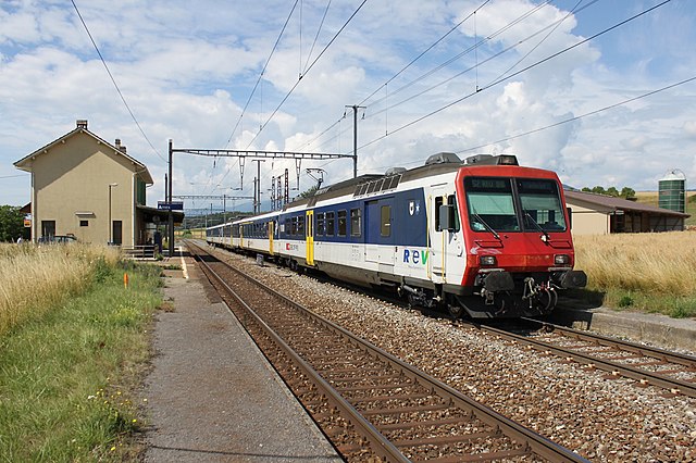
Yverdon-les-Bains
- town in the canton of Vaud, Switzerland, on Lake Neuchâtel
Hiking in Yverdon-les-Bains
Yverdon-les-Bains, located in Switzerland's Vaud region, is an appealing destination for hikers, offering a mix of scenic views, rich history, and diverse trails. Here are some highlights about hiking in and around Yverdon-les-Bains:...
- Country:
- Postal Code: 1400, 1432
- Local Dialing Code: 024
- Licence Plate Code: VD
- Coordinates: 46° 46' 43" N, 6° 38' 27" E
- GPS tracks (wikiloc): [Link]
- AboveSeaLevel: 435 м m
- Area: 11.28 sq km
- Population: 28486
- Web site: [Link]

Orbe
- municipality in Switzerland
Hiking in Orbe
Orbe, located in the Vaud region of Switzerland, offers beautiful hiking opportunities with its picturesque landscapes, historical sites, and diverse flora and fauna. Here are some highlights about hiking in and around Orbe:...
- Country:
- Postal Code: 1350
- Local Dialing Code: 024
- Licence Plate Code: VD
- Coordinates: 46° 43' 28" N, 6° 31' 56" E
- GPS tracks (wikiloc): [Link]
- AboveSeaLevel: 479 м m
- Area: 12.05 sq km
- Population: 6987
- Web site: [Link]


Yvonand
- municipality in Switzerland
Hiking in Yvonand
Yvonand, located along the shores of Lake Neuchâtel in Switzerland, offers a picturesque setting for hiking enthusiasts. The region is known for its beautiful landscapes, rolling hills, and scenic views of the lake and surrounding mountains. Here are some key points about hiking in Yvonand:...
- Country:
- Postal Code: 1462
- Local Dialing Code: 024
- Licence Plate Code: VD
- Coordinates: 46° 47' 25" N, 6° 44' 10" E
- GPS tracks (wikiloc): [Link]
- AboveSeaLevel: 434 м m
- Area: 13.38 sq km
- Population: 3349
- Web site: [Link]


Vallorbe
- municipality in Switzerland
Hiking in Vallorbe
Vallorbe is a picturesque region located in the Swiss Jura Mountains, known for its stunning landscapes, rich flora and fauna, and diverse hiking opportunities. Here are some key highlights for hiking in Vallorbe:...
- Country:
- Postal Code: 1337
- Local Dialing Code: 021
- Licence Plate Code: VD
- Coordinates: 46° 43' 0" N, 6° 23' 0" E
- GPS tracks (wikiloc): [Link]
- AboveSeaLevel: 757 м m
- Area: 2319 sq km
- Population: 3851
- Web site: [Link]


Montcherand
- municipality in Switzerland
Hiking in Montcherand
Montcherand is a charming village located in the Vaud region of Switzerland, surrounded by beautiful landscapes that are perfect for hiking enthusiasts. The area offers a variety of trails that cater to different skill levels, from leisurely walks to more challenging hikes....
- Country:
- Postal Code: 1454
- Local Dialing Code: 024
- Licence Plate Code: VD
- Coordinates: 46° 44' 0" N, 6° 31' 0" E
- GPS tracks (wikiloc): [Link]
- AboveSeaLevel: 569 м m
- Area: 3.05 sq km
- Population: 481
- Web site: [Link]


Montagny-près-Yverdon
- municipality in Switzerland
Hiking in Montagny-près-Yverdon
Montagny-près-Yverdon is a charming municipality located in the Vaud region of Switzerland, known for its beautiful landscapes and proximity to nature. If you’re considering hiking in this area, here are some highlights:...
- Country:
- Postal Code: 1442
- Local Dialing Code: 024
- Licence Plate Code: VD
- Coordinates: 46° 47' 0" N, 6° 37' 0" E
- GPS tracks (wikiloc): [Link]
- AboveSeaLevel: 455 м m
- Area: 3.55 sq km
- Population: 716
- Web site: [Link]


Valeyres-sous-Ursins
- municipality in Switzerland
Hiking in Valeyres-sous-Ursins
Valeyres-sous-Ursins is a charming village located in the district of Morges in the canton of Vaud, Switzerland. It features a beautiful natural landscape, making it an appealing destination for hiking enthusiasts. Here are some key aspects to consider when planning a hike in this region:...
- Country:
- Postal Code: 1412
- Local Dialing Code: 024
- Licence Plate Code: VD
- Coordinates: 46° 45' 0" N, 6° 39' 0" E
- GPS tracks (wikiloc): [Link]
- AboveSeaLevel: 551 м m
- Area: 2.83 sq km
- Population: 239
- Web site: [Link]


Essert-Pittet
- municipality in Switzerland
Hiking in Essert-Pittet
Essert-Pittet is a charming village located in the Swiss canton of Vaud, known for its picturesque landscapes and proximity to nature. While it may not be as widely recognized as some other Swiss hiking destinations, it offers a peaceful retreat for those looking to enjoy scenic trails and explore the stunning Swiss countryside....
- Country:
- Postal Code: 1435
- Local Dialing Code: 024
- Licence Plate Code: VD
- Coordinates: 46° 44' 0" N, 6° 35' 0" E
- GPS tracks (wikiloc): [Link]
- AboveSeaLevel: 450 м m
- Area: 2.76 sq km
- Web site: [Link]


Treycovagnes
- municipality in Switzerland
Hiking in Treycovagnes
Treycovagnes, located in Switzerland, is a small area that offers some beautiful hiking opportunities, particularly because of its proximity to the stunning landscapes of the Valais region. While Treycovagnes itself might not be as well-known as major hiking destinations in Switzerland, its surrounding areas can provide scenic trails suitable for various skill levels....
- Country:
- Postal Code: 1436
- Local Dialing Code: 024
- Licence Plate Code: VD
- Coordinates: 46° 46' 0" N, 6° 36' 0" E
- GPS tracks (wikiloc): [Link]
- AboveSeaLevel: 457 м m
- Area: 2.07 sq km
- Population: 451


Villars-Epeney
- municipality in Switzerland
Hiking in Villars-Epeney
Villars-Epeney is a picturesque area located in the Swiss Alps, known for its stunning landscapes and numerous hiking trails that cater to various skill levels. Here’s what you can expect when hiking in this region:...
- Country:
- Postal Code: 1404
- Local Dialing Code: 024
- Licence Plate Code: VD
- Coordinates: 46° 47' 0" N, 6° 42' 0" E
- GPS tracks (wikiloc): [Link]
- AboveSeaLevel: 548 м m
- Area: 0.86 sq km
- Population: 106
- Web site: [Link]


Mathod
- municipality in Switzerland
Hiking in Mathod
Mathod, a charming municipality in Switzerland, offers various hiking opportunities that cater to different skill levels. The area is characterized by beautiful landscapes, rolling hills, and scenic views, making it an excellent destination for outdoor enthusiasts....
- Country:
- Postal Code: 1438
- Local Dialing Code: 024
- Licence Plate Code: VD
- Coordinates: 46° 46' 0" N, 6° 34' 0" E
- GPS tracks (wikiloc): [Link]
- AboveSeaLevel: 445 м m
- Area: 6.59 sq km
- Population: 616
- Web site: [Link]


Cuarny
- municipality in Switzerland
Hiking in Cuarny
Cuarny is a lesser-known hiking destination that offers beautiful landscapes and outdoor experiences. While details about Cuarny may be limited, many regions often provide a range of trails that cater to different experience levels. Here are some general tips and insights for hiking in an area like Cuarny:...
- Country:
- Postal Code: 1404
- Local Dialing Code: 024
- Licence Plate Code: VD
- Coordinates: 46° 46' 0" N, 6° 41' 0" E
- GPS tracks (wikiloc): [Link]
- AboveSeaLevel: 580 м m
- Area: 4.56 sq km
- Population: 240
- Web site: [Link]
Fiez
- municipality in Switzerland
Hiking in Fiez
Fiez is not a widely known hiking destination, so information specifically about it may be limited. However, if you meant "Fiez" as a place within a specific region or if it might be a lesser-known trail or area in a popular hiking country, please provide more details....
- Country:
- Postal Code: 1420
- Local Dialing Code: 024
- Licence Plate Code: VD
- Coordinates: 46° 51' 5" N, 6° 34' 41" E
- GPS tracks (wikiloc): [Link]
- AboveSeaLevel: 1174 м m
- Area: 6.83 sq km
- Population: 425
- Web site: [Link]


Démoret
- municipality in Switzerland
Hiking in Démoret
Démoret is a lesser-known area for hiking, but it can offer some beautiful landscapes and trails for outdoor enthusiasts. While I do not have specific trail information for Démoret, I can provide general tips and guidance for hiking in rural or lesser-explored regions....
- Country:
- Postal Code: 1415
- Local Dialing Code: 024
- Licence Plate Code: VD
- Coordinates: 46° 45' 0" N, 6° 45' 0" E
- GPS tracks (wikiloc): [Link]
- AboveSeaLevel: 733 м m
- Area: 4.28 sq km
- Population: 146
- Web site: [Link]


Mutrux
- municipality in Switzerland
Hiking in Mutrux
Mutrux, a picturesque village located in Switzerland, is surrounded by stunning landscapes that make it a great place for hiking enthusiasts. Here are some key points about hiking in the area:...
- Country:
- Postal Code: 1428
- Local Dialing Code: 024
- Licence Plate Code: VD
- Coordinates: 46° 53' 0" N, 6° 43' 0" E
- GPS tracks (wikiloc): [Link]
- AboveSeaLevel: 748 м m
- Area: 3.21 sq km
- Population: 163

Suchy
- municipality in Switzerland
Hiking in Suchy
Suchy is a picturesque area for hiking, often known for its beautiful landscapes, diverse terrain, and various trails catering to different skill levels. It's typically characterized by features such as forests, mountains, valleys, and sometimes rivers or lakes, depending on the specific Suchy region you are referring to....
- Country:
- Postal Code: 1433
- Local Dialing Code: 024
- Licence Plate Code: VD
- Coordinates: 46° 43' 17" N, 6° 36' 18" E
- GPS tracks (wikiloc): [Link]
- AboveSeaLevel: 595 м m
- Area: 6.66 sq km
- Population: 604
- Web site: [Link]


Ependes
- municipality in Switzerland
Hiking in Ependes
Épendes, located in the Vaud canton of Switzerland, is a picturesque village surrounded by serene landscapes, making it an excellent spot for hiking enthusiasts. The region offers a mix of gentle rolling hills, lush fields, and stunning views of the Alps and the surrounding countryside....
- Country:
- Postal Code: 1434
- Local Dialing Code: 024
- Licence Plate Code: VD
- Coordinates: 46° 44' 41" N, 6° 36' 10" E
- GPS tracks (wikiloc): [Link]
- AboveSeaLevel: 431 м m
- Area: 4.82 sq km
- Population: 361
- Web site: [Link]


L'Abbaye
- village in Vallée de Joux and municipality of the canton of Vaud, Switzerland
Hiking in L'Abbaye
L'Abbaye, a charming village nestled in the Jura region of Switzerland, offers excellent opportunities for hiking amidst stunning natural landscapes. Here’s a brief overview of what you can expect when hiking in this picturesque area:...
- Country:
- Postal Code: 1344
- Local Dialing Code: 021
- Licence Plate Code: VD
- Coordinates: 46° 38' 8" N, 6° 18' 10" E
- GPS tracks (wikiloc): [Link]
- AboveSeaLevel: 1163 м m
- Area: 31.89 sq km
- Population: 1493
- Web site: [Link]


Le Lieu
- municipality in Switzerland
Hiking in Le Lieu
Le Lieu, located in the Jura region of Switzerland, is a fantastic destination for hiking enthusiasts. This area is characterized by its stunning natural landscapes, including rolling hills, dense forests, and beautiful lake views. Here are some key points to consider when hiking in Le Lieu:...
- Country:
- Postal Code: 1345
- Local Dialing Code: 021
- Licence Plate Code: VD
- Coordinates: 46° 39' 0" N, 6° 17' 0" E
- GPS tracks (wikiloc): [Link]
- AboveSeaLevel: 1043 м m
- Area: 32.54 sq km
- Population: 868
- Web site: [Link]

Suscévaz
- municipality in Switzerland
Hiking in Suscévaz
Suscévaz, while not widely recognized as a hiking destination, offers beautiful landscapes and potential trails for outdoor enthusiasts. Nestled in the countryside, it may have charming paths that wind through forests, fields, or along rivers, providing serene settings ideal for both hiking and nature walks....
- Country:
- Postal Code: 1437
- Local Dialing Code: 024
- Licence Plate Code: VD
- Coordinates: 46° 46' 0" N, 6° 35' 0" E
- GPS tracks (wikiloc): [Link]
- AboveSeaLevel: 445 м m
- Area: 4.15 sq km
- Population: 200
- Web site: [Link]


Ursins
- municipality in Switzerland
Hiking in Ursins
Ursins, located in the French region of Auvergne-Rhône-Alpes, offers a stunning backdrop for hiking enthusiasts. Nestled in the picturesque countryside, the area features a mix of rolling hills, forests, and scenic vistas that showcase the natural beauty of the region....
- Country:
- Postal Code: 1412
- Local Dialing Code: 024
- Licence Plate Code: VD
- Coordinates: 46° 44' 0" N, 6° 40' 0" E
- GPS tracks (wikiloc): [Link]
- AboveSeaLevel: 645 м m
- Area: 3.37 sq km
- Population: 218
- Web site: [Link]


Sainte-Croix
- municipality in Switzerland
Hiking in Sainte-Croix
Sainte-Croix, located in the Vaud region of Switzerland, is a lovely destination for hikers. Nestled in the Jura Mountains, it offers stunning views, varied terrain, and numerous trails suitable for all skill levels. Here are some key highlights about hiking in this area:...
- Country:
- Postal Code: 1450
- Local Dialing Code: 024
- Licence Plate Code: VD
- Coordinates: 46° 49' 0" N, 6° 30' 0" E
- GPS tracks (wikiloc): [Link]
- AboveSeaLevel: 1086 м m
- Area: 39.43 sq km
- Population: 4916
- Web site: [Link]


Grandson
- municipality in Switzerland
Hiking in Grandson
Grandson, Switzerland, is a charming town located on the shores of Lake Neuchâtel, surrounded by beautiful landscapes that offer a variety of hiking opportunities. Here are some highlights and key information about hiking in and around Grandson:...
- Country:
- Postal Code: 1422
- Local Dialing Code: 024
- Licence Plate Code: VD
- Coordinates: 46° 48' 31" N, 6° 38' 39" E
- GPS tracks (wikiloc): [Link]
- AboveSeaLevel: 490 м m
- Area: 786 sq km
- Population: 3280
- Web site: [Link]


Provence
- municipality in Switzerland
Hiking in Provence
Hiking in Provence, Switzerland, is a beautiful experience that offers stunning landscapes, charming villages, and a variety of trails for all experience levels. It's essential to note, however, that "Provence" typically refers to a region in southeastern France known for its lavender fields, vineyards, and Mediterranean climate. If you're specifically looking for hiking experiences within Switzerland, you might consider regions like the Alps or the areas close to Lake Geneva, such as the Vaud or Valais regions....
- Country:
- Postal Code: 1428
- Local Dialing Code: 024
- Licence Plate Code: VD
- Coordinates: 46° 54' 4" N, 6° 41' 3" E
- GPS tracks (wikiloc): [Link]
- AboveSeaLevel: 1283 м m
- Area: 31.84 sq km
- Population: 388
- Web site: [Link]


Juriens
- municipality in Switzerland
Hiking in Juriens
Juriens is a picturesque destination for hiking enthusiasts, offering diverse landscapes, from lush valleys to rocky terrain. Although specific trail information may not be abundantly documented, here are some general aspects to consider:...
- Country:
- Postal Code: 1326
- Local Dialing Code: 024
- Licence Plate Code: VD
- Coordinates: 46° 41' 0" N, 6° 27' 0" E
- GPS tracks (wikiloc): [Link]
- AboveSeaLevel: 797 м m
- Area: 9.35 sq km
- Population: 309
- Web site: [Link]


Vuiteboeuf
- municipality in Switzerland
Hiking in Vuiteboeuf
Vuiteboeuf is a picturesque village located in the Vaud region of Switzerland, renowned for its beautiful landscapes and tranquil hiking trails. Hiking in this area offers a variety of routes suitable for different skill levels, allowing both beginners and experienced hikers to enjoy the natural beauty....
- Country:
- Postal Code: 1445
- Local Dialing Code: 024
- Licence Plate Code: VD
- Coordinates: 46° 48' 29" N, 6° 32' 57" E
- GPS tracks (wikiloc): [Link]
- AboveSeaLevel: 584 м m
- Area: 5.06 sq km
- Population: 584
- Web site: [Link]

Valeyres-sous-Rances
- municipality in Switzerland
Hiking in Valeyres-sous-Rances
Valeyres-sous-Rances is a charming village located in the Jura region of Switzerland, known for its beautiful landscapes and outdoor activities, including hiking. Here are some highlights of hiking in this area:...
- Country:
- Postal Code: 1358
- Local Dialing Code: 024
- Licence Plate Code: VD
- Coordinates: 46° 45' 0" N, 6° 32' 0" E
- GPS tracks (wikiloc): [Link]
- AboveSeaLevel: 507 м m
- Area: 6.35 sq km
- Population: 629
- Web site: [Link]


Lignerolle
- municipality in Switzerland
Hiking in Lignerolle
Lignerolle is a picturesque village located in the Vaud region of Switzerland, surrounded by stunning landscapes, rolling hills, and a mix of forests and meadows. Hiking in this area offers an excellent opportunity to experience the natural beauty and tranquility of the Swiss countryside....
- Country:
- Postal Code: 1357
- Local Dialing Code: 024
- Licence Plate Code: VD
- Coordinates: 46° 44' 0" N, 6° 27' 0" E
- GPS tracks (wikiloc): [Link]
- AboveSeaLevel: 760 м m
- Area: 10.64 sq km
- Population: 416


Rances
- municipality in Switzerland
Hiking in Rances
Rance is a beautiful region in Brittany, France, known for its scenic landscapes, charming villages, and rich history. Hiking in Rance offers a variety of trails that cater to different skill levels, making it an ideal destination for both novice and experienced hikers. Here are some highlights and tips for hiking in the Rance area:...
- Country:
- Postal Code: 1439
- Local Dialing Code: 024
- Licence Plate Code: VD
- Coordinates: 46° 45' 57" N, 6° 30' 27" E
- GPS tracks (wikiloc): [Link]
- AboveSeaLevel: 609 м m
- Area: 9.84 sq km
- Population: 485
- Web site: [Link]

Croy
- municipality in Switzerland
Hiking in Croy
Croy, Switzerland, offers a beautiful and serene hiking experience, surrounded by the stunning landscapes of the Swiss Alps. While Croy itself may not be widely recognized as a prominent hiking destination like Zermatt or Interlaken, its locale provides access to various trails that are ideal for both casual walkers and seasoned hikers. Here are some highlights of hiking in and around Croy:...
- Country:
- Postal Code: 1322
- Local Dialing Code: 024
- Licence Plate Code: VD
- Coordinates: 46° 41' 38" N, 6° 28' 32" E
- GPS tracks (wikiloc): [Link]
- AboveSeaLevel: 643 м m
- Area: 4.48 sq km
- Population: 379
- Web site: [Link]
La Praz
- municipality in Switzerland
Hiking in La Praz
La Praz, located in the French Alps, is a beautiful destination for hiking enthusiasts. Known for its stunning mountain scenery, lush valleys, and clear alpine lakes, it offers a range of hiking trails suitable for various skill levels. Here are some key points about hiking in La Praz:...
- Country:
- Postal Code: 1327
- Local Dialing Code: 024
- Licence Plate Code: VD
- Coordinates: 46° 40' 0" N, 6° 26' 0" E
- GPS tracks (wikiloc): [Link]
- AboveSeaLevel: 872 м m
- Area: 5.12 sq km
- Population: 161


Fontaines-sur-Grandson
- municipality in Switzerland
Hiking in Fontaines-sur-Grandson
Fontaines-sur-Grandson is a beautiful village located in the canton of Vaud, Switzerland, near the shores of Lake Neuchâtel. The area is known for its picturesque landscapes, rolling hills, and scenic views, making it a great destination for hiking enthusiasts. Here are some key points to consider when hiking in and around Fontaines-sur-Grandson:...
- Country:
- Postal Code: 1421
- Local Dialing Code: 024
- Licence Plate Code: VD
- Coordinates: 46° 50' 0" N, 6° 37' 0" E
- GPS tracks (wikiloc): [Link]
- AboveSeaLevel: 563 м m
- Area: 7.86 sq km
- Population: 210
- Web site: [Link]


Sergey
- municipality in Switzerland
Hiking in Sergey
Sergey, Switzerland, is a picturesque destination for hikers, located in the Valais region near the famous ski resort of Verbier. The area is known for its stunning alpine scenery, including majestic mountains, scenic valleys, and beautiful lakes. Here are some key points to consider if you’re planning to hike in Sergey:...
- Country:
- Postal Code: 1355
- Local Dialing Code: 024
- Licence Plate Code: VD
- Coordinates: 46° 45' 4" N, 6° 30' 4" E
- GPS tracks (wikiloc): [Link]
- AboveSeaLevel: 611 м m
- Area: 1.46 sq km
- Population: 137
- Web site: [Link]


Orges
- municipality in Switzerland
Hiking in Orges
Orges, Switzerland, may not be widely known as a hiking destination, but the greater region around it offers a plethora of beautiful hiking opportunities. While Orges itself is a small locality that may not have documented trails, the surrounding areas, particularly in the Canton of Vaud and the nearby Jura Mountains, are rich in picturesque landscapes and well-maintained hiking paths....
- Country:
- Postal Code: 1430
- Local Dialing Code: 024
- Licence Plate Code: VD
- Coordinates: 46° 48' 44" N, 6° 34' 59" E
- GPS tracks (wikiloc): [Link]
- AboveSeaLevel: 596 м m
- Area: 4.02 sq km
- Population: 336
- Web site: [Link]


Molondin
- municipality in Switzerland
Hiking in Molondin
Hiking in Molondin, a picturesque region in Switzerland, offers stunning landscapes, tranquil lakes, and rich biodiversity. Nestled near Lake Neuchâtel, it's an excellent destination for both novice and experienced hikers....
- Country:
- Postal Code: 1415
- Local Dialing Code: 024
- Licence Plate Code: VD
- Coordinates: 46° 46' 0" N, 6° 45' 0" E
- GPS tracks (wikiloc): [Link]
- AboveSeaLevel: 611 м m
- Area: 5.49 sq km
- Population: 232
- Web site: [Link]


Premier
- municipality in Switzerland
Hiking in Premier
Hiking in the region of Premier, Switzerland, offers stunning views and a range of trails suitable for various skill levels. Although there isn't a well-known area specifically named "Premier," you may be referring to the broader region surrounding places like the Bernese Alps or canton of Valais, both renowned for their beautiful landscapes and extensive hiking opportunities....
- Country:
- Postal Code: 1324
- Local Dialing Code: 024
- Licence Plate Code: VD
- Coordinates: 46° 42' 15" N, 6° 26' 44" E
- GPS tracks (wikiloc): [Link]
- AboveSeaLevel: 860 м m
- Area: 6.12 sq km
- Population: 210
- Web site: [Link]
Mauborget
- municipality in Switzerland
Hiking in Mauborget
Mauborget, located in the French Alps, is a lesser-known but beautiful destination for hiking enthusiasts. If you're considering a hiking trip in this area, here are a few key points to keep in mind:...
- Country:
- Postal Code: 1453
- Local Dialing Code: 024
- Licence Plate Code: VD
- Coordinates: 46° 52' 0" N, 6° 36' 30" E
- GPS tracks (wikiloc): [Link]
- AboveSeaLevel: 1266 м m
- Area: 5.50 sq km
- Population: 119
- Web site: [Link]


Valeyres-sous-Montagny
- municipality in Switzerland
Hiking in Valeyres-sous-Montagny
Valeyres-sous-Montagny is a picturesque village located in the Vaud region of Switzerland, surrounded by beautiful landscapes and rolling hills, making it an ideal spot for hiking enthusiasts. Here are some highlights and tips for hiking in and around Valeyres-sous-Montagny:...
- Country:
- Postal Code: 1441
- Local Dialing Code: 024
- Licence Plate Code: VD
- Coordinates: 46° 48' 0" N, 6° 36' 0" E
- GPS tracks (wikiloc): [Link]
- AboveSeaLevel: 471 м m
- Area: 2.27 sq km
- Population: 705
- Web site: [Link]

Donneloye
- municipality in Switzerland
Hiking in Donneloye
Donneloye, located in Switzerland, offers scenic hiking opportunities that showcase the region's natural beauty. While the area may not be as well-known as some other Swiss hiking destinations, it provides a tranquil environment for those looking to explore the outdoors....
- Country:
- Postal Code: 1407, 1408
- Local Dialing Code: 024
- Licence Plate Code: VD
- Coordinates: 46° 45' 1" N, 6° 43' 11" E
- GPS tracks (wikiloc): [Link]
- AboveSeaLevel: 542 м m
- Area: 9.01 sq km
- Population: 809
- Web site: [Link]


Onnens
- municipality in Switzerland
Hiking in Onnens
Onnens is a charming village located in the canton of Vaud, Switzerland, known for its picturesque landscapes and proximity to the beautiful Lake Geneva. Hiking in and around Onnens offers a variety of trails that cater to different skill levels, making it a great destination for both novice and experienced hikers....
- Country:
- Postal Code: 1425
- Local Dialing Code: 024
- Licence Plate Code: VD
- Coordinates: 46° 50' 0" N, 6° 41' 0" E
- GPS tracks (wikiloc): [Link]
- AboveSeaLevel: 477 м m
- Area: 5.13 sq km
- Population: 476
- Web site: [Link]
L'Abergement
- municipality in Switzerland
Hiking in L'Abergement
L'Abergement is a charming destination for hiking enthusiasts, located in the picturesque region of the French Alps. While it may not be as widely known as some other hiking spots, it offers a selection of trails that cater to a variety of skill levels. Here are some highlights about hiking in L'Abergement:...
- Country:
- Postal Code: 1355
- Local Dialing Code: 024
- Licence Plate Code: VD
- Coordinates: 46° 45' 0" N, 6° 29' 0" E
- GPS tracks (wikiloc): [Link]
- AboveSeaLevel: 655 м m
- Area: 5.79 sq km
- Population: 237
- Web site: [Link]


Pomy
- municipality in Switzerland
Hiking in Pomy
Pomy is a small village located in the Swiss canton of Vaud, known for its picturesque landscapes and proximity to the beautiful Lake Geneva. While it may not be as widely recognized as some of the more famous hiking destinations in Switzerland, Pomy offers access to some lovely trails that showcase the region's natural beauty....
- Country:
- Postal Code: 1405
- Local Dialing Code: 024
- Licence Plate Code: VD
- Coordinates: 46° 45' 30" N, 6° 40' 9" E
- GPS tracks (wikiloc): [Link]
- AboveSeaLevel: 558 м m
- Area: 5.62 sq km
- Population: 785
- Web site: [Link]


Vugelles-La Mothe
- municipality in Switzerland
Hiking in Vugelles-La Mothe
Vugelles-La Mothe, located in the beautiful Vaud region of Switzerland, offers stunning landscapes and a range of hiking opportunities. This quaint village is surrounded by rolling hills, forests, and panoramic views of the surrounding mountains, making it an ideal destination for outdoor enthusiasts....
- Country:
- Postal Code: 1431
- Local Dialing Code: 024
- Licence Plate Code: VD
- Coordinates: 46° 49' 0" N, 6° 35' 0" E
- GPS tracks (wikiloc): [Link]
- AboveSeaLevel: 520 м m
- Area: 3.07 sq km
- Population: 122
- Web site: [Link]

Novalles
- municipality in Switzerland
Hiking in Novalles
Novalles, depending on the region you are referring to, generally offers diverse hiking opportunities characterized by scenic landscapes, varied terrains, and potentially rich flora and fauna. If we are discussing Novalles in Spain or a similarly named location, here are some key points to consider:...
- Country:
- Postal Code: 1431
- Local Dialing Code: 024
- Licence Plate Code: VD
- Coordinates: 46° 49' 0" N, 6° 35' 0" E
- GPS tracks (wikiloc): [Link]
- AboveSeaLevel: 571 м m
- Area: 206 sq km
- Population: 101


Giez
- municipality in Switzerland
Hiking in Giez
Giez, a charming village located in the Haute-Savoie region of France, is an excellent base for hiking enthusiasts. Nestled near the foothills of the Alps and the stunning Lake Annecy, it offers diverse trails that cater to different skill levels and preferences. Here are some highlights and considerations for hiking in and around Giez:...
- Country:
- Postal Code: 1429
- Local Dialing Code: 024
- Licence Plate Code: VD
- Coordinates: 46° 49' 0" N, 6° 37' 0" E
- GPS tracks (wikiloc): [Link]
- AboveSeaLevel: 529 м m
- Area: 4.77 sq km
- Population: 421
- Web site: [Link]


Vaulion
- municipality in Switzerland
Hiking in Vaulion
Vaulion is a charming village located in the Vaud region of Switzerland, offering a beautiful setting for hiking enthusiasts. The area is characterized by its rolling hills, lush forests, and picturesque landscapes, making it a great choice for various hiking trails. Here are some key points to consider when hiking in Vaulion:...
- Country:
- Postal Code: 1325
- Local Dialing Code: 021
- Licence Plate Code: VD
- Coordinates: 46° 41' 10" N, 6° 23' 3" E
- GPS tracks (wikiloc): [Link]
- AboveSeaLevel: 960 м m
- Area: 13.17 sq km
- Population: 485
- Web site: [Link]
Orzens
- municipality in Switzerland
Hiking in Orzens
It seems there may be a typo or misspelling in your request, as I couldn't find any specific information related to "Orzens." If you meant "Oregons," "Ouzens," or a specific hiking location, please clarify, and I’ll be happy to provide information on hiking trails, tips, or scenic spots in that area....
- Country:
- Postal Code: 1413
- Local Dialing Code: 021
- Licence Plate Code: VD
- Coordinates: 46° 43' 0" N, 6° 41' 0" E
- GPS tracks (wikiloc): [Link]
- AboveSeaLevel: 622 м m
- Area: 4.19 sq km
- Population: 194
- Web site: [Link]


Romainmôtier-Envy
- municipality in Switzerland
Hiking in Romainmôtier-Envy
Romainmôtier-Envy is a beautiful village located in the Vaud region of Switzerland, known for its stunning landscapes and rich history. When it comes to hiking, this area offers a variety of trails that cater to different skill levels, making it an excellent destination for both novice and experienced hikers....
- Country:
- Postal Code: 1323
- Local Dialing Code: 024
- Licence Plate Code: VD
- Coordinates: 46° 42' 0" N, 6° 28' 0" E
- GPS tracks (wikiloc): [Link]
- AboveSeaLevel: 674 м m
- Area: 697 sq km
- Population: 550
- Web site: [Link]


Rovray
- municipality in Switzerland
Hiking in Rovray
Rovray, located in Switzerland, offers hikers a picturesque escape with its stunning landscapes and well-maintained trails. As a part of the broader region of Vaud, it’s close to the waters of Lake Geneva and the lush Alpine foothills, making it an ideal spot for enthusiasts of all levels....
- Country:
- Postal Code: 1463
- Local Dialing Code: 024
- Licence Plate Code: VD
- Coordinates: 46° 47' 20" N, 6° 46' 0" E
- GPS tracks (wikiloc): [Link]
- AboveSeaLevel: 647 м m
- Area: 3.2 sq km
- Population: 186
- Web site: [Link]
Grandevent
- municipality in Switzerland
Hiking in Grandevent
While I don't have specific information on a location named "Grandevent," it may be a lesser-known hiking area or a local site. However, I can provide some general advice on hiking in mountainous or nature areas, which you can apply to your hiking experiences....
- Country:
- Postal Code: 1421
- Local Dialing Code: 024
- Licence Plate Code: VD
- Coordinates: 46° 50' 0" N, 6° 36' 0" E
- GPS tracks (wikiloc): [Link]
- AboveSeaLevel: 665 м m
- Area: 3.46 sq km
- Population: 229
- Web site: [Link]
Tévenon
- municipality in Switzerland
Hiking in Tévenon
Tévenon is a beautiful area that offers a variety of hiking opportunities amidst scenic landscapes. While specific trails may vary based on local maps and conditions, here are some general tips and highlights about hiking in this region:...
- Country:
- Postal Code: 1423
- Licence Plate Code: VD
- Coordinates: 46° 50' 48" N, 6° 37' 32" E
- GPS tracks (wikiloc): [Link]
- AboveSeaLevel: 750 м m
- Area: 14.27 sq km
- Population: 844
- Web site: [Link]
Shares border with regions:


Broye-Vully District
- district of the canton of Vaud, Switzerland
Hiking in Broye-Vully District
The Broye-Vully District, located in the canton of Vaud in Switzerland, is a fantastic destination for hiking enthusiasts. This region offers a variety of trails suitable for different skill levels, catering to both casual walkers and more experienced hikers....
- Country:
- Capital: Payerne
- Licence Plate Code: VD
- Coordinates: 46° 49' 0" N, 6° 56' 0" E
- GPS tracks (wikiloc): [Link]
- AboveSeaLevel: 471 м m
- Area: 264.98 sq km

Morges District
- district of the canton of Vaud, Switzerland
Hiking in Morges District
Morges District, located on the shores of Lake Geneva in Switzerland, offers a variety of scenic hiking opportunities that cater to different skill levels. The region boasts beautiful landscapes, vineyards, and charming villages, making it an excellent destination for hikers....
- Country:
- Capital: Morges
- Licence Plate Code: VD
- Coordinates: 46° 30' 0" N, 6° 30' 0" E
- GPS tracks (wikiloc): [Link]
- AboveSeaLevel: 492 м m
- Area: 372.99 sq km

Nyon District
- district of the canton of Vaud, Switzerland
Hiking in Nyon District
Hiking in the Nyon District, located in the Vaud canton of Switzerland, offers a stunning blend of natural beauty, cultural sites, and diverse landscapes. Here are some key highlights to consider when hiking in this area:...
- Country:
- Capital: Nyon
- Licence Plate Code: VD
- Coordinates: 46° 25' 12" N, 6° 13' 18" E
- GPS tracks (wikiloc): [Link]
- AboveSeaLevel: 469 м m
- Area: 307.34 sq km


Gros-de-Vaud District
- district of the canton of Vaud, Switzerland
Hiking in Gros-de-Vaud District
Gros-de-Vaud District, located in the canton of Vaud in Switzerland, offers a wonderful hiking experience with its picturesque landscapes, charming villages, and diverse terrain. Here are some highlights of hiking in this beautiful region:...
- Country:
- Capital: Echallens
- Licence Plate Code: VD
- Coordinates: 46° 37' 59" N, 6° 37' 59" E
- GPS tracks (wikiloc): [Link]
- AboveSeaLevel: 636 м m
- Area: 232.22 sq km