Ormoy (Ormoy)

- commune in Eure-et-Loir, France
- Country:

- Postal Code: 28210
- Coordinates: 48° 37' 19" N, 1° 28' 23" E


- GPS tracks (wikiloc): [Link]
- AboveSeaLevel: 140 м m
- Area: 9.04 sq km
- Population: 240
- Wikipedia en: wiki(en)
- Wikipedia: wiki(fr)
- Wikidata storage: Wikidata: Q1139843
- Wikipedia Commons Category: [Link]
- Freebase ID: [/m/03nrtsp]
- GeoNames ID: Alt: [6453918]
- SIREN number: [212802896]
- BnF ID: [152542195]
- INSEE municipality code: 28289
Shares border with regions:


Le Boullay-Thierry
- commune in Eure-et-Loir, France
- Country:
- Postal Code: 28210
- Coordinates: 48° 38' 17" N, 1° 25' 49" E
- GPS tracks (wikiloc): [Link]
- Area: 12.87 sq km
- Population: 560
- Web site: [Link]


Néron
- commune in Eure-et-Loir, France
- Country:
- Postal Code: 28210
- Coordinates: 48° 36' 9" N, 1° 30' 54" E
- GPS tracks (wikiloc): [Link]
- AboveSeaLevel: 88 м m
- Area: 19.04 sq km
- Population: 649
- Web site: [Link]

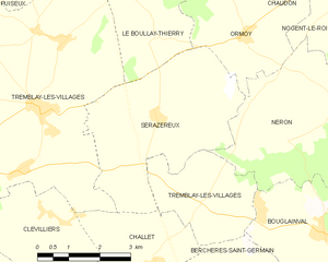
Serazereux
- commune in Eure-et-Loir, France
- Country:
- Postal Code: 28170
- Coordinates: 48° 35' 54" N, 1° 26' 4" E
- GPS tracks (wikiloc): [Link]
- Area: 15.58 sq km
- Population: 572


Nogent-le-Roi
- commune in Eure-et-Loir, France
- Country:
- Postal Code: 28210
- Coordinates: 48° 38' 55" N, 1° 31' 43" E
- GPS tracks (wikiloc): [Link]
- Area: 13.01 sq km
- Population: 4109
- Web site: [Link]


Chaudon
- commune in Eure-et-Loir, France
- Country:
- Postal Code: 28210
- Coordinates: 48° 39' 42" N, 1° 29' 49" E
- GPS tracks (wikiloc): [Link]
- Area: 11.34 sq km
- Population: 1668

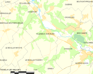
Villemeux-sur-Eure
- commune in Eure-et-Loir, France
- Country:
- Postal Code: 28210
- Coordinates: 48° 40' 24" N, 1° 27' 43" E
- GPS tracks (wikiloc): [Link]
- Area: 18.59 sq km
- Population: 1614
- Web site: [Link]