Villemeux-sur-Eure (Villemeux-sur-Eure)

- commune in Eure-et-Loir, France
- Country:

- Postal Code: 28210
- Coordinates: 48° 40' 24" N, 1° 27' 43" E


- GPS tracks (wikiloc): [Link]
- Area: 18.59 sq km
- Population: 1614
- Web site: http://www.villemeux.fr
- Wikipedia en: wiki(en)
- Wikipedia: wiki(fr)
- Wikidata storage: Wikidata: Q616543
- Wikipedia Commons Category: [Link]
- Freebase ID: [/m/03nrn8_]
- GeoNames ID: Alt: [6430929]
- SIREN number: [212804157]
- BnF ID: [152543450]
- INSEE municipality code: 28415
Shares border with regions:


Le Boullay-Thierry
- commune in Eure-et-Loir, France
- Country:
- Postal Code: 28210
- Coordinates: 48° 38' 17" N, 1° 25' 49" E
- GPS tracks (wikiloc): [Link]
- Area: 12.87 sq km
- Population: 560
- Web site: [Link]

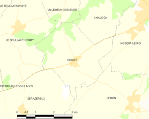
Ormoy
- commune in Eure-et-Loir, France
- Country:
- Postal Code: 28210
- Coordinates: 48° 37' 19" N, 1° 28' 23" E
- GPS tracks (wikiloc): [Link]
- AboveSeaLevel: 140 м m
- Area: 9.04 sq km
- Population: 240


Ouerre
- commune in Eure-et-Loir, France
- Country:
- Postal Code: 28500
- Coordinates: 48° 42' 4" N, 1° 27' 58" E
- GPS tracks (wikiloc): [Link]
- Area: 12.73 sq km
- Population: 713
- Web site: [Link]


Charpont
- commune in Eure-et-Loir, France
- Country:
- Postal Code: 28500
- Coordinates: 48° 42' 1" N, 1° 26' 22" E
- GPS tracks (wikiloc): [Link]
- Area: 7.12 sq km
- Population: 563


Croisilles
- commune in Eure-et-Loir, France
- Country:
- Postal Code: 28210
- Coordinates: 48° 41' 20" N, 1° 30' 15" E
- GPS tracks (wikiloc): [Link]
- Area: 5.72 sq km
- Population: 458


Chaudon
- commune in Eure-et-Loir, France
- Country:
- Postal Code: 28210
- Coordinates: 48° 39' 42" N, 1° 29' 49" E
- GPS tracks (wikiloc): [Link]
- Area: 11.34 sq km
- Population: 1668


Le Boullay-Mivoye
- commune in Eure-et-Loir, France
- Country:
- Postal Code: 28210
- Coordinates: 48° 38' 52" N, 1° 24' 24" E
- GPS tracks (wikiloc): [Link]
- Area: 10.92 sq km
- Population: 470