
Orvieto (Orvieto)
.svg)
- Italian comune
 Hiking in Orvieto
Orvieto, a stunning hilltop town in Italy's Umbria region, offers fantastic hiking opportunities with breathtaking views and rich historical contexts. Here are some highlights about hiking in and around Orvieto:
Trails and Areas to Explore
-
The Etruscan Ruins Trail: This trail leads you through paths that showcase ancient Etruscan ruins, including tombs and remnants of old settlements. It provides a fascinating insight into the area's history while allowing for scenic views of the surrounding landscape.
-
The Umbrian Countryside: Many trails wind through the lush Umbrian hills, vineyards, and olive groves. Popular routes include hikes along the Sentiero della Valle dei Calanchi, which offers dramatic geological formations and panoramic views.
-
The Montalto Route: For those seeking a bit more of a challenge, the hike to Montalto, the highest peak in the area, provides rewarding views of both Orvieto and the surrounding countryside.
-
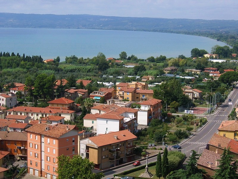
The Lake of Corbara: Located not far from Orvieto, this area offers beautiful trails around the lake. It's a great spot for a longer day hike with opportunities for bird watching and enjoying the serene water views.
What to Expect
-
Scenery: Hikers can look forward to a diverse landscape that features rolling hills, vineyards, and historical architecture.
-
Wildlife: The region is rich in flora and fauna, making it ideal for nature lovers.
-
Local Experience: Hiking trails often lead through small villages and farms, allowing for encounters with local culture and cuisine.
Tips for Hiking in Orvieto
-
Season: Spring (April to June) and fall (September to October) are the best seasons for hiking, with mild weather and beautiful scenery.
-
Gear: Good hiking shoes are essential, and it's advisable to carry water and snacks, especially on longer trails.
-
Maps and Guides: Familiarize yourself with local maps and possibly consider hiring a guide for the more complex trails or if you're less familiar with the area.
-
Safety: Keep an eye on the weather conditions, particularly in the fall and spring, as they can change rapidly.
Conclusion
Hiking in Orvieto not only allows you to enjoy the stunning natural beauty of Umbria but also immerses you in a rich tapestry of history and culture. Whether you're a beginner or an experienced hiker, you'll find trails that meet your interests and abilities in this mesmerizing part of Italy. Enjoy the outdoors, and don’t forget your camera—there are many beautiful vistas to capture!
- Country:

- Postal Code: 05018
- Local Dialing Code: 0763
- Licence Plate Code: TR
- Coordinates: 42° 43' 0" N, 12° 6' 0" E


- GPS tracks (wikiloc): [Link]
- AboveSeaLevel: 325 м m
- Area: 281.27 sq km
- Population: 20468
- Web site: http://www.comune.orvieto.tr.it
- Wikipedia en: wiki(en)
- Wikipedia: wiki(it)
- Wikidata storage: Wikidata: Q541
- Wikipedia Commons Gallery: [Link]
- Wikipedia Commons Category: [Link]
- Wikipedia Commons Maps Category: [Link]
- Freebase ID: [/m/01gc4c]
- GeoNames ID: Alt: [6539748]
- BnF ID: [11964041n]
- VIAF ID: Alt: [312798964]
- OSM relation ID: [42117]
- archINFORM location ID: [1012]
- Library of Congress authority ID: Alt: [n80113657]
- MusicBrainz area ID: [25db21d2-8ec3-4118-9f2b-a698bd4e5c59]
- Quora topic ID: [Orvieto]
- UN/LOCODE: [ITORV]
- Encyclopædia Britannica Online ID: [place/Orvieto]
- EMLO location ID: [12266905-e201-42ed-b3b2-88544533cfb4]
- Facebook Places ID: [109571335728295]
- Great Russian Encyclopedia Online ID: [2683115]
- NKCR AUT ID: [ge931382]
- DMOZ ID: Alt: [Regional/Europe/Italy/Regions/Umbria/Localities/Orvieto/]
- National Library of Israel ID: [000981017]
- YSO ID: [188406]
- Brockhaus Enzyklopädie online ID: [orvieto]
- ISTAT ID: 055023
- Italian cadastre code: G148
- US National Archives Identifier: 10044695
Shares border with regions:


Ficulle
- town in the region Umbria, in Italy
Hiking in Ficulle
Ficulle is a charming village located in the Umbria region of Italy, surrounded by beautiful landscapes and rolling hills. Hiking in this area provides an opportunity to explore picturesque trails, enjoy stunning views, and experience the rich natural and cultural heritage of the region....
- Country:
- Postal Code: 05016
- Local Dialing Code: 0763
- Licence Plate Code: TR
- Coordinates: 42° 50' 0" N, 12° 4' 0" E
- GPS tracks (wikiloc): [Link]
- AboveSeaLevel: 437 м m
- Area: 64.62 sq km
- Population: 1634
- Web site: [Link]


Montecchio
- town in the region Umbria, in Italy
Hiking in Montecchio
Montecchio is a beautiful area located in Italy that offers a variety of hiking opportunities amid stunning landscapes and rich historical contexts. While I'm not aware of a specific "Montecchio" with well-defined trails since there are several locations with that name throughout Italy, I can provide general information about hiking in areas known for their natural beauty and cultural significance....
- Country:
- Postal Code: 05020
- Local Dialing Code: 0744
- Licence Plate Code: TR
- Coordinates: 42° 39' 44" N, 12° 17' 17" E
- GPS tracks (wikiloc): [Link]
- AboveSeaLevel: 391 м m
- Area: 49.22 sq km
- Population: 1646
- Web site: [Link]
Porano
- town in the region Umbria, in Italy
Hiking in Porano
Porano, a charming village in Italy's Umbria region near Orvieto, offers beautiful landscapes and opportunities for hiking enthusiasts. The surrounding area features rolling hills, vineyards, and picturesque countryside, which makes it an excellent destination for both casual walkers and seasoned hikers....
- Country:
- Postal Code: 05010
- Local Dialing Code: 0763
- Licence Plate Code: TR
- Coordinates: 42° 41' 0" N, 12° 6' 0" E
- GPS tracks (wikiloc): [Link]
- AboveSeaLevel: 444 м m
- Area: 13.6 sq km
- Population: 1982
- Web site: [Link]


San Venanzo
- town in the region Umbria, in Italy
Hiking in San Venanzo
San Venanzo is a charming municipality located in the heart of Umbria, Italy, surrounded by beautiful landscapes and rich natural heritage. The region is characterized by rolling hills, forests, vineyards, and olive groves, making it a fantastic destination for hiking enthusiasts....
- Country:
- Postal Code: 05010
- Local Dialing Code: 075
- Licence Plate Code: TR
- Coordinates: 42° 52' 0" N, 12° 16' 0" E
- GPS tracks (wikiloc): [Link]
- AboveSeaLevel: 465 м m
- Area: 169.45 sq km
- Population: 2192
- Web site: [Link]


Bagnoregio
- Italian comune
Hiking in Bagnoregio
Bagnoregio, often referred to as the "dying town," is a picturesque hilltop village located in the Lazio region of Italy. It sits atop a hill overlooking the Tiber River Valley and is known for its stunning views and unique geology. Hiking in this area can be a rewarding experience, combining natural beauty with historical exploration....
- Country:
- Postal Code: 01022
- Local Dialing Code: 0761
- Licence Plate Code: VT
- Coordinates: 42° 37' 48" N, 12° 5' 21" E
- GPS tracks (wikiloc): [Link]
- AboveSeaLevel: 484 м m
- Area: 72.81 sq km
- Population: 3609
- Web site: [Link]

Bolsena
- Italian comune
Hiking in Bolsena
Bolsena, located in the Lazio region of Italy, is known for its stunning natural beauty and historical significance, making it an excellent destination for hiking enthusiasts. Here are some key points and recommendations for hiking in and around Bolsena:...
- Country:
- Postal Code: 01023
- Local Dialing Code: 0761
- Licence Plate Code: VT
- Coordinates: 42° 38' 41" N, 11° 59' 9" E
- GPS tracks (wikiloc): [Link]
- AboveSeaLevel: 350 м m
- Area: 63.57 sq km
- Population: 3941
- Web site: [Link]
Castiglione in Teverina
- Italian comune
Hiking in Castiglione in Teverina
Castiglione in Teverina is a charming village located in the province of Viterbo, in the Lazio region of Italy. Nestled in the picturesque landscape of the Tuscia area, it offers a variety of hiking opportunities for outdoor enthusiasts....
- Country:
- Postal Code: 01024
- Local Dialing Code: 0761
- Licence Plate Code: VT
- Coordinates: 42° 38' 56" N, 12° 12' 15" E
- GPS tracks (wikiloc): [Link]
- AboveSeaLevel: 228 м m
- Area: 19.89 sq km
- Population: 2321
- Web site: [Link]
Civitella d'Agliano
- Italian comune
Hiking in Civitella d'Agliano
Civitella d'Agliano is a charming village in Italy, located in the province of Viterbo in the Lazio region. Surrounded by beautiful landscapes, rolling hills, and lush vineyards, it offers some wonderful hiking opportunities for outdoor enthusiasts. Here are some highlights about hiking in and around Civitella d'Agliano:...
- Country:
- Postal Code: 01020
- Local Dialing Code: 0761
- Licence Plate Code: VT
- Coordinates: 42° 36' 15" N, 12° 11' 16" E
- GPS tracks (wikiloc): [Link]
- AboveSeaLevel: 262 м m
- Area: 32.96 sq km
- Population: 1557
- Web site: [Link]


Lubriano
- Italian comune
Hiking in Lubriano
Lubriano is a charming village located in the Italian region of Lazio, specifically in the province of Viterbo. It sits atop a hill, offering stunning views of the surrounding landscapes, including the nearby Necropolis of Tarquinia and the beautiful countryside of the Tuscia region. Hiking in and around Lubriano provides an excellent opportunity to explore this picturesque area rich in history and natural beauty....
- Country:
- Postal Code: 01020
- Local Dialing Code: 0761
- Licence Plate Code: VT
- Coordinates: 42° 38' 13" N, 12° 6' 34" E
- GPS tracks (wikiloc): [Link]
- AboveSeaLevel: 441 м m
- Area: 16.61 sq km
- Population: 893
- Web site: [Link]


Todi
- Italian comune
Hiking in Todi
Todi, a picturesque medieval town in the Umbria region of Italy, offers a range of hiking opportunities that allow you to explore its stunning natural landscapes and rich cultural heritage. Here are some key points to consider if you're planning to hike in Todi:...
- Country:
- Postal Code: 06059
- Local Dialing Code: 075
- Licence Plate Code: PG
- Coordinates: 42° 47' 0" N, 12° 25' 0" E
- GPS tracks (wikiloc): [Link]
- AboveSeaLevel: 410 м m
- Area: 222.86 sq km
- Population: 16606
- Web site: [Link]


Allerona
- town in the region Umbria, in Italy
Hiking in Allerona
Allerona is a charming town located in the province of Terni, in the Umbria region of Italy. It is set in a beautiful natural landscape, characterized by rolling hills, vineyards, olive groves, and lush forests, making it a fantastic destination for hikers and nature lovers....
- Country:
- Postal Code: 05011
- Local Dialing Code: 0763
- Licence Plate Code: TR
- Coordinates: 42° 49' 0" N, 11° 58' 0" E
- GPS tracks (wikiloc): [Link]
- AboveSeaLevel: 472 м m
- Area: 82.61 sq km
- Population: 1769
- Web site: [Link]


Baschi
- town in the region Umbria, in Italy
Hiking in Baschi
Baschi is a charming town located in the Umbria region of Italy, surrounded by beautiful landscapes that are ideal for hiking enthusiasts. The area is characterized by rolling hills, vineyards, olive groves, and stunning views of the Tiber River valley. Here are some highlights for hiking in and around Baschi:...
- Country:
- Postal Code: 05023
- Local Dialing Code: 0744
- Licence Plate Code: TR
- Coordinates: 42° 40' 0" N, 12° 13' 0" E
- GPS tracks (wikiloc): [Link]
- AboveSeaLevel: 165 м m
- Area: 68.57 sq km
- Population: 2682
- Web site: [Link]


Castel Giorgio
- town in the region Umbria, in Italy
Hiking in Castel Giorgio
Castel Giorgio is a small town located in the province of Terni, in the Umbria region of Italy. Surrounded by beautiful landscapes and rich natural beauty, it offers various opportunities for hiking and outdoor activities. Here are some key points to consider if you're planning a hiking trip in and around Castel Giorgio:...
- Country:
- Postal Code: 05013
- Local Dialing Code: 0763
- Licence Plate Code: TR
- Coordinates: 42° 42' 0" N, 11° 59' 0" E
- GPS tracks (wikiloc): [Link]
- AboveSeaLevel: 559 м m
- Area: 42.14 sq km
- Population: 2090
- Web site: [Link]


Castel Viscardo
- town in the region Umbria, in Italy
Hiking in Castel Viscardo
Castel Viscardo is a small town located in the Umbria region of Italy, surrounded by beautiful landscapes and rolling hills that make it an appealing destination for hikers. The area is rich in history, culture, and natural beauty, making it perfect for outdoor enthusiasts....
- Country:
- Postal Code: 05014
- Local Dialing Code: 0763
- Licence Plate Code: TR
- Coordinates: 42° 45' 19" N, 12° 0' 6" E
- GPS tracks (wikiloc): [Link]
- AboveSeaLevel: 507 м m
- Area: 26.22 sq km
- Population: 2876
- Web site: [Link]