
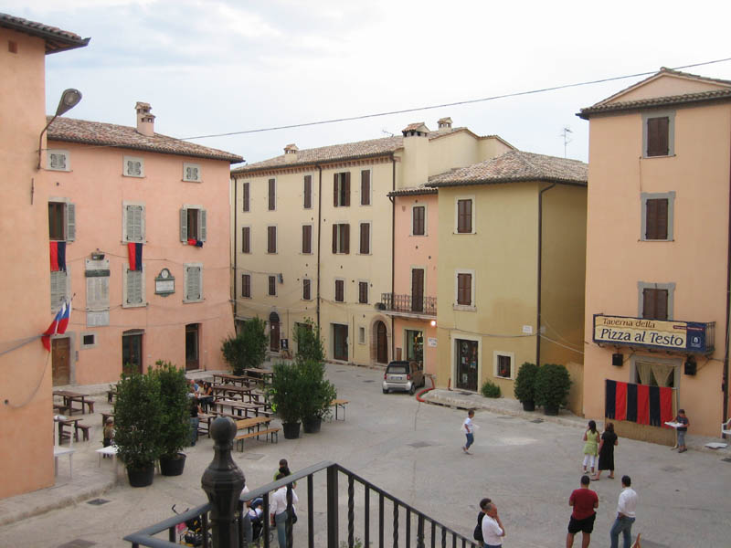
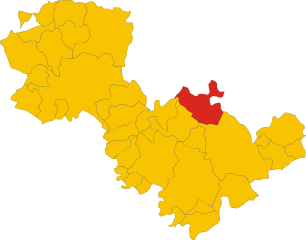
Todi (Todi)
.svg)
- Italian comune
 Hiking in Todi
Todi, a picturesque medieval town in the Umbria region of Italy, offers a range of hiking opportunities that allow you to explore its stunning natural landscapes and rich cultural heritage. Here are some key points to consider if you're planning to hike in Todi:
Hiking Trails
-
The Todi Loop: This is a popular circular trail that takes you around the hills surrounding the town. It offers breathtaking views of the Tiber Valley and the surrounding countryside, with opportunities to see vineyards and olive groves.
-
The Tevere River Path: This trail follows the Tiber River, providing a tranquil hiking experience. It’s a great way to experience the rich biodiversity of the area, with opportunities for bird watching and enjoying the scenic riverside views.
-
Mount Agliano: For those looking for a bit more challenge, the trails around Mount Agliano provide a great ascent with rewarding panoramic views from the top.
Natural Beauty
-
Rolling Hills: The landscape around Todi features classic Umbrian rolling hills, dotted with cypress trees and charming farms. The changing seasons offer different views, with vibrant colors in spring and summer and a golden palette in autumn.
-
Flora and Fauna: The area is rich in biodiversity, and you might encounter many native plants and wildlife along the hiking routes.
Cultural Stops
-
Historical Landmarks: Along the way, you can visit small medieval churches, ancient ruins, and other historical sites. The town itself, with its beautiful piazzas and architecture, is well worth exploring before or after your hike.
-
Local Cuisine: Don’t miss the chance to sample local Umbrian cuisine in Todi after your hike. Find a quaint trattoria or café to enjoy hearty pasta dishes, truffles, and local wines.
Best Time to Hike
- Spring and Fall: The best times to hike in Todi are during spring (March to June) and fall (September to November) when the weather is mild and the landscape is particularly beautiful.
- Summer: While summer can be hot, early morning hikes can be rewarding. Just be sure to bring plenty of water and sun protection.
Preparation
- Footwear: Sturdy hiking shoes are recommended as some trails can be rocky or uneven.
- Water and Snacks: Carry plenty of water and some snacks, as facilities may be sparse along the trails.
- Map or GPS: It’s advisable to have a map or a GPS device as some trails may not be well-marked.
Hiking in and around Todi offers a unique blend of natural beauty, historical richness, and cultural discovery, making it a rewarding experience for outdoor enthusiasts and casual walkers alike.
- Country:

- Postal Code: 06059
- Local Dialing Code: 075
- Licence Plate Code: PG
- Coordinates: 42° 47' 0" N, 12° 25' 0" E


- GPS tracks (wikiloc): [Link]
- AboveSeaLevel: 410 м m
- Area: 222.86 sq km
- Population: 16606
- Web site: http://www.comune.todi.pg.it
- Wikipedia en: wiki(en)
- Wikipedia: wiki(it)
- Wikidata storage: Wikidata: Q20579
- Wikipedia Commons Gallery: [Link]
- Wikipedia Commons Category: [Link]
- Freebase ID: [/m/01v39w]
- GeoNames ID: Alt: [6536883]
- VIAF ID: Alt: [239937814]
- OSM relation ID: [42137]
- GND ID: Alt: [4119637-5]
- archINFORM location ID: [3765]
- MusicBrainz area ID: [05febd0e-c419-4529-8b05-f141dbeafda6]
- Quora topic ID: [Todi]
- UN/LOCODE: [ITTDI]
- Encyclopædia Britannica Online ID: [place/Todi-Italy]
- Facebook Places ID: [106407812728190]
- Digital Atlas of the Roman Empire ID: [16578]
- DMOZ ID: Alt: [Regional/Europe/Italy/Regions/Umbria/Localities/Todi/]
- Nomisma ID: [tuder]
- ISTAT ID: 054052
- Italian cadastre code: L188
- US National Archives Identifier: 10044635
Shares border with regions:


Montecchio
- town in the region Umbria, in Italy
Hiking in Montecchio
Montecchio is a beautiful area located in Italy that offers a variety of hiking opportunities amid stunning landscapes and rich historical contexts. While I'm not aware of a specific "Montecchio" with well-defined trails since there are several locations with that name throughout Italy, I can provide general information about hiking in areas known for their natural beauty and cultural significance....
- Country:
- Postal Code: 05020
- Local Dialing Code: 0744
- Licence Plate Code: TR
- Coordinates: 42° 39' 44" N, 12° 17' 17" E
- GPS tracks (wikiloc): [Link]
- AboveSeaLevel: 391 м m
- Area: 49.22 sq km
- Population: 1646
- Web site: [Link]


San Venanzo
- town in the region Umbria, in Italy
Hiking in San Venanzo
San Venanzo is a charming municipality located in the heart of Umbria, Italy, surrounded by beautiful landscapes and rich natural heritage. The region is characterized by rolling hills, forests, vineyards, and olive groves, making it a fantastic destination for hiking enthusiasts....
- Country:
- Postal Code: 05010
- Local Dialing Code: 075
- Licence Plate Code: TR
- Coordinates: 42° 52' 0" N, 12° 16' 0" E
- GPS tracks (wikiloc): [Link]
- AboveSeaLevel: 465 м m
- Area: 169.45 sq km
- Population: 2192
- Web site: [Link]


Collazzone
- Italian comune
Hiking in Collazzone
Collazzone, located in the Umbria region of Italy, offers a beautiful setting for hiking enthusiasts. Nestled in the Italian countryside, this charming hilltop village is surrounded by lush landscapes, vineyards, and olive groves, providing a picturesque backdrop for various outdoor activities....
- Country:
- Postal Code: 06050
- Local Dialing Code: 075
- Licence Plate Code: PG
- Coordinates: 42° 54' 0" N, 12° 26' 0" E
- GPS tracks (wikiloc): [Link]
- AboveSeaLevel: 469 м m
- Area: 55.68 sq km
- Population: 3448
- Web site: [Link]


Fratta Todina
- Italian comune
Hiking in Fratta Todina
Fratta Todina is a picturesque town in the Umbrian region of Italy, known for its stunning landscapes, rolling hills, and rich historical heritage. Hiking in this area can be a delightful experience, offering a combination of natural beauty and cultural exploration. Here are some key points about hiking in Fratta Todina:...
- Country:
- Postal Code: 06054
- Local Dialing Code: 075
- Licence Plate Code: PG
- Coordinates: 42° 51' 0" N, 12° 22' 0" E
- GPS tracks (wikiloc): [Link]
- AboveSeaLevel: 215 м m
- Area: 17.43 sq km
- Population: 1821
- Web site: [Link]


Gualdo Cattaneo
- Italian comune
Hiking in Gualdo Cattaneo
Gualdo Cattaneo, a charming hilltop town in the Umbria region of Italy, offers several hiking opportunities that showcase its beautiful landscapes, rich history, and serene countryside. The area is characterized by rolling hills, vineyards, olive groves, and picturesque views, making it a great destination for outdoor enthusiasts....
- Country:
- Postal Code: 06035
- Local Dialing Code: 0742
- Licence Plate Code: PG
- Coordinates: 42° 55' 0" N, 12° 33' 0" E
- GPS tracks (wikiloc): [Link]
- AboveSeaLevel: 446 м m
- Area: 96.63 sq km
- Population: 5965
- Web site: [Link]


Marsciano
- Italian comune
Hiking in Marsciano
Marsciano is a charming town located in the Umbria region of Italy, surrounded by beautiful landscapes that provide excellent opportunities for hiking. The area is characterized by rolling hills, vineyards, olive groves, and picturesque views of the Umbrian countryside....
- Country:
- Postal Code: 06055
- Local Dialing Code: 075
- Licence Plate Code: PG
- Coordinates: 42° 55' 0" N, 12° 20' 0" E
- GPS tracks (wikiloc): [Link]
- AboveSeaLevel: 184 м m
- Area: 161.50 sq km
- Population: 18701
- Web site: [Link]

Massa Martana
- Italian comune
Hiking in Massa Martana
Massa Martana, located in the province of Terni in Italy's Umbria region, is a beautiful destination for hiking enthusiasts. The area is characterized by its lush landscapes, rolling hills, and rich historical significance, which makes it an excellent spot for outdoor adventures....
- Country:
- Postal Code: 06056
- Local Dialing Code: 075
- Licence Plate Code: PG
- Coordinates: 42° 47' 0" N, 12° 31' 0" E
- GPS tracks (wikiloc): [Link]
- AboveSeaLevel: 351 м m
- Area: 78.41 sq km
- Population: 3742
- Web site: [Link]
Monte Castello di Vibio
- Italian comune
Hiking in Monte Castello di Vibio
Monte Castello di Vibio is a charming town located in the Umbria region of Italy, known for its picturesque landscapes and historical significance. Hiking in this area can provide an excellent opportunity to enjoy the natural beauty of the Umbrian hills, as well as explore local culture and history....
- Country:
- Postal Code: 06057
- Local Dialing Code: 075
- Licence Plate Code: PG
- Coordinates: 42° 50' 0" N, 12° 21' 0" E
- GPS tracks (wikiloc): [Link]
- AboveSeaLevel: 423 м m
- Area: 31.95 sq km
- Population: 1531
- Web site: [Link]


Orvieto
- Italian comune
Hiking in Orvieto
Orvieto, a stunning hilltop town in Italy's Umbria region, offers fantastic hiking opportunities with breathtaking views and rich historical contexts. Here are some highlights about hiking in and around Orvieto:...
- Country:
- Postal Code: 05018
- Local Dialing Code: 0763
- Licence Plate Code: TR
- Coordinates: 42° 43' 0" N, 12° 6' 0" E
- GPS tracks (wikiloc): [Link]
- AboveSeaLevel: 325 м m
- Area: 281.27 sq km
- Population: 20468
- Web site: [Link]

Acquasparta
- town in the region Umbria, in Italy
Hiking in Acquasparta
Acquasparta is a charming town located in the Umbria region of Italy, known for its rich history and beautiful landscapes. It offers a variety of hiking opportunities that allow you to explore the scenic Umbrian countryside, with its rolling hills, ancient ruins, and lush greenery....
- Country:
- Postal Code: 05021
- Local Dialing Code: 0744
- Licence Plate Code: TR
- Coordinates: 42° 41' 0" N, 12° 33' 0" E
- GPS tracks (wikiloc): [Link]
- AboveSeaLevel: 320 м m
- Area: 81.61 sq km
- Population: 4676
- Web site: [Link]


Avigliano Umbro
- town in the region Umbria, in Italy
Hiking in Avigliano Umbro
Avigliano Umbro, located in the Umbria region of Italy, offers a picturesque landscape that is ideal for hiking enthusiasts. Nestled in the hills and surrounded by lush woods and valleys, this area provides a perfect blend of natural beauty, historical sites, and tranquility....
- Country:
- Postal Code: 05020
- Local Dialing Code: 0744
- Licence Plate Code: TR
- Coordinates: 42° 39' 0" N, 12° 26' 0" E
- GPS tracks (wikiloc): [Link]
- AboveSeaLevel: 441 м m
- Area: 51.34 sq km
- Population: 2509
- Web site: [Link]


Baschi
- town in the region Umbria, in Italy
Hiking in Baschi
Baschi is a charming town located in the Umbria region of Italy, surrounded by beautiful landscapes that are ideal for hiking enthusiasts. The area is characterized by rolling hills, vineyards, olive groves, and stunning views of the Tiber River valley. Here are some highlights for hiking in and around Baschi:...
- Country:
- Postal Code: 05023
- Local Dialing Code: 0744
- Licence Plate Code: TR
- Coordinates: 42° 40' 0" N, 12° 13' 0" E
- GPS tracks (wikiloc): [Link]
- AboveSeaLevel: 165 м m
- Area: 68.57 sq km
- Population: 2682
- Web site: [Link]