
Osnabrück (Osnabrück)

.svg)
- German city
 Hiking in Osnabrück
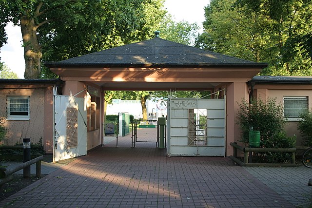
Osnabrück, located in Lower Saxony, Germany, is a fantastic destination for hiking enthusiasts. The region is characterized by its varied landscapes, including forests, hills, and meadows, making it ideal for both casual walkers and more experienced hikers.
Popular Hiking Areas:
-
Teutoburg Forest: Just south of Osnabrück lies the Teutoburg Forest, which features numerous trails that range from easy to moderate difficulty. The area is known for its impressive rock formations, deep forests, and panoramic views. Notable trails include the Hermannsweg, a long-distance path that starts here and offers stunning views.
-
Osnabrück Forest: Close to the city, the Osnabrück Forest offers several well-marked trails. This area is perfect for hiking, jogging, and nature walks, with paths that wind through tranquil woods and along picturesque streams.
-
Schlossgarten Osnabrück: For a more leisurely hike, the Schlossgarten (Castle Garden) offers charming paths through beautifully landscaped gardens. It’s also a great place to enjoy a picnic or relax after a day of hiking.
-
Hiking Trails Around Osnabrück: The region has a network of hiking trails, including the Osnabrücker Land circular hiking trail, which connects various rural landscapes, offering insights into local flora and fauna.
Tips for Hiking in Osnabrück:
-
Maps and Guides: It’s advisable to carry a reliable map or use a hiking app to navigate the trails. Many trails are well-marked, but having a map can help you find less frequented paths.
-
Weather Considerations: The weather can change quickly, so wearing layers and being prepared for rain is important. Check the local forecast before heading out.
-
Safety: Always inform someone of your hiking plans, especially if you are going on more remote trails. Carry water, snacks, and a first-aid kit for longer hikes.
-
Local Regulations: Respect local wildlife and plants, and adhere to any guidelines or restrictions in protected areas.
Conclusion:
Hiking in and around Osnabrück offers a beautiful mix of nature and historical landscapes. Whether you're looking for a short stroll through the Castle Garden or a challenging hike in the Teutoburg Forest, you’ll find a variety of trails suited to all levels of hikers. Enjoy the stunning views, diverse nature, and tranquility that this region has to offer!
- Country:

- Postal Code: 49074–49090
- Local Dialing Code: 05407; 05406; 05402; 0541
- Licence Plate Code: OS
- Coordinates: 52° 16' 44" N, 8° 2' 35" E


- GPS tracks (wikiloc): [Link]
- AboveSeaLevel: 63 м m
- Area: 119.8 sq km
- Population: 164070
- Web site: https://www.osnabrueck.de/
- Wikipedia en: wiki(en)
- Wikipedia: wiki(de)
- Wikidata storage: Wikidata: Q2916
- Wikipedia Commons Gallery: [Link]
- Wikipedia Commons Category: [Link]
- Wikipedia Commons Maps Category: [Link]
- Freebase ID: [/m/012g0n]
- GeoNames ID: Alt: [2856883]
- BnF ID: [119329086]
- VIAF ID: Alt: [169131077]
- OSM relation ID: [62631]
- GND ID: Alt: [4043974-4]
- archINFORM location ID: [360]
- Library of Congress authority ID: Alt: [n79075257]
- MusicBrainz area ID: [ece26d47-f077-4f54-ba45-4476ff394a79]
- Quora topic ID: [Osnabrück-Germany]
- TGN ID: [7005251]
- UN/LOCODE: [DEOSN]
- Encyclopædia Britannica Online ID: [place/Osnabruck]
- EMLO location ID: [9377bac1-d1e4-43d7-a73a-aa9d0ca49597]
- Facebook Places ID: [106063482767787]
- Great Russian Encyclopedia Online ID: [2680722]
- ISNI: Alt: [0000 0001 2265 4425]
- National Library of Israel ID: [000102112]
- NUTS code: [DE944]
- Klexikon article ID: [Osnabrück]
- Global Anabaptist Mennonite Encyclopedia Online ID: [Osnabrück (Niedersachsen, Germany)]
- NE.se ID: [osnabruck]
- German municipality key: 03404000
- German district key: 03404
Includes regions:


Darum/Gretesch/Lüstringen
- human settlement in Germany
Hiking in Darum/Gretesch/Lüstringen
Darum, Gretesch, and Lüstringen are areas located in Lower Saxony, Germany, with a mix of landscapes that can offer enjoyable hiking experiences. While they may not be as famous as larger national parks, you can still find beautiful trails and nature....
- Country:
- Postal Code: 49086
- Coordinates: 52° 16' 3" N, 8° 7' 50" E
- GPS tracks (wikiloc): [Link]
Dodesheide
- human settlement in Germany
Hiking in Dodesheide
Dodesheide is a scenic area located in Osnabrück, Germany, known for its hiking opportunities and beautiful natural landscapes. It features a mix of woodlands, meadows, and trails that attract both casual walkers and serious hikers....
- Country:
- Coordinates: 52° 18' 14" N, 8° 4' 22" E
- GPS tracks (wikiloc): [Link]
Hellern
- human settlement in Germany
Hiking in Hellern
It seems like you might be referring to hiking in a specific location, but I'm not familiar with a place called "Hellern." It’s possible that the spelling is different, or it might be a lesser-known area. If you meant a region or mountain range that sounds similar, please provide additional information or clarify the name....
- Country:
- Coordinates: 52° 15' 26" N, 7° 59' 41" E
- GPS tracks (wikiloc): [Link]
Westerberg
- human settlement in Germany
Hiking in Westerberg
Westerberg, located in the Osnabrück district of Lower Saxony, Germany, is a charming area known for its scenic landscapes, making it an excellent destination for hiking enthusiasts. Here are some key points about hiking in this region:...
- Country:
- Coordinates: 52° 16' 50" N, 8° 1' 30" E
- GPS tracks (wikiloc): [Link]
Fledder
- human settlement in Germany
Hiking in Fledder
Fledder is not a widely recognized hiking destination, so it’s possible that you might be referring to a specific local area, trail, or even a less prominent location. It would be helpful to have more context about the region or country you are asking about....
- Country:
- Coordinates: 52° 16' 1" N, 8° 4' 20" E
- GPS tracks (wikiloc): [Link]
Pye
- Osnabrück, Germany
Hiking in Pye
Hiking in Pye, a district of Osnabrück in Lower Saxony, Germany, offers visitors a unique blend of natural beauty and cultural exploration. The area is characterized by its scenic landscapes, including picturesque forests, rolling hills, and tranquil rural settings. Here are some highlights and tips for hiking in the region:...
- Country:
- Coordinates: 52° 19' 20" N, 7° 59' 50" E
- GPS tracks (wikiloc): [Link]
Gartlage
- human settlement in Germany
Hiking in Gartlage
Gartlage is a suburb of the city of Osnabrück in Lower Saxony, Germany. While Gartlage itself may not be widely known for specific hiking trails, the surrounding region offers ample opportunities for hiking enthusiasts. Here are a few things to consider if you're looking to hike around the area:...
- Country:
- Coordinates: 52° 17' 30" N, 8° 4' 7" E
- GPS tracks (wikiloc): [Link]
Hafen
- human settlement in Germany
Hiking in Hafen
Hafen, a district in Osnabrück, Germany, is not primarily known as a hiking destination, but it offers access to some pleasant walking routes and green spaces. The region around Osnabrück, including Hafen, is characterized by its beautiful landscapes, forests, and rivers, making it a suitable area for various outdoor activities, including hiking....
- Country:
- Coordinates: 52° 17' 0" N, 8° 1' 0" E
- GPS tracks (wikiloc): [Link]
Innenstadt
- human settlement in Germany
Hiking in Innenstadt
Hiking in the Innenstadt area of Osnabrück district offers a mix of urban exploration and access to nearby natural landscapes. Although Innenstadt itself is primarily an urban environment, it serves as a convenient starting point for various hiking routes that can lead you to parks and natural areas....
- Country:
- Coordinates: 52° 16' 0" N, 8° 3' 0" E
- GPS tracks (wikiloc): [Link]
Kalkhügel
- human settlement in Germany
Hiking in Kalkhügel
Kalkhügel, which translates to "Limestone Hills" in English, generally refers to a region characterized by limestone formations, offering unique landscapes and a variety of hiking opportunities. While there might not be a specific, globally recognized hiking destination named Kalkhügel, there are limestone regions in various parts of the world where you can enjoy excellent hiking experiences....
- Country:
- Coordinates: 52° 15' 34" N, 8° 2' 36" E
- GPS tracks (wikiloc): [Link]
Schinkel-Ost
- human settlement in Germany
Hiking in Schinkel-Ost
Schinkel-Ost, located in the Osnabrück district of Germany, offers a variety of hiking opportunities that showcase the natural beauty and scenic landscapes of this region. Here are some key points to consider if you're planning to hike in Schinkel-Ost:...
- Country:
- Postal Code: 49084
- Coordinates: 52° 16' 0" N, 8° 6' 0" E
- GPS tracks (wikiloc): [Link]

Nahne
- human settlement in Germany
Hiking in Nahne
It seems like there might be a typo or a misunderstanding in your question regarding "Nahne." If you're referring to a specific hiking area, trail, or location, could you please provide more context or clarify the name?...
- Country:
- Coordinates: 52° 14' 50" N, 8° 3' 30" E
- GPS tracks (wikiloc): [Link]

Schinkel
- District of Osnabrück, Germany
Hiking in Schinkel
Schinkel, located in the Osnabrück district of Lower Saxony, Germany, is a great spot for hiking enthusiasts. The region is characterized by its largely rural landscape, which includes lush forests, rolling hills, and scenic paths. Here are some key points to help you enjoy your hiking experience in Schinkel:...
- Country:
- Postal Code: 49084
- Coordinates: 52° 16' 45" N, 8° 4' 50" E
- GPS tracks (wikiloc): [Link]
Schölerberg
- human settlement in Germany
Hiking in Schölerberg
Schölerberg is a lovely area located near Osnabrück, Germany, known for its picturesque landscapes and well-maintained hiking trails. The region offers a variety of hiking experiences suitable for both beginners and more experienced hikers. Here are some highlights of hiking in Schölerberg:...
- Country:
- Coordinates: 52° 15' 27" N, 8° 3' 50" E
- GPS tracks (wikiloc): [Link]
Sonnenhügel
- human settlement in Germany
Hiking in Sonnenhügel
Sonnenhügel, translating to "Sunny Hill," offers a delightful experience for hiking enthusiasts, with its scenic trails and beautiful landscapes. While specific details may vary based on the region you're interested in (as multiple places might share the name), here are some general aspects you can expect when hiking in areas like Sonnenhügel:...
- Country:
- Coordinates: 52° 11' 0" N, 7° 48' 0" E
- GPS tracks (wikiloc): [Link]
- AboveSeaLevel: 56 м m
Sutthausen
- human settlement in Germany
Hiking in Sutthausen
Sutthausen is a district in the city of Osnabrück, located in Lower Saxony, Germany. While it may not be as famous for hiking as some of Germany's national parks or mountainous regions, it offers several opportunities for outdoor enthusiasts to enjoy nature....
- Country:
- Coordinates: 52° 14' 10" N, 8° 1' 38" E
- GPS tracks (wikiloc): [Link]
Voxtrup
- human settlement in Germany
Hiking in Voxtrup
Voxtrup is a small village located near Osnabrück in Lower Saxony, Germany. While it may not be a well-known hiking destination, there are opportunities for outdoor activities in the surrounding areas. Here are some tips for hiking in and around Voxtrup:...
- Country:
- Postal Code: 49086
- Coordinates: 52° 15' 10" N, 8° 6' 10" E
- GPS tracks (wikiloc): [Link]
Weststadt
- human settlement in Germany
Hiking in Weststadt
Weststadt is a district within the city of Osnabrück in Lower Saxony, Germany. While Weststadt itself is more urban and developed, the surrounding areas in the Osnabrück district offer some beautiful hiking opportunities....
- Country:
- Coordinates: 52° 16' 22" N, 8° 1' 27" E
- GPS tracks (wikiloc): [Link]
Widukindland
- human settlement in Germany
Hiking in Widukindland
Widukindland, also known as the Teutoburg Forest, is a beautiful hiking destination in Germany, particularly popular for its scenic landscapes and historical significance. Here are some key points to consider if you're planning a hiking trip there:...
- Country:
- Coordinates: 52° 17' 35" N, 8° 5' 25" E
- GPS tracks (wikiloc): [Link]
Wüste
- human settlement in Germany
Hiking in Wüste
Hiking in a desert (Wüste in German) can be an incredible experience, offering unique landscapes, diverse wildlife, and a sense of tranquility. However, it also presents specific challenges due to the environment. Here’s what you should know about hiking in desert areas:...
- Country:
- Coordinates: 52° 16' 0" N, 8° 2' 15" E
- GPS tracks (wikiloc): [Link]

Atter
- human settlement in Germany
Hiking in Atter
Atter is a district located in the city of Osnabrück, Germany, and it offers a variety of scenic hiking opportunities in and around the area. While Atter itself may not be known as a major hiking destination, its proximity to natural landscapes and recreational areas makes it a pleasant choice for outdoor enthusiasts....
- Country:
- Coordinates: 52° 17' 30" N, 7° 57' 3" E
- GPS tracks (wikiloc): [Link]
Haste
- human settlement in Germany
Hiking in Haste
Haste, located in the Osnabrück district of Germany, offers a variety of hiking opportunities suitable for different skill levels. The area is characterized by picturesque landscapes, including forests, fields, and meadows, making it an attractive destination for nature lovers and outdoor enthusiasts....
- Country:
- Coordinates: 52° 18' 30" N, 8° 2' 55" E
- GPS tracks (wikiloc): [Link]
Eversburg
- human settlement in Germany
Hiking in Eversburg
Eversburg is a charming district located in the municipality of Oldenburg, Germany. While it may not be as widely known for hiking as some other regions, it still offers picturesque landscapes and pleasant walking paths for outdoor enthusiasts. Here are some points to consider if you're looking to hike in or around Eversburg:...
- Country:
- Coordinates: 52° 17' 46" N, 7° 59' 29" E
- GPS tracks (wikiloc): [Link]
Shares border with regions:


Osnabrück
- district in Lower Saxony, Germany
Hiking in Osnabrück
Osnabrück district, located in Lower Saxony, Germany, offers a variety of hiking opportunities that cater to different skill levels and preferences. The region is characterized by its rolling hills, lush forests, and picturesque landscapes, making it an appealing destination for outdoor enthusiasts....
- Country:
- Capital: Osnabrück
- Licence Plate Code: OS
- Coordinates: 52° 19' 48" N, 8° 10' 12" E
- GPS tracks (wikiloc): [Link]
- AboveSeaLevel: 57 м m
- Area: 2122.00 sq km
- Population: 354807
- Web site: [Link]


Steinfurt
- German district of North Rhine-Westphalia
Hiking in Steinfurt
Hiking in the Steinfurt district, located in North Rhine-Westphalia, Germany, offers a variety of scenic trails and natural landscapes that are ideal for outdoor enthusiasts. The region is characterized by its rolling hills, woodlands, and charming villages, making it a great place for hiking and exploring nature....
- Country:
- Licence Plate Code: ST
- Coordinates: 52° 10' 12" N, 7° 40' 12" E
- GPS tracks (wikiloc): [Link]
- AboveSeaLevel: 42 м m
- Area: 1795.76 sq km
- Web site: [Link]