Pact (Pact)

- commune in Isère, France
 Hiking in Pact
Hiking in Pact, located in the Isère department of the Auvergne-Rhône-Alpes region in France, offers an excellent opportunity to explore the natural beauty of the Alps and the surrounding landscapes. Here are some key points to consider when hiking in and around Pact:
Trails and Routes:
-
Local Trails: Pact is situated near several hiking trails that vary in difficulty and length. Look for local trails that are well-marked, offering routes through forests, hills, and picturesque views of the surrounding countryside.
-
GR Routes: The Grande Randonnée (GR) trails, such as GR 9 or GR 738, are accessible from the region, providing longer multi-day hiking experiences for those looking to explore further.
-
Circuit de la Gorges de la Bourne: A popular hike in the nearby Vercors Regional Natural Park, this circuit features stunning rock formations and scenic views. While not in Pact itself, it’s an easily accessible option for hikers in the area.
Attractions:
- Natural Beauty: The landscapes around Pact and the Isère department are renowned for their stunning mountains, rivers, and lush forests, providing diverse ecosystems and breathtaking views.
- Wildlife: Hikers may encounter a variety of wildlife, including birds, deer, and other fauna typical of the Alpine region.
Best Time to Hike:
- Spring and Autumn: These seasons are ideal for hiking in the region, with mild temperatures and beautiful scenery as flowers bloom in spring and foliage changes in autumn.
- Summer: It can get warmer, so starting hikes early in the day is advisable to avoid the midday heat.
Preparation and Safety:
- Gear: Wear comfortable hiking boots, dress in layers, and bring rain gear, as the weather can change quickly in the mountains.
- Maps and Guides: Always carry a detailed map or use a hiking app to navigate trails. Inform someone of your hiking plans before setting out.
- Stay Hydrated: Bring enough water and snacks, especially for longer hikes.
Local Services:
- Accommodations: Depending on your preferences, you can find local guesthouses, camping sites, or chalets for overnight stays.
- Guided Tours: If you’re unfamiliar with the area or prefer guided hikes, consider hiring a local guide who can provide insights into the area's ecology and geography.
Overall, hiking in Pact, Isère, can be a rewarding experience with the right preparation and respect for nature. Enjoy your adventures!
- Country:

- Postal Code: 38270
- Coordinates: 45° 21' 10" N, 4° 59' 29" E


- GPS tracks (wikiloc): [Link]
- Area: 9.74 sq km
- Population: 840
- Web site: http://www.mairie-pact.fr/
- Wikipedia en: wiki(en)
- Wikipedia: wiki(fr)
- Wikidata storage: Wikidata: Q338765
- Wikipedia Commons Category: [Link]
- GeoNames ID: Alt: [6433276]
- SIREN number: [213802903]
- BnF ID: [152581024]
- VIAF ID: Alt: [140055626]
- INSEE municipality code: 38290
Shares border with regions:

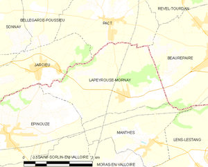
Lapeyrouse-Mornay
- commune in Drôme, France
Hiking in Lapeyrouse-Mornay
Lapeyrouse-Mornay is a charming commune located in the Auvergne-Rhône-Alpes region of France, known for its picturesque landscapes and natural beauty. While it might not be as widely recognized as some of the larger hiking destinations in the region, there are still opportunities for exploring the surrounding countryside....
- Country:
- Postal Code: 26210
- Coordinates: 45° 19' 23" N, 4° 59' 42" E
- GPS tracks (wikiloc): [Link]
- Area: 11.45 sq km
- Population: 1214
- Web site: [Link]


Moissieu-sur-Dolon
- commune in Isère, France
Hiking in Moissieu-sur-Dolon
Moissieu-sur-Dolon is a charming commune located in the Isère department of the Auvergne-Rhône-Alpes region in southeastern France. It is set in a picturesque landscape that can cater to various hiking enthusiasts, from beginners to more experienced trekkers. Here are some aspects of hiking in and around Moissieu-sur-Dolon:...
- Country:
- Postal Code: 38270
- Coordinates: 45° 23' 10" N, 4° 59' 16" E
- GPS tracks (wikiloc): [Link]
- Area: 14.38 sq km
- Population: 695
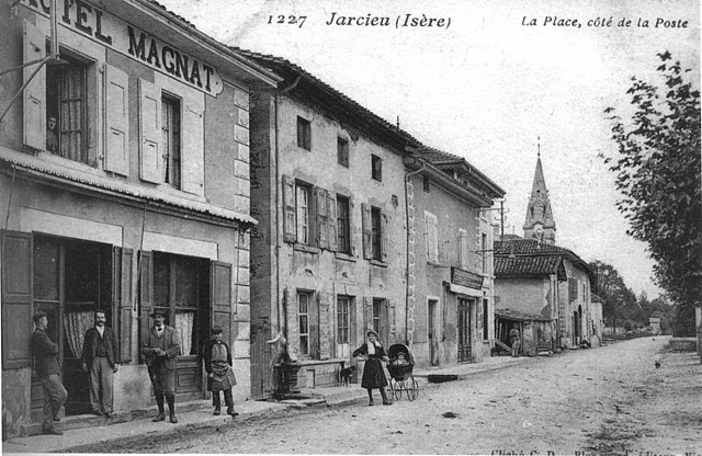
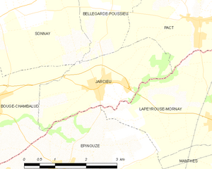
Jarcieu
- commune in Isère, France
Hiking in Jarcieu
Jarcieu is a charming village located in the Isère department in southeastern France. The area is surrounded by beautiful landscapes and offers a variety of opportunities for hiking enthusiasts, ranging from leisurely walks to more challenging trails. Here are some highlights and tips for hiking in Jarcieu:...
- Country:
- Postal Code: 38270
- Coordinates: 45° 20' 2" N, 4° 56' 47" E
- GPS tracks (wikiloc): [Link]
- Area: 6.31 sq km
- Population: 1028
- Web site: [Link]


Bellegarde-Poussieu
- commune in Isère, France
Hiking in Bellegarde-Poussieu
Bellegarde-Poussieu is a charming commune located in the Isère department in the Auvergne-Rhône-Alpes region of southeastern France. The area is known for its beautiful landscapes, rolling hills, and proximity to both the Rhône Valley and the foothills of the Alps, making it a great location for hiking enthusiasts....
- Country:
- Postal Code: 38270
- Coordinates: 45° 22' 30" N, 4° 57' 3" E
- GPS tracks (wikiloc): [Link]
- Area: 16.79 sq km
- Population: 982


Revel-Tourdan
- commune in Isère, France
Hiking in Revel-Tourdan
Revel-Tourdan, located in the Auvergne-Rhône-Alpes region of southeastern France, offers a picturesque setting for hiking enthusiasts. The area is known for its rolling hills, charming rural landscapes, and access to the rugged beauty of the surrounding mountains....
- Country:
- Postal Code: 38270
- Coordinates: 45° 23' 4" N, 5° 2' 14" E
- GPS tracks (wikiloc): [Link]
- Area: 11.62 sq km
- Population: 1042
- Web site: [Link]

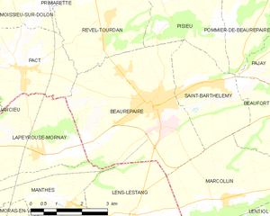
Beaurepaire
- commune in Isère, France
Hiking in Beaurepaire
Beaurepaire, located in the Isère department of France, is a charming commune that offers a variety of hiking opportunities. Nestled in the Rhône-Alpes region, it's surrounded by beautiful landscapes, including rolling hills and valleys, making it a great spot for outdoor enthusiasts....
- Country:
- Postal Code: 38270
- Coordinates: 45° 20' 18" N, 5° 3' 16" E
- GPS tracks (wikiloc): [Link]
- Area: 18.46 sq km
- Population: 4891
- Web site: [Link]