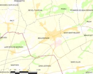
Lapeyrouse-Mornay (Lapeyrouse-Mornay)

- commune in Drôme, France
 Hiking in Lapeyrouse-Mornay
Lapeyrouse-Mornay is a charming commune located in the Auvergne-Rhône-Alpes region of France, known for its picturesque landscapes and natural beauty. While it might not be as widely recognized as some of the larger hiking destinations in the region, there are still opportunities for exploring the surrounding countryside.
Hiking Opportunities
-
Scenic Trails: The area around Lapeyrouse-Mornay offers various trails that lead through beautiful forests, rolling hills, and open fields. Many of these trails are suitable for different skill levels, from casual walkers to more experienced hikers.
-
Nature Observation: The rich biodiversity in the region allows for excellent opportunities for wildlife observation. Keep an eye out for local flora and fauna as you hike.
-
Nearby Natural Parks: The Vercors Regional Natural Park and the Pilat Regional Natural Park are relatively close by and provide extensive hiking options, including both well-marked trails and more adventurous routes.
-
Local Guides: Consider hiring a local guide who can provide insights into the area’s geography, history, and ecology, enhancing your hiking experience.
Preparation
- Map and Navigation: Always carry a reliable map or GPS device to help navigate the trails.
- Gear: Wear appropriate hiking boots, and layer your clothing according to the weather conditions. Carry enough water and snacks for your hike.
- Respect Nature: Follow local guidelines for Leave No Trace principles to protect the natural beauty of the region.
Best Time to Hike
- The best times for hiking in Lapeyrouse-Mornay typically fall between late spring and early autumn when the weather is milder and the landscapes are at their most vibrant. Spring offers blooming wildflowers, while autumn displays beautiful foliage.
Local Culture
Engaging with the local community can enrich your hiking experience. You might find small cafes or markets in the nearby towns where you can try local specialties after a day on the trails.
Overall, hiking in and around Lapeyrouse-Mornay offers a peaceful escape into nature, allowing you to enjoy the stunning landscapes and the tranquility of the French countryside.
- Country:

- Postal Code: 26210
- Coordinates: 45° 19' 23" N, 4° 59' 42" E


- GPS tracks (wikiloc): [Link]
- Area: 11.45 sq km
- Population: 1214
- Web site: https://mairie-lapeyrousemornay.fr/
- Wikipedia en: wiki(en)
- Wikipedia: wiki(fr)
- Wikidata storage: Wikidata: Q1009346
- Wikipedia Commons Category: [Link]
- Freebase ID: [/m/03mhhqg]
- GeoNames ID: Alt: [6430105]
- SIREN number: [212601553]
- BnF ID: [15253016b]
- PACTOLS thesaurus ID: [pcrtaReJoYrZ4W]
- WOEID: [601435]
- INSEE municipality code: 26155
Shares border with regions:

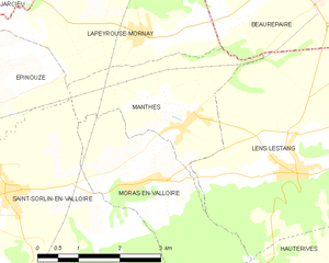
Manthes
- commune in Drôme, France
Hiking in Manthes
It seems there might be a typo or misunderstanding regarding "Manthes," as it's not a well-known hiking destination based on the common references. However, if you're referring to a specific location that has a different spelling or context, please provide more details....
- Country:
- Postal Code: 26210
- Coordinates: 45° 18' 10" N, 5° 0' 26" E
- GPS tracks (wikiloc): [Link]
- Area: 6.83 sq km
- Population: 668
- Web site: [Link]

Épinouze
- commune in Drôme, France
Hiking in Épinouze
Épinouze is a charming commune located in the Drôme department of southeastern France. It is surrounded by picturesque landscapes, making it a great spot for hiking enthusiasts. Here are some highlights and tips for hiking in the Épinouze area:...
- Country:
- Postal Code: 26210
- Coordinates: 45° 18' 33" N, 4° 55' 40" E
- GPS tracks (wikiloc): [Link]
- Area: 11.21 sq km
- Population: 1594
- Web site: [Link]


Pact
- commune in Isère, France
Hiking in Pact
Hiking in Pact, located in the Isère department of the Auvergne-Rhône-Alpes region in France, offers an excellent opportunity to explore the natural beauty of the Alps and the surrounding landscapes. Here are some key points to consider when hiking in and around Pact:...
- Country:
- Postal Code: 38270
- Coordinates: 45° 21' 10" N, 4° 59' 29" E
- GPS tracks (wikiloc): [Link]
- Area: 9.74 sq km
- Population: 840
- Web site: [Link]
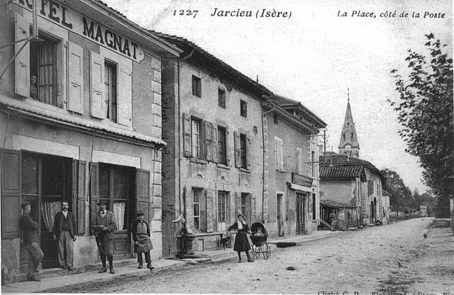
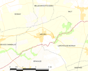
Jarcieu
- commune in Isère, France
Hiking in Jarcieu
Jarcieu is a charming village located in the Isère department in southeastern France. The area is surrounded by beautiful landscapes and offers a variety of opportunities for hiking enthusiasts, ranging from leisurely walks to more challenging trails. Here are some highlights and tips for hiking in Jarcieu:...
- Country:
- Postal Code: 38270
- Coordinates: 45° 20' 2" N, 4° 56' 47" E
- GPS tracks (wikiloc): [Link]
- Area: 6.31 sq km
- Population: 1028
- Web site: [Link]

Beaurepaire
- commune in Isère, France
Hiking in Beaurepaire
Beaurepaire, located in the Isère department of France, is a charming commune that offers a variety of hiking opportunities. Nestled in the Rhône-Alpes region, it's surrounded by beautiful landscapes, including rolling hills and valleys, making it a great spot for outdoor enthusiasts....
- Country:
- Postal Code: 38270
- Coordinates: 45° 20' 18" N, 5° 3' 16" E
- GPS tracks (wikiloc): [Link]
- Area: 18.46 sq km
- Population: 4891
- Web site: [Link]