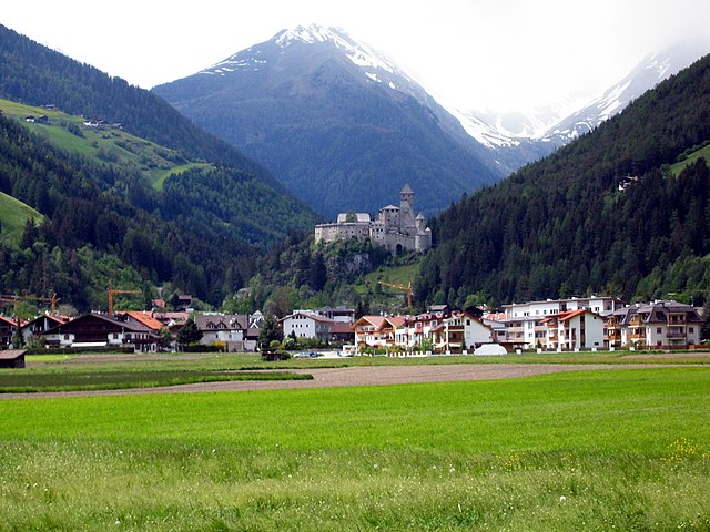
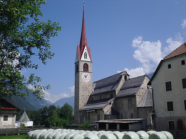
Percha (Perca)
.svg)
- Italian comune
 Hiking in Percha
Percha, known for its beautiful landscapes and outdoor recreational opportunities, offers a variety of hiking experiences for outdoor enthusiasts. While specific trails and details may vary, here are some general points to consider if you're planning to hike in this area:
Trail Options
-
Scenic Trails: Percha may feature trails that take you through forests, along rivers, or to scenic overlooks. Always check for local maps to find the best routes.
-
Difficulty Levels: Trails can vary in difficulty from easy, family-friendly walks to challenging backcountry hikes. Be sure to select a trail that matches your skill level and physical condition.
-
Wildlife Viewing: Hiking in Percha may offer opportunities to see local wildlife. Early morning or late afternoon hikes can increase your chances of spotting animals.
Preparation Tips
-
Check Weather Conditions: Always be prepared for changing weather. Look at forecasts and equip yourself accordingly.
-
Footwear: Wear appropriate hiking shoes or boots for the terrain you will encounter.
-
Hydration and Snacks: Carry enough water and energy-boosting snacks, especially for longer hikes.
-
Navigation: Familiarize yourself with the trail maps and consider using a GPS or compass to avoid getting lost.
Safety
-
Tell Someone Your Plans: Always inform someone about your hiking plans, including your intended route and estimated return time.
-
Leave No Trace: Follow Leave No Trace principles to protect the natural environment. This includes staying on marked trails and disposing of waste properly.
Local Regulations
Check if there are any specific rules or permits required for hiking in Percha. Some areas may have regulations regarding fire use or pet policies.
Conclusion
Hiking in Percha can be a rewarding experience, combining physical activity with the chance to enjoy nature's beauty. Always plan ahead, and go at your own pace to make the most of your time outdoors. If you're new to the area, consider reaching out to local hiking groups or visitor centers for more specific information on trails and current conditions. Happy hiking!
- Country:

- Postal Code: 39030
- Local Dialing Code: 0474
- Licence Plate Code: BZ
- Coordinates: 46° 47' 36" N, 11° 59' 0" E


- GPS tracks (wikiloc): [Link]
- AboveSeaLevel: 972 м m
- Area: 30.36 sq km
- Population: 1550
- Web site: http://www.comune.perca.bz.it
- Wikipedia en: wiki(en)
- Wikipedia: wiki(it)
- Wikidata storage: Wikidata: Q427475
- Wikipedia Commons Category: [Link]
- Freebase ID: [/m/0g9hz6]
- GeoNames ID: Alt: [6535917]
- VIAF ID: Alt: [167908951]
- OSM relation ID: [47328]
- GND ID: Alt: [4104685-7]
- UN/LOCODE: [ITPC5]
- ISTAT ID: 021063
- Italian cadastre code: G443
Shares border with regions:


Rasen-Antholz
- Italian comune
Hiking in Rasen-Antholz
Rasen-Antholz (Rasen-Antholz in German, or Rasun-Anterselva in Italian) is a picturesque valley located in the South Tyrol region of northern Italy, surrounded by the stunning Dolomites. This area is particularly popular for hiking due to its breathtaking landscapes, diverse trails, and natural beauty....
- Country:
- Postal Code: 39030
- Local Dialing Code: 0474
- Licence Plate Code: BZ
- Coordinates: 46° 51' 0" N, 12° 6' 0" E
- GPS tracks (wikiloc): [Link]
- AboveSeaLevel: 1030 м m
- Area: 121.57 sq km
- Population: 2907
- Web site: [Link]


Bruneck
- Italian comune
Hiking in Bruneck
Bruneck (Brunico in Italian) is a charming town located in South Tyrol, Northern Italy, surrounded by the stunning Dolomites mountain range. It serves as a fantastic base for hiking enthusiasts, offering a variety of trails suitable for all skill levels. Here are some key points to consider when planning your hiking adventure in and around Bruneck:...
- Country:
- Postal Code: 39031
- Local Dialing Code: 0474
- Licence Plate Code: BZ
- Coordinates: 46° 47' 58" N, 11° 56' 3" E
- GPS tracks (wikiloc): [Link]
- AboveSeaLevel: 838 м m
- Area: 45.27 sq km
- Population: 16356
- Web site: [Link]

Sand in Taufers
- comune in Nothern Italy
Hiking in Sand in Taufers
Sand in Taufers, or Campo Tures as it is known in Italian, is a picturesque village located in the Ahrntal Valley in South Tyrol, Italy. It's renowned for its stunning natural scenery, rich cultural heritage, and a variety of outdoor activities, particularly hiking. Here are some key points about hiking in this beautiful region:...
- Country:
- Postal Code: 39032
- Local Dialing Code: 0474
- Licence Plate Code: BZ
- Coordinates: 46° 54' 30" N, 11° 57' 37" E
- GPS tracks (wikiloc): [Link]
- AboveSeaLevel: 864 м m
- Area: 163.98 sq km
- Population: 5430
- Web site: [Link]

Gais, South Tyrol
- Italian comune
Hiking in Gais, South Tyrol
Gais, a picturesque village in South Tyrol, Italy, is an excellent destination for hiking enthusiasts. Nestled in the shadow of the stunning Dolomites, the area offers breathtaking landscapes, diverse trails, and a rich cultural heritage. Here’s an overview of what you can expect while hiking in and around Gais:...
- Country:
- Postal Code: 39030
- Local Dialing Code: 0474
- Licence Plate Code: BZ
- Coordinates: 46° 50' 0" N, 11° 57' 0" E
- GPS tracks (wikiloc): [Link]
- AboveSeaLevel: 841 м m
- Area: 60.62 sq km
- Population: 3279
- Web site: [Link]