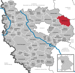
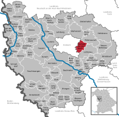
Petersaurach (Petersaurach)
- municipality of Germany
Petersaurach, located in Bavaria, Germany, is a charming area for hiking enthusiasts. The region is characterized by its beautiful landscapes, rolling hills, lush forests, and scenic trails that cater to various skill levels.
Popular Trails:
-
Rundweg Petersaurach: This circular trail offers a moderate hike that allows hikers to explore the surrounding countryside. It's approximately 10 km long and takes around 2-3 hours to complete, depending on your pace.
-
Nature Trails: There are several nature trails that focus on environmental education, showcasing local flora and fauna, as well as the natural beauty of the area. These trails are generally well-marked and suitable for families.
-
The Altmühltal Nature Park: While not directly in Petersaurach, this nearby park offers extensive hiking options and is easily accessible. The trails here wind through picturesque valleys and rock formations.
Best Seasons to Hike:
- Spring: Ideal for witnessing blooming wildflowers and pleasant temperatures.
- Autumn: The fall foliage can be stunning, making for beautiful hiking conditions.
- Summer: A great time for longer hikes, but be mindful of the heat and carry enough water.
Tips for Hiking in Petersaurach:
- Weather: Check the weather forecast before you head out, as conditions can change rapidly.
- Gear: Wear comfortable hiking shoes and dress in layers to accommodate temperature changes.
- Navigation: Use local maps or hiking apps to find well-marked trails and ensure you stay on course.
- Leave No Trace: Be sure to follow the principles of Leave No Trace, taking care of the natural environment.
Amenities:
Petersaurach has a variety of local accommodations and refreshment stops, including guesthouses and small cafes where you can rest and enjoy local cuisine after a day of hiking.
Overall, Petersaurach provides a fantastic range of hiking opportunities amidst a tranquil, picturesque setting, ideal for both novice and experienced hikers alike. Enjoy your adventure!
- Country:

- Postal Code: 91580
- Local Dialing Code: 0 98 72
- Licence Plate Code: AN
- Coordinates: 49° 17' 0" N, 10° 45' 0" E


- GPS tracks (wikiloc): [Link]
- AboveSeaLevel: 442 м m
- Area: 41.81 sq km
- Population: 3927
- Web site: http://www.petersaurach.de
- Wikipedia en: wiki(en)
- Wikipedia: wiki(de)
- Wikidata storage: Wikidata: Q507397
- Wikipedia Commons Category: [Link]
- Freebase ID: [/m/02q05fx]
- GeoNames ID: Alt: [2854737]
- VIAF ID: Alt: [242268890]
- OSM relation ID: [534381]
- GND ID: Alt: [4355483-0]
- Historical Gazetteer (GOV) ID: [PETAC1JN59JH]
- Bavarikon ID: [ODB_A00000049]
- German municipality key: 09571190
Shares border with regions:


Heilsbronn
- town in Germany
Heilsbronn, located in the region of Middle Franconia in Bavaria, Germany, offers a number of scenic hiking opportunities for outdoor enthusiasts. The area is known for its rolling hills, picturesque countryside, and historic sites, making it a great destination for both casual walkers and more experienced hikers. Here are some key points to consider when hiking in Heilsbronn:...
- Country:

- Postal Code: 91560
- Local Dialing Code: 09872
- Licence Plate Code: AN
- Coordinates: 49° 20' 19" N, 10° 47' 27" E


- GPS tracks (wikiloc): [Link]
- AboveSeaLevel: 400 м m
- Area: 62.23 sq km
- Population: 7409
- Web site: [Link]


Neuendettelsau
- municipality of Germany
Neuendettelsau is a charming village located in Bavaria, Germany, known for its picturesque landscapes and scenic hiking trails. The area offers a variety of hiking opportunities, suitable for different skill levels, from leisurely walks to more challenging treks....
- Country:

- Postal Code: 91564
- Local Dialing Code: 09874
- Licence Plate Code: AN
- Coordinates: 49° 16' 0" N, 10° 46' 0" E


- GPS tracks (wikiloc): [Link]
- AboveSeaLevel: 438 м m
- Area: 33.8 sq km
- Population: 6448
- Web site: [Link]


Dietenhofen
- municipality of Germany
Dietenhofen, located in Bavaria, Germany, is a great destination for hiking enthusiasts. The region boasts beautiful landscapes, charming villages, and a variety of trails suitable for different skill levels. Here are some key points to consider when hiking in and around Dietenhofen:...
- Country:

- Postal Code: 90599
- Local Dialing Code: 09824
- Licence Plate Code: AN
- Coordinates: 49° 24' 0" N, 10° 41' 24" E


- GPS tracks (wikiloc): [Link]
- AboveSeaLevel: 353 м m
- Area: 63.96 sq km
- Population: 4260
- Web site: [Link]


Bruckberg, Middle Franconia
- municipality of Germany
 Hiking in Bruckberg, Middle Franconia
Bruckberg, located in Middle Franconia, Germany, is a charming area that offers several opportunities for hiking enthusiasts. The region is characterized by its picturesque landscapes, which include rolling hills, lush forests, and tranquil countryside....
- Country:

- Postal Code: 91590
- Local Dialing Code: 09824
- Licence Plate Code: AN
- Coordinates: 49° 21' 0" N, 10° 42' 0" E


- GPS tracks (wikiloc): [Link]
- AboveSeaLevel: 347 м m
- Area: 7.62 sq km
- Population: 1223
- Web site: [Link]


Sachsen bei Ansbach
- municipality of Germany
Sachsen bei Ansbach, located in the Bavaria region of Germany, offers a variety of beautiful hiking trails that showcase its stunning landscapes and natural beauty. Here are some highlights you might consider when planning a hiking trip in the area:...
- Country:

- Postal Code: 91623
- Local Dialing Code: 09827
- Licence Plate Code: AN
- Coordinates: 49° 17' 0" N, 10° 39' 0" E


- GPS tracks (wikiloc): [Link]
- AboveSeaLevel: 406 м m
- Area: 20.95 sq km
- Population: 2283
- Web site: [Link]


Weihenzell
- municipality of Germany
Weihenzell is a picturesque village located in the region of Bavaria, Germany. This area is ideal for hiking enthusiasts due to its beautiful landscapes, rich nature, and accessible trails. Here are some key points to consider when hiking in and around Weihenzell:...
- Country:

- Postal Code: 91629
- Local Dialing Code: 09802
- Licence Plate Code: AN
- Coordinates: 49° 21' 0" N, 10° 37' 0" E


- GPS tracks (wikiloc): [Link]
- AboveSeaLevel: 387 м m
- Area: 45.18 sq km
- Population: 2095
- Web site: [Link]


Lichtenau
- human settlement in Germany
Lichtenau, located in the state of Bavaria, Germany, is surrounded by beautiful landscapes that offer a variety of hiking opportunities. The region is characterized by its rolling hills, forests, and picturesque views, making it an excellent destination for outdoor enthusiasts....
- Country:

- Postal Code: 91586
- Local Dialing Code: 09827
- Licence Plate Code: AN
- Coordinates: 49° 16' 0" N, 10° 41' 0" E


- GPS tracks (wikiloc): [Link]
- AboveSeaLevel: 390 м m
- Area: 41.39 sq km
- Population: 3486
- Web site: [Link]
