
Middle Franconia (Mittelfranken)


- administrative region of Franconia in Bavaria, Germany
 Hiking in Middle Franconia
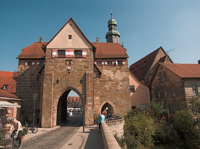
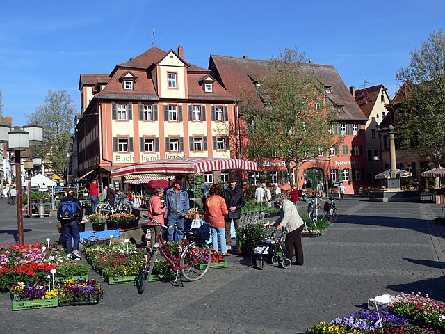
Middle Franconia, located in Bavaria, Germany, is a picturesque region known for its diverse landscapes, charming villages, and rich cultural heritage. It offers a variety of hiking opportunities suitable for all levels of experience. Here are some highlights regarding hiking in this area:
Scenic Trails
-
Frankenweg: This long-distance hiking trail spans approximately 520 kilometers across Franconia, passing through Middle Franconia. It offers a mix of forests, vineyards, and historical sites.
-
Altmühltal Nature Park: A beautiful area with well-marked trails, the Altmühltal offers a mix of rocky cliffs, river landscapes, and quaint towns. The Altmühl River runs through the park, providing a lovely backdrop for many hikes.
-
Nuremberg Surroundings: If you’re near the Nuremberg area, trails such as the Auf den Spuren der Geschichte (On the Tracks of History) take you through historical locales and natural beauty.
Natural Beauty
-
Rolling Hills and Forests: The region boasts rolling hills that are covered with dense forests, making it ideal for nature lovers. The lush greenery is especially vibrant in spring and summer.
-
Vineyards: Middle Franconia is known for its wine production, particularly for Silvaner and Müller-Thurgau varieties. Hiking through vineyards not only allows you to enjoy the scenery but also offers opportunities for wine tasting along the way.
Cultural Aspects
-
Historical Sites: Many trails lead to historical landmarks, castles, and traditional towns such as Rothenburg ob der Tauber and Dinkelsbühl. These sites provide a fascinating glimpse into the region's medieval past.
-
Local Cuisine: After a day of hiking, you can indulge in local Franconian cuisine. Look for Gasthäuser (guesthouses) that serve hearty meals and local wines.
Tips for Hiking in Middle Franconia
-
Trail Maps: Always carry a detailed trail map or download a hiking app for navigation. Many trails are well-marked, but having a map can help you stay on track.
-
Weather: Check the weather forecast before heading out, as conditions can change rapidly. Be prepared for unexpected rain or temperature changes, especially in spring and autumn.
-
Footwear: Wear comfortable hiking shoes with good traction, as some trails can be rocky or uneven.
-
Respect Nature: Practice Leave No Trace principles. Stay on the marked trails, and DO NOT disturb wildlife.
Whether you're an experienced hiker or a beginner, Middle Franconia has something to offer everyone. Enjoy the breathtaking landscapes and immerse yourself in the region's unique culture!
- Country:

- Capital: Ansbach
- Coordinates: 49° 18' 0" N, 10° 35' 0" E


- GPS tracks (wikiloc): [Link]
- AboveSeaLevel: 401 м m
- Area: 7245.70 sq km
- Population: 1750059
- Web site: http://www.bezirk-mittelfranken.de/
- Wikipedia en: wiki(en)
- Wikipedia: wiki(de)
- Wikidata storage: Wikidata: Q10551
- Wikipedia Commons Category: [Link]
- Wikipedia Commons Maps Category: [Link]
- GeoNames ID: Alt: [2870736]
- BnF ID: [119995604]
- VIAF ID: Alt: [240324910]
- OSM relation ID: [17614]
- GND ID: Alt: [4039681-2]
- Library of Congress authority ID: Alt: [n80160454]
- Bavarikon ID: [ODB_A00000001]
- ISNI: Alt: [0000 0004 0601 2694]
- NUTS code: [DE25]
- Ringgold ID: [373860]
- German regional key: 095
Includes regions:

Erlangen-Höchstadt
- district in Bavaria, Germany
Hiking in Erlangen-Höchstadt
Erlangen-Höchstadt is a scenic district in Bavaria, Germany, known for its beautiful landscapes and opportunities for outdoor activities, including hiking. The region offers a mix of rolling hills, woodlands, and agricultural fields, making it suitable for both casual and more adventurous hikers....
- Country:
- Capital: Erlangen
- Licence Plate Code: ERH
- Coordinates: 49° 40' 12" N, 10° 49' 48" E
- GPS tracks (wikiloc): [Link]
- AboveSeaLevel: 287 м m
- Area: 56465.80 sq km
- Population: 134136
- Web site: [Link]
Nürnberger Land
- district in Bavaria, Germany
Hiking in Nürnberger Land
Nürnberger Land, located in Bavaria, Germany, is a fantastic area for hiking enthusiasts. It features a diverse landscape that includes forests, hills, and picturesque valleys, making it ideal for both casual walkers and seasoned hikers. Here are some key points about hiking in Nürnberger Land:...
- Country:
- Capital: Lauf an der Pegnitz
- Licence Plate Code: PEG; N; LAU; HEB; ESB
- Coordinates: 49° 30' 0" N, 11° 22' 0" E
- GPS tracks (wikiloc): [Link]
- AboveSeaLevel: 355 м m
- Area: 800.00 sq km
- Population: 149127
- Web site: [Link]

Roth
- district in Bavaria, Germany
Hiking in Roth
Roth district, located in Bavaria, Germany, offers a variety of beautiful landscapes and hiking opportunities that appeal to both novice and experienced hikers. The area is characterized by rolling hills, forests, and picturesque views. Here are some highlights and tips for hiking in Roth:...
- Country:
- Capital: Roth
- Licence Plate Code: RH; HIP
- Coordinates: 49° 15' 0" N, 11° 4' 48" E
- GPS tracks (wikiloc): [Link]
- AboveSeaLevel: 355 м m
- Area: 895.00 sq km
- Population: 103944
- Web site: [Link]

Weißenburg-Gunzenhausen
- district of Bavaria, Germany
Hiking in Weißenburg-Gunzenhausen
Weißenburg-Gunzenhausen, located in Bavaria, Germany, is a great destination for hiking enthusiasts. This region is known for its beautiful landscapes, including hills, lakes, and forests, making it perfect for various outdoor activities....
- Country:
- Capital: Weißenburg in Bayern
- Licence Plate Code: WUG; GUN
- Coordinates: 49° 4' 48" N, 10° 49' 48" E
- GPS tracks (wikiloc): [Link]
- AboveSeaLevel: 452 м m
- Area: 970.83 sq km
- Population: 92331
- Web site: [Link]

Ansbach
- district in Bavaria, Germany
Hiking in Ansbach
Ansbach district, located in the region of Bavaria, Germany, offers a variety of hiking opportunities suitable for different skill levels. The region is characterized by its picturesque landscapes, including rolling hills, forests, and historical sites, making it a great destination for outdoor enthusiasts....
- Country:
- Capital: Ansbach
- Licence Plate Code: ROT; FEU; DKB; AN
- Coordinates: 49° 19' 48" N, 10° 30' 0" E
- GPS tracks (wikiloc): [Link]
- AboveSeaLevel: 426 м m
- Area: 1972.00 sq km
- Population: 157632
- Web site: [Link]

Fürth
- district in Bavaria, Germany
Hiking in Fürth
Fürth, located in Bavaria, Germany, offers a variety of hiking opportunities that cater to different skill levels and preferences. The area is characterized by beautiful hills, forests, and rivers, making it a great spot for outdoor enthusiasts....
- Country:
- Capital: Zirndorf
- Licence Plate Code: FÜ
- Coordinates: 49° 25' 0" N, 10° 50' 0" E
- GPS tracks (wikiloc): [Link]
- AboveSeaLevel: 397 м m
- Area: 308.00 sq km
- Population: 116193
- Web site: [Link]
Neustadt (Aisch)-Bad Windsheim
- district in Bavaria, Germany
Hiking in Neustadt (Aisch)-Bad Windsheim
Neustadt (Aisch)-Bad Windsheim, located in the Franconian region of Bavaria, Germany, offers a variety of scenic hiking opportunities for outdoor enthusiasts. The area is characterized by its picturesque landscapes, charming villages, and the rich cultural heritage of Franconia. Here are some highlights of hiking in this region:...
- Country:
- Capital: Neustadt an der Aisch
- Licence Plate Code: UFF; SEF; NEA
- Coordinates: 49° 34' 48" N, 10° 30' 0" E
- GPS tracks (wikiloc): [Link]
- AboveSeaLevel: 384 м m
- Area: 1267.54 sq km
- Population: 85686
- Web site: [Link]

Ansbach
- town in Bavaria, Germany
Hiking in Ansbach
Hiking in Ansbach, a charming town located in Bavaria, Germany, offers a variety of scenic trails and routes that showcase the region's natural beauty and rich history. The surrounding landscapes are characterized by rolling hills, dense forests, and picturesque countryside, making it an excellent destination for outdoor enthusiasts....
- Country:
- Postal Code: 91522
- Local Dialing Code: 09825; 09823; 09820; 09805; 09802; 0981
- Licence Plate Code: AN
- Coordinates: 49° 18' 0" N, 10° 35' 0" E
- GPS tracks (wikiloc): [Link]
- AboveSeaLevel: 409 м m
- Area: 99.92 sq km
- Population: 39839
- Web site: [Link]
Schwabach
- town in Bavaria, Germany
Hiking in Schwabach
Schwabach, located in the state of Bavaria, Germany, offers a variety of hiking opportunities that showcase the natural beauty and cultural heritage of the region. Here are some highlights for hiking in and around Schwabach:...
- Country:
- Postal Code: 91126
- Local Dialing Code: 0911; 09122
- Licence Plate Code: SC
- Coordinates: 49° 19' 45" N, 11° 1' 15" E
- GPS tracks (wikiloc): [Link]
- AboveSeaLevel: 326 м m
- Area: 40.71 sq km
- Population: 39546
- Web site: [Link]

Nuremberg
- city in the German state of Bavaria
Hiking in Nuremberg
Hiking in and around Nuremberg can offer a remarkable blend of urban exploration and natural beauty. Though Nuremberg itself is a city with a rich history, it is surrounded by picturesque landscapes that are perfect for hiking enthusiasts. Here are some highlights and tips for hiking in the region:...
- Country:
- Postal Code: 90402–90491
- Local Dialing Code: 0911
- Licence Plate Code: N
- Coordinates: 49° 27' 10" N, 11° 4' 40" E
- GPS tracks (wikiloc): [Link]
- AboveSeaLevel: 209 м m
- Area: 186.45 sq km
- Population: 515201
- Web site: [Link]

Fürth
- town in Bavaria, Germany
Hiking in Fürth
Fürth, located in Bavaria, Germany, offers several hiking opportunities that cater to various fitness levels and preferences. While it may not be as well-known as some of the larger cities for hiking, it has its charms and beautiful landscapes....
- Country:
- Postal Code: 90768; 90766; 90765; 90763; 90762
- Local Dialing Code: 0911
- Licence Plate Code: FÜ
- Coordinates: 49° 28' 42" N, 10° 59' 25" E
- GPS tracks (wikiloc): [Link]
- AboveSeaLevel: 296 м m
- Area: 63.35 sq km
- Population: 125403
- Web site: [Link]
Erlangen
- large city in Bavaria, Germany
Hiking in Erlangen
Erlangen, located in Bavaria, Germany, is surrounded by beautiful landscapes that offer various hiking opportunities. While the city itself is relatively flat, the nearby Franconian Switzerland region and the hills of the Fichtelgebirge provide excellent trails for hikers of all skill levels....
- Country:
- Postal Code: 91001; 91058; 91057; 91056; 91055; 91054; 91053; 91052
- Local Dialing Code: 09132; 09135; 0911; 09131
- Licence Plate Code: ER
- Coordinates: 49° 35' 47" N, 11° 0' 16" E
- GPS tracks (wikiloc): [Link]
- AboveSeaLevel: 279 м m
- Area: 76900000 sq km
- Population: 108336
- Web site: [Link]
Shares border with regions:


Lower Franconia
- administrative region of Franconia in Bavaria, Germany
Hiking in Lower Franconia
Lower Franconia, located in the northern part of Bavaria, Germany, is a great destination for hiking enthusiasts. This region is known for its diverse landscapes that range from rolling hills to picturesque vineyards and nature reserves, offering a variety of trails suitable for different skill levels....
- Country:
- Capital: Würzburg
- Coordinates: 50° 1' 28" N, 9° 55' 55" E
- GPS tracks (wikiloc): [Link]
- AboveSeaLevel: 289 м m
- Area: 8530.99 sq km
- Population: 1298849
- Web site: [Link]


Upper Franconia
- administrative region of Franconia in Bavaria, Germany
Hiking in Upper Franconia
Upper Franconia, located in northern Bavaria, Germany, is a lesser-known but stunning hiking destination characterized by its diverse landscapes, charming villages, and rich cultural heritage. Here are some highlights and tips for hiking in the region:...
- Country:
- Capital: Bayreuth
- Coordinates: 49° 57' 0" N, 11° 35' 0" E
- GPS tracks (wikiloc): [Link]
- AboveSeaLevel: 368 м m
- Area: 7230.19 sq km
- Population: 1062398
- Web site: [Link]


Upper Palatinate
- administrative regions of Bavaria, Germany
Hiking in Upper Palatinate
The Upper Palatinate (Oberpfalz) region in Bavaria, Germany, is known for its scenic landscapes, picturesque villages, and rich cultural heritage, making it an excellent destination for hiking enthusiasts. Here are some highlights and tips for hiking in the Upper Palatinate:...
- Country:
- Capital: Regensburg
- Coordinates: 49° 18' 0" N, 12° 12' 0" E
- GPS tracks (wikiloc): [Link]
- AboveSeaLevel: 628 м m
- Area: 9691.03 sq km
- Population: 1098378
- Web site: [Link]

Swabia
- administrative regions of Bavaria, Germany
Hiking in Swabia
Swabia, a picturesque region in Bavaria, Germany, offers a variety of hiking opportunities ranging from gentle walks to challenging trails. Known for its diverse landscapes, Swabia features lush forests, rolling hills, scenic lakes, and impressive mountain ranges, making it a fantastic destination for outdoor enthusiasts....
- Country:
- Capital: Augsburg
- Coordinates: 48° 30' 0" N, 10° 30' 0" E
- GPS tracks (wikiloc): [Link]
- AboveSeaLevel: 560 м m
- Area: 9992.03 sq km
- Population: 1857991
- Web site: [Link]


Upper Bavaria
- administrative regions of Bavaria, Germany
Hiking in Upper Bavaria
Upper Bavaria is a beautiful region in southern Germany, known for its stunning landscapes, charming villages, and a wealth of outdoor activities, particularly hiking. Here are some highlights and tips for hiking in Upper Bavaria:...
- Country:
- Capital: Munich
- Coordinates: 48° 8' 0" N, 11° 34' 0" E
- GPS tracks (wikiloc): [Link]
- AboveSeaLevel: 647 м m
- Area: 17529.63 sq km
- Population: 4588944
- Web site: [Link]