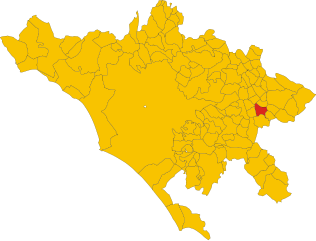
Pisoniano (Pisoniano)
.svg)
- Italian comune
 Hiking in Pisoniano
Pisoniano is a charming village located in the province of Rome, Italy, and surrounded by picturesque landscapes of the Lazio region. Hiking in and around Pisoniano offers a unique opportunity to explore beautiful valleys, ancient forests, and scenic viewpoints.
Hiking Routes and Trails
-
Sentiero di Pisoniano: This marked trail offers a variety of terrains, taking you through lush vegetation and providing stunning views of the surrounding countryside. It's suitable for hikers of different skill levels.
-
Monte Gennaro: A nearby hike that rewards you with breathtaking panoramic views. The path can be challenging but is well worth the effort for experienced hikers.
-
Nature Reserves: The surrounding areas encompass several nature reserves, such as the Parco dei Monti Lucretili, where you can discover diverse ecosystems and wildlife.
Tips for Hiking in Pisoniano
-
Best Time to Hike: Spring (April to June) and early fall (September to October) are ideal, as the weather is mild, and the landscape is vibrant.
-
Prepare for Varying Terrain: Be ready for a mix of trails, from easy walks to more challenging hikes. Good hiking boots are recommended.
-
Hydration and Snacks: Carry enough water and snacks, especially if you plan on longer hikes.
-
Navigation: Consider bringing a map or a GPS device, as some trails may not be well-marked.
-
Respect Nature: Always follow Leave No Trace principles to help preserve the natural environment.
Local Attractions
After your hike, you can explore the charming village of Pisoniano, known for its historical architecture and local cuisine. Take a moment to enjoy traditional Italian dishes in local restaurants, and perhaps visit nearby towns for a broader cultural experience.
In summary, Pisoniano is a wonderful destination for hiking enthusiasts looking to immerse themselves in the natural beauty and history of Italy. Be sure to plan your hike, take the necessary precautions, and most importantly, enjoy the stunning landscapes!
- Country:

- Postal Code: 00020
- Local Dialing Code: 06
- Licence Plate Code: RM
- Coordinates: 41° 54' 28" N, 12° 57' 30" E


- GPS tracks (wikiloc): [Link]
- AboveSeaLevel: 532 м m
- Area: 12.92 sq km
- Population: 739
- Web site: http://comune.pisoniano.rm.it
- Wikipedia en: wiki(en)
- Wikipedia: wiki(it)
- Wikidata storage: Wikidata: Q243152
- Wikipedia Commons Category: [Link]
- Freebase ID: [/m/0gm7y9]
- GeoNames ID: Alt: [6536959]
- OSM relation ID: [41631]
- ISTAT ID: 058077
- Italian cadastre code: G704
Shares border with regions:

Bellegra
- Italian comune
Hiking in Bellegra
Bellegra, nestled in the beautiful Aniene Valley of Italy, offers a variety of hiking opportunities that showcase the region's stunning natural landscapes, rich history, and diverse flora and fauna. Here’s an overview of what you can expect when hiking in this scenic area:...
- Country:
- Postal Code: 00030
- Local Dialing Code: 06
- Licence Plate Code: ROMA
- Coordinates: 41° 53' 0" N, 13° 2' 0" E
- GPS tracks (wikiloc): [Link]
- AboveSeaLevel: 815 м m
- Area: 18.78 sq km
- Population: 2841
- Web site: [Link]
Capranica Prenestina
- Italian comune
Hiking in Capranica Prenestina
Capranica Prenestina is a beautiful town nestled in the eastern part of the Lazio region in Italy, known for its scenic landscapes and rich historical heritage. Hiking in this area offers a delightful blend of nature, cultural exploration, and stunning views of the surrounding countryside....
- Country:
- Postal Code: 00030
- Local Dialing Code: 06
- Licence Plate Code: RM
- Coordinates: 41° 52' 0" N, 12° 57' 0" E
- GPS tracks (wikiloc): [Link]
- AboveSeaLevel: 915 м m
- Area: 20.36 sq km
- Population: 332
- Web site: [Link]
Cerreto Laziale
- Italian comune
Hiking in Cerreto Laziale
Cerreto Laziale is a charming village located in the Lazio region of Italy, not far from Rome. It offers a variety of hiking opportunities, often characterized by beautiful landscapes, historic towns, and lush nature....
- Country:
- Postal Code: 00020
- Local Dialing Code: 0774
- Licence Plate Code: RM
- Coordinates: 41° 56' 42" N, 12° 58' 58" E
- GPS tracks (wikiloc): [Link]
- AboveSeaLevel: 520 м m
- Area: 12.08 sq km
- Population: 1104
- Web site: [Link]
Ciciliano
- Italian comune
Hiking in Ciciliano
Ciciliano is a charming town in the Lazio region of Italy, located about 50 kilometers east of Rome. It is situated in a picturesque area characterized by rolling hills, dense forests, and scenic views, making it an excellent location for hiking enthusiasts. Here are some key points to consider when hiking in the Ciciliano area:...
- Country:
- Postal Code: 00020
- Local Dialing Code: 0774
- Licence Plate Code: ROMA
- Coordinates: 41° 57' 36" N, 12° 56' 30" E
- GPS tracks (wikiloc): [Link]
- AboveSeaLevel: 619 м m
- Area: 18.85 sq km
- Population: 1331
- Web site: [Link]


Gerano
- Italian comune
Hiking in Gerano
Gerano is a small village located in the region of Lazio, Italy, known for its picturesque landscapes and charming hilltop setting. Hiking in and around Gerano offers a wonderful experience for nature enthusiasts and outdoor lovers....
- Country:
- Postal Code: 00025
- Local Dialing Code: 0774
- Licence Plate Code: RM
- Coordinates: 41° 56' 0" N, 12° 59' 37" E
- GPS tracks (wikiloc): [Link]
- AboveSeaLevel: 502 м m
- Area: 10.12 sq km
- Population: 1250
- Web site: [Link]
San Vito Romano
- Italian comune
Hiking in San Vito Romano
San Vito Romano is a charming town located in the province of Rome, Italy, and is surrounded by beautiful natural landscapes, making it an excellent destination for hiking enthusiasts. The area is characterized by its hills, forests, and the stunning Simbruini Mountains to the east, providing a variety of trails suitable for different skill levels....
- Country:
- Postal Code: 00030
- Local Dialing Code: 06
- Licence Plate Code: RM
- Coordinates: 41° 53' 0" N, 12° 59' 0" E
- GPS tracks (wikiloc): [Link]
- AboveSeaLevel: 655 м m
- Area: 12.66 sq km
- Population: 3313
- Web site: [Link]