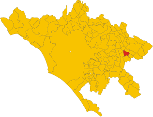
San Vito Romano (San Vito Romano)
.svg)
- Italian comune
 Hiking in San Vito Romano
San Vito Romano is a charming town located in the province of Rome, Italy, and is surrounded by beautiful natural landscapes, making it an excellent destination for hiking enthusiasts. The area is characterized by its hills, forests, and the stunning Simbruini Mountains to the east, providing a variety of trails suitable for different skill levels.
Hiking Trails
-
Monte Autore: One of the most popular hiking destinations near San Vito Romano, Monte Autore boasts spectacular views and diverse flora and fauna. The trail typically takes you through dense forests and offers a moderate challenge.
-
The Aniene Valley: Following the Aniene River, hikers can enjoy a scenic trek along the valley, where you can observe the diverse ecosystems, and even spot some local wildlife.
-
Simbruini Regional Park: Located close to San Vito Romano, this park has numerous trails that offer beautiful landscapes, historical sites, and opportunities for birdwatching. The park is home to various hiking paths that range from easy strolls to more challenging hikes.
Tips for Hiking in San Vito Romano
-
Research Trails: Always check trail conditions and difficulty levels before heading out. Some paths may be rocky or steep.
-
Prepare for the Weather: The weather can change quickly in the mountains, so be prepared with layers, rain gear, and sufficient water.
-
Footwear: Wear sturdy hiking boots with good grip, as some trails can be uneven.
-
Navigation: Consider bringing a map or using a GPS app for navigation, especially if you're venturing onto less-marked trails.
-
Local Cuisine: After a day of hiking, treat yourself to some local Italian cuisine in town, where you can find delicious traditional dishes.
Conclusion
Hiking in San Vito Romano offers a blend of natural beauty, tranquility, and adventure. Whether you're a seasoned hiker or a casual walker, there are trails across varying landscapes that will give you a unique experience of this picturesque region of Italy. Don't forget to take your camera – the views are breathtaking!
- Country:

- Postal Code: 00030
- Local Dialing Code: 06
- Licence Plate Code: RM
- Coordinates: 41° 53' 0" N, 12° 59' 0" E


- GPS tracks (wikiloc): [Link]
- AboveSeaLevel: 655 м m
- Area: 12.66 sq km
- Population: 3313
- Web site: http://www.sanvitoromano.rm.gov.it
- Wikipedia en: wiki(en)
- Wikipedia: wiki(it)
- Wikidata storage: Wikidata: Q243377
- Wikipedia Commons Category: [Link]
- Freebase ID: [/m/0gm8g0]
- GeoNames ID: Alt: [6536967]
- VIAF ID: Alt: [144609430]
- OSM relation ID: [41604]
- ISTAT ID: 058100
- Italian cadastre code: I400
Shares border with regions:

Bellegra
- Italian comune
Hiking in Bellegra
Bellegra, nestled in the beautiful Aniene Valley of Italy, offers a variety of hiking opportunities that showcase the region's stunning natural landscapes, rich history, and diverse flora and fauna. Here’s an overview of what you can expect when hiking in this scenic area:...
- Country:
- Postal Code: 00030
- Local Dialing Code: 06
- Licence Plate Code: ROMA
- Coordinates: 41° 53' 0" N, 13° 2' 0" E
- GPS tracks (wikiloc): [Link]
- AboveSeaLevel: 815 м m
- Area: 18.78 sq km
- Population: 2841
- Web site: [Link]
Capranica Prenestina
- Italian comune
Hiking in Capranica Prenestina
Capranica Prenestina is a beautiful town nestled in the eastern part of the Lazio region in Italy, known for its scenic landscapes and rich historical heritage. Hiking in this area offers a delightful blend of nature, cultural exploration, and stunning views of the surrounding countryside....
- Country:
- Postal Code: 00030
- Local Dialing Code: 06
- Licence Plate Code: RM
- Coordinates: 41° 52' 0" N, 12° 57' 0" E
- GPS tracks (wikiloc): [Link]
- AboveSeaLevel: 915 м m
- Area: 20.36 sq km
- Population: 332
- Web site: [Link]
Genazzano
- Italian comune
Hiking in Genazzano
Genazzano, a charming medieval town in the Lazio region of Italy, offers wonderful opportunities for hiking and exploring the surrounding landscapes. Nestled in the hills near the Aniene Valley, Genazzano is known for its picturesque views, historic architecture, and lush natural surroundings....
- Country:
- Postal Code: 00030
- Local Dialing Code: 06
- Licence Plate Code: ROMA
- Coordinates: 41° 50' 0" N, 12° 58' 0" E
- GPS tracks (wikiloc): [Link]
- AboveSeaLevel: 375 м m
- Area: 32.07 sq km
- Population: 5949
- Web site: [Link]


Olevano Romano
- Italian comune
Hiking in Olevano Romano
Olevano Romano, located in the Lazio region of Italy, is a beautiful destination for hiking enthusiasts. Nestled in the Aniene Valley, this charming town is surrounded by stunning landscapes, including rolling hills, dense woodlands, and picturesque views of the surrounding countryside....
- Country:
- Postal Code: 00035
- Local Dialing Code: 06
- Licence Plate Code: ROMA
- Coordinates: 41° 51' 38" N, 13° 1' 55" E
- GPS tracks (wikiloc): [Link]
- AboveSeaLevel: 571 м m
- Area: 26.16 sq km
- Population: 6664
- Web site: [Link]
Pisoniano
- Italian comune
Hiking in Pisoniano
Pisoniano is a charming village located in the province of Rome, Italy, and surrounded by picturesque landscapes of the Lazio region. Hiking in and around Pisoniano offers a unique opportunity to explore beautiful valleys, ancient forests, and scenic viewpoints....
- Country:
- Postal Code: 00020
- Local Dialing Code: 06
- Licence Plate Code: RM
- Coordinates: 41° 54' 28" N, 12° 57' 30" E
- GPS tracks (wikiloc): [Link]
- AboveSeaLevel: 532 м m
- Area: 12.92 sq km
- Population: 739
- Web site: [Link]