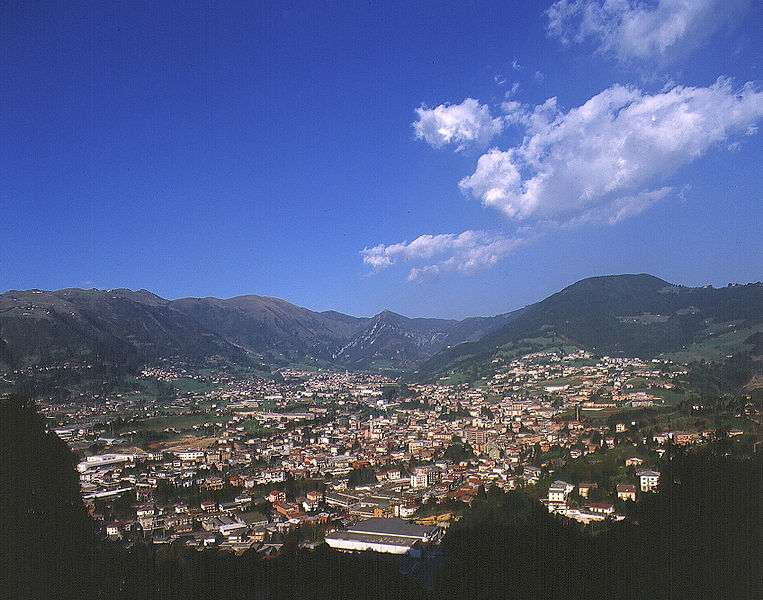
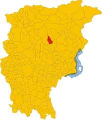
Ponte Nossa (Ponte Nossa)
.svg)
- Italian comune
 Hiking in Ponte Nossa
Ponte Nossa is a picturesque town located in the Lombardy region of northern Italy, part of the Bergamo province. Surrounded by the stunning Orobie Alps, it offers a variety of hiking opportunities, making it an excellent destination for both novice and experienced hikers.
Trails and Routes
-
Sentiero delle Orobie: This long-distance trail traverses the Orobie Alps and offers breathtaking views of the surrounding mountains, valleys, and lakes. The trail is well-marked, and various sections can be tackled based on your skill level.
-
Valle di Scalve: Just a short distance from Ponte Nossa, this valley has several trails that lead through lush forests, alpine meadows, and to scenic viewpoints. The pathways often allow access to local fauna and flora.
-
Cima di Piazzatorre: For those looking for a challenge, this hike provides a rewarding summit experience, with panoramic views at the top. It's a well-trodden route, so you'll often share the trail with other hikers.
-
Lago del Vallo: A gentler hike that leads to a beautiful lake, perfect for a picnic or simply relaxing amidst nature. This trail is suitable for families and those looking for a less strenuous outing.
Best Times to Hike
- Spring (April to June): The weather is mild, flowers are in bloom, and the trails are less crowded, making this a beautiful time to hike.
- Autumn (September to October): The foliage offers stunning colors, and temperatures are generally pleasant for outdoor activities.
Tips for Hiking in Ponte Nossa
- Preparation: Ensure you have the proper gear, including sturdy hiking boots, weather-appropriate clothing, and plenty of water and snacks.
- Maps and Guides: While many trails are marked, having a map or a hiking app can be helpful. Local visitor centers may also offer guided tours.
- Safety: Always let someone know your hiking plans, and be mindful of the weather conditions. The mountains can change rapidly, so be prepared for sudden changes.
Cultural Experience
While hiking in Ponte Nossa, take the time to appreciate the local culture. The area is rich in history and tradition, with opportunities to sample local cuisine, visit small villages, and experience the warmth of local hospitality.
Whether you're looking for some peaceful nature time or an adventurous hiking experience, Ponte Nossa has much to offer in the way of beautiful landscapes and trails. Enjoy your hiking exploration!
- Country:

- Postal Code: 24028
- Local Dialing Code: 035
- Licence Plate Code: BG
- Coordinates: 45° 52' 0" N, 9° 53' 0" E


- GPS tracks (wikiloc): [Link]
- AboveSeaLevel: 465 м m
- Area: 5.59 sq km
- Population: 1761
- Web site: http://www.comune.pontenellealpi.bl.it
- Wikipedia en: wiki(en)
- Wikipedia: wiki(it)
- Wikidata storage: Wikidata: Q101423
- Wikipedia Commons Gallery: [Link]
- Wikipedia Commons Category: [Link]
- Freebase ID: [/m/0gjcwc]
- GeoNames ID: Alt: [6536148]
- VIAF ID: Alt: [157549774]
- OSM relation ID: [46332]
- TGN ID: [5002526]
- UN/LOCODE: [ITPNS]
- ISTAT ID: 016168
- Italian cadastre code: F941
Shares border with regions:


Casnigo
- Italian comune
Hiking in Casnigo
Casnigo is a charming town located in the province of Bergamo, in the Lombardy region of northern Italy. Nestled within the Seriana Valley, it boasts stunning natural scenery, making it an excellent spot for hiking enthusiasts. Here are some key highlights for hiking in and around Casnigo:...
- Country:
- Postal Code: 24020
- Local Dialing Code: 035
- Licence Plate Code: BG
- Coordinates: 45° 48' 59" N, 9° 52' 0" E
- GPS tracks (wikiloc): [Link]
- AboveSeaLevel: 514 м m
- Area: 13.62 sq km
- Population: 3221
- Web site: [Link]


Clusone
- town and commune in Lombardy, Italy
Hiking in Clusone
Clusone is a charming town located in the Italian Alps, within the province of Bergamo in Lombardy. It's a wonderful area for hiking, offering a mix of scenic beauty, cultural landmarks, and varying levels of trails suitable for different experience levels....
- Country:
- Postal Code: 24023
- Local Dialing Code: 0346
- Licence Plate Code: BG
- Coordinates: 45° 53' 0" N, 9° 57' 0" E
- GPS tracks (wikiloc): [Link]
- AboveSeaLevel: 647 м m
- Area: 25 sq km
- Population: 8625
- Web site: [Link]

Gandino
- Italian comune
Hiking in Gandino
Gandino is a charming village located in the province of Bergamo, Lombardy, Italy. Nestled in the Seriana Valley and surrounded by stunning mountain landscapes, it offers a variety of hiking opportunities for outdoor enthusiasts. Here are some key aspects to consider when hiking in Gandino:...
- Country:
- Postal Code: 24024
- Local Dialing Code: 035
- Licence Plate Code: BG
- Coordinates: 45° 48' 42" N, 9° 54' 11" E
- GPS tracks (wikiloc): [Link]
- AboveSeaLevel: 553 м m
- Area: 29.03 sq km
- Population: 5390
- Web site: [Link]

Gorno
- Italian comune
Hiking in Gorno
Gorno is a small town in Bulgaria, located in the Pirin Mountains, which offers a variety of hiking opportunities for all levels of hikers. Here are some key points and tips for hiking in and around Gorno:...
- Country:
- Postal Code: 24020
- Local Dialing Code: 035
- Licence Plate Code: BG
- Coordinates: 45° 52' 0" N, 9° 50' 0" E
- GPS tracks (wikiloc): [Link]
- AboveSeaLevel: 710 м m
- Area: 10 sq km
- Population: 1580
- Web site: [Link]


Parre
- Italian comune
Hiking in Parre
Parre, a small town in the province of Bergamo, Italy, offers a charming backdrop for hikers with its stunning landscapes, picturesque views, and various trails. It's nestled in the Seriana Valley, surrounded by the captivating Orobie Mountains, which provide ample hiking opportunities for enthusiasts of all levels....
- Country:
- Postal Code: 24020
- Local Dialing Code: 035
- Licence Plate Code: BG
- Coordinates: 45° 52' 0" N, 9° 54' 0" E
- GPS tracks (wikiloc): [Link]
- AboveSeaLevel: 650 м m
- Area: 22.28 sq km
- Population: 2732
- Web site: [Link]


Premolo
- Italian comune
Hiking in Premolo
Premolo is a charming village located in the Bergamo province in Lombardy, northern Italy. Nestled in the Seriana Valley, surrounded by the stunning Orobie Alps, it offers a variety of hiking opportunities for both beginners and experienced hikers....
- Country:
- Postal Code: 24020
- Local Dialing Code: 035
- Licence Plate Code: BG
- Coordinates: 45° 52' 0" N, 9° 53' 0" E
- GPS tracks (wikiloc): [Link]
- AboveSeaLevel: 625 м m
- Area: 17.63 sq km
- Population: 1122
- Web site: [Link]