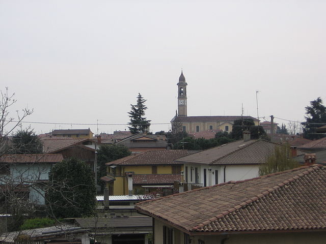
Pontoglio (Pontoglio)
.svg)
- Italian comune
 Hiking in Pontoglio
Pontoglio is a quaint town located in the Lombardy region of Italy, near the Oglio River, which offers a variety of hiking opportunities in and around the area. Here are some key points about hiking in and around Pontoglio:
-
Scenic Routes: The countryside surrounding Pontoglio offers picturesque landscapes, including fields, vineyards, and views of the nearby hills. Hiking trails often meander through these areas, providing great opportunities for nature photography and enjoying the local flora and fauna.
-
Oglio River: The Oglio River runs close to Pontoglio, and there are trails that follow its banks. These routes can be ideal for leisurely hikes or walks, providing a serene environment and the chance to observe wildlife, particularly birds.
-
Regional Parks: The nearby Parco dell'Oglio Nord is a protected area offering numerous trails for hiking, as well as opportunities for birdwatching and appreciating the local ecosystem. This park features a mix of forests, waterways, and agricultural lands.
-
Challenging Hikes: For those looking for a more challenging experience, the hills surrounding the area may provide steeper trails and more rugged terrain. You might consider planning a hike that combines a visit to nearby towns or historical sites.
-
Weather and Best Time to Hike: The best time to hike in Pontoglio is during the spring (April to June) and fall (September to October) when weather conditions are more temperate. Summers can get quite hot, while winters may bring snow, particularly at higher elevations.
-
Local Culture: Incorporating a hike with visits to local vineyards or agricultural sites can enhance your experience. Check if there are any local festivals or markets during your visit, as these can provide a taste of the region's culture and cuisine.
-
Preparation: Make sure to wear appropriate hiking footwear and pack essentials like water, snacks, and a first-aid kit. It's also a good idea to have a map or a GPS device, especially if you're exploring less-marked trails.
Always remember to respect nature by following Leave No Trace principles, ensuring you hike responsibly, and checking local regulations or trail conditions before heading out. Enjoy your hiking experience in Pontoglio!
- Country:

- Postal Code: 25037
- Local Dialing Code: 030
- Licence Plate Code: BS
- Coordinates: 45° 34' 0" N, 9° 51' 0" E


- GPS tracks (wikiloc): [Link]
- AboveSeaLevel: 155 м m
- Area: 11.09 sq km
- Population: 6887
- Web site: http://www.comune.pontoglio.bs.it/
- Wikipedia en: wiki(en)
- Wikipedia: wiki(it)
- Wikidata storage: Wikidata: Q111466
- Wikipedia Commons Category: [Link]
- Freebase ID: [/m/047d8x]
- GeoNames ID: Alt: [6543187]
- VIAF ID: Alt: [246950806]
- OSM relation ID: [45291]
- UN/LOCODE: [ITOTG]
- ISTAT ID: 017150
- Italian cadastre code: G869
Shares border with regions:


Cividate al Piano
- Italian comune
Hiking in Cividate al Piano
Cividate al Piano is a quaint town in the province of Bergamo, located in Lombardy, Italy. Nestled in the picturesque landscape at the foot of the Alps, it offers a variety of hiking opportunities for both novice and experienced hikers....
- Country:
- Postal Code: 24050
- Local Dialing Code: 0363
- Licence Plate Code: BG
- Coordinates: 45° 33' 0" N, 9° 49' 0" E
- GPS tracks (wikiloc): [Link]
- AboveSeaLevel: 147 м m
- Area: 9.73 sq km
- Population: 5185
- Web site: [Link]

Palosco
- Italian comune
Hiking in Palosco
Palosco is a small town in the Lombardy region of Italy, located near the foothills of the Alps and within striking distance of a variety of natural landscapes. While it may not be as famous as other hiking destinations in Italy, it offers some beautiful trails and opportunities for outdoor activities....
- Country:
- Postal Code: 24050
- Local Dialing Code: 035
- Licence Plate Code: BG
- Coordinates: 45° 35' 0" N, 9° 50' 0" E
- GPS tracks (wikiloc): [Link]
- AboveSeaLevel: 157 м m
- Area: 10.79 sq km
- Population: 5808
- Web site: [Link]

Chiari
- Italian comune
Hiking in Chiari
Chiari, located in the province of Brescia in Lombardy, Italy, is not only known for its charming historic center but also for its access to beautiful natural landscapes that are ideal for hiking enthusiasts. The surrounding area offers various trails and paths that cater to different skill levels, making it a great destination for both beginners and experienced hikers....
- Country:
- Postal Code: 25032
- Local Dialing Code: 030
- Licence Plate Code: BS
- Coordinates: 45° 31' 11" N, 9° 53' 0" E
- GPS tracks (wikiloc): [Link]
- AboveSeaLevel: 145 м m
- Area: 38.02 sq km
- Population: 18944
- Web site: [Link]

Palazzolo sull'Oglio
- Italian comune
Hiking in Palazzolo sull'Oglio
Palazzolo sull'Oglio is a charming town in the Lombardy region of Italy, located along the Oglio River. While it may not be as widely recognized as a hiking destination compared to the nearby mountains and lakes, it offers some pleasant walking and hiking opportunities in the surrounding areas. Here are some things to consider for hiking in and around Palazzolo sull'Oglio:...
- Country:
- Postal Code: 25036
- Local Dialing Code: 030
- Licence Plate Code: BS
- Coordinates: 45° 36' 0" N, 9° 53' 0" E
- GPS tracks (wikiloc): [Link]
- AboveSeaLevel: 170 м m
- Area: 23.04 sq km
- Population: 20026
- Web site: [Link]
Urago d'Oglio
- Italian comune
Hiking in Urago d'Oglio
Urago d'Oglio is a charming municipality in Italy, nestled in the Lombardy region, and offers a variety of scenic hiking opportunities for outdoor enthusiasts. Although it's a small area, there are several aspects to consider when hiking there:...
- Country:
- Postal Code: 25030
- Local Dialing Code: 030
- Licence Plate Code: BS
- Coordinates: 45° 31' 0" N, 9° 52' 0" E
- GPS tracks (wikiloc): [Link]
- AboveSeaLevel: 131 м m
- Area: 10 sq km
- Population: 3814
- Web site: [Link]