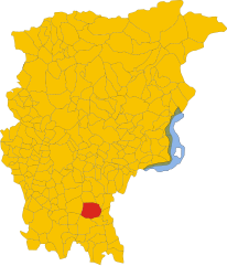
Palosco (Palosco)
.svg)
- Italian comune
 Hiking in Palosco
Palosco is a small town in the Lombardy region of Italy, located near the foothills of the Alps and within striking distance of a variety of natural landscapes. While it may not be as famous as other hiking destinations in Italy, it offers some beautiful trails and opportunities for outdoor activities.
Hiking Trails and Routes
-
Local Trails: The surrounding countryside offers a mix of easy to moderate trails. You can explore the hills, vineyards, and woodlands. Some trails lead you to charming rural areas with stunning views of the landscape.
-
Monte Misma: Just a short drive away, Monte Misma provides various hiking trails with varying difficulty levels. The routes offer panoramic views of the surrounding valleys and towns.
-
Parco Regionale dell'Adamello: A bit further out, this regional park is known for its exceptional beauty and biodiversity. It offers numerous trails ranging from easy walks to challenging hikes, catering to all skill levels.
Recommendations
-
Prepare: Make sure to have appropriate hiking gear, such as sturdy boots, weather-appropriate clothing, and plenty of water. Hiking maps or a GPS device can be very helpful.
-
Check the Weather: Conditions can change rapidly, especially in the foothills. Be sure to check the local weather forecast before heading out.
-
Local Guidance: If you're unfamiliar with the area, consider hiring a local guide or joining a hiking group to explore the trails safely and enhance your experience with local knowledge.
-
Respect Nature: Follow the Leave No Trace principles to help preserve the natural beauty of the area. Stay on marked trails, pack out what you pack in, and respect wildlife.
Conclusion
Hiking in and around Palosco can provide a serene and picturesque experience, perfect for those looking to explore the Italian countryside while enjoying some physical activity. Whether you're a seasoned hiker or a beginner, you'll find trails that suit your preference in this charming region.
- Country:

- Postal Code: 24050
- Local Dialing Code: 035
- Licence Plate Code: BG
- Coordinates: 45° 35' 0" N, 9° 50' 0" E


- GPS tracks (wikiloc): [Link]
- AboveSeaLevel: 157 м m
- Area: 10.79 sq km
- Population: 5808
- Web site: http://www.comune.palosco.bg.it/
- Wikipedia en: wiki(en)
- Wikipedia: wiki(it)
- Wikidata storage: Wikidata: Q101358
- Wikipedia Commons Gallery: [Link]
- Wikipedia Commons Category: [Link]
- Freebase ID: [/m/0gjckd]
- GeoNames ID: Alt: [6536146]
- VIAF ID: Alt: [244779905]
- OSM relation ID: [45352]
- UN/LOCODE: [ITPLC]
- ISTAT ID: 016157
- Italian cadastre code: G295
Shares border with regions:


Calcinate
- Italian comune
Hiking in Calcinate
Calcinate, located in the province of Bergamo in Italy, is not particularly known as a prime hiking destination, but it offers access to the scenic landscapes and trails in the surrounding regions of Lombardy. Here are some suggestions and information about hiking in and around Calcinate:...
- Country:
- Postal Code: 24050
- Local Dialing Code: 035
- Licence Plate Code: BG
- Coordinates: 45° 37' 16" N, 9° 48' 1" E
- GPS tracks (wikiloc): [Link]
- AboveSeaLevel: 186 м m
- Area: 15.08 sq km
- Population: 5985
- Web site: [Link]


Cividate al Piano
- Italian comune
Hiking in Cividate al Piano
Cividate al Piano is a quaint town in the province of Bergamo, located in Lombardy, Italy. Nestled in the picturesque landscape at the foot of the Alps, it offers a variety of hiking opportunities for both novice and experienced hikers....
- Country:
- Postal Code: 24050
- Local Dialing Code: 0363
- Licence Plate Code: BG
- Coordinates: 45° 33' 0" N, 9° 49' 0" E
- GPS tracks (wikiloc): [Link]
- AboveSeaLevel: 147 м m
- Area: 9.73 sq km
- Population: 5185
- Web site: [Link]
Martinengo
- Italian comune
Hiking in Martinengo
Martinengo is a charming town located in the Lombardy region of Italy, known for its picturesque landscapes and historical architecture. While it is not a well-known hiking destination, there are several opportunities to explore the natural beauty of the surrounding area....
- Country:
- Postal Code: 24057
- Local Dialing Code: 0363
- Licence Plate Code: BG
- Coordinates: 45° 34' 20" N, 9° 46' 3" E
- GPS tracks (wikiloc): [Link]
- AboveSeaLevel: 149 м m
- Area: 22.05 sq km
- Population: 10560
- Web site: [Link]


Mornico al Serio
- Italian comune
Hiking in Mornico al Serio
Mornico al Serio is a quaint village located in the province of Bergamo in Lombardy, Italy. While it may not be a well-known hiking destination, it is surrounded by beautiful landscapes that offer opportunities for outdoor activities, including hiking....
- Country:
- Postal Code: 24050
- Local Dialing Code: 035
- Licence Plate Code: BG
- Coordinates: 45° 35' 33" N, 9° 48' 32" E
- GPS tracks (wikiloc): [Link]
- AboveSeaLevel: 162 м m
- Area: 6.92 sq km
- Population: 2942
- Web site: [Link]


Telgate
- Italian comune
Hiking in Telgate
Telgate is a charming town located in the Lombardy region of Italy, nestled in the hills near Lake Iseo and the Orobian Alps. While it may not be as widely known as some larger hiking destinations, it offers a variety of outdoor activities, including hiking trails that cater to different skill levels....
- Country:
- Postal Code: 24060
- Local Dialing Code: 035
- Licence Plate Code: BG
- Coordinates: 45° 38' 0" N, 9° 51' 0" E
- GPS tracks (wikiloc): [Link]
- AboveSeaLevel: 191 м m
- Area: 8.3 sq km
- Population: 5040
- Web site: [Link]

Palazzolo sull'Oglio
- Italian comune
Hiking in Palazzolo sull'Oglio
Palazzolo sull'Oglio is a charming town in the Lombardy region of Italy, located along the Oglio River. While it may not be as widely recognized as a hiking destination compared to the nearby mountains and lakes, it offers some pleasant walking and hiking opportunities in the surrounding areas. Here are some things to consider for hiking in and around Palazzolo sull'Oglio:...
- Country:
- Postal Code: 25036
- Local Dialing Code: 030
- Licence Plate Code: BS
- Coordinates: 45° 36' 0" N, 9° 53' 0" E
- GPS tracks (wikiloc): [Link]
- AboveSeaLevel: 170 м m
- Area: 23.04 sq km
- Population: 20026
- Web site: [Link]
Pontoglio
- Italian comune
Hiking in Pontoglio
Pontoglio is a quaint town located in the Lombardy region of Italy, near the Oglio River, which offers a variety of hiking opportunities in and around the area. Here are some key points about hiking in and around Pontoglio:...
- Country:
- Postal Code: 25037
- Local Dialing Code: 030
- Licence Plate Code: BS
- Coordinates: 45° 34' 0" N, 9° 51' 0" E
- GPS tracks (wikiloc): [Link]
- AboveSeaLevel: 155 м m
- Area: 11.09 sq km
- Population: 6887
- Web site: [Link]


Bolgare
- Italian comune
Hiking in Bolgare
Bolgare is a small town in the province of Bergamo, Lombardy, Italy. Nestled in a beautiful region that offers access to the stunning landscapes of the Italian Alps, Bolgare is a great starting point for various hiking adventures....
- Country:
- Postal Code: 24060
- Local Dialing Code: 035
- Licence Plate Code: BG
- Coordinates: 45° 38' 3" N, 9° 49' 1" E
- GPS tracks (wikiloc): [Link]
- AboveSeaLevel: 199 м m
- Area: 8.59 sq km
- Population: 6183
- Web site: [Link]