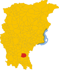
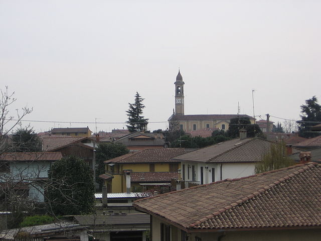
Cividate al Piano (Cividate al Piano)
.svg)
- Italian comune
 Hiking in Cividate al Piano
Cividate al Piano is a quaint town in the province of Bergamo, located in Lombardy, Italy. Nestled in the picturesque landscape at the foot of the Alps, it offers a variety of hiking opportunities for both novice and experienced hikers.
Hiking Trails
-
Sentiero dei Muri: This trail offers a beautiful walk through the local countryside and features characteristic rock walls. It is suitable for all skill levels and showcases stunning views of the surrounding hills and valleys.
-
Parco Regionale dei Colli di Bergamo: Just a short drive from Cividate al Piano, this regional park offers numerous hiking trails that range from easy walks to more challenging treks. The park is known for its diverse flora and fauna, and you can also find scenic viewpoints and picnic areas.
-
Sentiero del Gallo: This is a popular hiking route that leads you through the woodland areas surrounding Cividate al Piano. The trail is marked and offers a chance to encounter local wildlife and enjoy the serene natural surroundings.
Considerations
- Difficulty Levels: Make sure to choose trails that match your fitness level. Many trails are well-marked, but some may require a bit more navigational skill, so it's good to have a map or GPS app handy.
- Weather: The weather can change rapidly in this region, especially in the foothills of the Alps, so it's important to check the forecast before heading out and dress in layers.
- Safety: Always tell someone your hiking plans, carry enough water and snacks, and consider having a first-aid kit on hand.
Local Attractions
After your trek, consider exploring the local culture and cuisine. The town is known for its friendly atmosphere, local restaurants, and beautiful architecture, which provides a nice way to unwind and experience the charm of the region.
Best Time to Hike
The best months for hiking in the area are spring (April to June) and autumn (September to October), when temperatures are moderate, and the scenery is particularly beautiful with blooming flowers in spring and vibrant foliage in autumn.
Whether you’re looking for a leisurely stroll or a more challenging hike, Cividate al Piano and its surroundings offer a delightful hiking experience with plenty of natural beauty to enjoy.
- Country:

- Postal Code: 24050
- Local Dialing Code: 0363
- Licence Plate Code: BG
- Coordinates: 45° 33' 0" N, 9° 49' 0" E


- GPS tracks (wikiloc): [Link]
- AboveSeaLevel: 147 м m
- Area: 9.73 sq km
- Population: 5185
- Web site: http://www.comune.cividatealpiano.bg.it/
- Wikipedia en: wiki(en)
- Wikipedia: wiki(it)
- Wikidata storage: Wikidata: Q100373
- Wikipedia Commons Gallery: [Link]
- Wikipedia Commons Category: [Link]
- Freebase ID: [/m/041w84]
- GeoNames ID: Alt: [6536537]
- VIAF ID: Alt: [246992843]
- OSM relation ID: [45258]
- TGN ID: [1044279]
- UN/LOCODE: [ITCLY]
- ISTAT ID: 016076
- Italian cadastre code: C759
Shares border with regions:


Calcio, Lombardy
- Italian comune
Hiking in Calcio, Lombardy
Calcio, a small town in Lombardy near the Adda River, may not be as widely recognized as a hiking destination compared to other areas in Italy, but it offers charming landscapes and opportunities for outdoor activities. While the town itself is not a major hiking hub, it’s surrounded by beautiful natural areas that can be explored on foot....
- Country:
- Postal Code: 24054
- Local Dialing Code: 0363
- Licence Plate Code: BG
- Coordinates: 45° 30' 30" N, 9° 51' 3" E
- GPS tracks (wikiloc): [Link]
- AboveSeaLevel: 123 м m
- Area: 15.67 sq km
- Population: 5326
- Web site: [Link]


Cortenuova
- Italian comune
Hiking in Cortenuova
Cortenuova, located in the Lombardy region of Italy, is not primarily known for hiking as it is situated in a relatively flat area. However, the surrounding region of Lombardy offers a variety of outdoor activities, including hiking, especially if you venture a bit farther into the nearby foothills and mountains....
- Country:
- Postal Code: 24050
- Local Dialing Code: 0363
- Licence Plate Code: BG
- Coordinates: 45° 32' 20" N, 9° 47' 16" E
- GPS tracks (wikiloc): [Link]
- AboveSeaLevel: 133 м m
- Area: 7.35 sq km
- Population: 1986
- Web site: [Link]
Martinengo
- Italian comune
Hiking in Martinengo
Martinengo is a charming town located in the Lombardy region of Italy, known for its picturesque landscapes and historical architecture. While it is not a well-known hiking destination, there are several opportunities to explore the natural beauty of the surrounding area....
- Country:
- Postal Code: 24057
- Local Dialing Code: 0363
- Licence Plate Code: BG
- Coordinates: 45° 34' 20" N, 9° 46' 3" E
- GPS tracks (wikiloc): [Link]
- AboveSeaLevel: 149 м m
- Area: 22.05 sq km
- Population: 10560
- Web site: [Link]

Palosco
- Italian comune
Hiking in Palosco
Palosco is a small town in the Lombardy region of Italy, located near the foothills of the Alps and within striking distance of a variety of natural landscapes. While it may not be as famous as other hiking destinations in Italy, it offers some beautiful trails and opportunities for outdoor activities....
- Country:
- Postal Code: 24050
- Local Dialing Code: 035
- Licence Plate Code: BG
- Coordinates: 45° 35' 0" N, 9° 50' 0" E
- GPS tracks (wikiloc): [Link]
- AboveSeaLevel: 157 м m
- Area: 10.79 sq km
- Population: 5808
- Web site: [Link]
Pontoglio
- Italian comune
Hiking in Pontoglio
Pontoglio is a quaint town located in the Lombardy region of Italy, near the Oglio River, which offers a variety of hiking opportunities in and around the area. Here are some key points about hiking in and around Pontoglio:...
- Country:
- Postal Code: 25037
- Local Dialing Code: 030
- Licence Plate Code: BS
- Coordinates: 45° 34' 0" N, 9° 51' 0" E
- GPS tracks (wikiloc): [Link]
- AboveSeaLevel: 155 м m
- Area: 11.09 sq km
- Population: 6887
- Web site: [Link]
Urago d'Oglio
- Italian comune
Hiking in Urago d'Oglio
Urago d'Oglio is a charming municipality in Italy, nestled in the Lombardy region, and offers a variety of scenic hiking opportunities for outdoor enthusiasts. Although it's a small area, there are several aspects to consider when hiking there:...
- Country:
- Postal Code: 25030
- Local Dialing Code: 030
- Licence Plate Code: BS
- Coordinates: 45° 31' 0" N, 9° 52' 0" E
- GPS tracks (wikiloc): [Link]
- AboveSeaLevel: 131 м m
- Area: 10 sq km
- Population: 3814
- Web site: [Link]