Pralognan-la-Vanoise (Pralognan-la-Vanoise)

- commune in Savoie, France
 Hiking in Pralognan-la-Vanoise
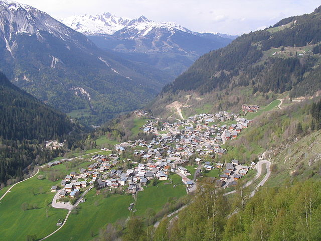
Pralognan-la-Vanoise is a charming village located in the heart of the Vanoise National Park in the French Alps. It is an excellent destination for hiking enthusiasts, offering a diverse range of trails suitable for varying skill levels, as well as breathtaking scenery.
Key Highlights for Hiking in Pralognan-la-Vanoise:
-
Stunning Landscapes: The area is renowned for its dramatic mountain landscapes, alpine meadows, and glacial views. The juxtaposition of green valleys and rugged peaks creates an unforgettable backdrop for hikers.
-
Varied Trails: Pralognan-la-Vanoise boasts numerous trails:
- Beginner Trails: Short and gentle hikes around the village or to nearby lakes, ideal for families or those new to hiking.
- Moderate Trails: More challenging hikes that take you deeper into the national park, such as the trail to the Lac des Vaches or the refuge at La Vallée de Chavière.
- Advanced Routes: For seasoned hikers, trails that lead to higher altitudes, such as the ascent of the Col de la Vanoise, provide exhilarating experiences with spectacular panoramas.
-
Accessibility: The starting points of many trails are easily accessible from the village, with well-marked paths and signage. The hiking season generally runs from late spring to early autumn, with the best conditions usually found from June to September.
-
Wildlife and Flora: The Vanoise National Park is home to diverse wildlife, including ibex, chamois, and a variety of bird species. Flowers such as edelweiss and alpine roses bloom in the warmer months, adding vibrant colors to the trails.
-
Refuges and Mountain Huts: Along many trails, you'll find refuges and mountain huts where you can rest and enjoy local cuisine. These stops are a great way to experience the culture of the region.
-
Guided Tours: For those seeking adventure or unfamiliar with the terrain, local guided tours are available. Experienced guides can enhance your hiking experience by providing insights into the area's natural history and helping navigate the trails.
-
Safety: As with any hiking adventure, it’s important to check weather conditions, equip yourself adequately, and be aware of your limits. Carry enough water, snacks, and appropriate gear.
-
Scenic Photography: The picturesque views throughout the region make it a perfect destination for photography enthusiasts. Sunrise and sunset hikes can provide particularly stunning photo opportunities.
Overall, hiking in Pralognan-la-Vanoise is a fantastic way to immerse yourself in the natural beauty of the Alps, whether you're looking for a leisurely walk or a challenging trek. Be sure to plan ahead and enjoy the breathtaking surroundings!
- Country:

- Postal Code: 73710
- Coordinates: 45° 22' 53" N, 6° 43' 17" E


- GPS tracks (wikiloc): [Link]
- Area: 88.57 sq km
- Population: 744
- Web site: https://mairiedepralognan.wordpress.com
- Wikipedia en: wiki(en)
- Wikipedia: wiki(fr)
- Wikidata storage: Wikidata: Q678166
- Wikipedia Commons Gallery: [Link]
- Wikipedia Commons Category: [Link]
- Freebase ID: [/m/03npg4b]
- GeoNames ID: Alt: [2985610]
- SIREN number: [217302066]
- BnF ID: [152741377]
- VIAF ID: Alt: [138435509]
- GND ID: Alt: [4291640-9]
- Library of Congress authority ID: Alt: [n85058173]
- INSEE municipality code: 73206
Shares border with regions:

Champagny-en-Vanoise
- commune in Savoie, France
Hiking in Champagny-en-Vanoise
Champagny-en-Vanoise is a picturesque village located in the Savoie region of the French Alps, and it serves as a fantastic base for hiking enthusiasts exploring the Vanoise National Park. The area is known for its stunning mountain scenery, diverse flora and fauna, and well-marked hiking trails suitable for all skill levels. Here are some key points about hiking in Champagny-en-Vanoise:...
- Country:
- Postal Code: 73350
- Coordinates: 45° 27' 16" N, 6° 41' 33" E
- GPS tracks (wikiloc): [Link]
- Area: 84.96 sq km
- Population: 605
- Web site: [Link]
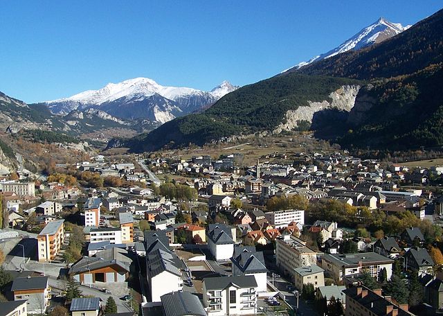

Modane
- commune in Savoie, France
Hiking in Modane
Modane is a picturesque town located in the Savoie region of the French Alps, known for its stunning landscapes and proximity to various outdoor activities, including hiking. Here are some key points to consider if you're planning to hike in and around Modane:...
- Country:
- Postal Code: 73500
- Coordinates: 45° 12' 5" N, 6° 40' 24" E
- GPS tracks (wikiloc): [Link]
- AboveSeaLevel: 1000 м m
- Area: 71.04 sq km
- Population: 3180
- Web site: [Link]


Les Allues
- commune in Savoie, France
Hiking in Les Allues
Les Allues is a charming village located in the French Alps, near the popular ski resort of Méribel in the Tarentaise Valley. While it is best known for its winter sports, Les Allues also offers beautiful hiking opportunities during the warmer months....
- Country:
- Postal Code: 73550
- Coordinates: 45° 25' 51" N, 6° 33' 23" E
- GPS tracks (wikiloc): [Link]
- Area: 85.99 sq km
- Population: 1848


Planay, Savoie
- commune in Savoie, France
Hiking in Planay, Savoie
Planay, located in the Savoie region of the French Alps, is a beautiful destination for hiking enthusiasts. The area is known for its stunning alpine landscapes, picturesque villages, and various hiking trails suitable for different experience levels. Here’s what you can expect when hiking in Planay:...
- Country:
- Postal Code: 73350
- Coordinates: 45° 25' 23" N, 6° 41' 55" E
- GPS tracks (wikiloc): [Link]
- Area: 22.41 sq km
- Population: 412


Aussois
- commune in Savoie, France
Hiking in Aussois
Aussois is a charming village located in the heart of the French Alps, specifically in the Savoie region. It's often considered a hidden gem for outdoor enthusiasts, especially hikers. The area is part of the Vanoise National Park and offers stunning views, diverse trails, and a rich natural environment....
- Country:
- Postal Code: 73500
- Coordinates: 45° 13' 39" N, 6° 44' 30" E
- GPS tracks (wikiloc): [Link]
- Area: 41.94 sq km
- Population: 659
- Web site: [Link]


Termignon
- former commune in Savoie, France
Hiking in Termignon
Termignon is a charming village located in the Maurienne Valley in the French Alps, part of the Savoie region. It offers a variety of hiking opportunities for outdoor enthusiasts, ranging from leisurely walks to challenging treks with stunning views of the surrounding mountains and valleys. Here are some highlights of hiking in and around Termignon:...
- Country:
- Postal Code: 73500
- Coordinates: 45° 16' 39" N, 6° 49' 1" E
- GPS tracks (wikiloc): [Link]
- Area: 149.03 sq km
- Population: 400
- Web site: [Link]


Saint-Bon-Tarentaise
- former commune in Savoie, France
Hiking in Saint-Bon-Tarentaise
Saint-Bon-Tarentaise is a stunning region located in the French Alps, known for its breathtaking mountain scenery and a variety of outdoor activities, especially hiking. Here are some key points about hiking in this beautiful area:...
- Country:
- Postal Code: 73120
- Coordinates: 45° 26' 2" N, 6° 38' 13" E
- GPS tracks (wikiloc): [Link]
- Area: 58.94 sq km
- Population: 1901
- Web site: [Link]

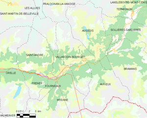
Villarodin-Bourget
- commune in Savoie, France
Hiking in Villarodin-Bourget
Villarodin-Bourget is a charming village located in the French Alps, near the Italian border, and forms part of the Maurienne valley. It offers a variety of hiking opportunities for both beginners and experienced hikers, with stunning landscapes and diverse trails....
- Country:
- Postal Code: 73500
- Coordinates: 45° 12' 50" N, 6° 41' 48" E
- GPS tracks (wikiloc): [Link]
- Area: 33.08 sq km
- Population: 521
- Web site: [Link]