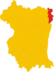
Preone (Preone)
.svg)
- Italian comune
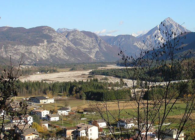
 Hiking in Preone
Preone is a picturesque village located in the Friuli Venezia Giulia region of Italy, nestled in the foothills of the Carnic Alps. This area offers a variety of hiking opportunities suitable for different skill levels, surrounded by breathtaking landscapes, rich flora and fauna, and stunning mountain views.
Hiking Opportunities in Preone:
-
Trail Variety:
- Easy Trails: There are gentle pathways perfect for beginners or families with children. These paths typically offer scenic views without challenging terrain.
- Moderate Trails: Ideal for hikers looking for a bit more challenge, these trails often include some elevation gain and could span more rugged landscapes.
- Challenging Routes: For experienced hikers, the area features more demanding hikes that go deeper into the mountains, requiring good physical condition and navigation skills.
-
Scenic Views:
- The trails often lead to panoramic viewpoints overlooking the valleys and peaks of the Carnic Alps. Bring your camera, as the photo opportunities are plentiful.
-
Nature and Wildlife:
- The region is rich in biodiversity, with several local species of plants and animals. Keep an eye out for various birds and possibly deer, especially in the early morning or late afternoon.
-
Local Attractions:
- Besides hiking, you can explore the local culture and cuisine. Preone has a rich heritage, and you may discover traditional farms or eateries serving local dishes.
- The nearby towns and villages also offer cultural landmarks and historical sites worth visiting during your hiking trip.
-
Seasons:
- Spring and early autumn are ideal times for hiking due to favorable weather and blooming nature. However, summer can also be pleasant, though it may be warmer.
-
Safety and Preparation:
- Always check the weather forecast before heading out, as conditions can change quickly in the mountains.
- Bring proper hiking gear, including sturdy footwear, adequate clothing layers, a map or GPS device, and sufficient water and snacks.
- It's wise to inform someone about your hiking plans and estimated return time.
Whether you're an experienced hiker or a beginner looking to enjoy some time in nature, Preone provides a lovely setting to engage with the great outdoors. Happy hiking!
- Country:

- Postal Code: 33020
- Local Dialing Code: 0433
- Licence Plate Code: UD
- Coordinates: 46° 24' 0" N, 12° 52' 0" E


- GPS tracks (wikiloc): [Link]
- AboveSeaLevel: 461 м m
- Area: 22.47 sq km
- Population: 234
- Web site: http://www.comune.preone.ud.gov.it/
- Wikipedia en: wiki(en)
- Wikipedia: wiki(it)
- Wikidata storage: Wikidata: Q53319
- Wikipedia Commons Category: [Link]
- Freebase ID: [/m/0gk9sm]
- GeoNames ID: Alt: [6536319]
- VIAF ID: Alt: [248753535]
- OSM relation ID: [79201]
- ISTAT ID: 030084
- Italian cadastre code: H038
Shares border with regions:


Tramonti di Sotto
- Italian comune
Hiking in Tramonti di Sotto
Tramonti di Sotto is a picturesque village located in the Friuli Venezia Giulia region of northeastern Italy, nestled within the Julian Alps. The area is known for its natural beauty, offering a range of hiking opportunities suitable for various skill levels. Here are some highlights of hiking in the region:...
- Country:
- Postal Code: 33090
- Local Dialing Code: 0427
- Licence Plate Code: PN
- Coordinates: 46° 17' 0" N, 12° 48' 0" E
- GPS tracks (wikiloc): [Link]
- AboveSeaLevel: 366 м m
- Area: 85.55 sq km
- Population: 367
- Web site: [Link]

Vito d'Asio
- Italian comune
Hiking in Vito d'Asio
Vito d'Asio is a picturesque village located in the Friuli Venezia Giulia region of northern Italy. Surrounded by the beautiful landscapes of the eastern Alps, this area offers various hiking opportunities for both beginners and experienced hikers. Here are some highlights and tips for hiking in Vito d'Asio:...
- Country:
- Postal Code: 33090
- Local Dialing Code: 0427
- Licence Plate Code: PN
- Coordinates: 46° 14' 0" N, 12° 56' 0" E
- GPS tracks (wikiloc): [Link]
- AboveSeaLevel: 381 м m
- Area: 53.72 sq km
- Population: 734
- Web site: [Link]
Enemonzo
- Italian comune
Hiking in Enemonzo
Enemonzo is a picturesque commune located in the Friuli Venezia Giulia region of northeastern Italy, known for its beautiful landscapes and outdoor activities, including hiking. Here are some highlights and tips for hiking in and around Enemonzo:...
- Country:
- Postal Code: 33020
- Local Dialing Code: 0433
- Licence Plate Code: UD
- Coordinates: 46° 24' 30" N, 12° 52' 46" E
- GPS tracks (wikiloc): [Link]
- AboveSeaLevel: 398 м m
- Area: 23.76 sq km
- Population: 1305
- Web site: [Link]

Socchieve
- Italian comune
Hiking in Socchieve
Socchieve, a picturesque area in the Julian Alps of Italy, is known for its stunning natural landscapes and diverse hiking trails suitable for a variety of skill levels. Here’s what you can expect when hiking in Socchieve:...
- Country:
- Postal Code: 33020
- Local Dialing Code: 0433
- Licence Plate Code: UD
- Coordinates: 46° 23' 48" N, 12° 50' 53" E
- GPS tracks (wikiloc): [Link]
- AboveSeaLevel: 480 м m
- Area: 66.12 sq km
- Population: 896
- Web site: [Link]


Verzegnis
- Italian comune
Hiking in Verzegnis
Verzegnis is a picturesque village located in the Friuli Venezia Giulia region of northeastern Italy. It's nestled in the Carnic Alps, which offer stunning landscapes, rich biodiversity, and a variety of hiking opportunities suitable for all levels of experience....
- Country:
- Postal Code: 33020
- Local Dialing Code: 0433
- Licence Plate Code: UD
- Coordinates: 46° 22' 59" N, 12° 58' 33" E
- GPS tracks (wikiloc): [Link]
- AboveSeaLevel: 407 м m
- Area: 39.33 sq km
- Population: 863
- Web site: [Link]