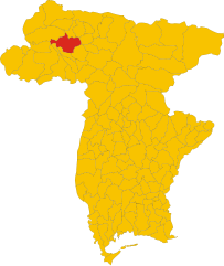
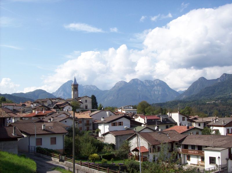
Socchieve (Socchieve)
.svg)
- Italian comune
 Hiking in Socchieve
Socchieve, a picturesque area in the Julian Alps of Italy, is known for its stunning natural landscapes and diverse hiking trails suitable for a variety of skill levels. Here’s what you can expect when hiking in Socchieve:
Trails and Scenery
-
Variety of Trails: There are numerous trails in and around Socchieve, ranging from easy walks suitable for families to more challenging hikes for experienced adventurers. The trails often wind through lush forests, meadows, and rocky terrain, providing scenic views of the surrounding mountains.
-
Panoramic Views: Many trails lead to viewpoints that offer breathtaking panoramas of the Julian Alps and the Friulian plain. The diverse topography presents plenty of opportunities for photography.
-
Wildlife: The area is home to various wildlife species, including deer, chamois, and a variety of bird species. Hikers may also encounter unique flora typical of alpine environments.
Popular Hiking Routes
-
Cima dei Preti: This is a popular hike that offers stunning views at the summit. It can be challenging, but the effort is rewarded with breathtaking scenery.
-
Sella Chianzutan: A moderate trail that is accessible and provides beautiful landscapes, making it a good choice for families or less experienced hikers.
-
Trekking through the Val d’Incarojo: This area provides more solitude and a chance to connect with nature, perfect for those looking to escape the more crowded paths.
Hiking Seasons
- Best Time to Hike: The ideal seasons for hiking in Socchieve are late spring through early autumn (May to October) when the weather is milder, and the trails are generally clear of snow.
- Winter Hiking: While many trails might be closed due to snow in winter, specific routes may be suitable for snowshoeing or winter hikes if conditions allow.
Preparation
- Gear: Ensure you have proper hiking boots, weather-appropriate clothing, and trekking poles if you prefer extra support.
- Maps and Guides: Having a map or a guide can enhance your experience, as you’ll have better awareness of the trails and points of interest.
- Safety: Always inform someone about your hiking plans, especially if you’re heading out on a less-trafficked trail, and consider carrying a first aid kit.
Local Culture
Don't miss the opportunity to explore local culture and cuisine in Socchieve after your hikes. There are charming mountain huts and restaurants where you can enjoy traditional Friulian dishes.
Conclusion
Hiking in Socchieve offers a delightful blend of natural beauty, adventure, and cultural experiences. Whether you’re seeking a casual stroll or a demanding trek, Socchieve has something to offer every outdoor enthusiast. Always remember to follow Leave No Trace principles to help preserve the natural beauty of this stunning region.
- Country:

- Postal Code: 33020
- Local Dialing Code: 0433
- Licence Plate Code: UD
- Coordinates: 46° 23' 48" N, 12° 50' 53" E


- GPS tracks (wikiloc): [Link]
- AboveSeaLevel: 480 м m
- Area: 66.12 sq km
- Population: 896
- Web site: http://www.comune.socchieve.ud.it/
- Wikipedia en: wiki(en)
- Wikipedia: wiki(it)
- Wikidata storage: Wikidata: Q53366
- Wikipedia Commons Category: [Link]
- Freebase ID: [/m/0gkbb2]
- GeoNames ID: Alt: [3166464]
- VIAF ID: Alt: [236144034]
- OSM relation ID: [79156]
- TGN ID: [1046928]
- ISTAT ID: 030110
- Italian cadastre code: I777
Shares border with regions:
Tramonti di Sopra
- Italian comune
Hiking in Tramonti di Sopra
Tramonti di Sopra is a beautiful area located in the Friuli Venezia Giulia region of Italy. It's known for its stunning landscapes, lush green valleys, and majestic mountains, making it a great destination for hiking enthusiasts....
- Country:
- Postal Code: 33090
- Local Dialing Code: 0427
- Licence Plate Code: PN
- Coordinates: 46° 19' 0" N, 12° 48' 0" E
- GPS tracks (wikiloc): [Link]
- AboveSeaLevel: 420 м m
- Area: 125.15 sq km
- Population: 301
- Web site: [Link]


Tramonti di Sotto
- Italian comune
Hiking in Tramonti di Sotto
Tramonti di Sotto is a picturesque village located in the Friuli Venezia Giulia region of northeastern Italy, nestled within the Julian Alps. The area is known for its natural beauty, offering a range of hiking opportunities suitable for various skill levels. Here are some highlights of hiking in the region:...
- Country:
- Postal Code: 33090
- Local Dialing Code: 0427
- Licence Plate Code: PN
- Coordinates: 46° 17' 0" N, 12° 48' 0" E
- GPS tracks (wikiloc): [Link]
- AboveSeaLevel: 366 м m
- Area: 85.55 sq km
- Population: 367
- Web site: [Link]


Ampezzo
- Italian comune
Hiking in Ampezzo
Ampezzo, located in the Friuli Venezia Giulia region of Italy, is a beautiful destination for hiking enthusiasts. Nestled in the Carnic Alps, it offers stunning landscapes, diverse trails, and ample opportunities to connect with nature....
- Country:
- Postal Code: 33021
- Local Dialing Code: 0433
- Licence Plate Code: UD
- Coordinates: 46° 25' 0" N, 12° 47' 0" E
- GPS tracks (wikiloc): [Link]
- AboveSeaLevel: 560 м m
- Area: 73 sq km
- Population: 983
- Web site: [Link]
Enemonzo
- Italian comune
Hiking in Enemonzo
Enemonzo is a picturesque commune located in the Friuli Venezia Giulia region of northeastern Italy, known for its beautiful landscapes and outdoor activities, including hiking. Here are some highlights and tips for hiking in and around Enemonzo:...
- Country:
- Postal Code: 33020
- Local Dialing Code: 0433
- Licence Plate Code: UD
- Coordinates: 46° 24' 30" N, 12° 52' 46" E
- GPS tracks (wikiloc): [Link]
- AboveSeaLevel: 398 м m
- Area: 23.76 sq km
- Population: 1305
- Web site: [Link]


Forni di Sotto
- Italian comune
Hiking in Forni di Sotto
Forni di Sotto is a beautiful gem in the Friuli Venezia Giulia region of northern Italy, nestled in the Carnic Alps. This area is known for its stunning natural landscapes, rich biodiversity, and a variety of hiking trails suitable for all levels of experience. Here are some highlights about hiking in Forni di Sotto:...
- Country:
- Postal Code: 33020
- Local Dialing Code: 0433
- Licence Plate Code: UD
- Coordinates: 46° 24' 0" N, 12° 40' 0" E
- GPS tracks (wikiloc): [Link]
- AboveSeaLevel: 777 м m
- Area: 93.6 sq km
- Population: 583
- Web site: [Link]

Ovaro
- Italian comune
Hiking in Ovaro
Ovaro is a beautiful town located in the Friuli Venezia Giulia region of northeastern Italy. It's situated in the Carnic Alps and is surrounded by stunning natural landscapes, making it a great destination for hiking enthusiasts. Here are some key points to consider when hiking in and around Ovaro:...
- Country:
- Postal Code: 33025
- Local Dialing Code: 0433
- Licence Plate Code: UD
- Coordinates: 46° 29' 0" N, 12° 52' 0" E
- GPS tracks (wikiloc): [Link]
- AboveSeaLevel: 525 м m
- Area: 57.9 sq km
- Population: 1875
- Web site: [Link]

Preone
- Italian comune
Hiking in Preone
Preone is a picturesque village located in the Friuli Venezia Giulia region of Italy, nestled in the foothills of the Carnic Alps. This area offers a variety of hiking opportunities suitable for different skill levels, surrounded by breathtaking landscapes, rich flora and fauna, and stunning mountain views....
- Country:
- Postal Code: 33020
- Local Dialing Code: 0433
- Licence Plate Code: UD
- Coordinates: 46° 24' 0" N, 12° 52' 0" E
- GPS tracks (wikiloc): [Link]
- AboveSeaLevel: 461 м m
- Area: 22.47 sq km
- Population: 234
- Web site: [Link]


Raveo
- Italian comune
Hiking in Raveo
Raveo, located in the Friuli Venezia Giulia region of northern Italy, offers a variety of beautiful hiking opportunities set against the backdrop of the stunning Friulian Alps. The area is known for its rich natural beauty, featuring lush forests, alpine meadows, and diverse wildlife, making it perfect for both casual walkers and experienced hikers....
- Country:
- Postal Code: 33029
- Local Dialing Code: 0433
- Licence Plate Code: UD
- Coordinates: 46° 26' 0" N, 12° 52' 0" E
- GPS tracks (wikiloc): [Link]
- AboveSeaLevel: 518 м m
- Area: 12.6 sq km
- Population: 446
- Web site: [Link]