Pulligny (Pulligny)

- commune in Meurthe-et-Moselle, France
- Country:

- Postal Code: 54160
- Coordinates: 48° 32' 31" N, 6° 8' 29" E


- GPS tracks (wikiloc): [Link]
- AboveSeaLevel: 234 м m
- Area: 9.3 sq km
- Population: 1184
- Web site: http://www.pulligny.fr
- Wikipedia en: wiki(en)
- Wikipedia: wiki(fr)
- Wikidata storage: Wikidata: Q1099419
- Wikipedia Commons Category: [Link]
- Freebase ID: [/m/03qdmf5]
- Freebase ID: [/m/03qdmf5]
- GeoNames ID: Alt: [6436808]
- GeoNames ID: Alt: [6436808]
- SIREN number: [215404377]
- SIREN number: [215404377]
- BnF ID: [15264506v]
- BnF ID: [15264506v]
- INSEE municipality code: 54437
- INSEE municipality code: 54437
Shares border with regions:
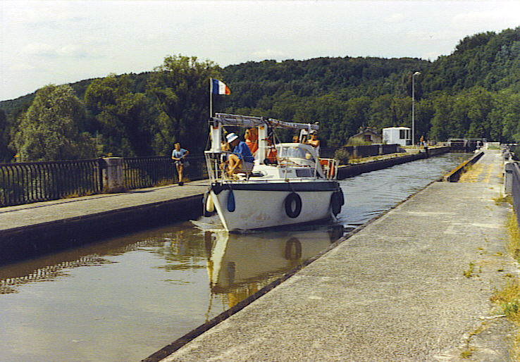
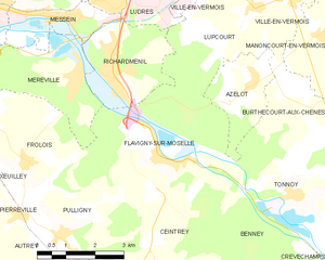
Flavigny-sur-Moselle
- commune in Meurthe-et-Moselle, France
- Country:
- Postal Code: 54630
- Coordinates: 48° 34' 9" N, 6° 11' 16" E
- GPS tracks (wikiloc): [Link]
- Area: 17.3 sq km
- Population: 1725
- Web site: [Link]


Autrey
- commune in Meurthe-et-Moselle, France
- Country:
- Postal Code: 54160
- Coordinates: 48° 31' 55" N, 6° 7' 49" E
- GPS tracks (wikiloc): [Link]
- AboveSeaLevel: 290 м m
- Area: 6.16 sq km
- Population: 178
Frolois
- commune in Meurthe-et-Moselle, France
- Country:
- Postal Code: 54160
- Coordinates: 48° 33' 54" N, 6° 7' 35" E
- GPS tracks (wikiloc): [Link]
- Area: 9.4 sq km
- Population: 706
Méréville
- commune in Meurthe-et-Moselle, France
- Country:
- Postal Code: 54850
- Coordinates: 48° 35' 32" N, 6° 9' 9" E
- GPS tracks (wikiloc): [Link]
- Area: 8.43 sq km
- Population: 1372


Ceintrey
- commune in Meurthe-et-Moselle, France
- Country:
- Postal Code: 54134
- Coordinates: 48° 31' 30" N, 6° 9' 54" E
- GPS tracks (wikiloc): [Link]
- Area: 11 sq km
- Population: 915


Pierreville
- commune in Meurthe-et-Moselle, France
- Country:
- Postal Code: 54160
- Coordinates: 48° 32' 56" N, 6° 7' 19" E
- GPS tracks (wikiloc): [Link]
- Area: 2.87 sq km
- Population: 315