canton of Vézelise (canton de Vézelise)
- canton of France (until March 2015)
- Country:

- Capital: Vézelise
- Coordinates: 48° 29' 12" N, 6° 5' 15" E


- GPS tracks (wikiloc): [Link]
- Wikidata storage: Wikidata: Q1550441
- INSEE canton code: [5429]
Includes regions:

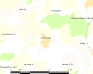
Chaouilley
- commune in Meurthe-et-Moselle, France
- Country:
- Postal Code: 54330
- Coordinates: 48° 26' 21" N, 6° 4' 5" E
- GPS tracks (wikiloc): [Link]
- Area: 5.12 sq km
- Population: 115

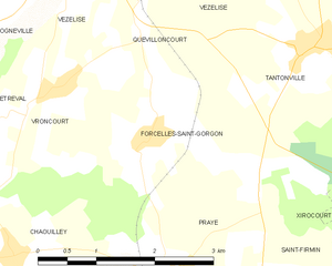
Forcelles-Saint-Gorgon
- commune in Meurthe-et-Moselle, France
- Country:
- Postal Code: 54330
- Coordinates: 48° 27' 23" N, 6° 6' 5" E
- GPS tracks (wikiloc): [Link]
- Area: 5.36 sq km
- Population: 159


Autrey
- commune in Meurthe-et-Moselle, France
- Country:
- Postal Code: 54160
- Coordinates: 48° 31' 55" N, 6° 7' 49" E
- GPS tracks (wikiloc): [Link]
- AboveSeaLevel: 290 м m
- Area: 6.16 sq km
- Population: 178


Pulligny
- commune in Meurthe-et-Moselle, France
- Country:
- Postal Code: 54160
- Coordinates: 48° 32' 31" N, 6° 8' 29" E
- GPS tracks (wikiloc): [Link]
- AboveSeaLevel: 234 м m
- Area: 9.3 sq km
- Population: 1184
- Web site: [Link]


Lalœuf
- commune in Meurthe-et-Moselle, France
- Country:
- Postal Code: 54115
- Coordinates: 48° 27' 54" N, 6° 0' 43" E
- GPS tracks (wikiloc): [Link]
- Area: 10.88 sq km
- Population: 293
Frolois
- commune in Meurthe-et-Moselle, France
- Country:
- Postal Code: 54160
- Coordinates: 48° 33' 54" N, 6° 7' 35" E
- GPS tracks (wikiloc): [Link]
- Area: 9.4 sq km
- Population: 706


Viterne
- commune in Meurthe-et-Moselle, France
- Country:
- Postal Code: 54123
- Coordinates: 48° 35' 16" N, 6° 1' 58" E
- GPS tracks (wikiloc): [Link]
- Area: 23.17 sq km
- Population: 729
- Web site: [Link]
They-sous-Vaudemont
- commune in Meurthe-et-Moselle, France
- Country:
- Postal Code: 54930
- Coordinates: 48° 24' 16" N, 6° 3' 34" E
- GPS tracks (wikiloc): [Link]
- Area: 1.7 sq km
- Population: 10


Thélod
- commune in Meurthe-et-Moselle, France
- Country:
- Postal Code: 54330
- Coordinates: 48° 32' 45" N, 6° 2' 43" E
- GPS tracks (wikiloc): [Link]
- Area: 10.76 sq km
- Population: 248


Vroncourt
- commune in Meurthe-et-Moselle, France
- Country:
- Postal Code: 54330
- Coordinates: 48° 27' 54" N, 6° 4' 49" E
- GPS tracks (wikiloc): [Link]
- Area: 4.16 sq km
- Population: 277
Vitrey
- commune in Meurthe-et-Moselle, France
- Country:
- Postal Code: 54330
- Coordinates: 48° 29' 12" N, 6° 2' 47" E
- GPS tracks (wikiloc): [Link]
- Area: 11.54 sq km
- Population: 214


Omelmont
- commune in Meurthe-et-Moselle, France
- Country:
- Postal Code: 54330
- Coordinates: 48° 30' 2" N, 6° 6' 42" E
- GPS tracks (wikiloc): [Link]
- Area: 4.69 sq km
- Population: 185


Houdreville
- commune in Meurthe-et-Moselle, France
- Country:
- Postal Code: 54330
- Coordinates: 48° 30' 24" N, 6° 6' 14" E
- GPS tracks (wikiloc): [Link]
- Area: 10.37 sq km
- Population: 454
- Web site: [Link]


Gugney
- commune in Meurthe-et-Moselle, France
- Country:
- Postal Code: 54930
- Coordinates: 48° 23' 54" N, 6° 3' 44" E
- GPS tracks (wikiloc): [Link]
- Area: 2.93 sq km
- Population: 73


Parey-Saint-Césaire
- commune in Meurthe-et-Moselle, France
- Country:
- Postal Code: 54330
- Coordinates: 48° 31' 52" N, 6° 4' 2" E
- GPS tracks (wikiloc): [Link]
- Area: 5.67 sq km
- Population: 240

Forcelles-sous-Gugney
- commune in Meurthe-et-Moselle, France
- Country:
- Postal Code: 54930
- Coordinates: 48° 23' 51" N, 6° 4' 41" E
- GPS tracks (wikiloc): [Link]
- AboveSeaLevel: 307 м m
- Area: 5.37 sq km
- Population: 94

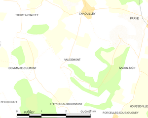
Vaudémont
- commune in Meurthe-et-Moselle, France
- Country:
- Postal Code: 54330
- Coordinates: 48° 25' 1" N, 6° 3' 22" E
- GPS tracks (wikiloc): [Link]
- Area: 5.76 sq km
- Population: 67

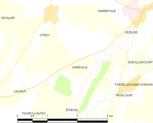
Ognéville
- commune in Meurthe-et-Moselle, France
- Country:
- Postal Code: 54330
- Coordinates: 48° 28' 30" N, 6° 3' 58" E
- GPS tracks (wikiloc): [Link]
- Area: 4.12 sq km
- Population: 105
- Web site: [Link]
Houdelmont
- commune in Meurthe-et-Moselle, France
- Country:
- Postal Code: 54330
- Coordinates: 48° 32' 4" N, 6° 5' 22" E
- GPS tracks (wikiloc): [Link]
- Area: 3.85 sq km
- Population: 224

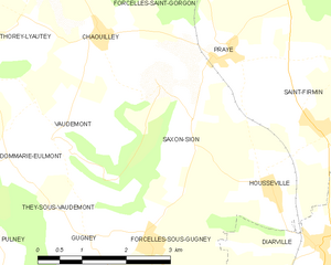
Saxon-Sion
- commune in Meurthe-et-Moselle, France
- Country:
- Postal Code: 54330
- Coordinates: 48° 25' 33" N, 6° 4' 44" E
- GPS tracks (wikiloc): [Link]
- Area: 6.25 sq km
- Population: 85


Clérey-sur-Brenon
- commune in Meurthe-et-Moselle, France
- Country:
- Postal Code: 54330
- Coordinates: 48° 30' 28" N, 6° 8' 15" E
- GPS tracks (wikiloc): [Link]
- Area: 4.42 sq km
- Population: 74


Étreval
- commune in Meurthe-et-Moselle, France
- Country:
- Postal Code: 54330
- Coordinates: 48° 27' 19" N, 6° 3' 5" E
- GPS tracks (wikiloc): [Link]
- Area: 2.37 sq km
- Population: 65

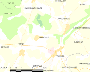
Hammeville
- commune in Meurthe-et-Moselle, France
- Country:
- Postal Code: 54330
- Coordinates: 48° 29' 58" N, 6° 3' 59" E
- GPS tracks (wikiloc): [Link]
- Area: 5.45 sq km
- Population: 174


Xeuilley
- commune in Meurthe-et-Moselle, France
- Country:
- Postal Code: 54990
- Coordinates: 48° 33' 59" N, 6° 5' 55" E
- GPS tracks (wikiloc): [Link]
- Area: 7.37 sq km
- Population: 843


Pierreville
- commune in Meurthe-et-Moselle, France
- Country:
- Postal Code: 54160
- Coordinates: 48° 32' 56" N, 6° 7' 19" E
- GPS tracks (wikiloc): [Link]
- Area: 2.87 sq km
- Population: 315


Marthemont
- commune in Meurthe-et-Moselle, France
- Country:
- Postal Code: 54330
- Coordinates: 48° 33' 35" N, 6° 2' 27" E
- GPS tracks (wikiloc): [Link]
- Area: 2.17 sq km
- Population: 43
Dommarie-Eulmont
- commune in Meurthe-et-Moselle, France
- Country:
- Postal Code: 54115
- Coordinates: 48° 24' 52" N, 6° 2' 0" E
- GPS tracks (wikiloc): [Link]
- Area: 5.52 sq km
- Population: 84


Thorey-Lyautey
- commune in Meurthe-et-Moselle, France
- Country:
- Postal Code: 54115
- Coordinates: 48° 26' 35" N, 6° 1' 43" E
- GPS tracks (wikiloc): [Link]
- Area: 6.19 sq km
- Population: 140


Praye
- commune in Meurthe-et-Moselle, France
- Country:
- Postal Code: 54116
- Coordinates: 48° 26' 4" N, 6° 6' 23" E
- GPS tracks (wikiloc): [Link]
- Area: 8.72 sq km
- Population: 274


Goviller
- commune in Meurthe-et-Moselle, France
- Country:
- Postal Code: 54330
- Coordinates: 48° 29' 50" N, 6° 0' 39" E
- GPS tracks (wikiloc): [Link]
- Area: 12.12 sq km
- Population: 425


Vézelise
- commune in Meurthe-et-Moselle, France
- Country:
- Postal Code: 54330
- Coordinates: 48° 29' 13" N, 6° 5' 16" E
- GPS tracks (wikiloc): [Link]
- Area: 5.35 sq km
- Population: 1433
- Web site: [Link]
Fraisnes-en-Saintois
- commune in Meurthe-et-Moselle, France
- Country:
- Postal Code: 54930
- Coordinates: 48° 22' 32" N, 6° 3' 25" E
- GPS tracks (wikiloc): [Link]
- Area: 6.39 sq km
- Population: 111


Quevilloncourt
- commune in Meurthe-et-Moselle, France
- Country:
- Postal Code: 54330
- Coordinates: 48° 28' 21" N, 6° 5' 58" E
- GPS tracks (wikiloc): [Link]
- Area: 2.92 sq km
- Population: 92