Trets (Trets)
- commune in Bouches-du-Rhône, France
Trets is a charming town located in the Provence-Alpes-Côte d'Azur region of France, and it offers access to some beautiful hiking opportunities. The surrounding landscape features rolling hills, vineyards, and stunning views of the Sainte-Victoire Mountain, making it an appealing destination for outdoor enthusiasts.
Here are some highlights for hiking in Trets:
Trails and Routes:
-
Sainte-Victoire Mountain: The iconic peak is nearby and offers various trails ranging from moderate to challenging. The views from the summit are breathtaking, providing a panoramic view of the Provence countryside.
-
Local Nature Reserves: There are several trails in the nearby nature reserves, like the Parc Naturel Régional Sainte-Baume, which is home to diverse flora and fauna. Hiking here gives you the chance to explore beautiful forests and rocky terrains.
-
Vignobles et Paysages: Many walking routes take you through vineyards and charming Provençal countryside, allowing hikers to enjoy not just the scenery but also local wine-tasting opportunities.
Tips for Hiking in Trets:
-
Season: Spring and fall are ideal for hiking, as temperatures are mild. Summers can be quite hot, so plan early morning or late afternoon hikes.
-
Equipment: Good hiking shoes are a must due to varied terrain. Bring plenty of water, a map or GPS, and sun protection (hat, sunscreen).
-
Local Guidance: Consider checking in with local tourist information centers for maps or guided tours, which can provide insights into the trails’ history and geology.
-
Respect Nature: As always, be mindful of the natural environment. Stay on marked trails, take your litter with you, and leave wildlife undisturbed.
By exploring the trails around Trets, you’ll not only get to enjoy nature but also immerse yourself in the scenic beauty and cultural heritage of the Provence region. Happy hiking!
- Country:

- Postal Code: 13530
- Coordinates: 43° 26' 49" N, 5° 41' 9" E


- GPS tracks (wikiloc): [Link]
- Area: 70.31 sq km
- Population: 10963
- Web site: http://www.ville-de-trets.fr
- Wikipedia en: wiki(en)
- Wikipedia: wiki(fr)
- Wikidata storage: Wikidata: Q640716
- Wikipedia Commons Category: [Link]
- Freebase ID: [/m/02rpc5g]
- GeoNames ID: Alt: [2971765]
- SIREN number: [211301106]
- BnF ID: [152473921]
- VIAF ID: Alt: [129124613]
- Library of Congress authority ID: Alt: [n88680354]
- PACTOLS thesaurus ID: [pcrthnk4GsyKUx]
- Quora topic ID: [Trets]
- TGN ID: [1035918]
- Trismegistos Geo ID: [20793]
- INSEE municipality code: 13110
Shares border with regions:

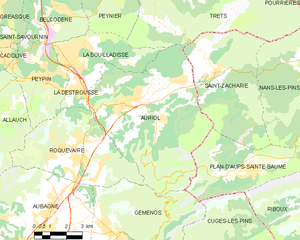
Auriol
- commune in Bouches-du-Rhône, France
Auriol, located in the Bouches-du-Rhône department in the Provence-Alpes-Côte d'Azur region of southern France, offers a variety of scenic hiking opportunities. Nestled between the Sainte-Baume mountains and the Calanques National Park, Auriol provides a beautiful backdrop with diverse landscapes, from hills and forests to rugged cliffs and Mediterranean flora....
- Country:

- Postal Code: 13390
- Coordinates: 43° 22' 10" N, 5° 37' 53" E


- GPS tracks (wikiloc): [Link]
- Area: 44.64 sq km
- Population: 11538
- Web site: [Link]

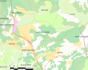
La Bouilladisse
- commune in Bouches-du-Rhône, France
La Bouilladisse is a charming commune located in the Bouches-du-Rhône department in southeastern France, nestled in the picturesque region of Provence. It offers a variety of hiking opportunities, characterized by beautiful landscapes, scenic views, and a mild Mediterranean climate....
- Country:

- Postal Code: 13720
- Coordinates: 43° 23' 43" N, 5° 35' 43" E


- GPS tracks (wikiloc): [Link]
- Area: 12.61 sq km
- Population: 6079
- Web site: [Link]


Nans-les-Pins
- commune in Var, France
Nans-les-Pins is a charming village located in the Var department in the Provence-Alpes-Côte d'Azur region of France. It's surrounded by beautiful landscapes, making it a great destination for hiking enthusiasts. Here are some highlights of hiking in and around Nans-les-Pins:...
- Country:

- Postal Code: 83860
- Coordinates: 43° 22' 14" N, 5° 46' 56" E


- GPS tracks (wikiloc): [Link]
- Area: 47.99 sq km
- Population: 4276
- Web site: [Link]

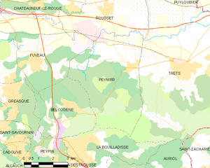
Peynier
- commune in Bouches-du-Rhône, France
Peynier is a charming village located in the Provence-Alpes-Côte d'Azur region of France. It's surrounded by beautiful landscapes, making it an excellent spot for hiking enthusiasts. Here are some highlights and tips for hiking in and around Peynier:...
- Country:

- Postal Code: 13790
- Coordinates: 43° 26' 49" N, 5° 38' 29" E


- GPS tracks (wikiloc): [Link]
- Area: 24.76 sq km
- Population: 3368
- Web site: [Link]

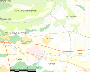
Rousset
- commune in Bouches-du-Rhône, France
Rousset, located in the Bouches-du-Rhône department of southern France, is a beautiful area that offers a variety of hiking opportunities, thanks to its stunning landscapes and proximity to the Sainte-Victoire Mountain. Here are some highlights for hiking in Rousset:...
- Country:

- Postal Code: 13790
- Coordinates: 43° 28' 56" N, 5° 37' 20" E


- GPS tracks (wikiloc): [Link]
- AboveSeaLevel: 224 м m
- Area: 19.5 sq km
- Population: 4768
- Web site: [Link]

Puyloubier
- commune in Bouches-du-Rhône, France
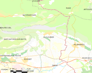
Puyloubier is a charming commune located in the Provence-Alpes-Côte d'Azur region of southern France, nestled at the foot of the Sainte-Victoire Mountain. Known for its beautiful landscapes and diverse ecosystems, it offers a variety of hiking opportunities for both novice and experienced hikers....
- Country:

- Postal Code: 13114
- Coordinates: 43° 31' 30" N, 5° 40' 37" E


- GPS tracks (wikiloc): [Link]
- Area: 40.85 sq km
- Population: 1799
- Web site: [Link]


Pourcieux
- commune in Var, France
Pourcieux is a charming village located in the Provence-Alpes-Côte d'Azur region of France. It offers a variety of hiking opportunities that allow you to explore the stunning natural landscapes of the surrounding areas. Here are some highlights and tips for hiking in Pourcieux:...
- Country:

- Postal Code: 83470
- Coordinates: 43° 28' 13" N, 5° 47' 11" E


- GPS tracks (wikiloc): [Link]
- Area: 21.23 sq km
- Population: 1503


Saint-Zacharie
- commune in Var, France
Saint-Zacharie is a charming commune located in the Provence-Alpes-Côte d'Azur region of France, nestled in the foothills of the Sainte-Baume mountain range. The area offers a range of hiking opportunities that cater to various skill levels and preferences, making it an excellent destination for outdoor enthusiasts....
- Country:

- Postal Code: 83640
- Coordinates: 43° 23' 3" N, 5° 42' 24" E


- GPS tracks (wikiloc): [Link]
- Area: 27.02 sq km
- Population: 5392

Pourrières
- commune in Var, France
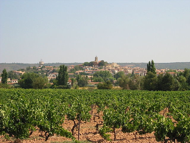
Pourrières is a charming village located in the Var department of the Provence-Alpes-Côte d'Azur region in southeastern France. It is surrounded by beautiful natural landscapes, making it an excellent destination for hiking enthusiasts....
- Country:

- Postal Code: 83910
- Coordinates: 43° 30' 14" N, 5° 44' 2" E


- GPS tracks (wikiloc): [Link]
- Area: 56.32 sq km
- Population: 5000

