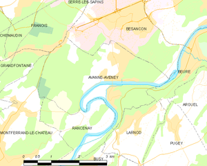
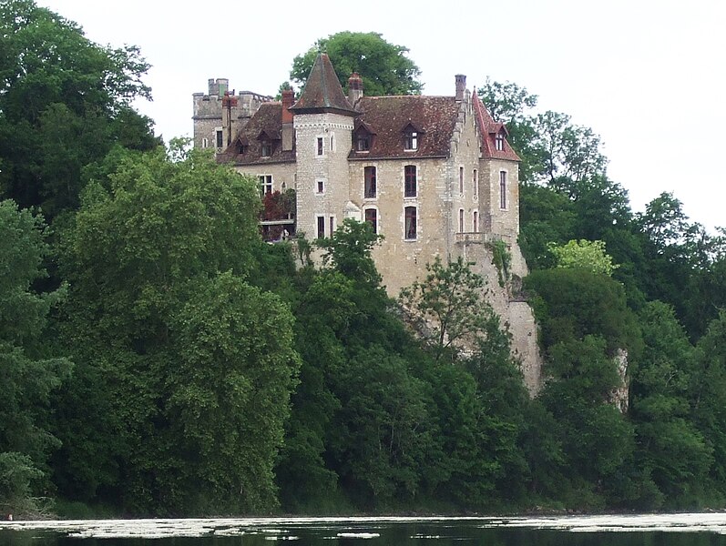
Rancenay (Rancenay)
- commune in Doubs, France
Rancenay is a small commune located in the Doubs department in the Bourgogne-Franche-Comté region of eastern France. The area is known for its beautiful natural landscapes, making it a great destination for hiking and outdoor activities. Here are some highlights about hiking in Rancenay:
Scenic Trails
-
Nature Paths: Rancenay and its surrounding regions boast various well-marked trails that wind through forests, meadows, and alongside streams, offering hikers diverse landscapes to explore.
-
Panoramic Views: Some hiking trails lead to elevated points where you can enjoy panoramic views of the Doubs countryside and the Jura Mountains. These viewpoints are perfect for taking breaks and enjoying the scenery.
Local Flora and Fauna
- The area is home to rich biodiversity. As you hike, you may encounter various wildlife species, including deer, foxes, and numerous bird species. The local flora includes a mix of deciduous and coniferous trees, wildflowers, and shrubs.
Cultural Heritage
- While hiking, keep an eye out for historical landmarks and local architecture that reflect the region's culture and history. You might find old farms, chapels, and other structures that tell the story of the area.
Hiking Tips
- Trail Maps: It's advisable to carry a detailed map of the hiking trails or use a GPS device, as some paths may not be well signposted.
- Weather Preparedness: Check the weather forecast before your hike and dress in layers. The weather can change quickly in mountainous regions.
- Safety: Ensure you have enough water and snacks, and inform someone about your hiking plans if you are going on a longer trek.
Best Time to Hike
- The ideal time for hiking in Rancenay is during the spring and fall when the weather is mild and the landscapes are particularly beautiful. Summer can be warm, while winter may bring snow, making some trails more challenging.
Local Amenities
- Rancenay may have limited amenities, so it's a good idea to pack everything you need, including food, water, and first aid supplies. If you need more extensive services, nearby towns may offer more options.
In summary, hiking in Rancenay can provide a peaceful escape into nature, with beautiful trails suitable for various skill levels. Whether you're an experienced hiker or a beginner, you're likely to enjoy the natural beauty and tranquility of this charming region.
- Country:

- Postal Code: 25320
- Coordinates: 47° 11' 13" N, 5° 57' 1" E


- GPS tracks (wikiloc): [Link]
- Area: 3.66 sq km
- Population: 293
- Wikipedia en: wiki(en)
- Wikipedia: wiki(fr)
- Wikidata storage: Wikidata: Q923274
- Wikipedia Commons Category: [Link]
- Freebase ID: [/m/03mhc7c]
- Freebase ID: [/m/03mhc7c]
- GeoNames ID: Alt: [6429951]
- GeoNames ID: Alt: [6429951]
- SIREN number: [212504773]
- SIREN number: [212504773]
- BnF ID: [15252703p]
- BnF ID: [15252703p]
- INSEE municipality code: 25477
- INSEE municipality code: 25477
Shares border with regions:


Avanne-Aveney
- commune in Doubs, France
Avanne-Aveney is a picturesque area in the Jura region of France, known for its beautiful landscapes and outdoor activities, including hiking. Here are some highlights and tips for hiking in this area:...
- Country:

- Postal Code: 25720
- Coordinates: 47° 12' 8" N, 5° 57' 51" E


- GPS tracks (wikiloc): [Link]
- AboveSeaLevel: 232 м m
- Area: 8.62 sq km
- Population: 2277
- Web site: [Link]


Larnod
- commune in Doubs, France
Larnod, located in the Rhône-Alpes region of France, offers picturesque hiking opportunities amid stunning natural landscapes. Here are some key aspects of hiking in the area:...
- Country:

- Postal Code: 25720
- Coordinates: 47° 11' 9" N, 5° 58' 19" E


- GPS tracks (wikiloc): [Link]
- Area: 4.05 sq km
- Population: 772


Montferrand-le-Château
- commune in Doubs, France
 Hiking in Montferrand-le-Château
Montferrand-le-Château, located near the city of Besançon in the Franche-Comté region of France, offers a range of hiking opportunities that showcase the natural beauty of the area. The region is characterized by its rolling hills, forests, and panoramic views, making it an ideal location for both casual hikers and more experienced outdoor enthusiasts....
- Country:

- Postal Code: 25320
- Coordinates: 47° 10' 59" N, 5° 54' 28" E


- GPS tracks (wikiloc): [Link]
- Area: 7.48 sq km
- Population: 2086
- Web site: [Link]


Thoraise
- commune in Doubs, France
Thoraise is a charming location in France, situated near the city of Besançon in the Bourgogne-Franche-Comté region. While it may not be a widely known hiking destination, the surrounding area offers beautiful landscapes and a variety of trails that cater to hikers of different abilities....
- Country:

- Postal Code: 25320
- Coordinates: 47° 10' 26" N, 5° 54' 11" E


- GPS tracks (wikiloc): [Link]
- Area: 3.99 sq km
- Population: 353


Busy
- commune in Doubs, France
Busy is a charming village located in the Doubs department in the Bourgogne-Franche-Comté region of eastern France. The area is known for its picturesque landscapes, dense woodlands, and scenic views, making it an excellent destination for hiking enthusiasts....
- Country:

- Postal Code: 25320
- Coordinates: 47° 10' 4" N, 5° 56' 52" E


- GPS tracks (wikiloc): [Link]
- Area: 5.2 sq km
- Population: 618
