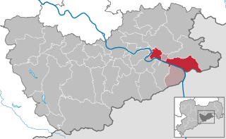
Rathmannsdorf (Rathmannsdorf)

- municipality in the Saxon district of Sächsische Schweiz-Osterzgebirge, Saxony, Germany
 Hiking in Rathmannsdorf
Rathmannsdorf is a charming village located in Germany, particularly known for its picturesque landscapes and proximity to stunning natural areas, making it a great destination for hiking enthusiasts. Here’s what you should know about hiking in Rathmannsdorf:
Scenic Trails:
-
Saxon Switzerland National Park: Rathmannsdorf is situated close to this stunning national park, characterized by its dramatic sandstone formations, deep gorges, and lush forests. Trails here offer a mix of gentle walks and more challenging hikes.
-
Bastei Bridge: One of the most iconic sights in the area is the Bastei Bridge. Hiking to this scenic viewpoint provides breathtaking views of the Elbe River and the surrounding rock formations. There are various trails leading to and from the bridge, suitable for different skill levels.
-
Lichtenhain Waterfall Trail: This is an accessible trail leading to the beautiful Lichtenhain Waterfall. The hike is relatively short, making it perfect for families or those looking for a gentle stroll amidst nature.
Trail Information:
-
Difficulty Levels: The area offers hikes ranging from easy family-friendly paths to more strenuous routes for experienced hikers. Make sure to check trail markers and maps available at local visitor centers.
-
Trail Signage: Trails in the region are generally well-marked. Look for signs indicating the direction and distance to points of interest.
Best Time to Hike:
-
Spring and Fall: These seasons offer moderate temperatures and beautiful views, with blooming flowers in spring and vibrant foliage in autumn.
-
Summer: While summer is popular among hikers, be prepared for higher temperatures and more tourists. Start your hikes early to avoid midday heat.
Additional Tips:
-
Equipment: Wear sturdy hiking boots and bring plenty of water, snacks, and a first aid kit. A walking stick can be useful for some of the steeper trails.
-
Weather Preparedness: Weather can change quickly in this region, so it’s advisable to check the forecast before heading out and to dress in layers.
-
Local Amenities: Rathmannsdorf may have local accommodations and eateries suitable for hikers looking to rest after a day on the trails. Be sure to check out local cuisine and hospitality.
-
Respect Nature: Follow Leave No Trace principles, respect wildlife, and stay on marked trails to preserve the natural beauty of the area.
Rathmannsdorf offers a wonderful combination of dramatic landscapes and well-maintained trails, making it an ideal spot for hiking adventures. Enjoy your hike!
- Country:

- Postal Code: 01814
- Local Dialing Code: 035022
- Licence Plate Code: PIR
- Coordinates: 50° 56' 0" N, 14° 8' 0" E


- GPS tracks (wikiloc): [Link]
- AboveSeaLevel: 225 м m
- Area: 4.37 sq km
- Population: 915
- Web site: http://www.rathmannsdorf.de
- Wikipedia en: wiki(en)
- Wikipedia: wiki(de)
- Wikidata storage: Wikidata: Q8227
- Wikipedia Commons Category: [Link]
- Freebase ID: [/m/02pspj8]
- Freebase ID: [/m/02pspj8]
- GeoNames ID: Alt: [2850195]
- GeoNames ID: Alt: [2850195]
- OSM relation ID: [534532]
- OSM relation ID: [534532]
- GND ID: Alt: [10033313-8]
- GND ID: Alt: [10033313-8]
- Historical Gazetteer (GOV) ID: [RATORFJO70BW]
- Historical Gazetteer (GOV) ID: [RATORFJO70BW]
- German municipality key: 14628320
- German municipality key: 14628320
Shares border with regions:

Bad Schandau
- town in Germany
Hiking in Bad Schandau
Bad Schandau, located in the Saxon Switzerland National Park in Germany, is a splendid destination for hiking enthusiasts. Known for its stunning sandstone formations, lush forests, and picturesque landscapes along the Elbe River, it offers a variety of trails for all skill levels. Here are some highlights:...
- Country:
- Postal Code: 01812–01814
- Local Dialing Code: 035022
- Licence Plate Code: PIR
- Coordinates: 50° 55' 0" N, 14° 9' 0" E
- GPS tracks (wikiloc): [Link]
- AboveSeaLevel: 146 м m
- Area: 46.77 sq km
- Population: 3606
- Web site: [Link]