Reutlingen (Landkreis Reutlingen)
- district of Baden-Württemberg, Germany
Reutlingen district, located in the southwest of Germany in the state of Baden-Württemberg, offers a variety of hiking experiences suitable for different skill levels, surrounded by beautiful landscapes, charming villages, and historical sites. Here are some highlights and tips for hiking in this area:
1.
Reutlingen district is part of the Swabian Jura (Schwäbische Alb), known for its limestone formations, rolling hills, and dense forests. You can explore numerous hiking trails, including:
- Swabian Jura Trails: The region features many well-marked trails such as the Albsteig or the Premium hiking trails, which traverse through picturesque landscapes, past meadows, and offer stunning viewpoints.
- Nature Reserves: The surrounding nature reserves, like the "Naturschutzgebiet Münsingen," create excellent hiking opportunities with unique flora and fauna.
2.
Hiking in the Reutlingen district not only offers natural beauty but also cultural experiences.
- Historic Towns: Many trails pass through historic towns and villages, like Reutlingen, which has a picturesque old town with medieval architecture and the famous "Zängles-Mädle" fountain.
- Castles and Ruins: Explore the castles and ruins like the Hohenzollern Castle, which provides both hiking routes and historical insights.
3.
The district has a range of trails catering to various skill levels:
- Easy Walks: Suitable for families or beginners, often leading through gentle hills and well-maintained paths.
- Moderate Hikes: Offers a bit more challenge with steeper ascents and rocky terrain.
- Difficult Trails: For experienced hikers looking for adventure and stunning panoramas.
4.
The best seasons for hiking in the Reutlingen district are spring through autumn, with mild weather and blooming nature typically between April and October. However, winter hiking can be equally rewarding, especially in snowy conditions.
5.
- Maps and Guides: Make sure to have a reliable hiking map or app, as some trails can be less marked.
- Safety Gear: Wear appropriate hiking shoes and bring essentials like a first aid kit, sufficient water, snacks, and weather protection.
- Local Tips: Check local tourism websites for any updated information on trail conditions or guided tours.
6.
Reutlingen is well connected by public transport, making it easy to reach trailheads. Train and bus services frequently operate in the area, providing convenient options for hikers.
Conclusion
Hiking in Reutlingen district offers a fantastic opportunity to experience the province of Baden-Württemberg's natural beauty and cultural heritage. Whether you are a seasoned hiker or a beginner, the various trails and scenic views promise an enriching outdoor experience.
- Country:

- Capital: Reutlingen
- Licence Plate Code: RT
- Coordinates: 48° 30' 0" N, 9° 12' 36" E


- GPS tracks (wikiloc): [Link]
- AboveSeaLevel: 661 м m
- Area: 1.09 sq km
- Population: 274691
- Web site: http://www.kreis-reutlingen.de/
- Wikipedia en: wiki(en)
- Wikipedia: wiki(de)
- Wikidata storage: Wikidata: Q8217
- Wikipedia Commons Category: [Link]
- Freebase ID: [/m/01kz3z]
- GeoNames ID: Alt: [3220792]
- VIAF ID: Alt: [154818436]
- OSM relation ID: [2796980]
- GND ID: Alt: [4049658-2]
- archINFORM location ID: [2583]
- Library of Congress authority ID: Alt: [n84060329]
- TGN ID: [7077326]
- ISNI: Alt: [0000 0004 0581 509X]
- NUTS code: [DE141]
- German district key: 08415
Includes regions:

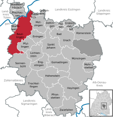
Reutlingen
- German city
Reutlingen, located in southwestern Germany, is surrounded by beautiful landscapes and offers a variety of hiking opportunities suitable for different skill levels. Here are some key points about hiking in the Reutlingen area:...
- Country:

- Postal Code: 72762; 72770; 72760
- Local Dialing Code: 07072; 07121
- Licence Plate Code: RT
- Coordinates: 48° 29' 0" N, 9° 13' 0" E


- GPS tracks (wikiloc): [Link]
- AboveSeaLevel: 382 м m
- Area: 87.04 sq km
- Population: 115006
- Web site: [Link]
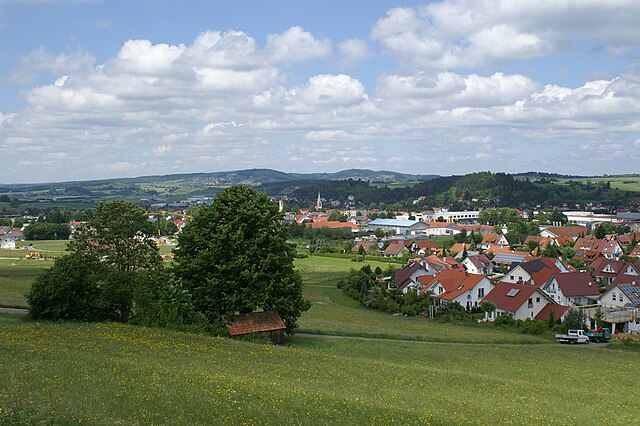

Münsingen
- town in the district of Reutlingen, Baden-Württemberg, Germany
Münsingen, located in the Swabian Jura region of Germany, offers a great variety of hiking opportunities for outdoor enthusiasts. Here's an overview of what you can expect when hiking in this area:...
- Country:

- Postal Code: 72525
- Local Dialing Code: 07384; 07383; 07381
- Licence Plate Code: RT
- Coordinates: 48° 24' 46" N, 9° 29' 43" E


- GPS tracks (wikiloc): [Link]
- AboveSeaLevel: 707 м m
- Area: 116.99 sq km
- Population: 13997
- Web site: [Link]


Pliezhausen
- municipality in Germany
Pliezhausen is a charming town located in Baden-Württemberg, Germany, known for its picturesque countryside and access to various hiking opportunities. While the town itself may not be a major hiking destination, its surrounding area offers beautiful trails that cater to a range of experience levels....
- Country:

- Postal Code: 72124
- Local Dialing Code: 07127
- Licence Plate Code: RT
- Coordinates: 48° 33' 34" N, 9° 12' 27" E


- GPS tracks (wikiloc): [Link]
- AboveSeaLevel: 341 м m
- Area: 17.31 sq km
- Population: 9651
- Web site: [Link]


St. Johann
- municipality in Germany
St. Johann, located in the Reutlingen district of Baden-Württemberg, Germany, offers a variety of hiking opportunities that cater to different skill levels. The region is characterized by its beautiful landscapes, including rolling hills, dense forests, and scenic views of the Swabian Jura. Here are some key highlights regarding hiking in St. Johann:...
- Country:

- Postal Code: 72813
- Local Dialing Code: 07122
- Licence Plate Code: RT
- Coordinates: 48° 27' 10" N, 9° 20' 35" E


- GPS tracks (wikiloc): [Link]
- AboveSeaLevel: 760 м m
- Area: 58.96 sq km
- Population: 5114
- Web site: [Link]


Eningen unter Achalm
- municipality in Germany
 Hiking in Eningen unter Achalm
Eningen, a small town in the state of Baden-Württemberg, Germany, offers a variety of hiking opportunities due to its picturesque surroundings and proximity to the Swabian Jura mountain range. Here are some key points to consider about hiking in and around Eningen:...
- Country:

- Postal Code: 72800
- Local Dialing Code: 07121
- Licence Plate Code: RT
- Coordinates: 48° 29' 13" N, 9° 15' 34" E


- GPS tracks (wikiloc): [Link]
- AboveSeaLevel: 464 м m
- Area: 23.13 sq km
- Population: 10688
- Web site: [Link]
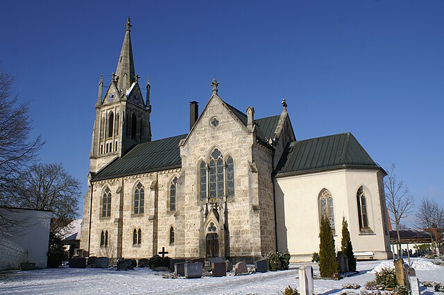

Römerstein
- municipality in Germany
Römerstein, located in the Swabian Jura region of Germany, offers a variety of hiking opportunities that showcase the area's stunning natural landscapes, historical sites, and geological features. Here are some details that might be helpful for hiking in Römerstein:...
- Country:

- Postal Code: 72587
- Local Dialing Code: 07382
- Licence Plate Code: RT
- Coordinates: 48° 29' 44" N, 9° 30' 38" E


- GPS tracks (wikiloc): [Link]
- AboveSeaLevel: 757 м m
- Area: 46.05 sq km
- Population: 4045
- Web site: [Link]


Sonnenbühl
- municipality in Germany
Sonnenbühl, located in the Baden-Württemberg region of Germany, is a picturesque area offering a range of hiking opportunities amid beautiful landscapes. Nestled in the Swabian Jura, it presents numerous trails that cater to different skill levels, making it an excellent destination for both beginner and experienced hikers....
- Country:

- Postal Code: 72820
- Local Dialing Code: 07128
- Licence Plate Code: RT
- Coordinates: 48° 23' 25" N, 9° 10' 52" E


- GPS tracks (wikiloc): [Link]
- AboveSeaLevel: 775 м m
- Area: 61.26 sq km
- Population: 6972
- Web site: [Link]

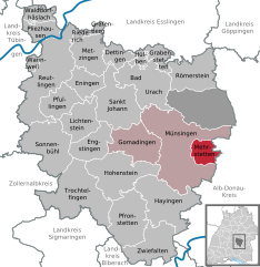
Mehrstetten
- municipality in Germany
Mehrstetten is a small village located in the Swabian Jura region of Germany, offering a range of hiking opportunities. The surrounding landscape is characterized by beautiful forests, rolling hills, and picturesque views, making it an excellent destination for outdoor enthusiasts. Here are some highlights of hiking in the Mehrstetten area:...
- Country:

- Postal Code: 72537
- Local Dialing Code: 07381
- Licence Plate Code: RT
- Coordinates: 48° 22' 32" N, 9° 34' 0" E


- GPS tracks (wikiloc): [Link]
- AboveSeaLevel: 750 м m
- Area: 17.1 sq km
- Population: 1402
- Web site: [Link]


Walddorfhäslach
- municipality in Germany
Walddorfhäslach is a quaint village located in the district of Tübingen in Baden-Württemberg, Germany. Nestled in a picturesque landscape of rolling hills, forests, and fields, it offers a peaceful hiking experience for both beginners and seasoned hikers....
- Country:

- Postal Code: 72141
- Local Dialing Code: 07127
- Licence Plate Code: RT
- Coordinates: 48° 35' 20" N, 9° 10' 52" E


- GPS tracks (wikiloc): [Link]
- AboveSeaLevel: 440 м m
- Area: 14.44 sq km
- Population: 4934
- Web site: [Link]


Hülben
- municipality in Germany
Hülben, located in the Swabian Jura region of Germany, offers a variety of hiking opportunities for both novices and experienced hikers. The area is characterized by beautiful landscapes, including rolling hills, dense forests, and scenic viewpoints....
- Country:

- Postal Code: 72584
- Local Dialing Code: 07125
- Licence Plate Code: RT
- Coordinates: 48° 31' 11" N, 9° 24' 28" E


- GPS tracks (wikiloc): [Link]
- AboveSeaLevel: 713 м m
- Area: 6.41 sq km
- Population: 2850
- Web site: [Link]


Hohenstein
- municipality in Baden-Württemberg, Germany
Hohenstein is a lovely hiking destination located near Reutlingen in Baden-Württemberg, Germany. The area is well known for its scenic views, picturesque landscapes, and a variety of hiking trails suitable for different skill levels. Here are some highlights and tips for hiking in Hohenstein:...
- Country:

- Postal Code: 72531
- Local Dialing Code: 07387
- Licence Plate Code: RT
- Coordinates: 48° 20' 52" N, 9° 22' 22" E


- GPS tracks (wikiloc): [Link]
- AboveSeaLevel: 741 м m
- Area: 61.71 sq km
- Population: 3644
- Web site: [Link]
Grafenberg
- town in Germany
Grafenberg, located near Reutlingen in Germany, offers a beautiful setting for hiking enthusiasts. The area is known for its scenic landscapes, including rolling hills, lush forests, and picturesque views of the Swabian Jura. Here are some key points to keep in mind if you're planning a hiking trip in Grafenberg:...
- Country:

- Postal Code: 72661
- Local Dialing Code: 07123
- Licence Plate Code: RT
- Coordinates: 48° 33' 22" N, 9° 18' 0" E


- GPS tracks (wikiloc): [Link]
- AboveSeaLevel: 422 м m
- Area: 3.51 sq km
- Population: 2617
- Web site: [Link]


Grabenstetten
- municipality in Germany
Grabenstetten is located in the Swabian Jura region of Germany and is known for its beautiful landscapes, hiking trails, and natural features. Here are some highlights and tips for hiking in the Grabenstetten area:...
- Country:

- Postal Code: 72582
- Local Dialing Code: 07382
- Licence Plate Code: RT
- Coordinates: 48° 31' 26" N, 9° 27' 42" E


- GPS tracks (wikiloc): [Link]
- AboveSeaLevel: 714 м m
- Area: 14.53 sq km
- Population: 1677
- Web site: [Link]

Pfullingen
- municipality in Germany
Pfullingen, located in the Baden-Württemberg region of Germany, is surrounded by picturesque landscapes, making it a great destination for hiking enthusiasts. The area features a variety of trails catering to different skill levels, offering breathtaking views of the Swabian Jura and the surrounding valleys....
- Country:

- Postal Code: 72793
- Local Dialing Code: 07121
- Licence Plate Code: RT
- Coordinates: 48° 27' 56" N, 9° 13' 34" E


- GPS tracks (wikiloc): [Link]
- AboveSeaLevel: 426 м m
- Area: 30.13 sq km
- Population: 17870
- Web site: [Link]


Trochtelfingen
- municipality in Germany
Trochtelfingen is a charming town located in the Baden-Württemberg region of Germany, surrounded by picturesque landscapes ideal for hiking. The area is characterized by a mix of forested areas, rolling hills, and scenic vistas, making it a great destination for both novice and experienced hikers....
- Country:

- Postal Code: 72814–72818
- Local Dialing Code: 07388; 07124
- Licence Plate Code: RT
- Coordinates: 48° 18' 29" N, 9° 14' 40" E


- GPS tracks (wikiloc): [Link]
- AboveSeaLevel: 700 м m
- Area: 79.22 sq km
- Population: 6360
- Web site: [Link]


Hayingen
- municipality in Germany
Hayingen is a charming town located in the Swabian Jura region of Baden-Württemberg, Germany. The area is known for its stunning natural landscapes, making it a wonderful destination for hiking enthusiasts. Here’s what you can expect when hiking in Hayingen:...
- Country:

- Postal Code: 72534
- Local Dialing Code: 07386
- Licence Plate Code: RT
- Coordinates: 48° 16' 31" N, 9° 28' 41" E


- GPS tracks (wikiloc): [Link]
- AboveSeaLevel: 661 м m
- Area: 63.36 sq km
- Population: 2200
- Web site: [Link]

Metzingen
- municipality in Germany
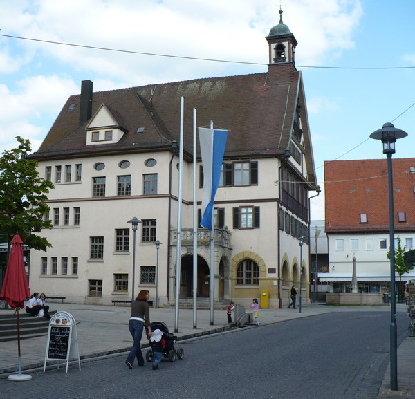
Metzingen, located in the Baden-Württemberg region of Germany, is not only known for its outlet shopping but also offers some lovely hiking opportunities in the surrounding areas. Here are a few highlights if you're considering hiking around Metzingen:...
- Country:

- Postal Code: 72555
- Local Dialing Code: 07123
- Licence Plate Code: RT
- Coordinates: 48° 32' 12" N, 9° 17' 9" E


- GPS tracks (wikiloc): [Link]
- AboveSeaLevel: 350 м m
- Area: 34.61 sq km
- Population: 21845
- Web site: [Link]


Wannweil
- municipality in Germany
Wannweil, a small municipality in Germany, is located in the state of Baden-Württemberg near the city of Reutlingen. While it may not be as well-known as some other hiking destinations, there are still opportunities for enjoying outdoor activities in the surrounding areas....
- Country:

- Postal Code: 72827
- Local Dialing Code: 07121
- Licence Plate Code: RT
- Coordinates: 48° 31' 0" N, 9° 9' 0" E


- GPS tracks (wikiloc): [Link]
- AboveSeaLevel: 332 м m
- Area: 5.34 sq km
- Population: 5331
- Web site: [Link]

Bad Urach
- municipality in Germany
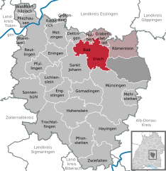
Bad Urach is a picturesque town located in the Swabian Jura region of Germany, known for its stunning landscapes, rich history, and diverse hiking trails. The area features a unique combination of hills, forests, and meadows, making it an ideal destination for outdoor enthusiasts....
- Country:

- Postal Code: 72562–72574
- Local Dialing Code: 07381; 07125
- Licence Plate Code: RT
- Coordinates: 48° 30' 0" N, 9° 24' 0" E


- GPS tracks (wikiloc): [Link]
- AboveSeaLevel: 463 м m
- Area: 55.45 sq km
- Population: 11910
- Web site: [Link]


Dettingen an der Erms
- municipality in Germany
 Hiking in Dettingen an der Erms
Dettingen an der Erms is a quaint village located in the Swabian Jura region of Germany, offering a range of scenic hiking opportunities. Nestled within lush forests and picturesque landscapes, it serves as an excellent base for outdoor enthusiasts. Here are some highlights of hiking in and around Dettingen an der Erms:...
- Country:

- Postal Code: 72581
- Local Dialing Code: 07123
- Licence Plate Code: RT
- Coordinates: 48° 31' 48" N, 9° 20' 50" E


- GPS tracks (wikiloc): [Link]
- AboveSeaLevel: 398 м m
- Area: 15.81 sq km
- Population: 9593
- Web site: [Link]
Engstingen
- municipality in Germany
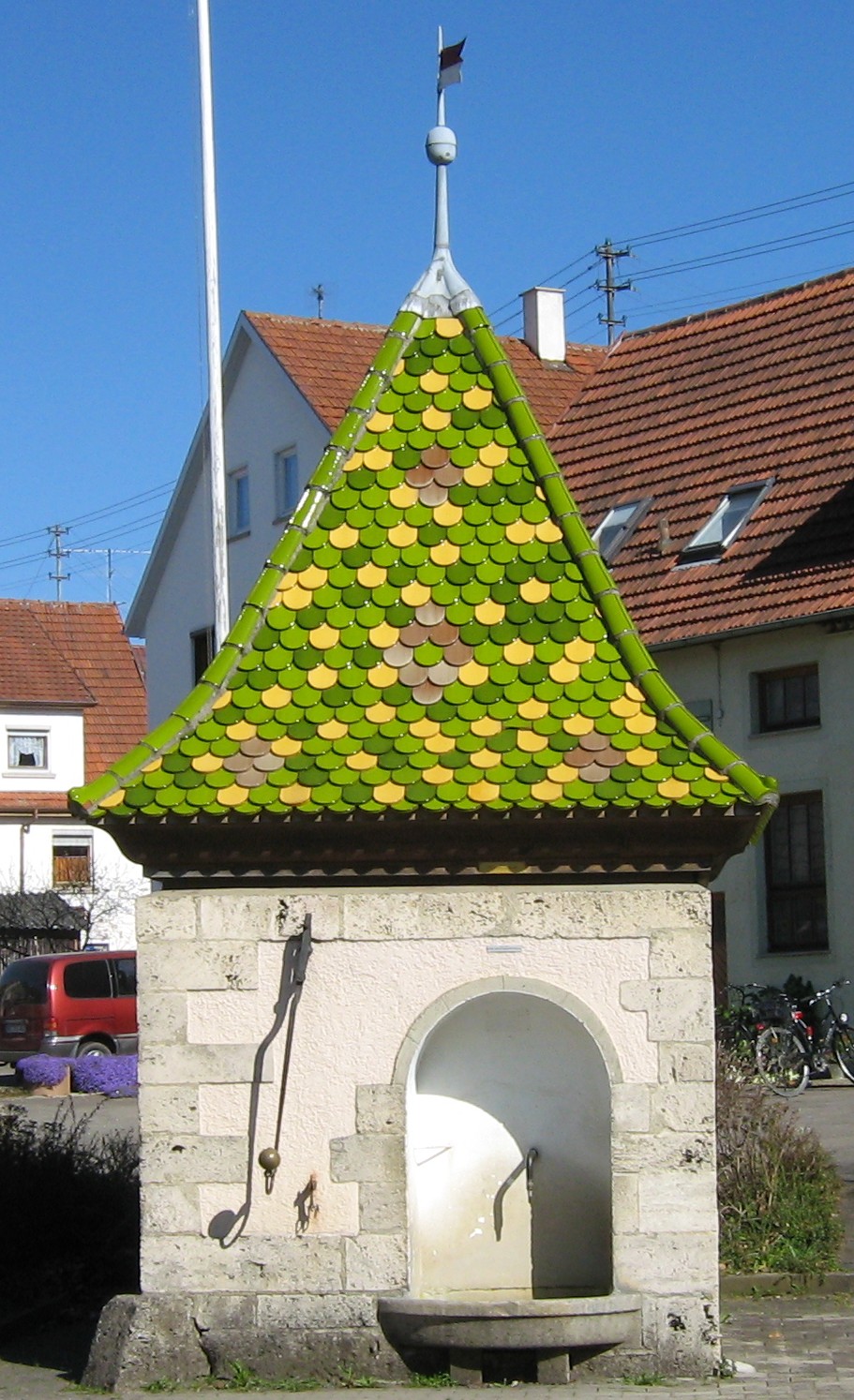
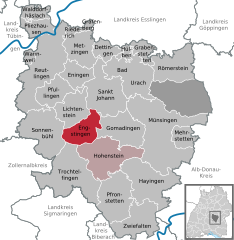
Engstingen, located in the Swabian Jura region of Germany, offers a variety of hiking opportunities amidst picturesque landscapes. The area is known for its beautiful rock formations, rolling hills, and diverse flora and fauna. Here are some points of interest for hiking in and around Engstingen:...
- Country:

- Postal Code: 72829
- Local Dialing Code: 07385; 07129
- Licence Plate Code: RT
- Coordinates: 48° 23' 13" N, 9° 17' 8" E


- GPS tracks (wikiloc): [Link]
- AboveSeaLevel: 700 м m
- Area: 31.51 sq km
- Population: 5226
- Web site: [Link]


Riederich
- municipality in Germany
Riederich is a small municipality in Germany, located in the state of Baden-Württemberg. Nestled near the Swabian Jura, this area offers a variety of hiking opportunities, particularly for those who enjoy scenic landscapes and natural beauty....
- Country:

- Postal Code: 72585
- Local Dialing Code: 07123
- Licence Plate Code: RT
- Coordinates: 48° 33' 37" N, 9° 16' 8" E


- GPS tracks (wikiloc): [Link]
- AboveSeaLevel: 324 м m
- Area: 4.64 sq km
- Population: 4288
- Web site: [Link]


Gomadingen
- municipality in Germany
Gomadingen is a charming municipality located in the Swabian Jura region of Germany, known for its beautiful landscapes and hiking opportunities. The area offers a variety of trails that cater to different skill levels and preferences, making it an ideal spot for both novice hikers and experienced outdoor enthusiasts....
- Country:

- Postal Code: 72532
- Local Dialing Code: 07385
- Licence Plate Code: RT
- Coordinates: 48° 23' 59" N, 9° 23' 26" E


- GPS tracks (wikiloc): [Link]
- AboveSeaLevel: 664 м m
- Area: 45.85 sq km
- Population: 2250
- Web site: [Link]

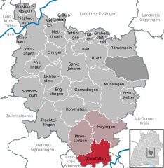
Zwiefalten
- municipality in Germany
Zwiefalten, located in the beautiful region of Baden-Württemberg, Germany, is known for its picturesque landscapes and numerous hiking opportunities. Here’s everything you need to know about hiking in this charming area:...
- Country:

- Postal Code: 88529
- Local Dialing Code: 07373
- Licence Plate Code: RT
- Coordinates: 48° 14' 2" N, 9° 27' 44" E


- GPS tracks (wikiloc): [Link]
- AboveSeaLevel: 538 м m
- Area: 45.43 sq km
- Population: 2233
- Web site: [Link]


Lichtenstein
- municipality in Baden-Württemberg, Germany
Lichtenstein, located in the Baden-Württemberg region of Germany, is a picturesque area known for its scenic landscapes and outdoor recreational opportunities. The region is especially famous for the Swabian Jura (Schwäbische Alb), a mountain range that offers a variety of hiking trails suitable for all skill levels....
- Country:

- Postal Code: 72805
- Local Dialing Code: 07129
- Licence Plate Code: RT
- Coordinates: 48° 25' 37" N, 9° 15' 13" E


- GPS tracks (wikiloc): [Link]
- AboveSeaLevel: 507 м m
- Area: 34.24 sq km
- Population: 9196
- Web site: [Link]
Pfronstetten
- municipality in Germany
Pfronstetten is a charming village located in the Swabian Jura region of Germany, known for its beautiful landscapes and opportunities for outdoor activities, particularly hiking. The area features a mix of lush forests, rolling hills, and scenic viewpoints that offer a variety of trails suitable for different hiking levels. Here are some highlights about hiking in Pfronstetten:...
- Country:

- Postal Code: 72539
- Local Dialing Code: 07388; 07373
- Licence Plate Code: RT
- Coordinates: 48° 17' 0" N, 9° 22' 0" E


- GPS tracks (wikiloc): [Link]
- AboveSeaLevel: 711 м m
- Area: 54.06 sq km
- Population: 1446
- Web site: [Link]
Shares border with regions:
Alb-Donau-Kreis
- district in Baden-Württemberg, Germany
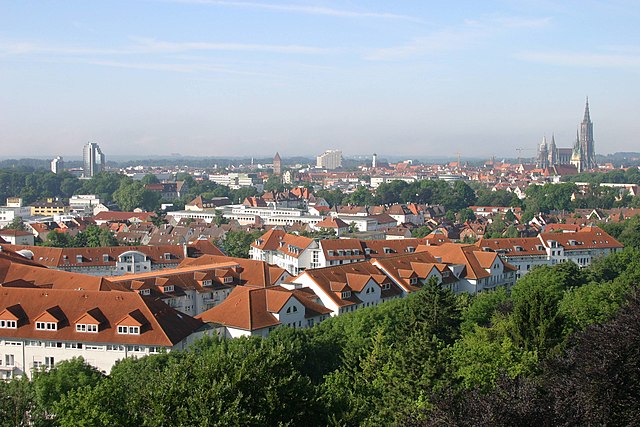
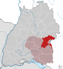
The Alb-Donau-Kreis is a beautiful district located in Baden-Württemberg, Germany, known for its diverse landscapes, rich nature, and historical sites. Hiking in this area offers a range of trails suitable for all levels of hikers, from beginners to more experienced trekkers. Here are some highlights and tips for hiking in Alb-Donau-Kreis:...
- Country:

- Capital: Ulm
- Licence Plate Code: UL
- Coordinates: 48° 24' 0" N, 9° 51' 0" E


- GPS tracks (wikiloc): [Link]
- AboveSeaLevel: 670 м m
- Area: 1358.67 sq km
- Population: 192104
- Web site: [Link]


Biberach district
- district in Baden-Württemberg, Germany
Biberach district, located in Baden-Württemberg, Germany, is an excellent destination for hikers, offering a blend of picturesque landscapes, cultural heritage, and diverse trails suitable for all skill levels....
- Country:

- Capital: Biberach an der Riss
- Licence Plate Code: BC
- Coordinates: 48° 4' 48" N, 9° 49' 48" E


- GPS tracks (wikiloc): [Link]
- AboveSeaLevel: 581 м m
- Area: 1409.82 sq km
- Population: 194019
- Web site: [Link]

Landkreis Sigmaringen
- district of Baden-Württemberg, Germany
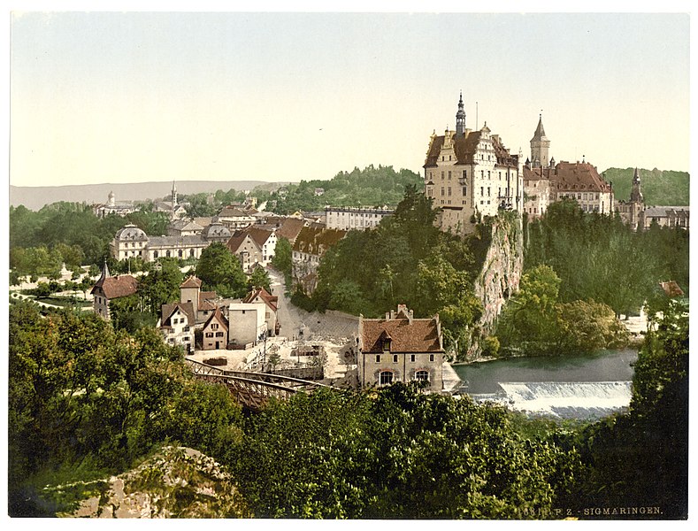
 Hiking in Landkreis Sigmaringen
Sigmaringen, located in the southwestern part of Germany in the state of Baden-Württemberg, offers a beautiful and diverse landscape for hiking enthusiasts. The region is characterized by its stunning natural scenery, which includes rolling hills, dense forests, and picturesque valleys along the Danube River. Here are some highlights for hiking in the Sigmaringen district:...
- Country:

- Capital: Sigmaringen
- Licence Plate Code: SIG
- Coordinates: 48° 4' 48" N, 9° 10' 12" E


- GPS tracks (wikiloc): [Link]
- AboveSeaLevel: 626 м m
- Area: 1204.36 sq km
- Population: 127272
- Web site: [Link]
