Landkreis Sigmaringen (Landkreis Sigmaringen)
- district of Baden-Württemberg, Germany
 Hiking in Landkreis Sigmaringen
Sigmaringen, located in the southwestern part of Germany in the state of Baden-Württemberg, offers a beautiful and diverse landscape for hiking enthusiasts. The region is characterized by its stunning natural scenery, which includes rolling hills, dense forests, and picturesque valleys along the Danube River. Here are some highlights for hiking in the Sigmaringen district:
Scenic Trails
-
Danube River Trails: The area is bordered by the Danube River, where you can find several trails that offer beautiful views of the river and surrounding landscapes. The trails often provide options for varying skill levels, from leisurely walks to more challenging hikes.
-
Swabian Jura (Schwäbische Alb): This mountain range features dramatic limestone cliffs and deep gorges, which are great for more adventurous hikers. The trails here range from easy to strenuous, with opportunities to explore unique geological formations and ancient ruins.
-
National Park Donau-Auen: Located just a short distance from Sigmaringen, this national park preserves natural habitats along the Danube River. The area is rich in flora and fauna and provides trails that allow you to immerse yourself in nature.
Historical Sites
- Sigmaringen Castle: While hiking, you may want to visit the impressive Sigmaringen Castle, which offers guided tours and panoramic views of the surrounding area. The castle is a significant historical landmark and adds a cultural element to your hike.
Hiking Tips
-
Local Maps and Guides: It's a good idea to obtain local hiking maps or use smartphone apps that provide trail information. The area tends to have well-marked paths, but a map can help you discover hidden gems.
-
Weather Considerations: Check the weather forecast before heading out, as conditions can change rapidly in the region. Dress in layers and bring necessary gear for the terrain you plan to tackle.
-
Respect Nature: Stay on marked paths, take your trash with you, and respect wildlife to help preserve the natural beauty of the area.
Accessibility
Sigmaringen is accessible by public transport, and many hiking trails can be reached from the town center. Whether you're looking for a short day hike or a longer trek, the Sigmaringen district has something to offer for all hiking enthusiasts.
- Country:

- Capital: Sigmaringen
- Licence Plate Code: SIG
- Coordinates: 48° 4' 48" N, 9° 10' 12" E


- GPS tracks (wikiloc): [Link]
- AboveSeaLevel: 626 м m
- Area: 1204.36 sq km
- Population: 127272
- Web site: http://www.landratsamt-sigmaringen.de/
- Wikipedia en: wiki(en)
- Wikipedia: wiki(de)
- Wikidata storage: Wikidata: Q8230
- Wikipedia Commons Category: [Link]
- Wikipedia Commons Maps Category: [Link]
- Freebase ID: [/m/01l6q9]
- GeoNames ID: Alt: [3220793]
- VIAF ID: Alt: [128483535]
- OSM relation ID: [2806390]
- GND ID: Alt: [4054931-8]
- archINFORM location ID: [2613]
- Library of Congress authority ID: Alt: [n82138791]
- TGN ID: [7077325]
- ISNI: Alt: [0000 0004 0480 3695]
- NUTS code: [DE149]
- Ringgold ID: [219628]
- German district key: 08437
Includes regions:

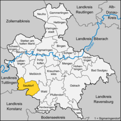
Sauldorf
- municipality in Germany
Sauldorf is a picturesque village located in the Baden-Württemberg region of Germany, surrounded by beautiful landscapes that make it an excellent destination for hiking enthusiasts. The area features a variety of trails suitable for different skill levels, ranging from easy walks to more challenging hikes....
- Country:

- Postal Code: 88605
- Local Dialing Code: 07578
- Licence Plate Code: SIG
- Coordinates: 47° 56' 40" N, 9° 6' 29" E


- GPS tracks (wikiloc): [Link]
- AboveSeaLevel: 646 м m
- Area: 49.72 sq km
- Population: 2525
- Web site: [Link]


Neufra
- municipality in Germany
Neufra, a small village located in the Baden-Württemberg region of Germany, offers beautiful landscapes and scenic hiking opportunities. While it may not be as famous as larger hiking destinations, it provides a charming experience for those looking to explore the countryside....
- Country:

- Postal Code: 72419
- Local Dialing Code: 07574
- Licence Plate Code: SIG
- Coordinates: 48° 14' 48" N, 9° 10' 58" E


- GPS tracks (wikiloc): [Link]
- AboveSeaLevel: 680 м m
- Area: 28.4 sq km
- Population: 1848
- Web site: [Link]

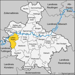
Leibertingen
- municipality in Germany
Leibertingen is a quaint village located in the picturesque region of Baden-Württemberg, Germany. It is surrounded by beautiful landscapes that make it a great destination for hiking enthusiasts. Here are some highlights of hiking in and around Leibertingen:...
- Country:

- Postal Code: 88637
- Local Dialing Code: 07466
- Licence Plate Code: SIG
- Coordinates: 48° 2' 33" N, 9° 0' 47" E


- GPS tracks (wikiloc): [Link]
- AboveSeaLevel: 797 м m
- Area: 47.20 sq km
- Population: 2103
- Web site: [Link]

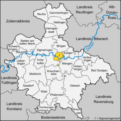
Sigmaringendorf
- municipality in Germany
Sigmaringendorf, a charming village located near the picturesque Danube River in the Swabian region of Germany, offers a variety of hiking opportunities for nature enthusiasts. The surrounding areas feature beautiful landscapes, including lush forests, rolling hills, and scenic riverbanks, making it an excellent destination for outdoor activities....
- Country:

- Postal Code: 72517
- Local Dialing Code: 07571
- Licence Plate Code: SIG
- Coordinates: 48° 3' 57" N, 9° 15' 43" E


- GPS tracks (wikiloc): [Link]
- AboveSeaLevel: 569 м m
- Area: 12.47 sq km
- Population: 3549
- Web site: [Link]


Stetten am kalten Markt
- municipality in Germany
 Hiking in Stetten am kalten Markt
Stetten am kalten Markt is a picturesque village located in the Swabian Jura region of Germany, which is known for its beautiful landscapes, dense forests, and variety of trails. Here are some key points to consider when hiking in and around Stetten am kalten Markt:...
- Country:

- Postal Code: 72510
- Local Dialing Code: 07573
- Licence Plate Code: SIG
- Coordinates: 48° 7' 23" N, 9° 4' 40" E


- GPS tracks (wikiloc): [Link]
- AboveSeaLevel: 768 м m
- Area: 56.47 sq km
- Population: 4818
- Web site: [Link]


Krauchenwies
- municipality in Germany
Krauchenwies is a small municipality located in the Baden-Württemberg region of Germany, offering a variety of outdoor activities, including hiking. While it may not be as widely known as some of the larger hiking destinations, it offers charming trails and beautiful natural scenery, which are perfect for those looking to explore the countryside....
- Country:

- Postal Code: 72505
- Local Dialing Code: 07576
- Licence Plate Code: SIG
- Coordinates: 48° 1' 1" N, 9° 15' 1" E


- GPS tracks (wikiloc): [Link]
- AboveSeaLevel: 599 м m
- Area: 44.66 sq km
- Population: 4985
- Web site: [Link]


Ostrach
- municipality in Germany
Ostrach is a charming town located in the southern part of Germany, in the state of Baden-Württemberg. While it is not as well-known as larger cities, it is situated near beautiful rural landscapes that are ideal for hiking....
- Country:

- Postal Code: 88356
- Local Dialing Code: 07585
- Licence Plate Code: SIG
- Coordinates: 47° 57' 0" N, 9° 23' 0" E


- GPS tracks (wikiloc): [Link]
- AboveSeaLevel: 610 м m
- Area: 108.91 sq km
- Population: 6704
- Web site: [Link]


Schwenningen
- municipality in the district of Sigmaringen, Baden-Württemberg, Germany
Schwenningen, located near Sigmaringen in Baden-Württemberg, Germany, is an excellent area for hiking enthusiasts. The region is known for its picturesque landscapes, varied terrain, and rich natural beauty, making it a great destination for both novice and experienced hikers....
- Country:

- Postal Code: 72477
- Local Dialing Code: 07579
- Licence Plate Code: SIG
- Coordinates: 48° 6' 16" N, 8° 59' 55" E


- GPS tracks (wikiloc): [Link]
- AboveSeaLevel: 870 м m
- Area: 19.34 sq km
- Population: 1595
- Web site: [Link]


Wald
- municipality in Baden-Württemberg, Germany
Wald, located in the Baden-Württemberg region of Germany, is an excellent destination for hiking enthusiasts. The area is characterized by its picturesque landscapes, diverse flora and fauna, and well-marked hiking trails. Here are some highlights to consider when planning your hiking adventure in Wald:...
- Country:

- Postal Code: 88639
- Local Dialing Code: 07578
- Licence Plate Code: SIG
- Coordinates: 47° 56' 12" N, 9° 10' 24" E


- GPS tracks (wikiloc): [Link]
- AboveSeaLevel: 657 м m
- Area: 43.87 sq km
- Population: 2599
- Web site: [Link]


Beuron
- municipality in Germany
Beuron is a picturesque village located in the Swabian Jura region of Germany, renowned for its stunning natural landscapes, rich history, and opportunities for hiking. Nestled along the banks of the Danube River, Beuron serves as an excellent starting point for various hiking trails that cater to different skill levels. Here are some key points about hiking in Beuron:...
- Country:

- Postal Code: 88631
- Local Dialing Code: 07579
- Licence Plate Code: SIG
- Coordinates: 48° 3' 0" N, 8° 58' 0" E


- GPS tracks (wikiloc): [Link]
- AboveSeaLevel: 609 м m
- Area: 35.1 sq km
- Population: 642
- Web site: [Link]


Herbertingen
- municipality in Germany
Herbertingen, a small town in Germany located in the state of Baden-Württemberg, offers a range of hiking opportunities that showcase the natural beauty of the Swabian countryside. Here are some highlights for hiking in this area:...
- Country:

- Postal Code: 88516–88518
- Local Dialing Code: 07586
- Licence Plate Code: SIG
- Coordinates: 48° 3' 36" N, 9° 26' 19" E


- GPS tracks (wikiloc): [Link]
- AboveSeaLevel: 547 м m
- Area: 38.65 sq km
- Population: 4784
- Web site: [Link]


Mengen
- municipality in Germany
Mengen, located in the Baden-Württemberg region of Germany, is not only known for its historical and cultural significance but also offers various opportunities for hiking enthusiasts. The surrounding areas are characterized by picturesque landscapes, including rolling hills, forests, and charming villages. Here are some key points about hiking in and around Mengen:...
- Country:

- Postal Code: 88512
- Local Dialing Code: 07572
- Licence Plate Code: SIG
- Coordinates: 48° 2' 59" N, 9° 19' 48" E


- GPS tracks (wikiloc): [Link]
- AboveSeaLevel: 561 м m
- Area: 49.80 sq km
- Population: 9816
- Web site: [Link]

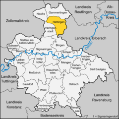
Hettingen
- municipality in Germany
Hettingen, a small town in Germany, offers a variety of scenic hiking opportunities that highlight the beauty of the surrounding countryside. Here are some key points to consider when hiking in and around Hettingen:...
- Country:

- Postal Code: 72513
- Local Dialing Code: 07574
- Licence Plate Code: SIG
- Coordinates: 48° 12' 58" N, 9° 13' 53" E


- GPS tracks (wikiloc): [Link]
- AboveSeaLevel: 644 м m
- Area: 46.06 sq km
- Population: 1797
- Web site: [Link]
Veringenstadt
- municipality in Germany
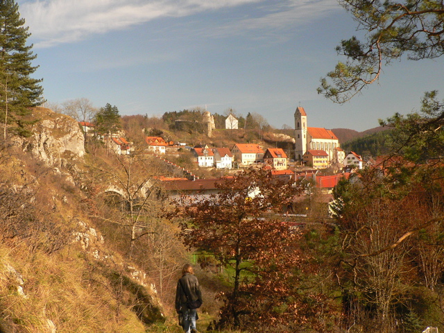
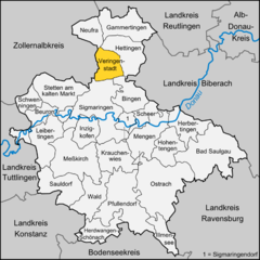
Veringenstadt, situated in the picturesque region of Baden-Württemberg, Germany, offers a wonderful hiking experience with its beautiful natural landscapes and historic sites. Nestled in the Swabian Jura, the area is characterized by rolling hills, dense forests, and charming meadows....
- Country:

- Postal Code: 72519
- Local Dialing Code: 07577
- Licence Plate Code: SIG
- Coordinates: 48° 10' 42" N, 9° 12' 43" E


- GPS tracks (wikiloc): [Link]
- AboveSeaLevel: 631 м m
- Area: 31.25 sq km
- Population: 2160
- Web site: [Link]

Messkirch
- municipality in Germany
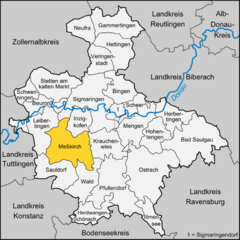
Meßkirch, located in the heart of the scenic Baden-Württemberg region in Germany, offers a variety of hiking experiences for all levels of outdoor enthusiasts. The area is characterized by its beautiful landscapes, lush forests, rolling hills, and a rich cultural backdrop....
- Country:

- Postal Code: 88605
- Local Dialing Code: 07578; 07575; 07570
- Licence Plate Code: SIG
- Coordinates: 47° 59' 0" N, 9° 7' 0" E


- GPS tracks (wikiloc): [Link]
- AboveSeaLevel: 614 м m
- Area: 76.22 sq km
- Population: 8302
- Web site: [Link]

Sigmaringen
- municipality in Germany
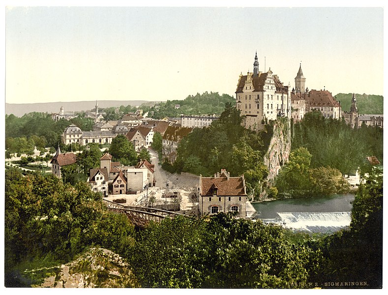
Sigmaringen, located in the Baden-Württemberg region of Germany, offers a beautiful setting for hiking enthusiasts. The area is characterized by its picturesque landscapes, including rolling hills, dense forests, and the banks of the Danube River. Here are some highlights and tips for hiking in the Sigmaringen area:...
- Country:

- Postal Code: 72488
- Local Dialing Code: 07531
- Licence Plate Code: SIG
- Coordinates: 48° 5' 12" N, 9° 12' 59" E


- GPS tracks (wikiloc): [Link]
- AboveSeaLevel: 584 м m
- Area: 92.84 sq km
- Population: 15756
- Web site: [Link]


Pfullendorf
- municipality in Germany
Pfullendorf, located in the state of Baden-Württemberg, Germany, is a charming town that offers a variety of hiking opportunities in the surrounding landscapes. Here are some key points to consider for hiking in and around Pfullendorf:...
- Country:

- Postal Code: 88630
- Local Dialing Code: 07552
- Licence Plate Code: SIG
- Coordinates: 47° 55' 27" N, 9° 15' 24" E


- GPS tracks (wikiloc): [Link]
- AboveSeaLevel: 654 м m
- Area: 90.56 sq km
- Population: 13077
- Web site: [Link]


Illmensee
- municipality in Germany
Illmensee is a picturesque mountain lake located in the scenic region of Baden-Württemberg, Germany. It's a great spot for hiking, offering stunning views and a variety of trails suitable for different skill levels. Here are some key details about hiking in Illmensee:...
- Country:

- Postal Code: 88636
- Local Dialing Code: 07558
- Licence Plate Code: SIG
- Coordinates: 47° 51' 40" N, 9° 22' 23" E


- GPS tracks (wikiloc): [Link]
- AboveSeaLevel: 763 м m
- Area: 24.92 sq km
- Population: 2010
- Web site: [Link]
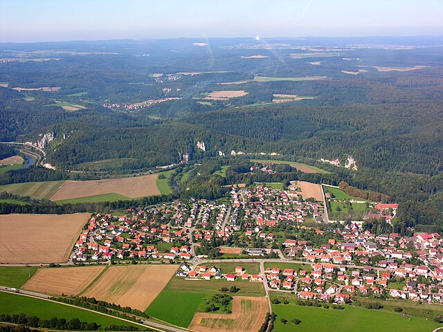
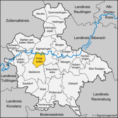
Inzigkofen
- municipality in Germany
Inzigkofen, located in Germany's Baden-Württemberg region, offers a variety of beautiful hiking opportunities, particularly within the unique landscape of the Danube River valley and the surrounding Swabian Jura. Here are some highlights and tips for hiking in this area:...
- Country:

- Postal Code: 72514
- Local Dialing Code: 07571
- Licence Plate Code: SIG
- Coordinates: 48° 4' 18" N, 9° 10' 32" E


- GPS tracks (wikiloc): [Link]
- AboveSeaLevel: 590 м m
- Area: 28.76 sq km
- Population: 2780
- Web site: [Link]
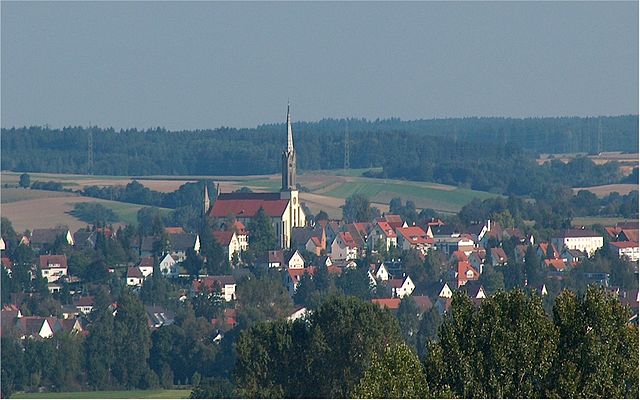

Hohentengen
- municipality in Germany
Hohentengen, located in the Landkreis Waldshut in Germany, offers a great experience for hikers looking to explore the scenic beauty of the region. The area is characterized by lush landscapes, rolling hills, and stunning views of the Rhine River....
- Country:

- Postal Code: 88367
- Local Dialing Code: 07572
- Licence Plate Code: SIG
- Coordinates: 48° 2' 0" N, 9° 23' 0" E


- GPS tracks (wikiloc): [Link]
- AboveSeaLevel: 594 м m
- Area: 36.56 sq km
- Population: 4118
- Web site: [Link]

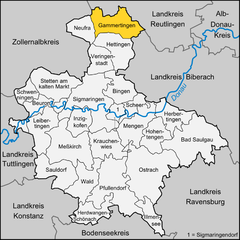
Gammertingen
- municipality in Germany
Gammertingen, a charming town located in the Swabian Jura region of Germany, offers a variety of hiking opportunities for nature lovers and outdoor enthusiasts. Here are some highlights and tips for hiking in and around Gammertingen:...
- Country:

- Postal Code: 72497–72501
- Local Dialing Code: 07574
- Licence Plate Code: SIG
- Coordinates: 48° 14' 58" N, 9° 13' 3" E


- GPS tracks (wikiloc): [Link]
- AboveSeaLevel: 662 м m
- Area: 52.97 sq km
- Population: 6400
- Web site: [Link]


Bingen
- municipality in the district of Sigmaringen, Baden-Württemberg, Germany
Bingen, located in the state of Baden-Württemberg, Germany, offers stunning hiking opportunities, particularly in the surrounding areas, which feature beautiful landscapes, vineyards, and views of the Rhine River....
- Country:

- Postal Code: 72511
- Local Dialing Code: 07571
- Licence Plate Code: SIG
- Coordinates: 48° 6' 42" N, 9° 16' 24" E


- GPS tracks (wikiloc): [Link]
- AboveSeaLevel: 600 м m
- Area: 37.01 sq km
- Population: 2678
- Web site: [Link]
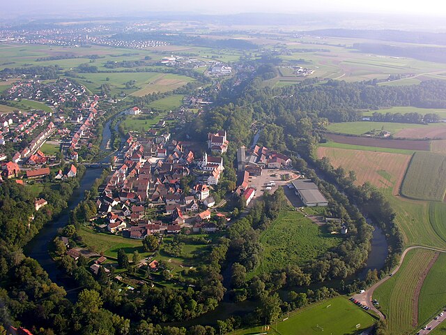

Scheer
- municipality in Germany
Scheer, located in Baden-Württemberg, Germany, is a charming town that offers various outdoor activities, including hiking. The region around Scheer features beautiful landscapes, rolling hills, and scenic views that are perfect for both casual walkers and more experienced hikers....
- Country:

- Postal Code: 72516
- Local Dialing Code: 07572
- Licence Plate Code: SIG
- Coordinates: 48° 4' 25" N, 9° 17' 36" E


- GPS tracks (wikiloc): [Link]
- AboveSeaLevel: 577 м m
- Area: 18.72 sq km
- Population: 2529
- Web site: [Link]


Herdwangen-Schönach
- municipality in Germany
Herdwangen-Schönach is a picturesque village located in the Baden-Württemberg region of Germany, surrounded by beautiful landscapes that are perfect for hiking. The area offers various trails suitable for all levels of hikers, ranging from easy walks suitable for families to more challenging routes for experienced hikers....
- Country:

- Postal Code: 88634
- Local Dialing Code: 07557
- Licence Plate Code: SIG
- Coordinates: 47° 51' 0" N, 9° 12' 0" E


- GPS tracks (wikiloc): [Link]
- AboveSeaLevel: 605 м m
- Area: 36.51 sq km
- Population: 3415
- Web site: [Link]

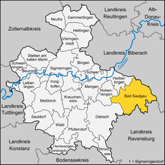
Bad Saulgau
- municipality in Germany
Bad Saulgau, located in the Baden-Württemberg region of Germany, offers a variety of hiking opportunities that appeal to outdoor enthusiasts. The area is characterized by its picturesque landscapes, lush green forests, and charming rural scenery, making it an excellent destination for hiking....
- Country:

- Postal Code: 88348
- Local Dialing Code: 07581
- Coordinates: 48° 1' 3" N, 9° 30' 1" E


- GPS tracks (wikiloc): [Link]
- AboveSeaLevel: 587 м m
- Area: 97.33 sq km
- Population: 17476
- Web site: [Link]
Shares border with regions:


Konstanz
- district in Baden-Württemberg, Germany
Hiking in the Konstanz district, located in the southern part of Germany near the borders with Switzerland and Austria, offers a blend of stunning natural beauty and cultural experiences. The area is characterized by the presence of Lake Constance (Bodensee), rolling hills, scenic vineyards, and picturesque towns. Here are some highlights and popular hiking options in the Konstanz district:...
- Country:

- Capital: Konstanz
- Licence Plate Code: KN
- Coordinates: 47° 49' 0" N, 8° 53' 0" E


- GPS tracks (wikiloc): [Link]
- AboveSeaLevel: 437 м m
- Area: 817.95 sq km
- Population: 270568
- Web site: [Link]


Tuttlingen
- district of Baden-Württemberg, Germany
Tuttlingen district, located in the southwestern part of Germany, is a beautiful region known for its diverse landscapes, including hills, forests, and rivers. This area is part of the Swabian Jura (Schwäbische Alb), making it an excellent destination for hiking enthusiasts....
- Country:

- Capital: Tuttlingen
- Licence Plate Code: TUT
- Coordinates: 48° 0' 0" N, 8° 48' 0" E


- GPS tracks (wikiloc): [Link]
- AboveSeaLevel: 831 м m
- Area: 734.40 sq km
- Population: 132476
- Web site: [Link]


Reutlingen
- district of Baden-Württemberg, Germany
Reutlingen district, located in the southwest of Germany in the state of Baden-Württemberg, offers a variety of hiking experiences suitable for different skill levels, surrounded by beautiful landscapes, charming villages, and historical sites. Here are some highlights and tips for hiking in this area:...
- Country:

- Capital: Reutlingen
- Licence Plate Code: RT
- Coordinates: 48° 30' 0" N, 9° 12' 36" E


- GPS tracks (wikiloc): [Link]
- AboveSeaLevel: 661 м m
- Area: 1.09 sq km
- Population: 274691
- Web site: [Link]


Biberach district
- district in Baden-Württemberg, Germany
Biberach district, located in Baden-Württemberg, Germany, is an excellent destination for hikers, offering a blend of picturesque landscapes, cultural heritage, and diverse trails suitable for all skill levels....
- Country:

- Capital: Biberach an der Riss
- Licence Plate Code: BC
- Coordinates: 48° 4' 48" N, 9° 49' 48" E


- GPS tracks (wikiloc): [Link]
- AboveSeaLevel: 581 м m
- Area: 1409.82 sq km
- Population: 194019
- Web site: [Link]


Landkreis Ravensburg
- district of Baden-Württemberg, Germany
 Hiking in Landkreis Ravensburg
Ravensburg district, located in the state of Baden-Württemberg in Germany, offers a diverse range of hiking opportunities for both casual walkers and experienced hikers. The region is characterized by its beautiful landscapes, rolling hills, and picturesque villages. Here are some highlights and tips for hiking in Ravensburg:...
- Country:

- Capital: Ravensburg
- Licence Plate Code: RV
- Coordinates: 47° 49' 12" N, 9° 48' 0" E


- GPS tracks (wikiloc): [Link]
- AboveSeaLevel: 698 м m
- Area: 1631.81 sq km
- Population: 272425
- Web site: [Link]


Bodenseekreis
- district of Baden-Württemberg, Germany
Bodenseekreis, located in the Baden-Württemberg region of Germany, is known for its stunning landscapes, charming towns, and proximity to Lake Constance (Bodensee). Hiking in this area can be a delightful experience due to its varied terrain, beautiful views, and a range of trails suitable for different skill levels. Here are some highlights and tips for hiking in Bodenseekreis:...
- Country:

- Capital: Friedrichshafen
- Licence Plate Code: FN
- Coordinates: 47° 44' 0" N, 9° 23' 0" E


- GPS tracks (wikiloc): [Link]
- AboveSeaLevel: 490 м m
- Area: 664.64 sq km
- Population: 205843
- Web site: [Link]
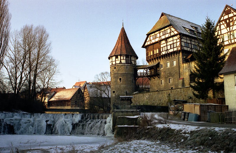

Zollernalb
- district of Baden-Württemberg, Germany
Zollernalbkreis, located in the state of Baden-Württemberg in Germany, offers a variety of hiking opportunities for outdoor enthusiasts. The region is characterized by its picturesque landscapes, rolling hills, dense forests, and charming villages. Here are some highlights and tips for hiking in Zollernalbkreis:...
- Country:

- Capital: Balingen
- Licence Plate Code: BL
- Coordinates: 48° 17' 0" N, 8° 56' 0" E


- GPS tracks (wikiloc): [Link]
- Population: 188170
- Web site: [Link]
