Biberach district (Landkreis Biberach)
- district in Baden-Württemberg, Germany
Biberach district, located in Baden-Württemberg, Germany, is an excellent destination for hikers, offering a blend of picturesque landscapes, cultural heritage, and diverse trails suitable for all skill levels.
Trails and Hiking Routes
-
Main Hiking Trails: The district features several well-marked trails, including segments of the Swabian Jura and the Upper Swabian Circular Trail. These trails typically range from easy walks to more challenging hikes, accommodating beginners and experienced hikers alike.
-
Nature Parks: The region is home to beautiful nature parks, such as the Donau-Auen and the Federsee nature reserve, where hikers can experience rich biodiversity, serene wetlands, and stunning views.
-
Scenic Views: Hiking in this area often offers breathtaking views, especially from higher elevations. Look for lookout points that provide panoramic vistas of the rolling hills and valleys characteristic of the Swabian landscape.
-
Cultural Trails: Some trails also combine hiking with cultural experiences, leading hikers through charming villages, historic churches, and local farms, providing insight into the local culture and history.
Best Times to Hike
-
Spring and Fall: These seasons are generally the most pleasant for hiking, with mild weather and fewer crowds. Spring blooms and autumn foliage enhance the scenic beauty of the trails.
-
Summer: While summer is popular for hiking, be sure to carry enough water and sun protection, as temperatures can rise.
Tips for Hikers
-
Trail Maps: It's recommended to carry a trail map or use a navigation app, as some trails may not be well marked in all areas.
-
Pack Essentials: Bring plenty of water, snacks, a first aid kit, and appropriate clothing, as weather can change quickly in the region.
-
Local Regulations: Respect local wildlife and nature. Stick to marked paths and follow any guidelines to minimize your impact on the environment.
-
Group Hiking: Consider hiking with a group or joining local hiking clubs to enhance your experience and meet fellow hiking enthusiasts.
Accessibility
Public transportation options may be available to access trailheads, especially from larger towns like Biberach an der Riss. Make sure to check local schedules and routes to plan your hike effectively.
Hiking in the Biberach district can be a rewarding experience, combining natural beauty, history, and an active lifestyle. Happy hiking!
- Country:

- Capital: Biberach an der Riss
- Licence Plate Code: BC
- Coordinates: 48° 4' 48" N, 9° 49' 48" E


- GPS tracks (wikiloc): [Link]
- AboveSeaLevel: 581 м m
- Area: 1409.82 sq km
- Population: 194019
- Web site: http://www.landkreis-biberach.de/
- Wikipedia en: wiki(en)
- Wikipedia: wiki(de)
- Wikidata storage: Wikidata: Q8223
- Wikipedia Commons Category: [Link]
- Freebase ID: [/m/01f0cb]
- GeoNames ID: Alt: [3220790]
- BnF ID: [135369360]
- VIAF ID: Alt: [129054269]
- OSM relation ID: [2804156]
- GND ID: Alt: [4006425-6]
- archINFORM location ID: [2339]
- Library of Congress authority ID: Alt: [n84087906]
- Quora topic ID: [Biberach]
- TGN ID: [7077328]
- ISNI: Alt: [0000 0001 2291 0396]
- NUTS code: [DE146]
- German district key: 08426
Includes regions:
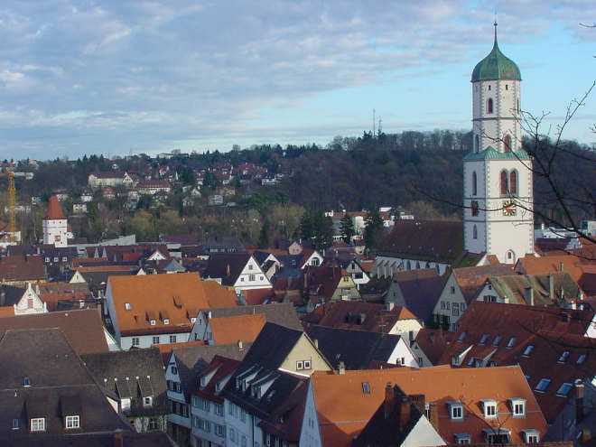
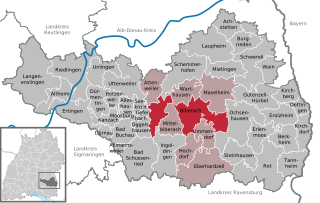
Biberach an der Riss
- city in Upper Swabia, Germany
 Hiking in Biberach an der Riss
Biberach an der Riss, located in southern Germany in the state of Baden-Württemberg, offers some great hiking opportunities that showcase the beautiful landscapes of the Swabian region. Here are some points to consider for your hiking adventure in and around Biberach:...
- Country:

- Postal Code: 88400
- Local Dialing Code: 07351
- Licence Plate Code: BC
- Coordinates: 48° 5' 53" N, 9° 47' 19" E


- GPS tracks (wikiloc): [Link]
- AboveSeaLevel: 533 м m
- Area: 72.16 sq km
- Population: 31525
- Web site: [Link]


Tannheim
- municipality in Baden-Württemberg, Germany
Tannheim is a stunning hiking destination located in the Tannheim Valley in Austria, near the border with Germany. The area is known for its picturesque landscapes, charming villages, and numerous hiking trails that cater to all levels of hikers. Here are some highlights and tips for hiking in Tannheim:...
- Country:

- Postal Code: 88459
- Local Dialing Code: 08395
- Licence Plate Code: BC
- Coordinates: 48° 0' 0" N, 10° 4' 59" E


- GPS tracks (wikiloc): [Link]
- AboveSeaLevel: 585 м m
- Area: 27.69 sq km
- Population: 2453
- Web site: [Link]


Eberhardzell
- municipality in Baden-Württemberg, Germany
Eberhardzell, located in the state of Baden-Württemberg, Germany, offers some excellent hiking opportunities. Nestled in a picturesque landscape with rolling hills, forests, and fields, the area is perfect for both casual walkers and more adventurous hikers....
- Country:

- Postal Code: 88436
- Local Dialing Code: 07358
- Licence Plate Code: BC
- Coordinates: 48° 0' 0" N, 9° 49' 0" E


- GPS tracks (wikiloc): [Link]
- AboveSeaLevel: 635 м m
- Area: 59.72 sq km
- Population: 4244
- Web site: [Link]


Altheim
- municipality in Baden-Württemberg, Germany; near Riedlingen
Altheim, a small municipality in the district of Biberach in Baden-Württemberg, Germany, is surrounded by beautiful landscapes that make for excellent hiking opportunities. The region features a mix of scenic trails, rolling hills, and picturesque countryside....
- Country:

- Postal Code: 88499
- Local Dialing Code: 07371
- Licence Plate Code: BC
- Coordinates: 48° 8' 40" N, 9° 26' 54" E


- GPS tracks (wikiloc): [Link]
- AboveSeaLevel: 541 м m
- Area: 23.74 sq km
- Population: 2135
- Web site: [Link]


Achstetten
- municipality in Baden-Württemberg, Germany
Achstetten is a small municipality located in Bavaria, Germany, surrounded by picturesque landscapes ideal for hiking enthusiasts. Although not as widely known as larger hiking destinations, it offers a range of trails that showcase the natural beauty of the region, including lush forests, rolling hills, and serene agricultural fields....
- Country:

- Postal Code: 88480
- Local Dialing Code: 07392
- Licence Plate Code: BC
- Coordinates: 48° 15' 35" N, 9° 53' 51" E


- GPS tracks (wikiloc): [Link]
- AboveSeaLevel: 503 м m
- Area: 23.38 sq km
- Population: 4382
- Web site: [Link]


Oggelshausen
- municipality in Baden-Württemberg, Germany
Oggelshausen is a charming village located in Bavaria, Germany. While it may not be as famous as some larger hiking destinations, it offers access to beautiful landscapes and trails in the surrounding area. Here are some highlights and tips for hiking in and around Oggelshausen:...
- Country:

- Postal Code: 88422
- Local Dialing Code: 07582
- Licence Plate Code: BC
- Coordinates: 48° 4' 17" N, 9° 39' 0" E


- GPS tracks (wikiloc): [Link]
- AboveSeaLevel: 594 м m
- Area: 13.12 sq km
- Population: 917
- Web site: [Link]

Bad Buchau
- town in Baden-Württemberg, Germany
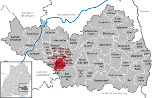
Bad Buchau, located in the Baden-Württemberg region of Germany, is a charming town known for its scenic landscapes, particularly around the Federsee Lake. This area offers a variety of hiking opportunities that cater to different skill levels and preferences....
- Country:

- Postal Code: 88422
- Local Dialing Code: 07582
- Licence Plate Code: BC
- Coordinates: 48° 3' 58" N, 9° 36' 36" E


- GPS tracks (wikiloc): [Link]
- AboveSeaLevel: 592 м m
- Area: 23.77 sq km
- Population: 3980
- Web site: [Link]


Riedlingen
- town in Baden-Württemberg, Germany
Riedlingen, a charming town in Baden-Württemberg, Germany, is situated near the banks of the Danube River. The area is known for its beautiful landscapes, historical sites, and ample opportunities for outdoor activities, including hiking. Here are some highlights and tips for hiking in and around Riedlingen:...
- Country:

- Postal Code: 88499
- Local Dialing Code: 07371
- Licence Plate Code: BC
- Coordinates: 48° 9' 19" N, 9° 28' 22" E


- GPS tracks (wikiloc): [Link]
- AboveSeaLevel: 540 м m
- Area: 64.97 sq km
- Population: 10512
- Web site: [Link]


Ummendorf
- municipality in Baden-Württemberg, Germany
Ummendorf is a charming village in Baden-Württemberg, Germany, situated near the Danube River and surrounded by picturesque landscapes that are perfect for hiking enthusiasts. Here are some key points about hiking in and around Ummendorf:...
- Country:

- Postal Code: 88444
- Local Dialing Code: 07351
- Licence Plate Code: BC
- Coordinates: 48° 3' 52" N, 9° 49' 38" E


- GPS tracks (wikiloc): [Link]
- AboveSeaLevel: 607 м m
- Area: 20.65 sq km
- Population: 4324
- Web site: [Link]

Burgrieden
- municipality in Baden-Württemberg, Germany
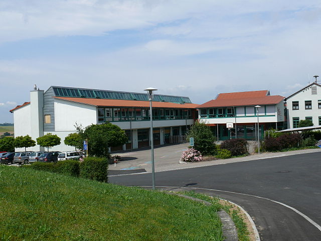
Burgrieden is a small village located in the state of Baden-Württemberg, Germany, and while it may not be as widely known for hiking as some of its neighboring areas, it still offers a lovely setting for outdoor enthusiasts. The region is characterized by picturesque landscapes, rolling hills, and a mix of forests and agricultural fields, making it a delightful place to explore on foot....
- Country:

- Postal Code: 88483
- Local Dialing Code: 07392
- Licence Plate Code: BC
- Coordinates: 48° 14' 25" N, 9° 56' 9" E


- GPS tracks (wikiloc): [Link]
- AboveSeaLevel: 503 м m
- Area: 21.87 sq km
- Population: 4000
- Web site: [Link]


Erlenmoos
- municipality in Baden-Württemberg, Germany
Erlenmoos is a beautiful area located in Germany, known for its serene landscapes and natural beauty, particularly suited for hiking enthusiasts. While specific trail information may change over time, here are some general aspects of hiking in Erlenmoos that you may find appealing:...
- Country:

- Postal Code: 88416
- Local Dialing Code: 07352
- Licence Plate Code: BC
- Coordinates: 48° 3' 47" N, 9° 58' 30" E


- GPS tracks (wikiloc): [Link]
- AboveSeaLevel: 639 м m
- Area: 24.26 sq km
- Population: 1687
- Web site: [Link]


Kanzach
- municipality in Baden-Württemberg, Germany
Kanzach, located in Germany, is situated near the breathtaking landscapes of the Swabian Jura and offers various hiking opportunities for enthusiasts of all levels. While small, the region is known for its scenic beauty and charming rural surroundings....
- Country:

- Postal Code: 88422
- Local Dialing Code: 07582
- Licence Plate Code: BC
- Coordinates: 48° 4' 36" N, 9° 33' 32" E


- GPS tracks (wikiloc): [Link]
- AboveSeaLevel: 585 м m
- Area: 11.14 sq km
- Population: 495
- Web site: [Link]


Dürmentingen
- municipality in Baden-Württemberg, Germany
Dürmentingen, a small town in the state of Baden-Württemberg, Germany, is situated near the scenic Upper Swabia region, which offers a variety of beautiful landscapes ideal for hiking enthusiasts. Here are some insights about hiking in and around Dürmentingen:...
- Country:

- Postal Code: 88525
- Local Dialing Code: 07371
- Licence Plate Code: BC
- Coordinates: 48° 7' 0" N, 9° 32' 0" E


- GPS tracks (wikiloc): [Link]
- AboveSeaLevel: 575 м m
- Area: 24.09 sq km
- Population: 2602
- Web site: [Link]


Alleshausen
- municipality in Baden-Württemberg, Germany
Alleshausen, a small village in the southern part of Germany, offers a picturesque setting for hiking enthusiasts. While it might not be as well-known as larger hiking destinations, the area around Alleshausen provides a variety of trails and natural beauty that make it a great spot for both beginners and experienced hikers....
- Country:

- Postal Code: 88422
- Local Dialing Code: 07582
- Licence Plate Code: BC
- Coordinates: 48° 6' 0" N, 9° 37' 0" E


- GPS tracks (wikiloc): [Link]
- AboveSeaLevel: 585 м m
- Area: 11.31 sq km
- Population: 475
- Web site: [Link]


Dettingen an der Iller
- municipality in Baden-Württemberg, Germany
 Hiking in Dettingen an der Iller
Dettingen an der Iller is a charming village located in Bavaria, Germany, which offers picturesque landscapes and great opportunities for hiking enthusiasts. Surrounded by the beautiful Allgäu region, hikers can enjoy a variety of trails ranging from easy walks to more challenging hikes....
- Country:

- Postal Code: 88451
- Local Dialing Code: 07354
- Licence Plate Code: BC
- Coordinates: 48° 6' 32" N, 10° 6' 43" E


- GPS tracks (wikiloc): [Link]
- AboveSeaLevel: 542 м m
- Area: 11.14 sq km
- Population: 2419
- Web site: [Link]


Ingoldingen
- municipality in Baden-Württemberg, Germany
Ingoldingen, a picturesque village located in Baden-Württemberg, Germany, offers a serene environment for hiking enthusiasts. The region is characterized by its beautiful landscapes, wooded areas, and rolling hills, making it ideal for a variety of hiking experiences....
- Country:

- Postal Code: 88456
- Local Dialing Code: 07355
- Licence Plate Code: BC
- Coordinates: 48° 1' 32" N, 9° 44' 31" E


- GPS tracks (wikiloc): [Link]
- AboveSeaLevel: 560 м m
- Area: 44.24 sq km
- Population: 2926
- Web site: [Link]


Allmannsweiler
- municipality in Baden-Württemberg, Germany
Allmannsweiler, located in the southern part of Germany near Lake Constance, offers a beautiful setting for hiking enthusiasts. The region is characterized by rolling hills, lush greenery, and scenic views of the lake and surrounding landscapes. Here are some highlights and tips for hiking in Allmannsweiler:...
- Country:

- Postal Code: 88348
- Local Dialing Code: 07582
- Licence Plate Code: BC
- Coordinates: 48° 1' 42" N, 9° 35' 37" E


- GPS tracks (wikiloc): [Link]
- AboveSeaLevel: 624 м m
- Area: 4.10 sq km
- Population: 303
- Web site: [Link]


Uttenweiler
- municipality in Baden-Württemberg, Germany
Uttenweiler, located in the Baden-Württemberg region of Germany, offers a tranquil setting for hiking enthusiasts. Nestled in the picturesque countryside, the area is characterized by rolling hills, lush forests, and charming farmland. While specific trails can vary, here are some general tips and highlights for hiking in and around Uttenweiler:...
- Country:

- Postal Code: 88524
- Local Dialing Code: 07374
- Licence Plate Code: BC
- Coordinates: 48° 9' 0" N, 9° 37' 0" E


- GPS tracks (wikiloc): [Link]
- AboveSeaLevel: 595 м m
- Area: 49.77 sq km
- Population: 3502
- Web site: [Link]


Betzenweiler
- municipality in Baden-Württemberg, Germany
Betzenweiler is a picturesque village located in the Swabian Jura region of Germany. It offers a variety of hiking opportunities for outdoor enthusiasts. Here are some key points to consider when planning a hiking trip to Betzenweiler:...
- Country:

- Postal Code: 88422
- Local Dialing Code: 07374
- Licence Plate Code: BC
- Coordinates: 48° 7' 0" N, 9° 34' 0" E


- GPS tracks (wikiloc): [Link]
- AboveSeaLevel: 565 м m
- Area: 9.70 sq km
- Population: 759
- Web site: [Link]

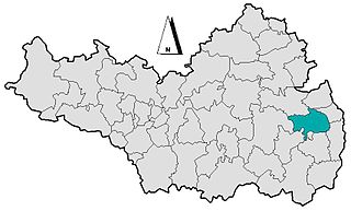
Erolzheim
- municipality in Baden-Württemberg, Germany
Erolzheim is a picturesque village located in the state of Baden-Württemberg in Germany. While not as widely known as some larger hiking destinations, it offers a charming landscape suitable for hiking and outdoor activities....
- Country:

- Postal Code: 88453
- Local Dialing Code: 07354
- Licence Plate Code: BC
- Coordinates: 48° 5' 24" N, 10° 4' 23" E


- GPS tracks (wikiloc): [Link]
- AboveSeaLevel: 552 м m
- Area: 26.31 sq km
- Population: 3203
- Web site: [Link]
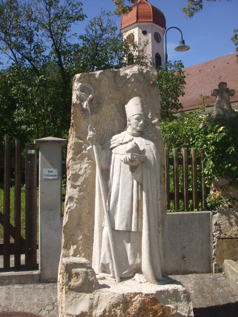
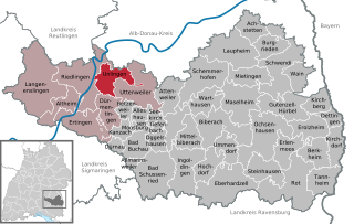
Unlingen
- municipality in Baden-Württemberg, Germany
Unlingen is a charming village located in the Baden-Württemberg region of Germany. While it may not be as widely known as other hiking destinations, it offers some beautiful trails and scenic landscapes for outdoor enthusiasts. Here are a few highlights of hiking in and around Unlingen:...
- Country:

- Postal Code: 88527
- Local Dialing Code: 07371
- Licence Plate Code: BC
- Coordinates: 48° 10' 2" N, 9° 31' 20" E


- GPS tracks (wikiloc): [Link]
- AboveSeaLevel: 535 м m
- Area: 26.87 sq km
- Population: 2413
- Web site: [Link]


Kirchberg an der Iller
- municipality in Baden-Württemberg, Germany
 Hiking in Kirchberg an der Iller
Kirchberg an der Iller, located in Bavaria, Germany, is surrounded by beautiful landscapes and offers several picturesque hiking trails that cater to various skill levels. Here are some highlights about hiking in the area:...
- Country:

- Postal Code: 88486
- Local Dialing Code: 07354
- Licence Plate Code: BC
- Coordinates: 48° 8' 0" N, 10° 5' 0" E


- GPS tracks (wikiloc): [Link]
- AboveSeaLevel: 537 м m
- Area: 18.64 sq km
- Population: 2044
- Web site: [Link]


Kirchdorf an der Iller
- municipality in Baden-Württemberg, Germany
 Hiking in Kirchdorf an der Iller
Kirchdorf an der Iller, located in the scenic Allgäu region of Bavaria, Germany, offers a variety of hiking opportunities amidst beautiful landscapes. Here are some highlights and tips for hiking in and around Kirchdorf an der Iller:...
- Country:

- Postal Code: 88457
- Local Dialing Code: 07354
- Licence Plate Code: BC
- Coordinates: 48° 4' 30" N, 10° 7' 46" E


- GPS tracks (wikiloc): [Link]
- AboveSeaLevel: 551 м m
- Area: 22.86 sq km
- Population: 3478
- Web site: [Link]
Attenweiler
- municipality in Baden-Württemberg, Germany
Attenweiler is a small municipality located in the state of Baden-Württemberg, Germany. While it may not be as well-known as some major hiking destinations, the surrounding countryside and regional trails offer beautiful landscapes and a peaceful atmosphere for hikers....
- Country:

- Postal Code: 88448
- Local Dialing Code: 07357
- Licence Plate Code: BC
- Coordinates: 48° 8' 0" N, 9° 42' 0" E


- GPS tracks (wikiloc): [Link]
- AboveSeaLevel: 605 м m
- Area: 27.21 sq km
- Population: 1910
- Web site: [Link]


Bad Schussenried
- town in Baden-Württemberg, Germany
Bad Schussenried, located in the southwestern part of Germany, is a charming town in the state of Baden-Württemberg. It's known for its picturesque landscapes, rich history, and well-marked hiking trails, making it a great destination for hikers of all levels....
- Country:

- Postal Code: 88427
- Local Dialing Code: 07583
- Licence Plate Code: BC
- Coordinates: 48° 0' 24" N, 9° 39' 31" E


- GPS tracks (wikiloc): [Link]
- AboveSeaLevel: 570 м m
- Area: 55.02 sq km
- Population: 8668
- Web site: [Link]


Ochsenhausen
- town in Baden-Württemberg, Germany
Ochsenhausen, a charming town located in the southwest of Germany in the state of Baden-Württemberg, offers a variety of hiking opportunities that allow you to explore the picturesque landscapes of the region. The area is characterized by lush forests, rolling hills, and scenic countryside, which makes it perfect for outdoor enthusiasts....
- Country:

- Postal Code: 88416
- Local Dialing Code: 07352
- Licence Plate Code: BC
- Coordinates: 48° 4' 20" N, 9° 56' 53" E


- GPS tracks (wikiloc): [Link]
- AboveSeaLevel: 613 м m
- Area: 59.96 sq km
- Population: 8805
- Web site: [Link]


Rot an der Rot
- municipality in Baden-Württemberg, Germany
Rot an der Rot, located in the Baden-Württemberg region of Germany, is a beautiful area that offers various hiking opportunities amidst scenic landscapes. The region features rolling hills, picturesque villages, and wooded areas that provide a peaceful backdrop for hikers....
- Country:

- Postal Code: 88430
- Local Dialing Code: 08395
- Licence Plate Code: BC
- Coordinates: 48° 1' 0" N, 10° 2' 0" E


- GPS tracks (wikiloc): [Link]
- AboveSeaLevel: 595 м m
- Area: 63.44 sq km
- Population: 4424
- Web site: [Link]
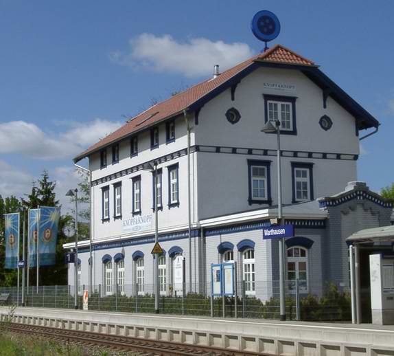
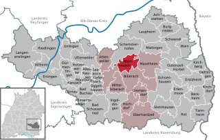
Warthausen
- municipality in Baden-Württemberg, Germany
Warthausen, located in the state of Baden-Württemberg, Germany, offers beautiful hiking opportunities that allow you to explore the picturesque landscapes of the region. Here are some highlights about hiking in and around Warthausen:...
- Country:

- Postal Code: 88447
- Local Dialing Code: 07351
- Licence Plate Code: BC
- Coordinates: 48° 7' 43" N, 9° 47' 51" E


- GPS tracks (wikiloc): [Link]
- AboveSeaLevel: 590 м m
- Area: 26 sq km
- Population: 5303
- Web site: [Link]
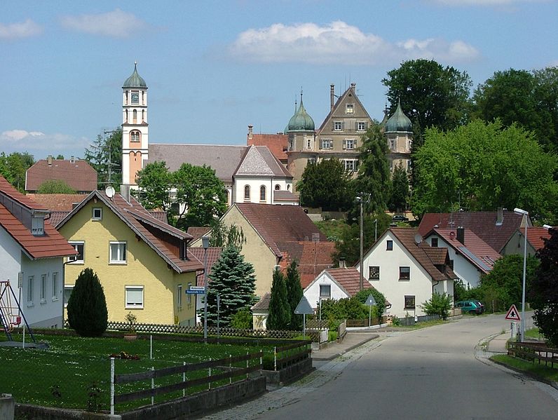

Gutenzell-Hürbel
- municipality in Baden-Württemberg, Germany
Gutenzell-Hürbel is a small municipality located in the state of Baden-Württemberg, Germany. It is situated in a picturesque part of the country, surrounded by lush countryside and natural beauty, making it a great destination for hiking enthusiasts....
- Country:

- Postal Code: 88484
- Local Dialing Code: 07352
- Licence Plate Code: BC
- Coordinates: 48° 6' 48" N, 9° 59' 51" E


- GPS tracks (wikiloc): [Link]
- AboveSeaLevel: 588 м m
- Area: 37.86 sq km
- Population: 1829
- Web site: [Link]


Steinhausen an der Rottum
- municipality in Baden-Württemberg, Germany
 Hiking in Steinhausen an der Rottum
Steinhausen an der Rottum is a charming village located in the Baden-Württemberg region of Germany. It's surrounded by picturesque landscapes, making it a great spot for hiking enthusiasts. Here are some highlights and tips for hiking in and around Steinhausen an der Rottum:...
- Country:

- Postal Code: 88416
- Local Dialing Code: 07352
- Licence Plate Code: BC
- Coordinates: 48° 1' 27" N, 9° 57' 21" E


- GPS tracks (wikiloc): [Link]
- AboveSeaLevel: 672 м m
- Area: 29.88 sq km
- Population: 2092
- Web site: [Link]


Hochdorf
- municipality in Baden-Württemberg, Germany
Hochdorf, located in the district of Biberach in Baden-Württemberg, Germany, offers a peaceful and scenic environment for hikers. The region is characterized by its beautiful landscapes, rolling hills, and picturesque views, making it an ideal destination for outdoor enthusiasts....
- Country:

- Postal Code: 88454
- Local Dialing Code: 07355
- Licence Plate Code: BC
- Coordinates: 48° 2' 0" N, 9° 47' 0" E


- GPS tracks (wikiloc): [Link]
- AboveSeaLevel: 574 м m
- Area: 23.77 sq km
- Population: 2345
- Web site: [Link]


Seekirch
- municipality in Baden-Württemberg, Germany
Seekirch, located in Germany, is a beautiful area that offers various hiking opportunities. The region is known for its picturesque landscapes, featuring rolling hills, forested areas, and serene lakes, making it a great destination for outdoor enthusiasts....
- Country:

- Postal Code: 88422
- Local Dialing Code: 07582
- Licence Plate Code: BC
- Coordinates: 48° 6' 21" N, 9° 38' 30" E


- GPS tracks (wikiloc): [Link]
- AboveSeaLevel: 595 м m
- Area: 5.77 sq km
- Population: 296
- Web site: [Link]

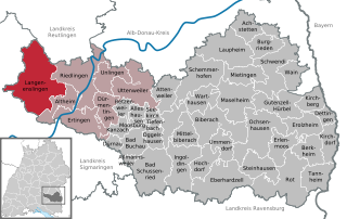
Langenenslingen
- municipality in Baden-Württemberg, Germany
Langenenslingen is a charming village located in the Baden-Württemberg region of Germany. Surrounded by picturesque landscapes, it offers a great setting for hiking enthusiasts. Here are some highlights and tips for hiking in and around Langenenslingen:...
- Country:

- Postal Code: 88515
- Local Dialing Code: 07376
- Licence Plate Code: BC
- Coordinates: 48° 8' 52" N, 9° 22' 45" E


- GPS tracks (wikiloc): [Link]
- AboveSeaLevel: 571 м m
- Area: 88.40 sq km
- Population: 3484
- Web site: [Link]

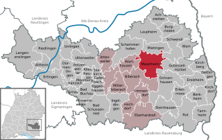
Maselheim
- municipality in Baden-Württemberg, Germany
Maselheim is a small town in Germany, located in the state of Baden-Württemberg. While it may not be as widely recognized as some larger hiking destinations, it offers opportunities for hiking and outdoor activities in the surrounding areas, particularly in the beautiful landscapes of the Swabian Jura and the nearby countryside....
- Country:

- Postal Code: 88437
- Local Dialing Code: 07351
- Licence Plate Code: BC
- Coordinates: 48° 8' 0" N, 9° 53' 0" E


- GPS tracks (wikiloc): [Link]
- AboveSeaLevel: 544 м m
- Area: 47.02 sq km
- Population: 4437
- Web site: [Link]

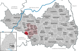
Dürnau
- municipality in Biberach district, Baden-Württemberg, Germany
Dürnau, located in the Biberach district of Baden-Württemberg, Germany, is surrounded by beautiful countryside, making it an appealing location for hiking enthusiasts. The area offers various trails that cater to different skill levels, from easy strolls to more challenging routes....
- Country:

- Postal Code: 88422
- Local Dialing Code: 07582
- Licence Plate Code: BC
- Coordinates: 48° 3' 37" N, 9° 33' 17" E


- GPS tracks (wikiloc): [Link]
- AboveSeaLevel: 578 м m
- Area: 7.28 sq km
- Population: 415
- Web site: [Link]


Schemmerhofen
- municipality in Baden-Württemberg, Germany
Schemmerhofen is a charming municipality located in the state of Baden-Württemberg, Germany. While it is not as widely recognized for hiking as other regions in Germany, it does offer opportunities for outdoor enthusiasts to explore the beautiful countryside....
- Country:

- Postal Code: 88433
- Local Dialing Code: 07356
- Licence Plate Code: BC
- Coordinates: 48° 10' 25" N, 9° 47' 22" E


- GPS tracks (wikiloc): [Link]
- AboveSeaLevel: 520 м m
- Area: 50.18 sq km
- Population: 8032
- Web site: [Link]


Ertingen
- municipality in Baden-Württemberg, Germany
Ertingen is a charming town in Germany that offers beautiful countryside and opportunities for hiking enthusiasts. While it may not be as famous as some larger hiking destinations, its local trails can provide a pleasant experience for those looking to explore the great outdoors. Here are some tips and information about hiking in and around Ertingen:...
- Country:

- Postal Code: 88521
- Local Dialing Code: 07371
- Licence Plate Code: BC
- Coordinates: 48° 6' 0" N, 9° 28' 0" E


- GPS tracks (wikiloc): [Link]
- AboveSeaLevel: 572 м m
- Area: 37.74 sq km
- Population: 5403
- Web site: [Link]


Mietingen
- municipality in Baden-Württemberg, Germany
Mietingen is a small municipality located in Baden-Württemberg, Germany, known for its picturesque landscapes and serene countryside. While it may not be a major hiking destination compared to more mountainous regions, it offers several opportunities for outdoor enthusiasts to explore the natural beauty of the area. Here are some general points to consider when looking to hike in and around Mietingen:...
- Country:

- Postal Code: 88487
- Local Dialing Code: 07392; 07356; 07353
- Licence Plate Code: BC
- Coordinates: 48° 11' 0" N, 9° 54' 0" E


- GPS tracks (wikiloc): [Link]
- AboveSeaLevel: 517 м m
- Area: 26.34 sq km
- Population: 4404
- Web site: [Link]


Schwendi
- municipality in Baden-Württemberg, Germany
Schwendi is a picturesque town located in the state of Baden-Württemberg, Germany. Although it may not be as widely known as some larger hiking destinations, the surrounding area offers beautiful landscapes and numerous trails that are perfect for hikers of all levels. Here are some highlights:...
- Country:

- Postal Code: 88477
- Local Dialing Code: 07353
- Licence Plate Code: BC
- Coordinates: 48° 10' 32" N, 9° 58' 33" E


- GPS tracks (wikiloc): [Link]
- AboveSeaLevel: 544 м m
- Area: 49.23 sq km
- Population: 6339
- Web site: [Link]


Mittelbiberach
- municipality in Baden-Württemberg, Germany
Mittelbiberach is a charming town located in the state of Baden-Württemberg, Germany. It offers a scenic environment for hiking enthusiasts, with lush forests, rolling hills, and well-marked trails that cater to various skill levels....
- Country:

- Postal Code: 88441
- Local Dialing Code: 07351
- Licence Plate Code: BC
- Coordinates: 48° 5' 0" N, 9° 45' 0" E


- GPS tracks (wikiloc): [Link]
- AboveSeaLevel: 577 м m
- Area: 23.68 sq km
- Population: 4163
- Web site: [Link]


Moosburg
- municipality in Baden-Württemberg, Germany
Moosburg, situated in Baden-Württemberg, is a charming location that provides some wonderful opportunities for hiking enthusiasts. While Moosburg itself may not be as widely known as other hiking destinations in the region, it is surrounded by picturesque landscapes, forests, and rolling hills that are typical of Baden-Württemberg....
- Country:

- Postal Code: 88422
- Local Dialing Code: 07582
- Licence Plate Code: BC
- Coordinates: 48° 5' 20" N, 9° 35' 49" E


- GPS tracks (wikiloc): [Link]
- AboveSeaLevel: 590 м m
- Area: 1.86 sq km
- Population: 210
- Web site: [Link]


Tiefenbach
- municipality in Baden-Württemberg, Germany
Tiefenbach in Biberach, located in Germany, offers beautiful hiking opportunities amidst scenic views and the charm of the Swabian countryside. The area is characterized by gentle hills, lush forests, and picturesque landscapes that make for enjoyable and diverse hiking experiences....
- Country:

- Postal Code: 88422
- Local Dialing Code: 07582
- Licence Plate Code: BC
- Coordinates: 48° 5' 16" N, 9° 39' 7" E


- GPS tracks (wikiloc): [Link]
- AboveSeaLevel: 588 м m
- Area: 6.95 sq km
- Population: 513
- Web site: [Link]
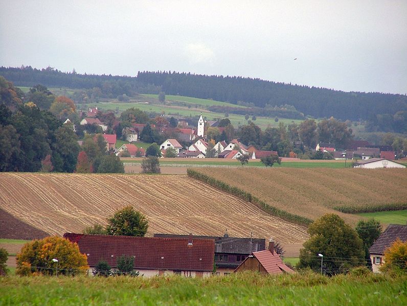

Wain
- municipality in Baden-Württemberg, Germany
Wain, located in the state of Baden-Württemberg in Germany, offers a variety of outdoor opportunities for hiking enthusiasts. This region, characterized by lush landscapes and a mix of forested areas and agricultural fields, provides scenic views and a peaceful hiking experience....
- Country:

- Postal Code: 88489
- Local Dialing Code: 07353
- Licence Plate Code: BC
- Coordinates: 48° 11' 17" N, 10° 1' 13" E


- GPS tracks (wikiloc): [Link]
- AboveSeaLevel: 530 м m
- Area: 20.14 sq km
- Population: 1573
- Web site: [Link]


Laupheim
- town in Baden-Württemberg, Germany
Laupheim is located in the region of Baden-Württemberg, Germany, and is surrounded by beautiful natural landscapes that can provide a great experience for hikers. While Laupheim itself is a small town, it offers access to various trails and outdoor activities in the surrounding areas, including the Swabian Jura and other scenic routes....
- Country:

- Postal Code: 88471
- Local Dialing Code: 07392
- Licence Plate Code: BC
- Coordinates: 48° 13' 44" N, 9° 52' 47" E


- GPS tracks (wikiloc): [Link]
- AboveSeaLevel: 528 м m
- Area: 61.78 sq km
- Population: 20655
- Web site: [Link]


Berkheim
- municipality in Baden-Württemberg, Germany
Berkheim, located in Germany, is a charming little village that offers access to beautiful hiking trails in the surrounding areas, including the scenic landscapes of the Swabian Jura. While the village itself may not be a well-known hiking destination, it serves as a gateway for exploring nature....
- Country:

- Postal Code: 88450
- Local Dialing Code: 08395; 07354
- Licence Plate Code: BC
- Coordinates: 48° 3' 0" N, 10° 5' 0" E


- GPS tracks (wikiloc): [Link]
- AboveSeaLevel: 563 м m
- Area: 25.02 sq km
- Population: 2655
- Web site: [Link]
Shares border with regions:


Unterallgäu
- district in Bavaria, Germany
Unterallgäu is a beautiful region in Bavaria, Germany, known for its picturesque landscapes, charming villages, and extensive hiking trails. Located in the Allgäu, it's characterized by rolling hills, lush meadows, and stunning views of the Alpine foothills. Here are some highlights if you're considering hiking in Unterallgäu:...
- Country:

- Capital: Mindelheim
- Licence Plate Code: MN
- Coordinates: 48° 0' 0" N, 10° 30' 0" E


- GPS tracks (wikiloc): [Link]
- Area: 1230.24 sq km
- Population: 115770
- Web site: [Link]

Neu-Ulm
- district in Bavaria, Germany
Neu-Ulm, located in Bavaria, Germany, offers several options for hiking enthusiasts. The region is known for its picturesque landscapes, combining rivers, hills, and forests. Here are some key points about hiking in Neu-Ulm:...
- Country:

- Capital: Neu-Ulm
- Licence Plate Code: NU; ILL
- Coordinates: 48° 20' 0" N, 10° 10' 0" E


- GPS tracks (wikiloc): [Link]
- AboveSeaLevel: 474 м m
- Area: 515.00 sq km
- Population: 140666
- Web site: [Link]


Memmingen
- town in Bavaria, Germany
Memmingen, located in Bavaria, Germany, is surrounded by picturesque landscapes and offers various hiking opportunities. Here’s an overview of what you can expect when hiking in and around Memmingen:...
- Country:

- Postal Code: 87700
- Local Dialing Code: 08331
- Licence Plate Code: MM
- Coordinates: 47° 59' 16" N, 10° 10' 52" E


- GPS tracks (wikiloc): [Link]
- AboveSeaLevel: 601 м m
- Area: 70 sq km
- Population: 42841
- Web site: [Link]


Reutlingen
- district of Baden-Württemberg, Germany
Reutlingen district, located in the southwest of Germany in the state of Baden-Württemberg, offers a variety of hiking experiences suitable for different skill levels, surrounded by beautiful landscapes, charming villages, and historical sites. Here are some highlights and tips for hiking in this area:...
- Country:

- Capital: Reutlingen
- Licence Plate Code: RT
- Coordinates: 48° 30' 0" N, 9° 12' 36" E


- GPS tracks (wikiloc): [Link]
- AboveSeaLevel: 661 м m
- Area: 1.09 sq km
- Population: 274691
- Web site: [Link]
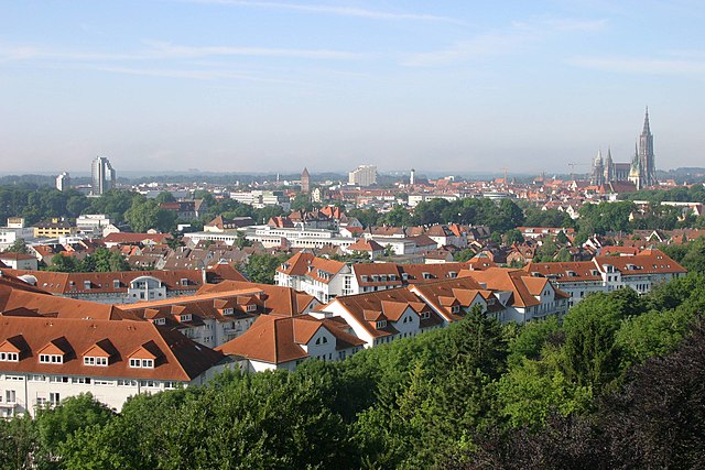
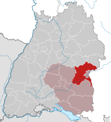
Alb-Donau-Kreis
- district in Baden-Württemberg, Germany
The Alb-Donau-Kreis is a beautiful district located in Baden-Württemberg, Germany, known for its diverse landscapes, rich nature, and historical sites. Hiking in this area offers a range of trails suitable for all levels of hikers, from beginners to more experienced trekkers. Here are some highlights and tips for hiking in Alb-Donau-Kreis:...
- Country:

- Capital: Ulm
- Licence Plate Code: UL
- Coordinates: 48° 24' 0" N, 9° 51' 0" E


- GPS tracks (wikiloc): [Link]
- AboveSeaLevel: 670 м m
- Area: 1358.67 sq km
- Population: 192104
- Web site: [Link]


Landkreis Ravensburg
- district of Baden-Württemberg, Germany
 Hiking in Landkreis Ravensburg
Ravensburg district, located in the state of Baden-Württemberg in Germany, offers a diverse range of hiking opportunities for both casual walkers and experienced hikers. The region is characterized by its beautiful landscapes, rolling hills, and picturesque villages. Here are some highlights and tips for hiking in Ravensburg:...
- Country:

- Capital: Ravensburg
- Licence Plate Code: RV
- Coordinates: 47° 49' 12" N, 9° 48' 0" E


- GPS tracks (wikiloc): [Link]
- AboveSeaLevel: 698 м m
- Area: 1631.81 sq km
- Population: 272425
- Web site: [Link]
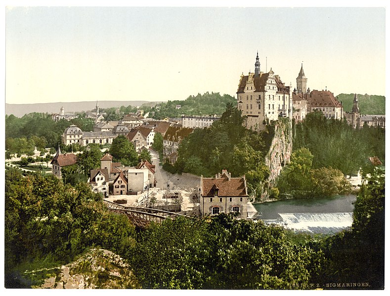

Landkreis Sigmaringen
- district of Baden-Württemberg, Germany
 Hiking in Landkreis Sigmaringen
Sigmaringen, located in the southwestern part of Germany in the state of Baden-Württemberg, offers a beautiful and diverse landscape for hiking enthusiasts. The region is characterized by its stunning natural scenery, which includes rolling hills, dense forests, and picturesque valleys along the Danube River. Here are some highlights for hiking in the Sigmaringen district:...
- Country:

- Capital: Sigmaringen
- Licence Plate Code: SIG
- Coordinates: 48° 4' 48" N, 9° 10' 12" E


- GPS tracks (wikiloc): [Link]
- AboveSeaLevel: 626 м m
- Area: 1204.36 sq km
- Population: 127272
- Web site: [Link]
