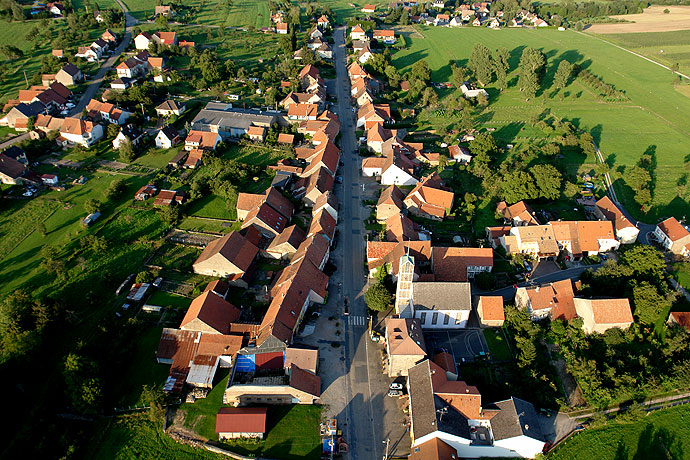
Rexingen (Rexingen)

- commune in Bas-Rhin, France
- Country:

- Postal Code: 67320
- Coordinates: 48° 54' 8" N, 7° 10' 53" E


- GPS tracks (wikiloc): [Link]
- Area: 2.32 sq km
- Population: 205
- Wikipedia en: wiki(en)
- Wikipedia: wiki(fr)
- Wikidata storage: Wikidata: Q21364
- Wikipedia Commons Category: [Link]
- Freebase ID: [/m/03m9bbn]
- Freebase ID: [/m/03m9bbn]
- GeoNames ID: Alt: [6618455]
- GeoNames ID: Alt: [6618455]
- SIREN number: [216703967]
- SIREN number: [216703967]
- BnF ID: [15271538z]
- BnF ID: [15271538z]
- VIAF ID: Alt: [140139423]
- VIAF ID: Alt: [140139423]
- INSEE municipality code: 67396
- INSEE municipality code: 67396
Shares border with regions:
Bettwiller
- commune in Bas-Rhin, France
- Country:
- Postal Code: 67320
- Coordinates: 48° 53' 11" N, 7° 10' 45" E
- GPS tracks (wikiloc): [Link]
- Area: 4.06 sq km
- Population: 309

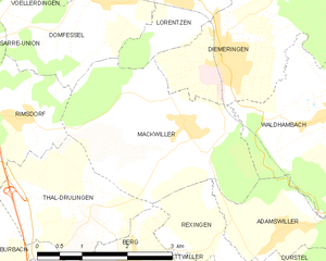
Mackwiller
- commune in Bas-Rhin, France
- Country:
- Postal Code: 67430
- Coordinates: 48° 55' 34" N, 7° 10' 31" E
- GPS tracks (wikiloc): [Link]
- Area: 9.02 sq km
- Population: 573
- Web site: [Link]
Thal-Drulingen
- commune in Bas-Rhin, France
- Country:
- Postal Code: 67320
- Coordinates: 48° 54' 36" N, 7° 8' 44" E
- GPS tracks (wikiloc): [Link]
- Area: 5.25 sq km
- Population: 181


Berg
- commune in Bas-Rhin, France
- Country:
- Postal Code: 67320
- Coordinates: 48° 53' 50" N, 7° 9' 22" E
- GPS tracks (wikiloc): [Link]
- Area: 7.72 sq km
- Population: 374
- Web site: [Link]

Adamswiller
- commune in Bas-Rhin, France
- Country:
- Postal Code: 67320
- Coordinates: 48° 54' 17" N, 7° 12' 10" E
- GPS tracks (wikiloc): [Link]
- Area: 3.4 sq km
- Population: 378
Durstel
- commune in Bas-Rhin, France
- Country:
- Postal Code: 67320
- Coordinates: 48° 53' 30" N, 7° 11' 50" E
- GPS tracks (wikiloc): [Link]
- Area: 4.76 sq km
- Population: 400