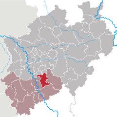
Rhein-Berg District (Rheinisch-Bergischer Kreis)
- district in North Rhine-Westphalia, Germany
The Rheinisch-Bergischer Kreis is a beautiful region located in North Rhine-Westphalia, Germany, known for its diverse landscapes, picturesque villages, and extensive network of hiking trails. Here are some key highlights and tips regarding hiking in this area:
Hiking Trails
-
Sauerland Trail: This is a section of the larger hiking network and provides stunning views of the surrounding hills and forests. The trails vary in difficulty, making them suitable for both beginners and experienced hikers.
-
Bergischer Weg: This long-distance trail runs through the Bergisches Land region, including the Rheinisch-Bergischer Kreis. It is about 250 kilometers and consists of several stages, showcasing the area's natural beauty, historical landmarks, and charming towns.
-
Local Trails: There are many local hiking routes, often marked and maintained by local hiking clubs. These can range from short loops around villages to more challenging routes that traverse the hilly terrain.
Landscape and Nature
- Diverse Ecosystems: The region features a mix of forests, meadows, and hills, with the Wupper River adding to the scenic beauty. Hikers can enjoy a variety of flora and fauna, particularly in the nature reserves.
- Panoramic Views: Due to the hilly terrain, many trails offer excellent viewpoints where you can see the rolling hills and valleys of the Bergisches Land.
Safety and Preparation
- Weather: The weather can change quickly, so it's important to check forecasts and dress in layers. Waterproof gear is advisable, especially in the rainy season.
- Trail Markings: Most trails are well-marked with signs, but it's a good idea to bring a map or use a GPS app, particularly on less-traveled paths.
- Water and Snacks: Carry enough water and snacks, especially on longer hikes, as facilities may be limited on the trails.
Facilities and Accessibility
- Public Transport: The region is well-connected by public transport, making it easy to access various trailheads.
- Accommodation: There are numerous options for accommodation, from hotels and guesthouses to campsites, catering to different budgets.
Local Culture
- Culinary Delights: After a long hike, you can indulge in local cuisine. Try traditional dishes in nearby towns, and sample local beers and wines.
- Cultural Sites: Incorporate visits to historical sites like castles and museums into your hiking itinerary to experience the rich cultural heritage of the region.
Overall, hiking in the Rheinisch-Bergischer Kreis offers a mix of natural beauty, cultural experiences, and well-maintained trails, making it a great destination for hikers of all skill levels. Whether you're looking for a leisurely stroll or an adventurous trek, you'll find plenty to enjoy in this scenic region.
- Country:

- Licence Plate Code: GL
- Coordinates: 51° 1' 0" N, 7° 12' 0" E


- GPS tracks (wikiloc): [Link]
- AboveSeaLevel: 235 м m
- Area: 438 sq km
- Web site: https://www.rbk-direkt.de/
- Wikipedia en: wiki(en)
- Wikipedia: wiki(de)
- Wikidata storage: Wikidata: Q6295
- Wikipedia Commons Gallery: [Link]
- Wikipedia Commons Category: [Link]
- Wikipedia Commons Maps Category: [Link]
- Freebase ID: [/m/019scq]
- GeoNames ID: Alt: [3247446]
- VIAF ID: Alt: [125601684]
- OSM relation ID: [62343]
- GND ID: Alt: [4049766-5]
- archINFORM location ID: [2585]
- Library of Congress authority ID: Alt: [n88277030]
- TGN ID: [7077174]
- National Library of Israel ID: [001022851]
- NUTS code: [DEA2B]
- German district key: 05378
Shares border with regions:


Cologne
- city in North Rhine-Westphalia, Germany
Hiking around Cologne offers a diverse range of outdoor experiences, combining beautiful landscapes, historical sites, and scenic views. While the city itself is urban, there are several excellent hiking options nearby. Here are some highlights:...
- Country:

- Postal Code: 51147; 51145; 51143; 51109; 51107; 51105; 51103; 51069; 51067; 51065; 51063; 51061; 50999; 50997; 50996; 50969; 50968; 50939; 50937; 50935; 50931; 50859; 50858; 50833; 50829; 50827; 50825; 50823; 50739; 50737; 50735; 50733; 50767; 50765; 50679; 50678; 50676; 50677; 50674; 50672; 50670; 50668; 50667; 51149
- Local Dialing Code: 2203; 2236; 2234; 2233; 2232; 221
- Licence Plate Code: K
- Coordinates: 50° 56' 32" N, 6° 57' 28" E


- GPS tracks (wikiloc): [Link]
- AboveSeaLevel: 52 м m
- Area: 405.01 sq km
- Population: 1080394
- Web site: [Link]


Mettmann
- district in North Rhine-Westphalia, Germany
Mettmann, located in North Rhine-Westphalia, Germany, offers a variety of hiking opportunities that cater to different skill levels and preferences. The region features picturesque landscapes, including forests, hills, and scenic views, making it ideal for outdoor activities....
- Country:

- Licence Plate Code: ME
- Coordinates: 51° 15' 0" N, 7° 0' 0" E


- GPS tracks (wikiloc): [Link]
- AboveSeaLevel: 143 м m
- Web site: [Link]


Rhein-Sieg District
- German district of North Rhine-Westphalia
Rhein-Sieg-Kreis, located in North Rhine-Westphalia, Germany, offers a variety of hiking opportunities for both beginners and experienced hikers. This diverse region features beautiful landscapes, rolling hills, forests, rivers, and charming towns, making it an excellent destination for outdoor enthusiasts. Here are some highlights and tips for hiking in this area:...
- Country:

- Licence Plate Code: SU
- Coordinates: 50° 45' 0" N, 7° 15' 0" E


- GPS tracks (wikiloc): [Link]
- AboveSeaLevel: 170 м m
- Area: 1153.2 sq km
- Web site: [Link]


