
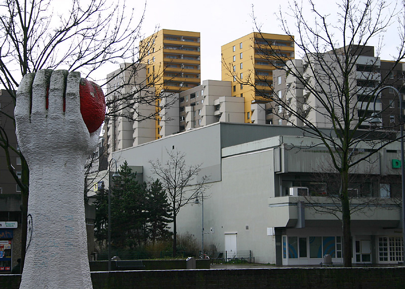
Cologne (Köln)


- city in North Rhine-Westphalia, Germany
 Hiking in Cologne
Hiking around Cologne offers a diverse range of outdoor experiences, combining beautiful landscapes, historical sites, and scenic views. While the city itself is urban, there are several excellent hiking options nearby. Here are some highlights:
1.
- Rhein-Energie-Stadion and Stadtwald: This urban park offers pleasant walking trails where you can enjoy nature without leaving the city.
- Poller Wiesen: Located by the Rhine River, this area provides scenic paths and picnic spots with beautiful views of the river and the Cologne skyline.
2.
- Wahner Heide Nature Reserve: Just outside of Cologne, this area is known for its heathland, forests, and diverse wildlife. It features several marked trails of varying lengths and difficulty levels.
- Zülpicher Aue: A natural area along the Rhine, perfect for hiking and spotting wildlife, with trails that often lead to the riverside.
3.
- This long-distance trail runs along the Rhine River from Bonn to Wiesbaden, offering breath-taking views and charming villages. The section near Cologne features hilly terrain and beautiful vineyards, making it ideal for a full-day hike or shorter excursions.
4.
- Although a bit further away from Cologne (about an hour’s drive), this national park is an excellent destination for hiking enthusiasts. It offers extensive trails through forests, hills, and along lakes, catering to various skill levels.
5.
- Consider joining local hiking clubs or groups, which often organize regular hikes within the region. This can be a great way to meet fellow hiking enthusiasts and explore trails you might not have discovered on your own.
Hiking Tips for Cologne:
- Best Time to Hike: Spring and autumn offer the best weather conditions, while summer can be hot, and winter can bring muddy trails. Always check the weather forecast before heading out.
- Equipment: Wear sturdy hiking shoes and bring essentials such as water, snacks, a map or GPS, and a first-aid kit.
- Public Transport: Cologne has excellent public transport connections, making it easy to reach various hiking destinations without a car.
With its combination of urban and natural environments, Cologne provides a unique backdrop for hiking adventures! Enjoy your time exploring the trails!
- Country:

- Postal Code: 51147; 51145; 51143; 51109; 51107; 51105; 51103; 51069; 51067; 51065; 51063; 51061; 50999; 50997; 50996; 50969; 50968; 50939; 50937; 50935; 50931; 50859; 50858; 50833; 50829; 50827; 50825; 50823; 50739; 50737; 50735; 50733; 50767; 50765; 50679; 50678; 50676; 50677; 50674; 50672; 50670; 50668; 50667; 51149
- Local Dialing Code: 2203; 2236; 2234; 2233; 2232; 221
- Licence Plate Code: K
- Coordinates: 50° 56' 32" N, 6° 57' 28" E


- GPS tracks (wikiloc): [Link]
- AboveSeaLevel: 52 м m
- Area: 405.01 sq km
- Population: 1080394
- Web site: http://www.stadt-koeln.de
- Wikipedia en: wiki(en)
- Wikipedia: wiki(de)
- Wikidata storage: Wikidata: Q365
- Wikipedia Commons Gallery: [Link]
- Wikipedia Commons Category: [Link]
- Wikipedia Commons Maps Category: [Link]
- Freebase ID: [/m/01v8c]
- GeoNames ID: Alt: [2886242]
- BnF ID: [11931745m]
- VIAF ID: Alt: [157037914]
- OSM relation ID: [62578]
- GND ID: Alt: [4031483-2]
- archINFORM location ID: [402]
- Library of Congress authority ID: Alt: [n80050882]
- MusicBrainz area ID: [b8a2776a-eedf-48ea-a6f3-1a9070f0b823]
- WOEID: [667931]
- Quora topic ID: [Cologne-Germany]
- TGN ID: [7004446]
- SUDOC authorities ID: [026371677]
- Encyclopædia Britannica Online ID: [place/Cologne-Germany]
- Encyclopædia Universalis ID: [cologne]
- HDS ID: [6585]
- EMLO location ID: [d9b29744-9a05-49d8-babd-7837aa09f998]
- Facebook Places ID: [115735848437200]
- Great Russian Encyclopedia Online ID: [2059580]
- ISNI: Alt: [0000 0001 2309 4618]
- NKCR AUT ID: [ge129620]
- Pleiades ID: [108751]
- National Library of Israel ID: [000979263]
- NUTS code: [DEA23]
- Giant Bomb ID: [3035-3196]
- Klexikon article ID: [Köln]
- BabelNet ID: [00020695n]
- Brockhaus Enzyklopädie online ID: [köln-30]
- Global Anabaptist Mennonite Encyclopedia Online ID: [Cologne (Nordrhein-Westfalen, Germany)]
- NDL Auth ID: [00628473]
- NE.se ID: [köln]
- Catholic Encyclopedia ID: [04116a]
- Cultureel Woordenboek identifier: [idioom/keulen]
- German municipality key: 05315000
- US National Archives Identifier: 10044969
- German district key: 05315
Includes regions:


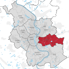
Mülheim
- city district of Cologne No. 9
Hiking in Mülheim
Mülheim is a district in the city of Cologne, Germany, located along the banks of the Rhine River. While it may not be as famous for its hiking trails as some other areas in Germany, Mülheim and its surroundings offer several opportunities for enjoyable outdoor activities, including walking and light hiking....
- Country:
- Coordinates: 50° 58' 0" N, 7° 1' 0" E
- GPS tracks (wikiloc): [Link]
- AboveSeaLevel: 53 м m
- Area: 52.2 sq km
Holweide
- city quarter no. 904 of Cologne, Germany
Hiking in Holweide
Holweide, located in Cologne, Germany, is not widely recognized as a major hiking destination, but it does offer some opportunities for walking and exploring nature nearby. While it may not have extensive hiking trails itself, the surrounding areas and parks provide options for outdoor enthusiasts....
- Country:
- Coordinates: 50° 58' 10" N, 7° 2' 41" E
- GPS tracks (wikiloc): [Link]


Dellbrück
- city quarter no. 905 of Cologne,Germany
Hiking in Dellbrück
Dellbrück, a district in the eastern part of Cologne (Köln), offers a variety of outdoor activities, including hiking. While it's not as mountainous as some other areas in Germany, there are still several enjoyable trails and green spaces that can be explored....
- Country:
- Coordinates: 50° 58' 43" N, 7° 4' 13" E
- GPS tracks (wikiloc): [Link]
Müngersdorf
- city quarter no. 306 of Cologne, Germany
Hiking in Müngersdorf
Müngersdorf is a district in the city of Cologne, Germany, and while it is primarily urban, there are some opportunities for hiking and outdoor activities in the surrounding areas. If you're considering hiking near Müngersdorf, here are some points to keep in mind:...
- Country:
- Coordinates: 50° 56' 24" N, 6° 52' 49" E
- GPS tracks (wikiloc): [Link]
Weiden
- city quarter no. 307 of Cologne, Germany
Hiking in Weiden
Weiden is a district located in the western part of Cologne (Köln), Germany. While it may not be widely known for extensive hiking trails, it offers a few appealing options for outdoor enthusiasts. Here are some highlights regarding hiking in and around Weiden:...
- Country:
- Coordinates: 50° 56' 17" N, 6° 50' 0" E
- GPS tracks (wikiloc): [Link]
Dünnwald
- city quarter no. 907 of Cologne, Germany
Hiking in Dünnwald
Dünnwald, located in the northeastern part of Köln (Cologne), is known for its beautiful nature and green spaces, making it a great spot for hiking and outdoor activities. Here are some key points about hiking in Dünnwald:...
- Country:
- Coordinates: 51° 0' 0" N, 7° 2' 19" E
- GPS tracks (wikiloc): [Link]


Poll
- city quarter no. 701 of Cologne, Germany
Hiking in Poll
Hiking in the Poll district of Cologne offers a unique blend of urban and natural experiences. Although Poll is primarily a residential area, it is adjacent to the Rhine River and several parks, making it a great spot for walking and outdoor activities....
- Country:
- Coordinates: 50° 54' 48" N, 6° 59' 24" E
- GPS tracks (wikiloc): [Link]
- AboveSeaLevel: 52 м m


Bayenthal
- city quarter No. 201 of Cologne, Germany
Hiking in Bayenthal
Bayenthal is a neighborhood in Cologne, Germany, known for its pleasant residential environment and proximity to the Rhine River. While Bayenthal itself is more urban, it does offer opportunities for walking and enjoying nature. Here are a few aspects to consider for hiking or walking in and around Bayenthal:...
- Country:
- Coordinates: 50° 54' 44" N, 6° 58' 3" E
- GPS tracks (wikiloc): [Link]
- AboveSeaLevel: 51 м m
- Population: 8714


Rodenkirchen
- city district of Cologne No. 2
Hiking in Rodenkirchen
Rodenkirchen is a district in the city of Cologne, Germany, located along the banks of the Rhine River. While it might not be traditionally known as a hiking destination, there are some beautiful walking and hiking opportunities in and around Rodenkirchen. Here are a few highlights:...
- Country:
- Coordinates: 50° 53' 29" N, 6° 59' 28" E
- GPS tracks (wikiloc): [Link]
- Area: 54.6 sq km


Cologne-Innenstadt
- central city district of the city of Cologne No. 1, Germany
Hiking in Cologne-Innenstadt
Hiking directly in Innenstadt (the city center) of Cologne may not offer traditional hiking trails, as it's primarily an urban area. However, there are several great options for enjoying the outdoors and some scenic walks that can provide a hiking-like experience....
- Country:
- Coordinates: 50° 56' 12" N, 6° 57' 37" E
- GPS tracks (wikiloc): [Link]
- Area: 16.4 sq km

Chorweiler
- city district of Cologne No. 6
Hiking in Chorweiler
Chorweiler is a district in the northern part of Cologne, Germany. While it may not be a major hiking destination, there are still opportunities to enjoy nature and walking trails in and around the area....
- Country:
- Coordinates: 51° 2' 38" N, 6° 53' 44" E
- GPS tracks (wikiloc): [Link]
- Area: 67.2 sq km
- Web site: [Link]

Kalk
- city district of Cologne No. 8
Hiking in Kalk
Kalk, a district in Cologne, Germany, is not primarily known for hiking as it is more urbanized compared to the surrounding areas. However, there are several opportunities for walking and exploring the green spaces in and around Kalk....
- Country:
- Coordinates: 50° 56' 9" N, 7° 1' 7" E
- GPS tracks (wikiloc): [Link]
- Area: 38.2 sq km
- Population: 119055
- Web site: [Link]


Ehrenfeld
- city district of Cologne No. 4
Hiking in Ehrenfeld
Ehrenfeld is a vibrant district in Cologne, Germany, known for its artistic scene and multicultural atmosphere rather than traditional hiking trails. However, there are various outdoor activities and walking opportunities available in and around the area. Here’s what you can expect when considering a hiking or outdoor experience in Ehrenfeld:...
- Country:
- Coordinates: 50° 56' 47" N, 6° 55' 6" E
- GPS tracks (wikiloc): [Link]
- Area: 23.8 sq km


Porz
- city district of Cologne No. 7, Germany
Hiking in Porz
Porz is a district within the city of Cologne, Germany, and it is not primarily known for extensive hiking opportunities like some more rural areas or national parks. However, there are still some great options for outdoor activities and walks in and around Porz....
- Country:
- Coordinates: 50° 53' 16" N, 7° 3' 19" E
- GPS tracks (wikiloc): [Link]
- AboveSeaLevel: 54 м m
- Area: 78.8 sq km
- Population: 112819
- Web site: [Link]


Lindenthal
- city district of Cologne No. 3
Hiking in Lindenthal
Lindenthal, located in the city of Cologne, Germany, is primarily an urban area known for its parks and green spaces rather than traditional hiking trails. However, it offers some pleasant opportunities for walking and enjoying nature within the city....
- Country:
- Coordinates: 50° 55' 34" N, 6° 54' 36" E
- GPS tracks (wikiloc): [Link]
- Area: 41.6 sq km


Nippes
- city district of Cologne No. 5
Hiking in Nippes
Nippes is a district in Cologne, Germany, that is primarily urban, characterized by residential areas, parks, and some green spaces. While it's not a traditional hiking destination, there are still opportunities for walking and exploring nature nearby. Here are some suggestions for enjoying hiking and walking in and around Nippes:...
- Country:
- Coordinates: 50° 57' 52" N, 6° 57' 30" E
- GPS tracks (wikiloc): [Link]
- Area: 31.8 sq km
- Population: 115540
- Web site: [Link]


Bocklemünd/Mengenich
- city quarter no. 405 of Cologne, Germany
Hiking in Bocklemünd/Mengenich
Bocklemünd-Mengenich is a district located in the northwest of Cologne, Germany. While it may not be as well-known as some of the major hiking destinations in the country, there are still opportunities for outdoor activities in the surrounding areas....
- Country:
- Coordinates: 50° 58' 32" N, 6° 51' 32" E
- GPS tracks (wikiloc): [Link]
- AboveSeaLevel: 52 м m
- Population: 10350


Sülz
- city quarter No. 302 of Cologne, Germany
Hiking in Sülz
Sülz is a charming area located in the city of Cologne, Germany, known for its picturesque neighborhoods and green spaces. While Sülz itself may not be a typical hiking destination, there are opportunities for walking and enjoying nature nearby....
- Country:
- Coordinates: 50° 55' 3" N, 6° 55' 27" E
- GPS tracks (wikiloc): [Link]

Deutz
Hiking in Deutz
Deutz is a picturesque and renowned wine region located in the Ahr Valley of Germany, famous for its steep vineyards and high-quality wines, particularly Pinot Noir. While Deutz itself may not be a hiking destination, the surrounding Ahr Valley offers stunning landscapes and excellent hiking opportunities....
- Country:
- Web site: [Link]
Rodenkirchen
- city quarter No. 208 of Cologne, Germany, subdivision of the city district Rodenkirchen
Hiking in Rodenkirchen
Rodenkirchen, a district of Cologne (Köln), offers scenic walking and hiking opportunities, primarily along the banks of the Rhine River. While Rodenkirchen itself may not have extensive hiking trails like those found in more rural areas, it provides picturesque routes that are ideal for leisurely hikes and walks....
- Country:
- Coordinates: 50° 53' 29" N, 6° 59' 28" E
- GPS tracks (wikiloc): [Link]
Shares border with regions:


Leverkusen
- city in North Rhine-Westphalia, Germany
Hiking in Leverkusen
Leverkusen, located in North Rhine-Westphalia, Germany, is not traditionally known as a hiking hotspot, but it offers various opportunities for outdoor enthusiasts. Here are some key points about hiking in Leverkusen:...
- Country:
- Postal Code: 51368–51381
- Local Dialing Code: 0214
- Licence Plate Code: LEV
- Coordinates: 51° 2' 0" N, 6° 59' 0" E
- GPS tracks (wikiloc): [Link]
- AboveSeaLevel: 52 м m
- Area: 78.87 sq km
- Population: 163113
- Web site: [Link]
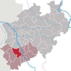
Rhein-Kreis Neuss
- district in North Rhine-Westphalia, Germany
Hiking in Rhein-Kreis Neuss
Rhein-Kreis Neuss, located in North Rhine-Westphalia, Germany, offers a variety of hiking opportunities that showcase its natural beauty and cultural heritage. The region is characterized by scenic landscapes, rolling hills, forests, and rivers, making it an ideal destination for hikers of all levels. Here are some key features and trails you might consider:...
- Country:
- Licence Plate Code: NE
- Coordinates: 51° 9' 55" N, 6° 39' 14" E
- GPS tracks (wikiloc): [Link]
- AboveSeaLevel: 48 м m
- Area: 576.52 sq km
- Web site: [Link]


Mettmann
- district in North Rhine-Westphalia, Germany
Hiking in Mettmann
Mettmann, located in North Rhine-Westphalia, Germany, offers a variety of hiking opportunities that cater to different skill levels and preferences. The region features picturesque landscapes, including forests, hills, and scenic views, making it ideal for outdoor activities....
- Country:
- Licence Plate Code: ME
- Coordinates: 51° 15' 0" N, 7° 0' 0" E
- GPS tracks (wikiloc): [Link]
- AboveSeaLevel: 143 м m
- Web site: [Link]


Rhein-Sieg District
- German district of North Rhine-Westphalia
Hiking in Rhein-Sieg District
Rhein-Sieg-Kreis, located in North Rhine-Westphalia, Germany, offers a variety of hiking opportunities for both beginners and experienced hikers. This diverse region features beautiful landscapes, rolling hills, forests, rivers, and charming towns, making it an excellent destination for outdoor enthusiasts. Here are some highlights and tips for hiking in this area:...
- Country:
- Licence Plate Code: SU
- Coordinates: 50° 45' 0" N, 7° 15' 0" E
- GPS tracks (wikiloc): [Link]
- AboveSeaLevel: 170 м m
- Area: 1153.2 sq km
- Web site: [Link]

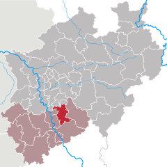
Rhein-Erft District
- district in North Rhine-Westphalia, Germany
Hiking in Rhein-Erft District
Rhein-Erft-Kreis is a beautiful region in North Rhine-Westphalia, Germany, known for its diverse landscapes, historical sites, and numerous hiking trails. Here’s what you should know about hiking in this area:...
- Country:
- Licence Plate Code: BM
- Coordinates: 50° 55' 12" N, 6° 40' 12" E
- GPS tracks (wikiloc): [Link]
- AboveSeaLevel: 79 м m
- Area: 704.7 sq km
- Web site: [Link]

Rhein-Berg District
- district in North Rhine-Westphalia, Germany
Hiking in Rhein-Berg District
The Rheinisch-Bergischer Kreis is a beautiful region located in North Rhine-Westphalia, Germany, known for its diverse landscapes, picturesque villages, and extensive network of hiking trails. Here are some key highlights and tips regarding hiking in this area:...
- Country:
- Licence Plate Code: GL
- Coordinates: 51° 1' 0" N, 7° 12' 0" E
- GPS tracks (wikiloc): [Link]
- AboveSeaLevel: 235 м m
- Area: 438 sq km
- Web site: [Link]