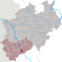
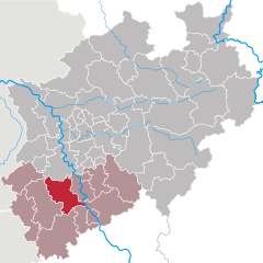
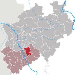
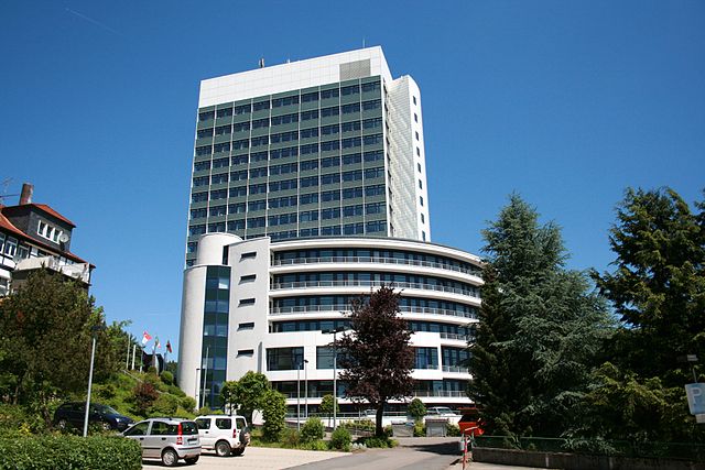
Cologne Government Region (Regierungsbezirk Köln)
- government region of North Rhine-Westphalia, Germany
 Hiking in Cologne Government Region
Hiking in the Cologne region offers a delightful blend of scenic landscapes, historical sites, and easy access to nature. The area around Cologne features a variety of hiking trails, ranging from leisurely walks to more challenging hikes. Here are some highlights and popular options for hiking in and around Cologne:
1.
This long-distance trail runs along the banks of the Rhine River from Bonn to Wiesbaden and passes through picturesque towns, vineyards, and castles. The stretch near Cologne takes you through beautiful scenery and offers great views of the river.
2.
There are numerous well-marked local trails around Cologne. The following municipalities offer excellent hiking options:
- Königswinter: Just south of Cologne, this area features trails around the Siebengebirge mountain range, known for its beautiful hills and historic sites.
- Bergisches Land: North-east of Cologne, this region is characterized by rolling hills, lush forests, and small lakes. The Bergischer Panoramasteig is a popular long-distance trail here.
3.
This reserve offers a mix of woodland and open meadows, perfect for a peaceful hike. You can explore the network of trails that wind through the reserve and enjoy birdwatching.
4.
For a more urban hiking experience, you can explore the Cologne Stadtwald (Cologne City Forest) located in Lindenthal. It's a large park area with various trails, ideal for walking, running, or a leisurely hike.
5.
Though a bit further from the city, the Eifel National Park, located about an hour's drive from Cologne, offers spectacular hiking opportunities. The park is filled with diverse flora and fauna, rolling hills, and beautiful lakes. Numerous trails cater to different levels of hiking experience.
6.
Hiking in the Cologne area often allows hikers to explore historical sites along the trails, including ancient churches, castles, and other significant landmarks. Plan your route to incorporate some cultural stops.
Tips for Hiking in Cologne:
- Weather Conditions: Be aware of weather conditions, as they can change quickly.
- Trail Maps and Apps: Use trail maps or hiking apps to ensure you stay on track. Many hiking paths are well marked, but it’s always good to have a reliable navigation tool.
- Wear Comfortable Shoes: Proper footwear is essential for a pleasant hiking experience.
- Prepare for the Terrain: Some trails may have steep inclines or rocky sections, so be prepared for varying terrain.
With its beautiful landscapes and rich history, the Cologne region is a fantastic place for hikers of all levels to explore and enjoy nature.
- Country:

- Capital: Cologne
- Coordinates: 50° 49' 48" N, 6° 55' 12" E


- GPS tracks (wikiloc): [Link]
- Area: 7363.97 sq km
- Web site: http://www.bezreg-koeln.nrw.de/
- Wikipedia en: wiki(en)
- Wikipedia: wiki(de)
- Wikidata storage: Wikidata: Q7927
- Wikipedia Commons Category: [Link]
- Wikipedia Commons Maps Category: [Link]
- Freebase ID: [/m/019gbf]
- GeoNames ID: Alt: [2886241]
- VIAF ID: Alt: [312798116]
- OSM relation ID: [72022]
- GND ID: Alt: [2015740-X]
- TGN ID: [7145469]
- NUTS code: [DEA2]
- GNS Unique Feature ID: -1810562
Includes regions:


Leverkusen
- city in North Rhine-Westphalia, Germany
Leverkusen, located in North Rhine-Westphalia, Germany, is not traditionally known as a hiking hotspot, but it offers various opportunities for outdoor enthusiasts. Here are some key points about hiking in Leverkusen:...
- Country:

- Postal Code: 51368–51381
- Local Dialing Code: 0214
- Licence Plate Code: LEV
- Coordinates: 51° 2' 0" N, 6° 59' 0" E


- GPS tracks (wikiloc): [Link]
- AboveSeaLevel: 52 м m
- Area: 78.87 sq km
- Population: 163113
- Web site: [Link]


Cologne
- city in North Rhine-Westphalia, Germany
Hiking around Cologne offers a diverse range of outdoor experiences, combining beautiful landscapes, historical sites, and scenic views. While the city itself is urban, there are several excellent hiking options nearby. Here are some highlights:...
- Country:

- Postal Code: 51147; 51145; 51143; 51109; 51107; 51105; 51103; 51069; 51067; 51065; 51063; 51061; 50999; 50997; 50996; 50969; 50968; 50939; 50937; 50935; 50931; 50859; 50858; 50833; 50829; 50827; 50825; 50823; 50739; 50737; 50735; 50733; 50767; 50765; 50679; 50678; 50676; 50677; 50674; 50672; 50670; 50668; 50667; 51149
- Local Dialing Code: 2203; 2236; 2234; 2233; 2232; 221
- Licence Plate Code: K
- Coordinates: 50° 56' 32" N, 6° 57' 28" E


- GPS tracks (wikiloc): [Link]
- AboveSeaLevel: 52 м m
- Area: 405.01 sq km
- Population: 1080394
- Web site: [Link]


Bonn
- city in Germany, former capital
Bonn, located along the banks of the Rhine River in Germany, is surrounded by beautiful natural landscapes, making it a great place for hiking enthusiasts. The region offers a variety of trails that cater to different skill levels, from leisurely walks along the river to more challenging hikes in the nearby hills and forests. Here are some highlights of hiking in and around Bonn:...
- Country:

- Postal Code: 53111–53229
- Local Dialing Code: 0228
- Licence Plate Code: BN
- Coordinates: 50° 44' 2" N, 7° 5' 59" E


- GPS tracks (wikiloc): [Link]
- AboveSeaLevel: 60 м m
- Area: 141.06 sq km
- Population: 327919
- Web site: [Link]


Heinsberg
- district in North Rhine-Westphalia, Germany
Heinsberg, located in the northwestern part of North Rhine-Westphalia, Germany, offers a variety of hiking opportunities that cater to different skill levels and interests. The district is characterized by its picturesque landscape, which includes rolling hills, woodlands, and agricultural fields. Here are some key points to consider when hiking in Heinsberg:...
- Country:

- Licence Plate Code: HS
- Coordinates: 51° 0' 0" N, 6° 10' 12" E


- GPS tracks (wikiloc): [Link]
- AboveSeaLevel: 38 м m
- Web site: [Link]


Aachen cities region
- German district of North Rhine-Westphalia
 Hiking in Aachen cities region
Aachen, located in western Germany, is surrounded by beautiful landscapes that are ideal for hiking enthusiasts. The district offers a variety of trails that cater to different skill levels, providing opportunities to explore both natural and historical sites. Here are some highlights and tips for hiking in the Aachen district:...
- Country:

- Capital: Aachen
- Licence Plate Code: MON; AC
- Coordinates: 50° 46' 7" N, 6° 5' 49" E


- GPS tracks (wikiloc): [Link]
- AboveSeaLevel: 168 м m
- Area: 707.15 sq km
- Population: 545067
- Web site: [Link]


Düren
- German district of North Rhine-Westphalia
Düren district, located in North Rhine-Westphalia, Germany, offers a variety of hiking opportunities that cater to different skill levels and preferences. The region is characterized by its lush landscapes, rolling hills, and scenic views, making it an excellent destination for outdoor enthusiasts....
- Country:

- Licence Plate Code: DN
- Coordinates: 50° 49' 48" N, 6° 30' 0" E


- GPS tracks (wikiloc): [Link]
- AboveSeaLevel: 118 м m
- Web site: [Link]


Euskirchen
- German district of North Rhine-Westphalia
Euskirchen district, located in North Rhine-Westphalia, Germany, offers a variety of hiking opportunities that cater to all levels of hikers. The scenic landscapes and diverse terrains make it an attractive destination for outdoor enthusiasts....
- Country:

- Licence Plate Code: EU
- Coordinates: 50° 30' 0" N, 6° 40' 12" E


- GPS tracks (wikiloc): [Link]
- AboveSeaLevel: 418 м m
- Area: 1248.73 sq km
- Web site: [Link]


Rhein-Sieg District
- German district of North Rhine-Westphalia
Rhein-Sieg-Kreis, located in North Rhine-Westphalia, Germany, offers a variety of hiking opportunities for both beginners and experienced hikers. This diverse region features beautiful landscapes, rolling hills, forests, rivers, and charming towns, making it an excellent destination for outdoor enthusiasts. Here are some highlights and tips for hiking in this area:...
- Country:

- Licence Plate Code: SU
- Coordinates: 50° 45' 0" N, 7° 15' 0" E


- GPS tracks (wikiloc): [Link]
- AboveSeaLevel: 170 м m
- Area: 1153.2 sq km
- Web site: [Link]


Rhein-Erft District
- district in North Rhine-Westphalia, Germany
Rhein-Erft-Kreis is a beautiful region in North Rhine-Westphalia, Germany, known for its diverse landscapes, historical sites, and numerous hiking trails. Here’s what you should know about hiking in this area:...
- Country:

- Licence Plate Code: BM
- Coordinates: 50° 55' 12" N, 6° 40' 12" E


- GPS tracks (wikiloc): [Link]
- AboveSeaLevel: 79 м m
- Area: 704.7 sq km
- Web site: [Link]


Rhein-Berg District
- district in North Rhine-Westphalia, Germany
The Rheinisch-Bergischer Kreis is a beautiful region located in North Rhine-Westphalia, Germany, known for its diverse landscapes, picturesque villages, and extensive network of hiking trails. Here are some key highlights and tips regarding hiking in this area:...
- Country:

- Licence Plate Code: GL
- Coordinates: 51° 1' 0" N, 7° 12' 0" E


- GPS tracks (wikiloc): [Link]
- AboveSeaLevel: 235 м m
- Area: 438 sq km
- Web site: [Link]


Oberbergischer Kreis
- district of North Rhine-Westphalia, Germany
 Hiking in Oberbergischer Kreis
Oberbergischer Kreis, located in North Rhine-Westphalia, Germany, is known for its beautiful landscapes, rolling hills, and dense forests, making it a fantastic destination for hiking enthusiasts. Here are some key details to help you plan your hiking adventure in this region:...
- Country:

- Licence Plate Code: GM
- Coordinates: 51° 2' 0" N, 7° 31' 0" E


- GPS tracks (wikiloc): [Link]
- AboveSeaLevel: 413 м m
- Area: 918.53 sq km
- Population: 271332
- Web site: [Link]