
Ribeauvillé (Ribeauvillé)

- commune in Haut-Rhin, France
- Country:

- Postal Code: 68150
- Coordinates: 48° 11' 43" N, 7° 19' 6" E


- GPS tracks (wikiloc): [Link]
- Area: 32.21 sq km
- Population: 4746
- Web site: http://www.ribeauville.net
- Wikipedia en: wiki(en)
- Wikipedia: wiki(fr)
- Wikidata storage: Wikidata: Q148483
- Wikipedia Commons Gallery: [Link]
- Wikipedia Commons Category: [Link]
- Freebase ID: [/m/078pcw]
- GeoNames ID: Alt: [2983705]
- SIREN number: [216802694]
- BnF ID: [15271971w]
- VIAF ID: Alt: [241849160]
- GND ID: Alt: [4420082-1]
- archINFORM location ID: [12866]
- MusicBrainz area ID: [019c0504-1806-4b96-b92e-2b8fd28c942e]
- TGN ID: [7009465]
- Encyclopædia Britannica Online ID: [place/Ribeauville]
- EMLO location ID: [3bdc992a-d2b2-4301-b31b-5dabee776907]
- Global Anabaptist Mennonite Encyclopedia Online ID: [Ribeauvillé (Alsace, France)]
- INSEE municipality code: 68269
Shares border with regions:


Lièpvre
- commune in Haut-Rhin, France
- Country:
- Postal Code: 68660
- Coordinates: 48° 16' 20" N, 7° 16' 57" E
- GPS tracks (wikiloc): [Link]
- Area: 12.55 sq km
- Population: 1751


Saint-Hippolyte
- commune in Haut-Rhin, France
- Country:
- Postal Code: 68590
- Coordinates: 48° 13' 55" N, 7° 22' 18" E
- GPS tracks (wikiloc): [Link]
- Area: 17.86 sq km
- Population: 1005
- Web site: [Link]


Rodern
- commune in Haut-Rhin, France
- Country:
- Postal Code: 68590
- Coordinates: 48° 13' 30" N, 7° 21' 13" E
- GPS tracks (wikiloc): [Link]
- AboveSeaLevel: 260 м m
- Area: 7.05 sq km
- Population: 344


Riquewihr
- commune in Haut-Rhin, France
- Country:
- Postal Code: 68340
- Local Dialing Code: 3
- Coordinates: 48° 9' 59" N, 7° 17' 49" E
- GPS tracks (wikiloc): [Link]
- Area: 17.04 sq km
- Population: 1109
- Web site: [Link]


Zellenberg
- commune in Haut-Rhin, France
- Country:
- Postal Code: 68340
- Coordinates: 48° 10' 15" N, 7° 19' 11" E
- GPS tracks (wikiloc): [Link]
- AboveSeaLevel: 374 м m
- Area: 4.96 sq km
- Population: 333

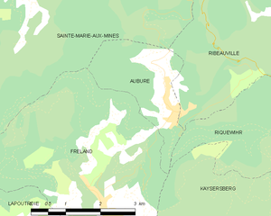
Aubure
- commune in Haut-Rhin, France
- Country:
- Postal Code: 68150
- Coordinates: 48° 11' 50" N, 7° 13' 17" E
- GPS tracks (wikiloc): [Link]
- Area: 4.9 sq km
- Population: 356
- Web site: [Link]


Bergheim
- commune in Haut-Rhin, France
- Country:
- Postal Code: 68750
- Coordinates: 48° 12' 19" N, 7° 21' 42" E
- GPS tracks (wikiloc): [Link]
- AboveSeaLevel: 211 м m
- Area: 19.16 sq km
- Population: 2111
- Web site: [Link]


Guémar
- commune in Haut-Rhin, France
- Country:
- Postal Code: 68970
- Coordinates: 48° 11' 19" N, 7° 23' 49" E
- GPS tracks (wikiloc): [Link]
- AboveSeaLevel: 193 м m
- Area: 18.22 sq km
- Population: 1330
- Web site: [Link]


Sainte-Marie-aux-Mines
- commune in Haut-Rhin, France
- Country:
- Postal Code: 68160
- Coordinates: 48° 14' 48" N, 7° 11' 2" E
- GPS tracks (wikiloc): [Link]
- Area: 45.23 sq km
- Population: 5136
- Web site: [Link]


Thannenkirch
- commune in Haut-Rhin, France
- Country:
- Postal Code: 68590
- Coordinates: 48° 13' 58" N, 7° 18' 14" E
- GPS tracks (wikiloc): [Link]
- Area: 4.6 sq km
- Population: 438


Sainte-Croix-aux-Mines
- commune in Haut-Rhin, France
- Country:
- Postal Code: 68160
- Coordinates: 48° 15' 44" N, 7° 13' 31" E
- GPS tracks (wikiloc): [Link]
- Area: 27.85 sq km
- Population: 1965
- Web site: [Link]


Kaysersberg
- former commune in Haut-Rhin, France
- Country:
- Postal Code: 68240
- Coordinates: 48° 8' 21" N, 7° 15' 39" E
- GPS tracks (wikiloc): [Link]
- AboveSeaLevel: 240 м m
- Area: 24.82 sq km
- Population: 2703
- Web site: [Link]

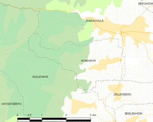
Hunawihr
- commune in Haut-Rhin, France
- Country:
- Postal Code: 68150
- Local Dialing Code: 389
- Coordinates: 48° 10' 49" N, 7° 18' 41" E
- GPS tracks (wikiloc): [Link]
- AboveSeaLevel: 686 м m
- Area: 4.81 sq km
- Population: 598
- Web site: [Link]