Ribennes (Ribennes)

- commune in Lozère, France
- Country:

- Postal Code: 48700
- Coordinates: 44° 38' 21" N, 3° 23' 52" E


- GPS tracks (wikiloc): [Link]
- Area: 24.97 sq km
- Population: 165
- Wikipedia en: wiki(en)
- Wikipedia: wiki(fr)
- Wikidata storage: Wikidata: Q669486
- Wikipedia Commons Category: [Link]
- Freebase ID: [/m/02z0xvw]
- Freebase ID: [/m/02z0xvw]
- GeoNames ID: Alt: [6435135]
- GeoNames ID: Alt: [6435135]
- SIREN number: [214801268]
- SIREN number: [214801268]
- BnF ID: [15261531b]
- BnF ID: [15261531b]
- INSEE municipality code: 48126
- INSEE municipality code: 48126
Shares border with regions:


Saint-Amans
- commune in Lozère, France
- Country:
- Postal Code: 48700
- Coordinates: 44° 39' 47" N, 3° 27' 0" E
- GPS tracks (wikiloc): [Link]
- Area: 9.98 sq km
- Population: 154


Saint-Sauveur-de-Peyre
- former commune in Lozère, France
- Country:
- Postal Code: 48130
- Coordinates: 44° 39' 31" N, 3° 17' 14" E
- GPS tracks (wikiloc): [Link]
- Area: 27.61 sq km
- Population: 271
- Web site: [Link]


Javols
- former commune in Lozère, France
- Country:
- Postal Code: 48130
- Coordinates: 44° 41' 36" N, 3° 20' 32" E
- GPS tracks (wikiloc): [Link]
- Area: 31.21 sq km
- Population: 331
- Web site: [Link]


Rieutort-de-Randon
- commune in Lozère, France
- Country:
- Postal Code: 48700
- Coordinates: 44° 38' 4" N, 3° 28' 42" E
- GPS tracks (wikiloc): [Link]
- Area: 62.34 sq km
- Population: 774

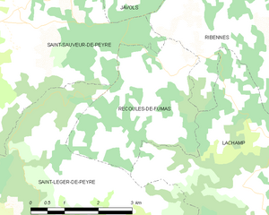
Recoules-de-Fumas
- commune in Lozère, France
- Country:
- Postal Code: 48100
- Coordinates: 44° 38' 28" N, 3° 20' 45" E
- GPS tracks (wikiloc): [Link]
- Area: 9.77 sq km
- Population: 100


Serverette
- commune in Lozère, France
- Country:
- Postal Code: 48700
- Coordinates: 44° 42' 15" N, 3° 23' 10" E
- GPS tracks (wikiloc): [Link]
- Area: 17.35 sq km
- Population: 263
Saint-Gal
- commune in Lozère, France
- Country:
- Postal Code: 48700
- Coordinates: 44° 40' 8" N, 3° 25' 30" E
- GPS tracks (wikiloc): [Link]
- Area: 9.88 sq km
- Population: 94
Lachamp
- commune in Lozère, France
- Country:
- Postal Code: 48100
- Coordinates: 44° 36' 41" N, 3° 22' 14" E
- GPS tracks (wikiloc): [Link]
- Area: 25.89 sq km
- Population: 173