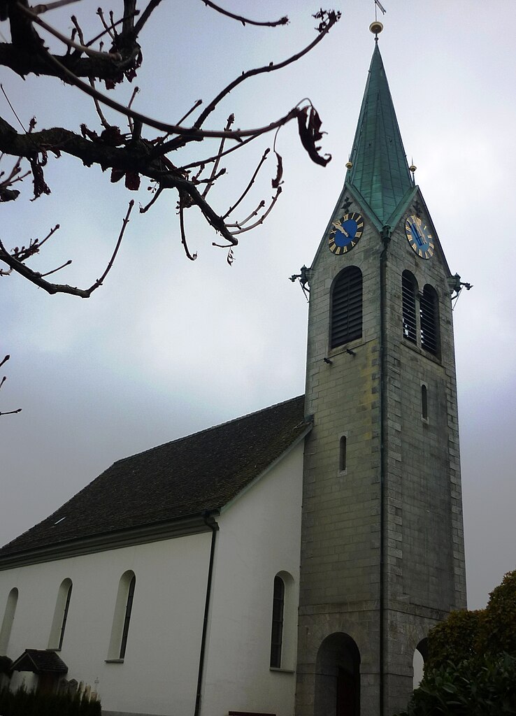
Richterswil (Richterswil)

- municipality in Switzerland
 Hiking in Richterswil
Richterswil, located on the shores of Lake Zurich in Switzerland, offers a range of hiking opportunities that showcase the region's natural beauty and scenic landscapes. Here are some highlights for hiking in and around Richterswil:
-
Lake Zurich Promenade: A pleasant and accessible route, this promenade stretches along the lake and features beautiful views of the water and surrounding mountains. It’s ideal for leisurely walks and short hikes.
-
Uetikon and the Uetikon Ridge: Just a short distance from Richterswil, you can hike up to the Uetikon Ridge. This trail offers stunning panoramic views over Lake Zurich and the Alps. It is a moderate hike that is well-marked.
-
Alpthal and the Ägeri Valley: A bit further from Richterswil, you can explore the trails around the Ägeri Valley. These hikes can range from easy to challenging and provide opportunities to see local flora and fauna, as well as charming Swiss villages.
-
Nature Reserves: The area is home to several nature reserves where you can hike and enjoy the local wildlife. These spots are great for birdwatching and experiencing the tranquility of the Swiss landscape.
-
Wine Trails: The vineyards near Richterswil offer scenic hiking paths that weave through beautiful landscapes and wine-growing regions. Some routes include stops at local wineries, allowing for a tasting experience.
Tips for Hiking in Richterswil:
- Seasonal Considerations: Spring and early autumn are optimal for hiking to enjoy mild weather and blooming landscapes. Summer can be warmer, while winter may bring snow, affecting trail accessibility.
- Equipment: Wear sturdy hiking shoes, and dress in layers to adapt to changing weather conditions. A walking stick can also be helpful for navigating steeper sections.
- Maps and Guidance: Make sure to have a reliable map or GPS device, as some trails can be less well marked. Local tourist information can provide helpful guides and recommendations.
Overall, hiking in Richterswil and its surroundings can be a delightful experience, combining natural beauty, cultural sights, and a chance to immerse yourself in the scenic Swiss landscape. Enjoy your hikes!
- Country:

- Postal Code: 8805
- Local Dialing Code: 043; 044
- Licence Plate Code: ZH
- Coordinates: 47° 12' 29" N, 8° 42' 21" E


- GPS tracks (wikiloc): [Link]
- AboveSeaLevel: 588 м m
- Area: 7.54 sq km
- Population: 13407
- Web site: http://www.richterswil.ch
- Wikipedia en: wiki(en)
- Wikipedia: wiki(de)
- Wikidata storage: Wikidata: Q68227
- Wikipedia Commons Category: [Link]
- Wikipedia Commons Maps Category: [Link]
- Freebase ID: [/m/0gtt6c]
- GeoNames ID: Alt: [7286894]
- VIAF ID: Alt: [136163303]
- OSM relation ID: [1682194]
- GND ID: Alt: [4104033-8]
- MusicBrainz area ID: [06e4444d-d1cf-464f-a229-3a11309e7e98]
- Quora topic ID: [Richterswil]
- HDS ID: [101]
- Swiss municipality code: [0138]
Shares border with regions:


Männedorf
- municipality in Switzerland
Hiking in Männedorf
Männedorf is a picturesque town located on the shores of Lake Zurich in Switzerland, offering beautiful hiking opportunities with stunning views of the lake and the surrounding mountains. Here are some highlights about hiking in and around Männedorf:...
- Country:
- Postal Code: 8708
- Local Dialing Code: 044
- Licence Plate Code: ZH
- Coordinates: 47° 15' 35" N, 8° 41' 59" E
- GPS tracks (wikiloc): [Link]
- AboveSeaLevel: 498 м m
- Area: 4.78 sq km
- Population: 10957
- Web site: [Link]


Hütten
- municipality in Switzerland
Hiking in Hütten
Hütten, nestled in the Swiss Alps, is a dream destination for hiking enthusiasts. The region offers stunning views, diverse trails, and a rich cultural heritage associated with the Swiss mountains. Here’s a comprehensive overview of hiking in this picturesque area:...
- Country:
- Postal Code: 8825
- Local Dialing Code: 044
- Licence Plate Code: ZH
- Coordinates: 47° 10' 23" N, 8° 39' 58" E
- GPS tracks (wikiloc): [Link]
- AboveSeaLevel: 741 м m
- Area: 7.24 sq km
- Population: 895
- Web site: [Link]

Schönenberg
- municipality in Switzerland
Hiking in Schönenberg
Schönenberg, located near Zürich, Switzerland, offers a variety of hiking opportunities surrounded by beautiful landscapes and panoramic views of the Zürcher Oberland and Lake Zürich. Here are some highlights to consider when planning a hike in this area:...
- Country:
- Postal Code: 8824
- Local Dialing Code: 044
- Licence Plate Code: ZH
- Coordinates: 47° 11' 38" N, 8° 38' 41" E
- GPS tracks (wikiloc): [Link]
- AboveSeaLevel: 714 м m
- Area: 11.0 sq km
- Population: 1844
- Web site: [Link]


Wollerau
- municipality in Switzerland
Hiking in Wollerau
Wollerau is a charming municipality located on the shores of Lake Zurich in Switzerland, and it offers a variety of hiking opportunities that cater to different skill levels and preferences. Nestled between hills and the lake, the surrounding area boasts picturesque landscapes, lush forests, and panoramic views....
- Country:
- Postal Code: 8832
- Local Dialing Code: 043; 044
- Licence Plate Code: SZ
- Coordinates: 47° 11' 17" N, 8° 42' 7" E
- GPS tracks (wikiloc): [Link]
- AboveSeaLevel: 597 м m
- Area: 6.50 sq km
- Population: 7101
- Web site: [Link]


Wädenswil
- municipality in the canton of Zürich, Switzerland
Hiking in Wädenswil
Wädenswil, located on the shores of Lake Zurich in Switzerland, offers beautiful hiking trails that suit various skill levels and provide stunning views of both the lake and the surrounding mountains. Here are some highlights and popular trails in and around Wädenswil:...
- Country:
- Postal Code: 8833
- Local Dialing Code: 044; 043
- Licence Plate Code: ZH
- Coordinates: 47° 13' 30" N, 8° 39' 7" E
- GPS tracks (wikiloc): [Link]
- AboveSeaLevel: 597 м m
- Area: 17.37 sq km
- Population: 21716
- Web site: [Link]


Stäfa
- municipality in Switzerland
Hiking in Stäfa
Stäfa, located on the eastern shore of Lake Zurich in Switzerland, is a charming town that offers various hiking opportunities with stunning views of the lake and surrounding landscapes. Here are some highlights for hiking in and around Stäfa:...
- Country:
- Postal Code: 8712
- Local Dialing Code: 044; 043
- Licence Plate Code: ZH
- Coordinates: 47° 14' 24" N, 8° 43' 58" E
- GPS tracks (wikiloc): [Link]
- AboveSeaLevel: 523 м m
- Area: 8.59 sq km
- Population: 14389
- Web site: [Link]

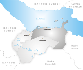
Freienbach
- municipality in the canton of Schwyz, Switzerland
Hiking in Freienbach
Freienbach, located in the canton of Schwyz in Switzerland, offers beautiful hiking opportunities with stunning views of Lake Zurich and the surrounding mountains. Here are some highlights and tips for hiking in the area:...
- Country:
- Postal Code: 8807
- Local Dialing Code: 055
- Licence Plate Code: SZ
- Coordinates: 47° 11' 45" N, 8° 46' 16" E
- GPS tracks (wikiloc): [Link]
- AboveSeaLevel: 463 м m
- Area: 20.30 sq km
- Population: 16269
- Web site: [Link]