Horgen District (Bezirk Horgen)
- district of the canton of Zürich, Switzerland
Horgen District, located in the Canton of Zurich in Switzerland, is a beautiful area known for its diverse landscapes, which include lakes, forests, and rolling hills. Hiking here offers a range of trails suitable for various skill levels, from leisurely walks to more challenging hikes.
Highlights of Hiking in Horgen District:
-
Scenic Views:
- The region provides stunning views of Lake Zurich, the Alps, and picturesque villages. Many trails lead to viewpoints that offer breathtaking panoramas.
-
Trail Network:
- Horgen District has a well-maintained network of hiking trails. The routes are often marked and can take you through forests, meadows, and along the lakeshore.
-
Popular Hiking Routes:
- Uetliberg Mountain: Although not directly in Horgen, it's a short distance away and offers panoramic views of the entire Zurich area.
- Horgen to Zug: A more extended hike that provides stunning scenery alongside Lake Zurich.
- Forest Trails: Paths through the surrounding woods are perfect for those seeking tranquility away from urban life.
-
Wildlife and Nature:
- Horgen’s natural environment is rich in local flora and fauna. Hikers might encounter diverse wildlife, particularly birds and small mammals.
-
Cultural Points of Interest:
- The area is home to charming villages, historical sites, and traditional Swiss architecture, making the hike culturally enriching.
-
Accessibility:
- Horgen is well-connected by public transport, making it easy to access starting points for hiking trails without needing to drive.
Tips for Hiking in Horgen District:
- Weather Considerations: Always check the weather forecast before heading out and dress in layers to accommodate changing conditions.
- Trail Maps: Carry a map or use hiking apps to navigate the trails easily, as some areas may not have full cell service.
- Hydration and Snacks: Bring plenty of water and snacks, especially on longer hikes.
- Respect Nature: Stay on marked trails, and take care to dispose of waste properly to help preserve the environment.
Whether you're looking for a peaceful escape or an adventurous hike, the Horgen District offers a wealth of opportunities for all hiking enthusiasts.
- Country:

- Capital: Horgen
- Licence Plate Code: ZH
- Coordinates: 47° 14' 0" N, 8° 36' 0" E


- GPS tracks (wikiloc): [Link]
- AboveSeaLevel: 459 м m
- Area: 104.16 sq km
- Web site: http://www.bezirke.zh.ch
- Wikipedia en: wiki(en)
- Wikipedia: wiki(de)
- Wikidata storage: Wikidata: Q660579
- Wikipedia Commons Category: [Link]
- Freebase ID: [/m/0d94tr]
- GeoNames ID: Alt: [6458847]
- BnF ID: [11960299j]
- VIAF ID: Alt: [248955036]
- GND ID: Alt: [4025859-2]
- archINFORM location ID: [42723]
Includes regions:
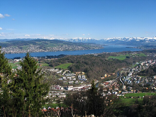

Langnau am Albis
- municipality in Switzerland
Langnau am Albis, located in the canton of Zurich, Switzerland, is a beautiful area for hiking, offering a mix of scenic landscapes, forests, and panoramic views of the surrounding Alps and Lake Zurich. Here are some highlights and tips for hiking in this region:...
- Country:

- Postal Code: 8135
- Local Dialing Code: 01
- Licence Plate Code: ZH
- Coordinates: 47° 17' 22" N, 8° 32' 29" E


- GPS tracks (wikiloc): [Link]
- AboveSeaLevel: 468 м m
- Area: 8.66 sq km
- Population: 7500
- Web site: [Link]
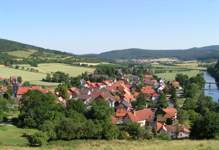
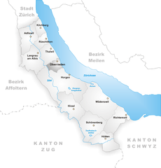
Oberrieden
- municipality in the canton of Zurich, Switzerland
Oberrieden, a picturesque municipality in the canton of Zurich, Switzerland, offers a wonderful backdrop for hiking enthusiasts. The area is characterized by its scenic landscapes, which include rolling hills, lush forests, and stunning views of Lake Zurich and the Swiss Alps....
- Country:

- Postal Code: 8942
- Local Dialing Code: 043; 044
- Licence Plate Code: ZH
- Coordinates: 47° 16' 40" N, 8° 34' 41" E


- GPS tracks (wikiloc): [Link]
- AboveSeaLevel: 460 м m
- Area: 2.76 sq km
- Population: 5090
- Web site: [Link]
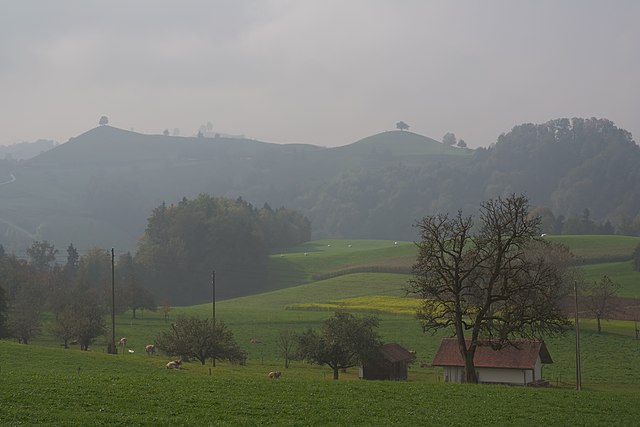

Hirzel
- Village in Switzerland
Hirzel is a picturesque village located in the Zurich region of Switzerland, nestled amidst beautiful landscapes that are perfect for hiking enthusiasts. The area is characterized by rolling hills, lush forests, and stunning views of the surrounding Alps and Lake Zurich, making it an ideal destination for both casual walkers and experienced hikers....
- Country:

- Postal Code: 8816
- Local Dialing Code: 01
- Licence Plate Code: ZH
- Coordinates: 47° 13' 1" N, 8° 36' 37" E


- GPS tracks (wikiloc): [Link]
- AboveSeaLevel: 678 м m
- Area: 9.68 sq km
- Population: 2158
- Web site: [Link]


Kilchberg
- municipality in the canton of Zürich, Switzerland
Kilchberg, located on the shores of Lake Zurich, is a charming town that offers beautiful hiking opportunities in the surrounding areas. While Kilchberg itself is relatively small, it serves as a gateway to several scenic trails that take you through picturesque landscapes, forests, and along the lake....
- Country:

- Postal Code: 8802
- Local Dialing Code: 044; 043
- Licence Plate Code: ZH
- Coordinates: 47° 19' 29" N, 8° 32' 57" E


- GPS tracks (wikiloc): [Link]
- AboveSeaLevel: 467 м m
- Area: 2.58 sq km
- Population: 8437
- Web site: [Link]


Rüschlikon
- municipality in the canton of Zürich, Switzerland
Rüschlikon, located on the shores of Lake Zurich in Switzerland, is a beautiful area that offers a variety of hiking opportunities. The combination of lake views, rolling hills, and picturesque landscapes makes it an attractive destination for both casual wanderers and experienced hikers....
- Country:

- Postal Code: 8803
- Local Dialing Code: 044; 043
- Licence Plate Code: ZH
- Coordinates: 47° 18' 29" N, 8° 33' 15" E


- GPS tracks (wikiloc): [Link]
- AboveSeaLevel: 444 м m
- Area: 2.93 sq km
- Population: 5830
- Web site: [Link]


Hütten
- municipality in Switzerland
Hütten, nestled in the Swiss Alps, is a dream destination for hiking enthusiasts. The region offers stunning views, diverse trails, and a rich cultural heritage associated with the Swiss mountains. Here’s a comprehensive overview of hiking in this picturesque area:...
- Country:

- Postal Code: 8825
- Local Dialing Code: 044
- Licence Plate Code: ZH
- Coordinates: 47° 10' 23" N, 8° 39' 58" E


- GPS tracks (wikiloc): [Link]
- AboveSeaLevel: 741 м m
- Area: 7.24 sq km
- Population: 895
- Web site: [Link]
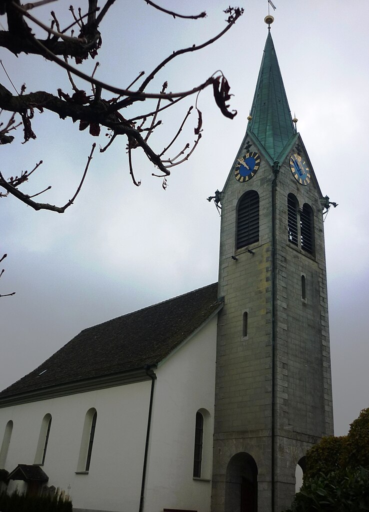

Schönenberg
- municipality in Switzerland
Schönenberg, located near Zürich, Switzerland, offers a variety of hiking opportunities surrounded by beautiful landscapes and panoramic views of the Zürcher Oberland and Lake Zürich. Here are some highlights to consider when planning a hike in this area:...
- Country:

- Postal Code: 8824
- Local Dialing Code: 044
- Licence Plate Code: ZH
- Coordinates: 47° 11' 38" N, 8° 38' 41" E


- GPS tracks (wikiloc): [Link]
- AboveSeaLevel: 714 м m
- Area: 11.0 sq km
- Population: 1844
- Web site: [Link]


Adliswil
- municipality in Switzerland
Adliswil, located just south of Zurich in Switzerland, offers a variety of hiking opportunities that showcase the beautiful landscapes of the Zurich region. Here are some highlights and tips for hiking in Adliswil:...
- Country:

- Postal Code: 8134
- Local Dialing Code: 043; 044
- Licence Plate Code: ZH
- Coordinates: 47° 18' 34" N, 8° 31' 17" E


- GPS tracks (wikiloc): [Link]
- AboveSeaLevel: 485 м m
- Area: 7.79 sq km
- Population: 18731
- Web site: [Link]


Richterswil
- municipality in Switzerland
Richterswil, located on the shores of Lake Zurich in Switzerland, offers a range of hiking opportunities that showcase the region's natural beauty and scenic landscapes. Here are some highlights for hiking in and around Richterswil:...
- Country:

- Postal Code: 8805
- Local Dialing Code: 043; 044
- Licence Plate Code: ZH
- Coordinates: 47° 12' 29" N, 8° 42' 21" E


- GPS tracks (wikiloc): [Link]
- AboveSeaLevel: 588 м m
- Area: 7.54 sq km
- Population: 13407
- Web site: [Link]


Horgen
- municipality in the canton of Zürich, Switzerland
Horgen, located on the southern shore of Lake Zurich in Switzerland, offers a variety of hiking opportunities suited for different skill levels and interests. Here are some highlights:...
- Country:

- Postal Code: 8810
- Local Dialing Code: 044; 043
- Licence Plate Code: ZH
- Coordinates: 47° 15' 39" N, 8° 35' 51" E


- GPS tracks (wikiloc): [Link]
- AboveSeaLevel: 415 м m
- Area: 30.75 sq km
- Population: 22476
- Web site: [Link]


Thalwil
- municipality in the canton of Zürich, Switzerland
Thalwil, located in the canton of Zurich, Switzerland, is a beautiful area that offers a wonderful range of hiking opportunities. Nestled along the shores of Lake Zurich and surrounded by rolling hills and lush forests, Thalwil is an excellent starting point for both easy walks and more challenging hikes....
- Country:

- Postal Code: 8800
- Local Dialing Code: 044
- Licence Plate Code: ZH
- Coordinates: 47° 17' 43" N, 8° 33' 53" E


- GPS tracks (wikiloc): [Link]
- AboveSeaLevel: 468 м m
- Area: 5.53 sq km
- Population: 17784
- Web site: [Link]


Wädenswil
- municipality in the canton of Zürich, Switzerland
Wädenswil, located on the shores of Lake Zurich in Switzerland, offers beautiful hiking trails that suit various skill levels and provide stunning views of both the lake and the surrounding mountains. Here are some highlights and popular trails in and around Wädenswil:...
- Country:

- Postal Code: 8833
- Local Dialing Code: 044; 043
- Licence Plate Code: ZH
- Coordinates: 47° 13' 30" N, 8° 39' 7" E


- GPS tracks (wikiloc): [Link]
- AboveSeaLevel: 597 м m
- Area: 17.37 sq km
- Population: 21716
- Web site: [Link]
Shares border with regions:


Affoltern District
- district of the canton of Zürich, Switzerland
Affoltern District, located in the canton of Zurich, Switzerland, offers a variety of hiking opportunities that showcase the beautiful Swiss landscape, charming villages, and rich cultural heritage. Here are some key points about hiking in this region:...
- Country:

- Capital: Affoltern am Albis
- Licence Plate Code: ZH
- Coordinates: 47° 16' 0" N, 8° 28' 0" E


- GPS tracks (wikiloc): [Link]
- AboveSeaLevel: 664 м m
- Area: 113.01 sq km
- Web site: [Link]


Zürich District
Hiking in the Zürich District offers a wonderful blend of urban and natural experiences. The area provides a variety of trails that cater to different skill levels, from easy walks suitable for families to more challenging hikes for seasoned adventurers. Here are some popular hiking spots and trails you might consider:...
- Country:

- Capital: Zürich
- Licence Plate Code: ZH
- Coordinates: 47° 23' 0" N, 8° 32' 0" E


- GPS tracks (wikiloc): [Link]
- AboveSeaLevel: 412 м m
- Area: 87.78 sq km
- Web site: [Link]

