Ricigliano (Ricigliano)

- Italian comune
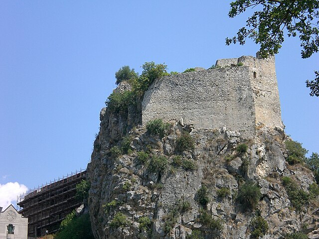
 Hiking in Ricigliano
Ricigliano is a charming village located in the Campania region of southern Italy, known for its picturesque landscapes and rich cultural history. Hiking in and around Ricigliano offers the opportunity to explore scenic trails that boast beautiful views of the surrounding hills and the picturesque countryside.
Hiking Trails
-
Local Trails: There are various local hiking trails that weave through olive groves, vineyards, and forests. These paths often lead you to scenic viewpoints or historic landmarks.
-
Mount Marzano: Located nearby, this mountain has several trails that cater to different skill levels. The hike to the summit rewards you with breathtaking panoramic views of the surrounding area.
-
Parco Regionale dei Monti Picentini: A bit further afield, this regional park features a variety of hiking routes through diverse ecosystems, including mountains, valleys, and rivers. It's ideal for those seeking more challenging hikes.
Recommended Hiking Tips
- Prepare for Varied Terrain: The trails can vary significantly from easy walks to more challenging hikes, so be sure to choose a route that matches your skill level.
- Bring Water and Snacks: It's important to stay hydrated, especially during summer hikes when temperatures can rise.
- Wear Proper Footwear: Sturdy hiking boots with good grip are recommended, especially if you're exploring rocky or uneven terrain.
- Check Weather Conditions: The weather can change rapidly; always check the forecast before heading out, and be prepared for sudden changes.
- Respect the Environment: Follow Leave No Trace principles, and be mindful of local wildlife and flora.
Cultural and Historical Attractions
While hiking, you might also enjoy the chance to explore some of the cultural aspects of Ricigliano. Look for opportunities to visit local churches, traditional farms, or enjoy a picnic with locally produced food.
Conclusion
Overall, hiking in Ricigliano and its surroundings can be a wonderful way to experience the natural beauty and culture of the Campania region. Whether you’re an avid hiker or a casual walker, you'll find trails that suit your interests.
- Country:

- Postal Code: 84020
- Local Dialing Code: 0828
- Licence Plate Code: SA
- Coordinates: 40° 40' 0" N, 15° 29' 0" E


- GPS tracks (wikiloc): [Link]
- AboveSeaLevel: 560 м m
- Area: 27.92 sq km
- Population: 1116
- Web site: http://www.comune.ricigliano.sa.it
- Wikipedia en: wiki(en)
- Wikipedia: wiki(it)
- Wikidata storage: Wikidata: Q81434
- Wikipedia Commons Category: [Link]
- Freebase ID: [/m/0frgdq]
- GeoNames ID: Alt: [6537409]
- OSM relation ID: [40660]
- Digital Atlas of the Roman Empire ID: [41775]
- ISTAT ID: 065105
- Italian cadastre code: H277
Shares border with regions:

Balvano
- Italian comune
Hiking in Balvano
Balvano, located in the Basilicata region of southern Italy, offers beautiful landscapes and varied hiking opportunities for outdoor enthusiasts. The area is characterized by its scenic hills, chestnut and oak forests, and beautiful valleys, making it perfect for nature lovers....
- Country:
- Postal Code: 85050
- Local Dialing Code: 0971
- Licence Plate Code: PZ
- Coordinates: 40° 39' 0" N, 15° 31' 0" E
- GPS tracks (wikiloc): [Link]
- AboveSeaLevel: 425 м m
- Area: 42.15 sq km
- Population: 1828
- Web site: [Link]


Muro Lucano
- Italian comune
Hiking in Muro Lucano
Muro Lucano is a picturesque town located in the Basilicata region of southern Italy, known for its stunning landscapes, historical sites, and rich cultural heritage. Hiking in and around Muro Lucano offers an excellent opportunity to explore the natural beauty of the area, including its mountains, valleys, and rivers. Here are some insights for hiking in this region:...
- Country:
- Postal Code: 85054
- Local Dialing Code: 0976
- Licence Plate Code: PZ
- Coordinates: 40° 45' 0" N, 15° 29' 0" E
- GPS tracks (wikiloc): [Link]
- AboveSeaLevel: 600 м m
- Area: 126.18 sq km
- Population: 5344
- Web site: [Link]


Romagnano al Monte
- Italian comune
Hiking in Romagnano al Monte
Romagnano al Monte is a small village located in the province of Salerno, in the Campania region of Italy. Nestled in the hills of the Cilento and Vallo di Diano National Park, it offers a variety of hiking opportunities that showcase the stunning natural landscapes and rich biodiversity of the area....
- Country:
- Postal Code: 84020
- Local Dialing Code: 0828
- Licence Plate Code: SA
- Coordinates: 40° 37' 41" N, 15° 27' 29" E
- GPS tracks (wikiloc): [Link]
- AboveSeaLevel: 650 м m
- Area: 9.67 sq km
- Population: 375
- Web site: [Link]
San Gregorio Magno
- Italian comune
Hiking in San Gregorio Magno
San Gregorio Magno is a charming town located in the Campania region of Italy, surrounded by the beautiful landscapes of the Cilento and Vallo di Diano National Park. This area offers a variety of hiking opportunities, ranging from easy walks to more challenging trails through natural parks, mountains, and historical sites....
- Country:
- Postal Code: 84020
- Local Dialing Code: 0828
- Licence Plate Code: SA
- Coordinates: 40° 39' 0" N, 15° 24' 0" E
- GPS tracks (wikiloc): [Link]
- AboveSeaLevel: 508 м m
- Area: 50.05 sq km
- Population: 4221
- Web site: [Link]